...

September 2025

Oman Tour Itinerary: 7-Day Guide to Culture, Adventure & Hidden Gems

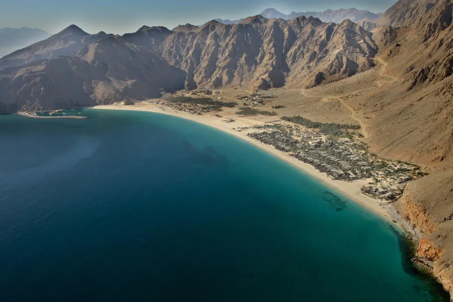
Imagine leaving behind the city hustle for a place just a short flight away, where you can drive on smooth highways through vast deserts one day and explore lush green mountains the next. That’s Oman. While your friends are posting the same Dubai mall photos, you could be watching sea turtles nest under a blanket of stars or sipping traditional Omani coffee in a mountain village where the air is cool and crisp. This isn’t just another Middle Eastern destination – it’s a country that feels like nature’s playground, designed perfectly for the curious Indian traveler. This is the only Oman trip planner you’ll need as an Indian family, couple, or solo adventurer. From navigating the e-visa process to finding delicious vegetarian meals, from driving through dramatic wadis to camping under desert stars – we’ve got every detail covered. Whether you’re planning a romantic getaway or a family adventure, these things to do in Oman will transform your week into memories that last a lifetime. Why Oman is a Perfect Getaway for Indians It’s Closer Than You Think A 3.5-hour flight from Mumbai or Delhi puts you in Muscat – shorter than most domestic trips to Goa. What surprised me most was how this proximity doesn’t compromise the exotic factor. You’re still stepping into a completely different world. You’ll Feel Right at Home (Sort Of) Oman hosts over 700,000 Indian expats, creating a familiar comfort zone without losing the thrill of being somewhere new. Shopkeepers greet you in Hindi, restaurants understand “kam mirch” (less spice), and you’ll spot familiar faces from Kerala working in hotels and restaurants. Yet the Omani culture shines through beautifully – it’s this perfect blend that makes Indian travelers feel welcomed, not just tolerated. Safety That Lets You Truly Relax Oman ranks as one of the world’s safest countries. Families can explore confidently, solo female travelers feel secure, and parents don’t spend their vacation worrying. The roads are pristine, the people are genuinely helpful, and petty crime is virtually non-existent. Premium Experience Without the Premium Price Tag While a week in Switzerland might cost ₹2 lakhs per person, Oman offers similar natural beauty and luxury experiences for roughly half that budget. Your money goes further, especially when you factor in the variety – mountains, deserts, beaches, and culture all in one trip. Planning Your Oman Trip: The Essentials Visa for Indians Getting an Oman visa is refreshingly simple. Apply online through the Royal Oman Police e-visa portal – no embassy visits, no document submissions, no stress. The tourist visa costs around 20 OMR (approximately ₹4,300) and is valid for 30 days. Quick Visa Facts: For the most current visa information, always check the official Royal Oman Police e-visa portal. Best Time to Visit Oman October to April: The Golden Window This is when Oman transforms into paradise. Temperatures hover around 25-30°C – perfect for hiking, driving, and outdoor adventures. The mountains are pleasantly cool, and even the desert becomes enjoyable during these months. May to September: Skip It (Mostly) Summer temperatures regularly hit 45°C and above. However, there’s one exception – Salalah experiences the Khareef (monsoon) season from June to September, turning the southern region into a green oasis while the rest of the country bakes. For detailed weather forecasts and historical climate data, check Weather.com’s Oman section Month Temperature Best For Avoid If Nov-Feb 20-28°C Everything! Peak season You prefer fewer crowds Mar-Apr 25-35°C Great weather, fewer crowds You’re very heat sensitive May-Sep 35-45°C+ Salalah’s Khareef season only You’re doing desert/mountain activities Oct 28-38°C Good weather returning Still quite warm for some Connectivity & SIM Cards Grab a local SIM card at Muscat Airport immediately after clearing immigration. Ooredoo and Oman Mobile both offer tourist packages starting from 10 OMR (₹2,150) for 5GB data valid for 30 days. Trust me, having Google Maps working flawlessly makes the entire road trip stress-free. Currency & Budgeting The Omani Rial (OMR) is pegged to the US Dollar, making 1 OMR approximately ₹215-220. Unlike other Middle Eastern countries, Oman operates primarily on cash, though cards are widely accepted in hotels and restaurants. Daily Budget Guide (Per Person): Budget Level Daily Cost Includes Excludes Budget ₹5,000-7,000 3-star hotels, local restaurants, self-drive economy car Luxury experiences, alcohol Mid-range ₹10,000-15,000 4-star resorts, mix of local and tourist restaurants, SUV rental Premium desert camps, fine dining Luxury ₹20,000+ 5-star properties, guided tours, luxury desert experiences Nothing – go wild! Getting Around: The Great Omani Road Trip Here’s the truth about transportation in Oman: you need to drive. This isn’t like Europe where trains connect everything, or like Thailand where tuk-tuks are everywhere. Oman’s beauty lies scattered across dramatic landscapes, and the journey between destinations is half the adventure. Vehicle Choice Made Simple: Why Driving in Oman is a Joy: Roads are immaculate – better than most Indian highways. Speed limits are clearly marked and strictly enforced (good for safety-conscious families). Fuel is incredibly cheap, and parking is free almost everywhere. The Ultimate 7-Day Oman Itinerary Day 1: Arrival in Muscat & Souq Magic Morning: Land in Muscat, collect your rental car, and check into your hotel. If you arrive early, grab lunch at a local restaurant – try the Omani breakfast of eggs with local bread. Afternoon: Visit the Sultan Qaboos Grand Mosque, one of the world’s most beautiful mosques. Important: Dress modestly (long pants and sleeves; women need headscarves). The mosque closes to visitors at 11 AM except Saturdays, so plan accordingly. Check current visiting hours and guidelines at the Sultan Qaboos Grand Mosque official website Evening: Lose yourself in Mutrah Souq. Unlike sterile Dubai malls, this souq pulses with authentic energy. Bargain for frankincense, Omani silver jewelry, and traditional khanjar daggers (decorative ones for tourists are fine to carry home). Travel Tip: Download the Careem app – it’s like Ola but for Oman, perfect for short city trips when you don’t want to drive. Food Highlight: End the day at Bait Al Luban restaurant for your first taste of authentic

Oman Tour Itinerary: 7-Day Guide to Culture, Adventure & Hidden Gems Read More »

Bedse Caves, Maharashtra: A Complete Guide to Its Ancient Wonders

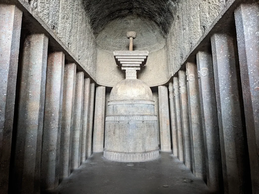
Ever wondered what it feels like to stand inside a 2,000-year-old prayer hall carved straight into a mountain? At Bedse Caves in Maharashtra, you can do exactly that. Unlike their famous neighbors Karla and Bhaja, these ancient Buddhist caves offer something special: intricate pillar carvings and a peaceful atmosphere away from the crowds. This complete guide covers everything you need to know about visiting Bedse Caves, from its fascinating history to practical tips that will make your trip memorable. Whether you’re a history enthusiast, architecture lover, or weekend adventurer, you’ll find the essential information to plan your perfect visit. Quick Facts About Bedse Caves Location: Near Kamshet, Pune District, MaharashtraBuilt: Around 1st Century BCEKnown For: Grand Chaitya (Prayer Hall) & Vihara (Monastery)Best Time to Visit: Monsoon & Winter (June to February)Trek Difficulty: Easy to Moderate (approximately 400 steps)Entry Fee: Free entry (Check ASI official website for latest updates)Timings: Sunrise to sunset (Verify current timings here)Distance from Pune: 60 kmDistance from Mumbai: 120 km Planning Your Visit to Bedse Caves How to Reach Bedse Caves From Pune (60 km, 1.5 hours): Take the Mumbai-Pune Expressway and exit at Kamshet. From Kamshet, follow the road toward Bedse village. The last 2 km involves a narrow village road, so drive carefully. Park at the base of the hill near the village and begin your climb. From Mumbai (120 km, 2.5 hours): Take the Mumbai-Pune Expressway toward Pune. Exit at Kamshet and follow the same route as mentioned above. Early morning departure is recommended to avoid expressway traffic. Transport Options: By Car: Most convenient option. The road to Bedse village is accessible but narrow in the final stretch. By Train + Auto: Take a train to Kamshet station, then hire an auto-rickshaw to the base of Bedse Caves (approximately ₹200-300). By Bike: Popular choice among adventure enthusiasts. The winding roads offer scenic views, especially during monsoon season. The Final Climb From the parking area near Bedse village, you’ll face approximately 400 stone steps carved into the hillside. The climb takes 20-30 minutes at a steady pace. The initial section is steeper, but the path levels out as you approach the caves. During monsoon, the steps can be slippery, so wear shoes with good grip. The path winds through rocky terrain dotted with small shrubs and wildflowers during the rainy season. About halfway up, you’ll get your first glimpse of the cave entrances carved into the dark basalt rock face. Essential Visitor Information Best Season to Visit: Monsoon (June to September): The surrounding landscape transforms into lush green valleys. Waterfalls appear on nearby hills, creating a magical atmosphere. However, the climb can be challenging due to wet steps. Winter (October to February): Pleasant weather with clear skies. Perfect for photography and comfortable exploration. The morning mist often creates dramatic views of the valley below. Summer (March to May): Hot and dry conditions. Early morning or late afternoon visits are recommended if you’re traveling during this period. Available Facilities: The Story of Bedse Caves: A Journey Through Ancient India Historical Background Bedse Caves were carved during the Satavahana dynasty around the 1st century BCE, making them contemporary with the more famous Karla Caves. These caves served as a Buddhist monastery, strategically located along the ancient trade route connecting the ports of western India with inland markets. Archaeological evidence suggests that wealthy merchants and royal patrons funded the construction of these caves. The location wasn’t random – positioned on a hilltop, the monastery had commanding views of the trade routes below, while providing monks with the solitude needed for meditation and study. Dr. James Burgess, who extensively documented these caves in the late 19th century, noted their architectural significance in his surveys for the Archaeological Survey of India. His work revealed that Bedse represents a crucial phase in the evolution of rock-cut architecture in the Western Ghats. Architecture and Carvings Explained The Main Chaitya (Prayer Hall): Walking into the main chaitya at Bedse is like stepping into a stone cathedral. The hall stretches 45 feet long and 25 feet wide, with a vaulted ceiling that rises 35 feet above. The most striking feature is the colonnade of octagonal pillars leading toward the stupa at the far end. Each pillar tells a story through its carvings. Unlike the simpler designs at nearby caves, Bedse pillars feature elaborate capitals decorated with riders on elephants and horses. These aren’t just decorative – they represent the donors who funded the cave’s construction, immortalized in stone. The solid stone stupa at the hall’s end served as the focal point for Buddhist rituals. Monks would walk clockwise around it during prayers, following a practice that continues in Buddhist monasteries today. The Vihara (Monastery): Adjacent to the prayer hall, the residential quarters consist of small cells arranged around a central courtyard. Each cell measures roughly 8 feet by 6 feet – just enough space for a monk’s sleeping mat, robes, and begging bowl. The walls show evidence of wooden fittings that once held the monks’ few possessions. Looking closely, you can still see slots cut into the rock where wooden shelves and pegs were inserted. Water Management System: One of Bedse’s most impressive features is its sophisticated water harvesting system. Large cisterns carved into the rock collected rainwater, ensuring the monastery’s survival during dry months. This engineering marvel demonstrates the practical wisdom of ancient Indian architects who understood the monsoon patterns of the region. The Unique Pillar Carvings: What sets Bedse apart from other Buddhist caves in Maharashtra are its distinctive pillar capitals. Each capital features a pot-shaped base supporting figures of riders – some on elephants, others on horses. Art historians believe these represent the merchant-donors who funded the caves. The craftsmanship is remarkable. Despite being carved over 2,000 years ago, the expressions on the riders’ faces remain clearly visible. The horses’ manes flow naturally, and the elephants’ trunks curve gracefully, showing the sculptors’ deep understanding of animal anatomy. Making Your Trip Better: Practical Tips and Insights Photography Tips for Bedse Caves

Bedse Caves, Maharashtra: A Complete Guide to Its Ancient Wonders Read More »

The Best Time to Visit the Masai Mara: A Complete Guide for Indian Travelers

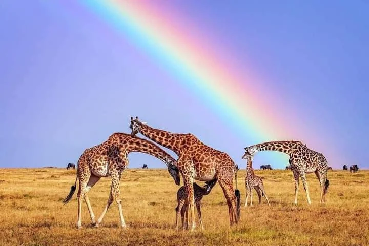
Picture this: You’re sitting in an open safari vehicle as the African sun paints the sky golden orange. Suddenly, thunder fills the air – not from clouds, but from thousands of hooves. A massive herd of wildebeest charges toward the crocodile-filled Mara River, their survival instincts driving them forward in one of nature’s most spectacular displays. This is the Masai Mara during migration season, and timing your visit right means the difference between witnessing this magic or missing it entirely. As safari planning experts who’ve helped hundreds of Indian travelers experience Africa’s wonders, we know that choosing when to visit the Masai Mara can make or break your dream safari. The good news? Every month offers something special in this incredible ecosystem. The key is matching your travel goals with the right season. Quick Planning Summary Your Goal Best Months Why See the Great Migration July – October Peak river crossings, dramatic wildlife action Save Money & Avoid Crowds April – May, November Green season beauty, 40-50% lower prices See Baby Animals January – March Calving season, incredible predator activity Best Weather June – October Dry season, clear skies, easy game drives Bird Watching November – April Migratory birds arrive, lush landscapes Masai Mara: The Basics for First-Time Visitors Located in Kenya’s Great Rift Valley, the Masai Mara welcomes 1.5 million wildebeest onto its sprawling savannahs each July through October during the world-famous Great Migration. This 1,510 square kilometer reserve connects seamlessly with Tanzania’s Serengeti, creating one of Africa’s most important wildlife ecosystems. Understanding the Mara’s two main seasons is crucial for planning: Dry Season (June – October): Clear skies, sparse vegetation makes wildlife easier to spot, but expect higher prices and more tourists. Green Season (November – May): Lush landscapes, fewer crowds, and budget-friendly rates, but afternoon rain showers are common. Month-by-Month Guide to the Masai Mara January – March: The Secret Calving Season Weather: Hot days (25-28°C), cool nights, occasional short showers Wildlife Highlights: Wildebeest calving season in southern Serengeti, newborn animals attract predators Pros: Cons: One thing you’ll notice right away in January is how active the predators become. Our guides always recommend early morning game drives during this period because big cats are most active when temperatures are cooler. April – May: The Hidden Gem Season Weather: Long rains begin, afternoon thunderstorms, lush green landscapes Wildlife Highlights: Resident wildlife thrives, spectacular birdlife, fewer crowds Pros: Cons: The green season transforms the Mara into a completely different place. The usually golden grasslands turn emerald green, creating a backdrop that’s absolutely stunning for photography. June: The Perfect Balance Weather: Rains taper off, pleasant temperatures, clear skies return Wildlife Highlights: Excellent resident game viewing, migration herds start moving north Pros: Cons: July – October: The Great Migration Spectacular Weather: Dry season peaks, clear blue skies, minimal rainfall Wildlife Highlights: August is considered the peak of the migration season in the Masai Mara. The iconic Mara River crossings, where wildebeest risk their lives to cross crocodile-infested waters, happen during this time Pros: Cons: Mid to late August is regarded as a safe month to visit for successful viewing, though the exact timing varies yearly depending on rainfall patterns. November: Post-Migration Magic Weather: Short rains begin, fresh green growth appears Wildlife Highlights: Resident wildlife returns to normal patterns, excellent birdwatching Pros: Cons: December: Year-End Wildlife Bonanza Weather: Short rains continue, warm temperatures, occasional storms Wildlife Highlights: High concentration of resident animals, predator activity increases Pros: Cons: The Great Wildebeest Migration Explained The Great Migration is nature’s most incredible wildlife spectacle. The exact dates of the migration vary slightly from year to year, but in 2025 it should begin around mid-July, peaking toward the end of August and early September, and ending in late October. Here’s what makes it so special: The Journey: Over 1.5 million wildebeest, accompanied by 200,000 zebras and 300,000 Thomson’s gazelles, follow ancient migration routes between Kenya’s Masai Mara and Tanzania’s Serengeti. The Drama: The most heart-stopping moments happen at the Mara River and Talek River crossings, where massive herds must brave crocodile-infested waters to reach fresh grazing lands. The Timing: July to October for the Mara River crossings offers your best chance to witness these dramatic scenes, though exact timing depends on rainfall patterns each year. Pro Tip: River crossings are unpredictable. Herds might cross multiple times in a day, or wait days before attempting. Our experienced guides recommend staying near the rivers during peak season for the best chances. Beyond the Migration: Year-Round Wildlife Wonders The Green Season Advantage (November – May) Don’t dismiss the green season! This period offers incredible advantages: Photography Paradise: The contrast between lush landscapes and wildlife creates stunning imagery. Professional photographers often prefer these months for portfolio shoots. Predator Action: It is estimated that there are close to 850 to 900 Lions in the Masai Mara National Reserve and surrounding conservancies, and they’re incredibly active year-round. Bird Paradise: Over 470 species call the Mara home, with spectacular migrants arriving during the green season. Baby Animals: January through March brings calving season, when you’ll see countless young zebras, antelopes, and other animals taking their first steps. Resident Wildlife Highlights The Mara isn’t just about migration. Year-round residents include: Practical Planning for Indian Travelers Getting There from India Flights: Direct and connecting flights operate from Mumbai, Delhi, and Bangalore to Nairobi’s Jomo Kenyatta International Airport. Kenya Airways offers convenient connections, while Emirates and Qatar Airways provide comfortable one-stop options. Airport to Mara: Two options await: Budget Planning by Season Peak Season (July-October): Green Season (April-May, November): Avoiding Crowds: The Private Conservancy Secret The Maasai Mara Wildlife Conservancies Association (MMWCA) has 24 conservancies at different stages of development within the Mara Landscape. Staying in conservancies like Mara North, Naboisho, or Ol Choro offers: Indian Traveler Considerations Vegetarian Options: Most safari lodges now cater excellently to vegetarian diets, with many offering Indian cuisine options upon request. Cultural Comfort: The tourism industry in Kenya is well-versed in hosting Indian travelers, with many guides speaking basic

The Best Time to Visit the Masai Mara: A Complete Guide for Indian Travelers Read More »

15 Amazing Things to Do in Kadamakkudy

Tired of the city noise? Imagine a place just 30 minutes from Kochi where the only traffic is a lone fishing boat gliding through serene backwaters. Welcome to Kadamakkudy, a cluster of peaceful islands that feels like stepping into a different world entirely. Kadamakkudy isn’t your typical tourist destination – and that’s exactly what makes it special. This collection of verdant islands offers something increasingly rare: genuine tranquility, authentic village life, and unspoiled natural beauty. Here, you’ll find farmers tending to unique saltwater paddy fields, fishermen casting their nets at dawn, and toddy shops serving the freshest seafood you’ve ever tasted. In this guide, we’ll share our first-hand experiences and detailed tips to help you explore Kadamakkudy beyond the usual tourist trail. We’ve talked to locals, eaten at their favorite spots, and found the best-kept secrets just for you. From breathtaking sunrises and traditional boat rides to ancient churches and cycling through emerald paddy fields, here’s everything you need to plan your perfect Kadamakkudy adventure. Quick Kadamakkudy Planner Quick Info Details Best Time to Visit October to March (ideal weather and birdwatching) Distance from Kochi 30-40 minutes by road How to Reach Drive from Kochi or take ferry from Vypeen Ideal Duration 1-2 days for complete experience Perfect For Nature lovers, photographers, slow travelers, weekend getaways Must-Try Experience Sunrise boat ride + traditional seafood meal Budget Range ₹1,500-3,000 per person per day Mobile Network Patchy in some areas – download offline maps Getting to & Around Kadamakkudy (The Practical Stuff) How to Reach Kadamakkudy By Road: The most convenient way to reach Kadamakkudy is by road from Ernakulam or Kochi. The journey takes about 30-40 minutes through scenic countryside. You can hire a taxi (expect to pay around ₹800-1,200) or drive your own vehicle. By Ferry: For a more authentic experience, take the local ferry service from Vypeen. The traditional boats operate throughout the day, and the 20-minute journey itself becomes part of your Kadamakkudy experience. Ferry tickets cost around ₹15-25 per person. Nearest Transportation Hubs: Navigating the Islands Like a Local Once you’re in Kadamakkudy, the best way to explore is slowly. The local jankar (traditional ferry) connects different parts of the island for just ₹10-20. For more flexibility, hire a private boat (₹500-800 for 2-3 hours) or rent a bicycle from local shops (₹100-150 per day). Walking is equally rewarding – the islands are small enough to cover on foot, and you’ll discover hidden corners that even boats can’t reach. Top Nature & Outdoor Activities Witness a Magical Sunrise from a Boat There’s something almost spiritual about watching the sun rise over Kadamakkudy’s backwaters. As the first light touches the water, the entire landscape transforms into shades of gold and amber. The air is crisp, filled with the sounds of waking birds and gentle water lapping against your boat. Pro Tip: Ask your boatman to take you toward the Veeranpuzha backwaters around 6:30 AM for the most spectacular views. We recommend booking your boat ride the evening before (₹600-800 for 2 hours). Go Birdwatching in the Wetlands Kadamakkudy is a paradise for bird enthusiasts. The wetlands come alive during early morning hours with kingfishers diving for fish, cormorants spreading their wings to dry, and majestic brahminy kites soaring overhead. During winter months (November-February), you might spot migratory birds adding to the diversity. Essential Tip: Bring binoculars and head out between 6-8 AM for the best sightings. The area near the paddy fields offers the richest birdwatching experience. Kayak Through Peaceful Mangrove Forests Kayaking through Kadamakkudy’s narrow mangrove channels offers an intimate encounter with nature. The dense canopy creates a natural tunnel, and you’ll often spot mudskippers, crabs, and various water birds in their natural habitat. This eco-friendly activity supports local conservation efforts too. Practical Details: Kayak rentals available from local operators for ₹400-600 per hour, including basic safety equipment. Take a Slow Walk Through the Pokkali Paddy Fields The Pokkali cultivation system is unique to this region – it’s one of the few places in the world where rice grows in saltwater. Walking through these emerald fields, especially during the growing season (June-November), feels like stepping into a living painting. The farmers here follow ancient techniques passed down through generations. Best Experience: Visit during early morning or late afternoon when the light creates beautiful reflections on the water-filled fields. Try Your Hand at Fishing with Chinese Nets The iconic Chinese fishing nets are not just for show in Kadamakkudy – they’re still actively used by local fishermen. Many are happy to explain the technique and sometimes let visitors try operating these ancient contraptions. It’s harder than it looks but incredibly satisfying when you actually catch something! When to Go: Early morning (5-7 AM) or evening (4-6 PM) when fishing activity is at its peak. Culture, Food & Village Life The Toddy Shop Experience: More Than Just a Drink Let’s clear up a common misconception – toddy shops in Kadamakkudy aren’t just about the fermented palm wine. They’re the heart of local dining culture, serving some of the freshest seafood you’ll find anywhere. Picture this: you’re sitting on a simple wooden bench, enjoying perfectly spiced Karimeen Pollichathu (pearl spot fish wrapped in banana leaves) while fishermen discuss their morning catch at the next table. Must-Try Dishes: Our Experience: We visited Shibu’s Toddy Shop during our last trip, and the seafood was incredibly fresh – caught that very morning! Don’t be shy to ask for the ‘special’ of the day. The owner, Shibu, speaks good English and loves sharing stories about island life. Explore the Historic St. George Roman Syrian Church This centuries-old church stands as a testament to Kadamakkudy’s rich cultural heritage. Built in traditional Kerala architectural style with Portuguese influences, the church features beautiful wooden carvings and ancient murals. The peaceful courtyard offers a moment of quiet reflection, and the local priest often shares fascinating stories about the island’s history. Visit Timing: Open daily 6 AM – 7 PM. Sunday morning mass (9 AM) offers a glimpse

15 Amazing Things to Do in Kadamakkudy Read More »

Talpona Beach Best Time to Visit: When & How to Experience Goa’s Hidden Gem

Forget the Goa you think you know. Picture this: the morning sun warming golden sand, the gentle sound of a river meeting the sea, and the only footprints besides yours belonging to a shorebird. This isn’t Baga or Anjuna—this is Talpona Beach, South Goa’s best-kept secret that I stumbled upon three years ago while escaping the tourist trail. You’re wondering when the best time to visit Talpona Beach is, and the answer isn’t just a month—it’s about the experience you’re looking for. After visiting Talpona across different seasons and spending countless hours with local fishermen and conservationists, I’ve learned that timing here is everything. The Short Answer: When is the Absolute Best Time to Visit Talpona? For perfect weather, calm seas, and the chance to see nesting Olive Ridley turtles, the best time to visit Talpona Beach is from November to February. During these months, you’ll find clear blue skies, temperatures hovering between 20-30°C, and gentle waves perfect for swimming. But that’s not the whole story. The ‘best’ time truly depends on whether you’re seeking solitude, wildlife encounters, or experiencing Goa’s dramatic monsoon beauty. Each season at Talpona offers something completely different, and I’ve fallen in love with this beach in every single one. A Season-by-Season Guide to Talpona’s Charm Winter (November – March): The Postcard-Perfect Season This is Talpona at its most Instagram-worthy. When I first visited in December, I couldn’t believe a place this beautiful existed just 45 minutes from Palolem. The weather is absolutely perfect—clear skies, gentle breezes, and temperatures that make you want to spend entire days on the sand. What makes winter special: The downside? This is peak tourist season, though Talpona remains significantly quieter than other Goa beaches. Expect higher accommodation rates and book your beach hut in advance, especially for December and January visits. My insider tip: Visit on weekday mornings between 6-8 AM. You’ll likely have the entire beach to yourself, and the light is magical for photography. Monsoon (June – September): The Dramatic, Green Season Most travel guides will tell you to avoid Goa during monsoon. They’re wrong—at least when it comes to Talpona. This season transforms the landscape into something from a movie. The beach becomes wild and untamed, with dramatic waves crashing against the shore and the surrounding hills turning emerald green. What makes monsoon magical: Important considerations: I spent a monsoon week here writing, and it was incredibly inspiring. The sound of waves, the fresh smell after rain, and the dramatic skies created the perfect creative atmosphere. Shoulder Months (April, May, October): The Insider’s Secret These months are my personal favorite for visiting Talpona, and here’s why: fewer tourists, lower prices, and unique seasonal experiences. Yes, it’s hotter, but the trade-offs are worth it for savvy travelers. April-May advantages: October advantages: The challenge: Temperatures can reach 35-38°C during midday. My strategy is simple: enjoy the beach from sunrise to 10 AM, take a midday break in shade or explore inland areas, then return for sunset activities. The Olive Ridley Turtles: A Once-in-a-Lifetime Experience This is what makes Talpona truly special. Between November and April, ancient Olive Ridley turtles return to these shores to nest—the same beach where they were born decades ago. Witnessing this is nothing short of magical. I’ll never forget my first turtle sighting. It was a February evening, and local conservationist Ravi pointed out fresh tracks in the sand. “Mama turtle came last night,” he whispered. We followed the tracks to a freshly covered nest, and I realized I was standing where new life would emerge in 45-60 days. When and how to see them: Responsible viewing guidelines: The Goa Forest Department works closely with local communities to protect these gentle giants. Supporting their conservation efforts by visiting responsibly ensures future generations can witness this wonder. More Than a Beach: Exploring the Talpona River and Mangroves What sets Talpona apart from other Goa beaches is the river estuary and mangrove ecosystem. The Talpona River meets the Arabian Sea here, creating a unique environment teeming with life. My favorite experience? Hiring local fisherman Suresh for an early morning boat ride through the mangrove tunnels. As we glided through green canopies reflected in still water, he pointed out kingfishers, herons, and even a small crocodile sunning itself on a log. River and mangrove highlights: Ask a local boatman to take you through the mangrove tunnels at high tide—it feels like entering another world. The silence is broken only by bird calls and gentle water lapping against the boat. Your Talpona Activity Planner: What to Do and When Activity Best Time Season Insider Tips Swimming & Sunbathing 7-10 AM, 4-7 PM Nov-Apr Avoid midday sun; check for rip currents Turtle Watching 5-7 AM Dec-Apr Follow tracks from previous night River Boat Rides High tide times Oct-May Check tide times locally Photography Sunrise, sunset Year-round Golden hour at river mouth is spectacular Birdwatching Early morning Oct-Mar Bring binoculars; mangroves are best spots Solitude Seeking Weekday mornings Apr-Oct Shoulder seasons offer maximum peace My photography recommendations: Where to Stay & Eat: Honest Local Recommendations Let me be upfront: Talpona is a remote beach with limited amenities. Don’t expect luxury resorts or fancy restaurants. Do expect incredible hospitality and the freshest seafood of your life. Accommodation options: The beach huts are simple but charming, usually run by local families who’ve been here for generations. My go-to is the family-run shack at the north end—Maria’s hospitality is unmatched, and her fish curry is legendary. Dining experiences: Essential amenities info: Getting to This Hidden Gem Reaching Talpona is part of its charm—it requires a bit of effort, which keeps the crowds away. From Palolem Beach: 15-minute scenic drive through small villages From Canacona Railway Station: 20-minute auto-rickshaw ride From Goa International Airport: 1.5-hour drive via NH66 My recommended transport method: Rent a scooter in Palolem or Canacona. The road from Palolem is scenic, with traditional Goan houses and cashew plantations—drive slowly and soak it in! Parking is free right on the beach.

Talpona Beach Best Time to Visit: When & How to Experience Goa’s Hidden Gem Read More »

Devbagh Beach Activities: Costs, Wildlife & Hidden Gems You Must Know

Ever dreamt of a place where a calm river gently shakes hands with the mighty Arabian Sea? Welcome to Devbagh Beach, where the Kali River creates a mesmerizing confluence with the ocean, painting a picture so stunning that even seasoned travelers stop in their tracks. Tucked away in Karnataka’s Karwar district, Devbagh isn’t your typical crowded beach destination. This hidden paradise offers something truly special – a peaceful blend of river and sea activities, incredible wildlife encounters, and water sports that’ll get your heart racing. Unlike the bustling beaches of Goa just a few hours away, Devbagh feels like nature’s own private playground. This complete guide covers everything you need to know about devbagh beach activities – from thrilling jet ski rides to peaceful kayaking adventures. I’ll break down real costs, share safety tips from local operators, reveal the best times to spot Olive Ridley turtles, and give you insider secrets that most tourists never discover. Whether you’re a budget backpacker or planning a family getaway, you’ll find exactly what you need to plan the perfect Devbagh adventure. Quick Guide: Devbagh Activities at a Glance Activity Average Cost (per person) Best For What to Expect Jet Ski ₹600 – ₹1,000 Thrill-seekers High-speed, 10-15 min ride Parasailing ₹1,200 – ₹1,700 Amazing Views 5-10 min flight, boat-assisted Banana Boat Ride ₹600 – ₹900 Groups & Families Fun, bumpy ride, expect to get wet Kayaking ₹700 – ₹1,100 Nature Lovers Peaceful paddling in the estuary Scuba Diving ₹2,500 – ₹4,000 Adventurers Exploring underwater marine life Boat Safari ₹800 – ₹1,200 Wildlife Enthusiasts Dolphin spotting, mangrove exploration Speed Boat ₹1,000 – ₹1,500 Groups Fast ride across the confluence Decoding Costs & Planning Your Budget The prices in our table include basic safety equipment and a trained guide, but here’s what you need to know about the fine print. Most water sports operators provide life jackets, helmets (for jet skiing), and basic instruction as part of their standard package. However, don’t be surprised if they charge extra for GoPro recordings of your adventure – usually around ₹300-500 additional. Money-Saving Hacks That Actually Work: Hidden Costs to Watch For: Pro tip: Carry cash in smaller denominations. Many operators prefer cash payments and might not have change for large notes. Top Water & Beach Adventures in Devbagh Jet Skiing: Pure Adrenaline Rush The moment the jet ski accelerates beneath you, cutting through the crystal-clear waters where river meets sea, you’ll understand why this tops everyone’s list. The ride typically lasts 10-15 minutes, giving you enough time to feel the spray on your face and experience that incredible sensation of flying over water. Local operators like Durga Watersports ensure you get a safety briefing before you ride. The instructor stays nearby on another jet ski, so even beginners feel confident. The best part? You’ll ride through both the calm river section and the more exciting sea waves – it’s like getting two different experiences in one go. Parasailing: Bird’s Eye Paradise Floating 200 feet above the confluence, with the Western Ghats on one side and endless Arabian Sea on the other, parasailing at Devbagh offers views that’ll make your Instagram followers seriously jealous. The 5-10 minute flight gives you enough time to soak in the panoramic beauty and spot dolphins in the water below. Safety is excellent here – operators use modern equipment and follow international standards. You’re harnessed securely to the parachute while a speedboat pulls you up gradually. The landing is smooth, right back on the boat deck. Even if you’re afraid of heights, the gentle takeoff makes it manageable for most people. Banana Boat Rides: Family Fun Guaranteed Picture this: you and your squad bouncing across the waves on a bright yellow inflatable banana, trying not to fall off as the speedboat driver intentionally takes sharp turns. It’s impossible not to laugh during a banana boat ride, making it perfect for families and friend groups. The rides last about 15 minutes, and yes, you will get soaked. Operators usually “flip” the banana boat at least once during the ride – it’s all part of the fun. Life jackets are mandatory, and the water isn’t too deep, so even non-swimmers can enjoy this activity safely. Kayaking & Estuary Boat Rides: Nature’s Meditation For those seeking tranquility over thrills, kayaking through Devbagh’s backwaters is pure magic. Paddle silently through narrow channels lined with mangroves, where kingfishers dart between branches and fish eagles soar overhead. The water here is so calm it perfectly reflects the sky, creating a mirror-like surface that photographers absolutely love. The guided kayaking tours last 45 minutes to an hour, taking you deep into the estuary where most tourists never venture. Your guide will point out different bird species, explain the mangrove ecosystem, and share local fishing traditions. It’s educational, peaceful, and incredibly beautiful. Scuba Diving: Underwater Secrets Devbagh’s underwater world comes alive between October and May when visibility reaches up to 15 meters. The marine life here includes colorful reef fish, rays, and if you’re lucky, small reef sharks that are completely harmless to humans. The diving sites are suitable for beginners, with depths ranging from 8-12 meters. Certified instructors from PADI-affiliated centers handle all dives. The experience includes a 30-minute theory session, equipment fitting, and a 30-45 minute underwater exploration. First-time divers always do a shallow water practice session before heading to the main diving spot. Devbagh’s Natural Wonders: Wildlife & Conservation The Olive Ridley Turtles: Nature’s Annual Miracle Devbagh holds a special place in marine conservation as a vital nesting site for Olive Ridley turtles. Between December and March, these ancient mariners return to the same beaches where they were born decades ago, continuing a cycle that’s been happening for millions of years. According to reports by The Indian Express, Devbagh is recognized as a key nesting ground, making it a sensitive and important ecological zone that requires careful protection. During peak nesting season (January-February), you might witness the incredible sight of mother turtles coming ashore at night to lay

Devbagh Beach Activities: Costs, Wildlife & Hidden Gems You Must Know Read More »

aysen region, chile

Navigating Aysen: An Expert’s Guide to Chile’s Untamed Patagonian Frontier

Part I: The Call of the Wild: Why Aysén is Chile’s Untamed Frontier Aysén: An Introduction to Patagonia’s Hidden Heart The Aysén Region, officially known as the Aysén del General Carlos Ibáñez del Campo Region, is a sprawling, untamed expanse nestled deep within Chilean Patagonia. Situated south of the Lakes District and north of the famed Torres del Paine National Park, it exists as a remote and off-the-beaten-path destination for those seeking genuine adventure.1 It is a land of dramatic geographical contrasts, bordered by the intricate maze of Pacific Ocean fjords to the west and the formidable Andes Mountains to the east. This rugged landscape is a dynamic mosaic of majestic mountains, colossal glaciers, and two of the largest ice fields in the world: the Northern and Southern Patagonian Ice Fields. The Northern Ice Field is contained entirely within the borders of Laguna San Rafael National Park.1 The region’s terrain is characterized by glaciated valleys and fjords, with mountain elevations ranging from 1,000 to 4,000 meters. The lower slopes are blanketed by dense, broad-leaved evergreen forests, while perennial snowfields cap the higher peaks.3 For administrative purposes, Aysén is divided into four provinces: Aisén, General Carrera, Coihaique, and Capitán Pratt.3 The regional capital and largest urban center is the city of Coihaique, which serves as a vital hub for the entire region’s travel and commerce.2 While human settlements are sparse, the region’s rivers, such as the turbulent Baker River, are among the most powerful in Chile. The regional economy, while small, is traditionally based on animal husbandry, particularly sheep and cattle, as well as the production of timber and, to a lesser extent, mining for gold, silver, and zinc.3 The Route of the Parks: A Backbone of Conservation At the very core of a journey through Aysén is the Carretera Austral, or Southern Highway. This legendary road, also known as Ruta 7, is the region’s primary artery, snaking its way for approximately 1,240 kilometers (770 miles) from Puerto Montt in the north to the remote outpost of Villa O’Higgins in the south.2 This road is not merely a means of transportation but a destination in itself, renowned as one of the most spectacular scenic drives in the world and a true bucket-list item for any traveler.1 The Carretera Austral is a centerpiece of a much larger, globally significant conservation project: the Route of the Parks (Ruta de los Parques). This initiative is a monumental 2,735-kilometer conservation trail that connects 17 national parks, forming a contiguous protected corridor from Puerto Montt all the way to Cape Horn.5 The grand vision behind this route is to protect an astonishing 11.8 million hectares of pristine ecosystems—an area nearly three times the size of Switzerland—to serve as a “natural solution” to the global crisis of biodiversity loss and climate change.9 The project, which is a collaborative effort between the public and private sectors, aims to foster an economy based on low-impact nature tourism, ensuring that the local communities and the environment thrive in harmony.8 The Aysén region is a critical component of this effort, containing national park gems such as Patagonia National Park and Cerro Castillo National Park.8 It is essential for travelers to understand that the Carretera Austral is a dynamic and evolving entity, not a static feature on a map. While travel guides and blogs have long described it as a “mostly unpaved” or “dirt road,” this characterization is becoming increasingly outdated, particularly for certain sections.1 Research indicates that significant “ongoing road works” have resulted in approximately half of the route already being paved.12 More specifically, the northern section, from Puerto Montt to Coihaique, is now “mostly tarred” with only intermittent unpaved stretches.12 In contrast, the southern portion, from Coihaique to Villa O’Higgins, remains “mostly gravel road”.12 This continuous transformation has profound implications for a traveler’s journey, directly affecting travel time, vehicle choice, and the overall experience. The perceived need for a 4×4, for example, is becoming less universal and is now most critical only for those planning to drive on narrow mountain roads or cross certain remote border crossings into Argentina.13 This nuanced reality challenges the long-held image of the highway and requires more precise planning than in previous years. Table 1: The Aysén Travel Hubs at a Glance Town Name Role Key Attractions Available Services Coyhaique Regional Capital, Transport Hub Main Square, Coyhaique National Reserve, Hub for adventure tours ATM, Gas, Supermarket, Restaurants, Hotels 5 Puyuhuapi Fjord-side Village Puyuhuapi Hot Springs, German-influenced architecture Gas (Diesel only), Lodges, Restaurants 5 Puerto Río Tranquilo Glacier & Lake Gateway Marble Caves (Capillas de Mármol), Exploradores Glacier ATM, Gas, Lodges, Tour Operators 5 Chile Chico Lakeside Town Views of Lake General Carrera, Jeinimeni National Reserve ATM, Gas, Supermarket 5 Cochrane Conservation Hub Patagonia National Park, Fly-fishing ATM, Gas, Lodges, Restaurants 5 Villa O’Higgins End of the Road End of Carretera Austral, O’Higgins Glacier ATM, Gas 5 Part II: Preparing for the Expedition: Essential Planning & Logistics The Travel Arc: Getting to and Around Aysén Accessing the Aysén region, a land defined by its remoteness, requires careful logistical planning. The most frequent and efficient method of arrival is by air. The main gateway is Balmaceda Airport (BBA), located just 56 km southeast of the regional capital, Coihaique.14 Currently, there are no direct international flights to Balmaceda; travelers must first fly into Santiago (SCL) and then take a domestic flight, a journey of approximately 2.5 hours.14 Balmaceda also serves as a crucial hub for domestic air travel, with daily flights connecting it to Puerto Montt (PMC) and regular services to Punta Arenas (PUQ), effectively linking Aysén to the rest of Patagonia and Chile’s Lakes District.16 For a more immersive and scenic approach, the region is also well-connected by sea. Multi-day adventure cruises, such as those operated by Skorpios, embark from Puerto Montt and navigate the labyrinthine fjords and islands, with itineraries often culminating at the magnificent San Rafael Glacier.16 For those who prefer a more relaxed, multi-day journey, the Navimag ferry provides a breathtaking four-day/three-night trip

Navigating Aysen: An Expert’s Guide to Chile’s Untamed Patagonian Frontier Read More »

How Niagara Falls Was Formed: Geological Story, Hidden History & What It Means Today

Ever wondered what it would look like to see a river carve through solid rock? That’s exactly the story of Niagara Falls—a spectacular tale of ice, water, and time that began over 12,000 years ago. Standing at the edge of this thundering cascade, you’re witnessing one of nature’s most incredible construction projects, where how Niagara Falls was formed involves a perfect storm of geological forces that continue shaping our world today. This isn’t just another tourist attraction story. The formation of Niagara Falls is a masterclass in geological drama, featuring massive ice sheets, ancient buried valleys, and a recipe of rock layers that created the perfect conditions for one of the world’s most famous waterfalls. By understanding this incredible journey, you’ll discover how glacial melting, the birth of the Great Lakes, and the unique Niagara Escarpment combined to create this natural wonder that continues evolving before our eyes. Based on well-documented geological findings from leading institutions, this story will take you on a 12,000-year journey that transforms how you see this iconic waterfall forever. Quick Information Table Formation Details Information Age of Niagara Falls Approximately 12,000 years old Formation Period End of last Ice Age (Wisconsin Glaciation) Primary Formation Process Glacial meltwater erosion over Niagara Escarpment Key Rock Layers Lockport Formation (hard caprock) over Rochester/Queenston Formation (soft shale) Current Retreat Rate About 1 foot per year (reduced from 3-5 feet due to hydroelectric diversions) Total Gorge Length 7 miles from Lewiston to current falls location Height of Falls 167 feet (Horseshoe Falls), 70 feet (American Falls) Water Source Great Lakes drainage system via Niagara River Future Projection Will reach Lake Erie in approximately 50,000 years Daily Water Flow 6 million cubic feet per minute (peak flow) The Ancient Landscape: A World Covered in Ice Picture this: 20,000 years ago, where Niagara Falls now thunders, there was nothing but ice. Lots of ice. The massive Wisconsin Glacier, part of the last great Ice Age, stretched across most of northeastern North America like a frozen blanket up to two miles thick. This wasn’t just any ordinary ice sheet—it was a geological bulldozer that completely reshaped the landscape beneath it. The Wisconsin Glacier did more than just cover the land. As it slowly crept across the region, it carved deep valleys, scraped away hilltops, and completely rearranged the drainage patterns that had existed for millions of years. One of the most fascinating discoveries in understanding how Niagara Falls was formed is the Saint David’s Buried Gorge—a “ghost river” valley that the glacier filled with debris and sediment. This ancient valley, now hidden beneath layers of glacial deposits, tells us that water was carving paths through this landscape long before our modern Niagara River existed. The glacier essentially hit the reset button on the entire region’s geography, setting the stage for something completely new to emerge once the ice began its final retreat. The sheer weight of this ice sheet also pressed down on the Earth’s crust, causing the land to sink. This geological process, called isostatic depression, would later play a crucial role in shaping the Great Lakes and the drainage patterns that would eventually create the Niagara River. A New Beginning: The Ice Melts and a Mighty River Awakens Around 12,000 years ago, the climate began to warm, and the Wisconsin Glacier started its dramatic retreat. But this wasn’t a gentle melting process—it was an explosive geological event that released unimaginable amounts of water across the landscape. Imagine trying to drain a bathtub the size of several states all at once. That’s the scale of glacial melting that reshaped this region. As the massive ice sheet melted, it created temporary lakes, raging rivers, and floods that would make today’s most extreme weather events look like gentle spring showers. The meltwater had to go somewhere, and it began filling the deep basins that the glacier had carved during its advance. These basins would become what we now know as the Great Lakes—Erie, Ontario, Huron, Michigan, and Superior. The formation of these Great Lakes created an entirely new drainage system. Water from the upper Great Lakes now needed to flow toward the Atlantic Ocean, and the most direct route was through the newly formed connection between Lake Erie and Lake Ontario. This connection became the Niagara River, born from the Great Lakes drainage system that the glacier had inadvertently designed. Here’s where the story gets interesting: this new Niagara River needed to find its way from the higher elevation of Lake Erie (about 571 feet above sea level) down to Lake Ontario (about 245 feet above sea level). That 326-foot elevation difference meant the water would flow with tremendous force—but where exactly it would flow depended on what kind of rock it encountered along the way. The Niagara Escarpment: Nature’s Perfect Recipe for a Waterfall Think of the Niagara Escarpment as a giant layer cake made of different kinds of rock, each with its own personality when it comes to dealing with flowing water. This ancient cliff face, formed hundreds of millions of years ago, stretches for hundreds of miles through Ontario, New York, Wisconsin, and Michigan. But it’s here at Niagara where it created the perfect conditions for a spectacular waterfall. The “frosting” on this geological layer cake is the Lockport Formation—a tough, hard layer of limestone and dolomite that geologists call caprock. This rock formed about 430 million years ago when this area was covered by a warm, shallow sea. The limestone is incredibly resistant to erosion, which means water has a tough time wearing it away. It’s like nature’s concrete, holding firm against the pounding of millions of gallons of water. Beneath this hard caprock lies the “cake” itself—softer rock layers, particularly the Rochester Formation, made up of shale and other sedimentary rocks. These softer layers are like geological butter compared to the limestone frosting above them. When water hits these rocks, they crumble and wash away relatively easily. The Queenston Formation, even deeper in this rock layer cake, consists

How Niagara Falls Was Formed: Geological Story, Hidden History & What It Means Today Read More »

majuli, assam

Discover Majuli Island: Heritage, Nature, & Hidden Gems of the World’s Largest River Island

Your Journey to India’s Island Treasure Begins Ever wondered if an entire world can exist on an island in the middle of a river? In Assam, it does. Welcome to Majuli, where time moves differently, and every sunrise brings stories that have been told for centuries. So, what truly makes Majuli famous? It’s not just its size as the world’s largest river island. It’s a living, breathing cultural treasure, a haven for nature lovers, and a testament to a way of life that exists in harmony with the mighty Brahmaputra. Here, monks still chant ancient prayers while artisans create masks that bring mythology to life. Villages rise on stilts, birds migrate across continents to call this place home, and every meal tells the story of the river’s bounty. This guide will give you everything you need to plan an unforgettable trip to this remarkable island. From understanding why the Satras matter to finding the perfect homestay, from watching traditional dance performances to cycling through villages that feel untouched by time – we’ve got you covered. Quick Information at a Glance Category Details Location Brahmaputra River, Jorhat District, Assam, India Island Size 880 sq km (world’s largest river island) Best Time to Visit November to March (winter season) Nearest Airport Jorhat Airport (JRH) – 45 minutes to ferry Ferry Route Nimati Ghat to Kamalabari Ghat Ferry Cost ₹10-15 per person, ₹100 for two-wheelers Ferry Duration 30-45 minutes depending on boat type Main Attractions 4 major Satras, Mishing villages, bird watching Accommodation Homestays (₹800-1500), eco-resorts (₹2000-4000) Local Transport Scooter rental (₹350-500/day), bicycle (₹100-150/day) Languages Spoken Assamese, Hindi, Mishing, basic English Currency Indian Rupee (cash only – limited ATMs) Mobile Network Patchy coverage, consider digital detox Must-Try Food Tupula bhat, river fish curry, apong (rice beer) Cultural Highlights Satriya dance, mask making, traditional weaving Avoid Visiting July to October (monsoon – ferry disruptions) The Living Culture: Why Majuli is the Heartbeat of Assam The Satras: More Than Just Monasteries Step into any Satra in Majuli, and you’ll immediately understand why this island is considered the cultural capital of Assam. These aren’t just religious institutions – they’re living museums where neo-Vaishnavite culture thrives in its purest form. At Kamalabari Satra, the morning begins with the haunting melody of borgeet floating across the courtyard. The monks, called bhakats, move gracefully in their white cotton garments, their prayers creating a rhythm that has remained unchanged for over 500 years. The architecture itself tells a story – notice how the main prayer hall stands on massive wooden pillars, each carved with intricate designs that represent different aspects of Lord Krishna’s life. But it’s at Dakhinpat Satra where culture truly comes alive. During the Raas Leela festival, which usually falls in November, the entire community gathers to watch performances that transform the courtyard into Vrindavan itself. Young monks become dancers, their faces painted in traditional designs, their movements telling stories of divine love through Satriya dance – one of India’s eight classical dance forms that was born right here in Majuli. Samaguri Satra offers a different kind of magic. Here, in small workshops that smell of paint and bamboo, master craftsmen create the elaborate masks used in traditional performances. Watch Hem Chandra Goswami work on a demon mask – each stroke of his brush adds character to what will become Ravana or Mahishasur on stage. These aren’t souvenirs; they’re sacred art pieces that take weeks to complete. Meet the People: The Mishing Tribe and Local Artisans The real soul of Majuli lies in its people, particularly the Mishing community who have called this island home for generations. Their traditional homes, called chang ghars, rise on bamboo stilts like wooden ships floating above the ground. This isn’t just architectural charm – it’s survival wisdom passed down through centuries of living with the Brahmaputra’s unpredictable floods. Bolin Pegu, a Mishing weaver from Jengraimukh village, invited me into her home where three generations of women work on a single handloom. The silk thread catches the afternoon light as her daughter creates a mekhela chador in deep red and gold – colors that represent prosperity and joy in Assamese culture. What makes Mishing textiles special isn’t just their beauty; it’s the stories woven into each pattern. The wave design represents the Brahmaputra, while the flower motifs symbolize the island’s fertility. The pottery village of Salmora showcases another side of Majuli’s artisan culture. Here, entire families work together creating everything from traditional gamochas (hand towels) to decorative items. The clay comes from the riverbank, shaped by hands that learned the craft from their grandparents, then fired in kilns that have been in the same spot for decades. The Wild Side: Majuli’s Natural Wonders A Birder’s Paradise Majuli transforms into a birdwatcher’s paradise between November and March when thousands of migratory birds arrive from as far as Siberia and Central Asia. The island’s numerous beels (wetlands) become temporary homes for species you won’t easily spot elsewhere in India. Early morning at Molai Beel offers the best birding experience. As mist rises from the water, you’ll spot the majestic Greater Adjutant Stork – locally called hargila – wading through shallow waters. These prehistoric-looking birds, standing nearly five feet tall, are endangered globally, but Majuli provides them crucial breeding grounds. Pelicans arrive in large flocks, their synchronized fishing creating ripples across the calm water. But it’s the smaller birds that create the real spectacle. Various species of egrets, herons, and kingfishers create a symphony of colors against the backdrop of water hyacinth and lotus blooms. The Northern Pintail ducks paddle in perfect formations, while cormorants dive and surface with silver fish in their beaks. The best birding spots are along the southern shore near Tengapania and around the smaller wetlands scattered across the island. Local guides, many of them fishermen who know every bird by its call, can take you to spots where you might glimpse the rare Black-necked Stork or the elegant Sarus Crane. The Brahmaputra’s Influence The Brahmaputra isn’t just Majuli’s boundary –

Discover Majuli Island: Heritage, Nature, & Hidden Gems of the World’s Largest River Island Read More »

Yana, Karnataka, India, stone mountains

Yana, Karnataka, India: Discover the Sacred Rocks, Caves & Waterfalls of India’s Cleanest Village

What if a place could blend ancient myth, raw nature, and deep spirituality all in one? Welcome to Yana, where towering black rocks pierce through emerald forests, and sacred caves hold centuries-old secrets. This extraordinary village in Karnataka isn’t just another dot on the map—it’s where legends come alive and nature displays its most dramatic artistry. Nestled in the Western Ghats, Yana, Karnataka, India stands as a testament to how mythology and geology can create something truly magical. Recently recognized as one of India’s cleanest villages, Yana offers an experience that goes far beyond typical tourist destinations. Quick Information Table Feature Details Location Yana Village, Uttara Kannada District, Karnataka Main Attractions Bhairaveshwara Shikhara, Mohini Shikhara, Cave Temple Timings 8:00 AM to 6:00 PM Entry Fee Small fee applicable (check latest rates) Best Time to Visit September to February (Post-monsoon and Winter) Trek Difficulty Easy (Approx. 0.5 km from the road) Nearest Airport Hubli Airport (HBX) Nearest Railway Kumta Railway Station (KT) The Land of Mist and Majesty: Yana’s Location Picture this: you’re driving through the lush Malenadu region of the Western Ghats when suddenly, two massive black sentinels emerge from the forest canopy. This is your first glimpse of Yana, tucked away in the Uttara Kannada district of Karnataka. The village sits at the perfect elevation where monsoon clouds kiss the earth, creating a mystical atmosphere especially during the post-monsoon months. The cool, misty mornings here feel like nature’s own air conditioning, making your trek to the rocks refreshingly comfortable. During winter months (October to February), the forest comes alive with a symphony of bird calls, while the rocks glisten with morning dew. This is when photography enthusiasts capture their best shots, as the interplay of light and shadow creates dramatic silhouettes against the clear blue sky. The Twin Giants: Yana’s Rock Formations Standing like ancient guardians, Bhairaveshwara Shikhara (120 meters) and Mohini Shikhara (90 meters) dominate Yana’s landscape. These aren’t ordinary rocks—they’re solid, crystalline Karst limestone formations that have been sculpted by millions of years of rainfall and wind. Think of them as nature’s sculptures, carved with patience that only geological time can afford. The limestone here is unique—it’s almost black due to mineral deposits, giving the rocks an otherworldly appearance that changes throughout the day. In morning light, they appear silver-grey, while sunset paints them in deep charcoal hues. Local guides often ask visitors what they see in the rock shapes. Some say Bhairaveshwara looks like a massive fortress, while Mohini resembles a graceful dancer frozen in stone. What will you see when you stand beneath these towering monoliths? The approach to the rocks is through a well-maintained forest path. As you walk, notice how the temperature drops and the air becomes fresher. The canopy above filters sunlight into dancing patterns on the ground, creating a natural kaleidoscope effect. Inside the Earth: The Sacred Cave Temple Beneath Bhairaveshwara Shikhara lies something truly extraordinary—a natural cave temple that has been drawing pilgrims for centuries. As you duck through the narrow entrance, the outside world fades away, replaced by cool, humid air and the gentle echo of water droplets. The cave houses a Swayambhu Shiva Linga, which means it formed naturally without human intervention. Above it, water constantly drips from the limestone ceiling, creating a natural abhishekam (ritual bathing of the deity). This continuous process has been happening for millennia, wearing smooth grooves in the rock floor. Near the Shiva Linga stands a beautifully carved statue of Goddess Chandika, her serene expression illuminated by oil lamps that devotees keep burning. The interplay of shadows and flickering light creates an almost hypnotic atmosphere. Experience Tip: Take a moment inside the cool, quiet cave. Close your eyes and listen to the rhythmic dripping of water—it’s like nature’s own meditation music. Many visitors report feeling a profound sense of peace here, regardless of their religious beliefs. The Legend of the Ashen Demon: Yana’s Story Every rock and cave in Yana has a story, but none as captivating as the legend of Bhasmasura (the Ash Demon). According to Hindu mythology, this powerful demon once terrorized the heavens after receiving a deadly boon—anything he touched with his hand would turn to ash. When Bhasmasura tried to use this power on Lord Shiva himself, Vishnu intervened by taking the form of Mohini, an enchanting woman. Mesmerized by her beauty, the demon was tricked into placing his hand on his own head, instantly reducing himself to ashes. The locals believe that Bhasmasura fell right here at Yana, and the black soil around the rocks is said to contain his ashes. This is why the nearby waterfall is called Vibhuthi Falls—’vibhuthi’ meaning sacred ash in Sanskrit. Whether you believe the legend or not, there’s something undeniably mystical about walking on this dark earth, surrounded by these imposing black rocks that seem to guard ancient secrets. Beyond the Rocks: Vibhuthi Falls & Forest Trek Just a short trek from the main rock formations, Vibhuthi Falls offers a perfect complement to your Yana experience. The waterfall cascades down multiple tiers, creating natural pools where you can dip your feet after the trek. During monsoon season (June to September), the falls are at their most powerful, but the trek can be slippery. Post-monsoon visits (October to January) offer the best balance—decent water flow with safer walking conditions. Trekker’s Essential Checklist ✅ Comfortable shoes with good grip (the forest floor can be damp)✅ Water bottle and light snacks (stay hydrated!)✅ Insect repellent (forest mosquitoes are active in evenings)✅ Small bag to carry your trash back (help keep Yana clean)✅ Camera with extra batteries (you’ll want to capture everything)✅ Light jacket (caves and forest can be cool) Best time to start: Early morning (7 AM) to avoid crowds and enjoy the cool forest air. Your Complete Yana Travel Plan How to Reach Yana By Air: Hubli Airport (HBX) is the nearest airport, about 170 km away. From there, hire a taxi or take a bus to Sirsi, then continue to Yana. By

Yana, Karnataka, India: Discover the Sacred Rocks, Caves & Waterfalls of India’s Cleanest Village Read More »

Seraphinite AcceleratorOptimized by Seraphinite Accelerator
Turns on site high speed to be attractive for people and search engines.