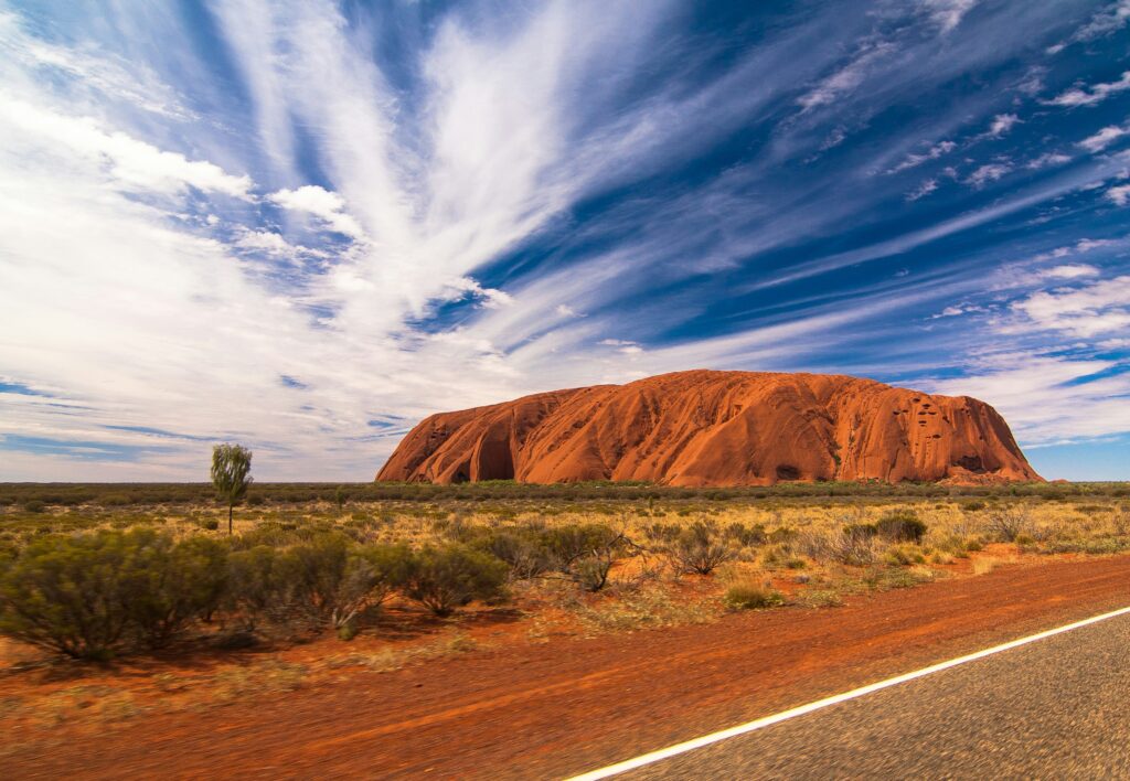
Standing at the edge of Australia’s Red Centre, watching the sunrise paint Uluru-Kata Tjuta National Park in shades of crimson and gold, I’m reminded why this place captivates millions. As someone who manages travel operations and has organized countless tours to this World Heritage-listed park, I can tell you that Uluru-Kata Tjuta National Park offers more than stunning photos – it delivers a soul-stirring connection to ancient Anangu culture and landscapes that have existed for millennia.
Here’s the thing: planning a trip to Uluru-Kata Tjuta National Park requires more than just booking flights. You need insider knowledge about entry fees, the best walking trails, cultural sensitivities, and practical logistics. After years of helping travelers experience the Red Centre properly, I’ve put together everything you need to know for an unforgettable 2026 visit.
What Is Uluru-Kata Tjuta National Park? 🏜️
Located in Australia’s Northern Territory, approximately 450 kilometers southwest of Alice Springs, Uluru-Kata Tjuta National Park is a dual-listed UNESCO World Heritage site recognized for both its outstanding natural and cultural values. This designation – one of only a handful worldwide – honors the park’s geological significance and its deep spiritual importance to the Anangu people, who have been the traditional custodians of this land for over 30,000 years.
The park spans 1,325 square kilometers of red desert, home to two of Australia’s most iconic natural landmarks: Uluru (the massive sandstone monolith) and Kata Tjuta (a collection of 36 weathered rock domes).
| Park Feature | Details |
|---|---|
| Size | 1,325 square kilometers |
| Nearest Town | Yulara (18 km from Uluru) |
| Climate Type | Semi-arid desert |
| UNESCO Status | Dual-listed (1987 for natural, 1994 for cultural) |
| Traditional Owners | Anangu (Pitjantjatjara and Yankunytjatjara people) |
| Elevation – Uluru | 348 meters above ground |
| Elevation – Kata Tjuta | 546 meters above ground (tallest dome) |
| Annual Visitors | Approximately 250,000+ |
The park operates under joint management between Parks Australia and the Anangu traditional owners – a model that has set international standards for indigenous land management since the historic 1985 Handback, when the Australian Government returned ownership to its rightful custodians.
Uluru vs Kata Tjuta — Are They the Same Thing?
This is one of the most common questions I get from travelers. While both are part of the same national park, Uluru and Kata Tjuta are distinctly different geological formations with their own unique characteristics.
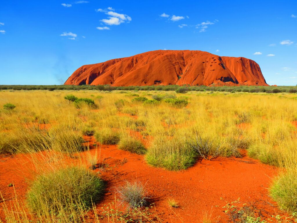
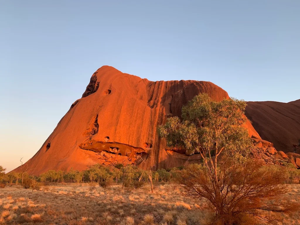
Uluru is a single massive sandstone monolith – essentially one enormous rock rising 348 meters above the desert floor with a circumference of 9.4 kilometers. What you see is actually just the tip; geologists estimate that most of Uluru extends several kilometers underground. The rock is approximately 550 million years old and was formed through the compression of ancient sand dunes.
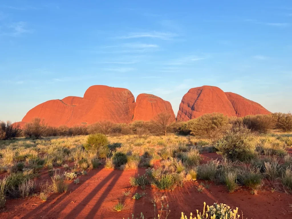
Kata Tjuta, whose name means “many heads” in the local Anangu language, consists of 36 separate dome formations spread across more than 20 square kilometers. The tallest dome, Mount Olga, rises 546 meters – actually 200 meters higher than Uluru. These domes are made of conglomerate rock (a mixture of boulders, pebbles, and sand cemented together) and are estimated to be around 500 million years old.
Think of it this way: Uluru is like a single, smooth cathedral dome, while Kata Tjuta is a cluster of weathered, rounded peaks that create mysterious valleys and gorges between them.
Why Is Uluru-Kata Tjuta National Park So Famous? 🌟
Beyond the obvious visual drama, Uluru-Kata Tjuta National Park holds profound significance that transcends typical tourist attractions. In my experience planning tours, understanding this “why” transforms a simple sightseeing trip into a meaningful journey.
Geological Wonder: These formations represent one of Earth’s most remarkable geological stories. The sandstone of Uluru contains minerals that oxidize (rust) when exposed to air, creating that famous red color. At sunrise and sunset, the changing angle of sunlight amplifies different mineral compositions, making the rock appear to glow in shades ranging from deep purple to brilliant orange-red.
Spiritual Heart: For the Anangu people, this landscape embodies Tjukurpa – their traditional law, culture, and creation stories. Tjukurpa explains how ancestral beings shaped the land, created the waterholes, and established the laws that govern Anangu life. Every cave, waterhole, and rock formation has stories attached, making the entire park a living cultural textbook.
According to Anangu Tjukurpa, during the creation period, ancestral beings traveled across the land, hunting, fighting, loving, and teaching. As they moved, they created the landscape features we see today. The Mala (rufous hare-wallaby) people camped at Uluru, the Kuniya (woma python) fought the Liru (poisonous snake) at Mutitjulu Waterhole, and these stories are preserved in the rock art and landscape itself.
Global Icon Status: Uluru has become one of the world’s most photographed natural landmarks, featured in countless films, documentaries, and travel campaigns. It represents Australia’s ancient heart and has become a pilgrimage site for travelers seeking connection with nature and indigenous culture.
Scientific Importance: The park protects rare desert ecosystems, including over 400 plant species and numerous threatened animals like the Great Desert Skink and Mulgara. The joint management model has pioneered fire management techniques that balance traditional Anangu burning practices with modern conservation science.
Visitor Planning Essentials (Logistics Focus) 📋
Let me share the practical details that can make or break your visit. As someone who coordinates logistics daily, I know these specifics matter.
Uluru-Kata Tjuta National Park Entry Fee 💰
All visitors require a park pass to enter Uluru-Kata Tjuta National Park. Here’s what you need to know for 2026:
Pass Details:
- 3-day pass (consecutive days)
- Adults (18+): Approximately AUD $38 per person
- Children and teenagers (under 18): FREE
- Valid for 3 consecutive days from first entry
- Covers access to both Uluru and Kata Tjuta
How to Purchase:
- Online (recommended): Purchase from the Parks Australia website before arrival. You’ll receive a QR code to scan at the entry station – use the left-hand lane for quick entry
- At Entry Station: Available if you can’t purchase online, but expect queues during peak times
Where Money Goes: This is important to understand. 100% of park pass revenue is reinvested directly into:
- Park maintenance and facilities
- Anangu community support and training programs
- Cultural site preservation
- Fire, weed, and feral animal management
- Business development opportunities for traditional owners
You cannot use a Northern Territory parks pass here – Uluru-Kata Tjuta National Park is federally managed by Parks Australia, requiring its own separate pass.
Uluru-Kata Tjuta National Park Opening Hours ⏰
The park operates year-round with seasonal hour variations:
| Season | Opening Hours | Note |
|---|---|---|
| December-February (Summer) | 5:00 AM – 9:00 PM | Extremely hot; walks close early |
| March-May (Autumn) | 5:00 AM – 8:00 PM | Ideal conditions |
| June-August (Winter) | 6:30 AM – 7:30 PM | Cold nights, perfect days |
| September-November (Spring) | 5:00 AM – 8:00 PM | Warming up, wildflowers |
Important: During summer, when temperatures exceed 36°C (forecast or actual), walking trails beyond certain points close at 11:00 AM due to extreme heat stroke risk. The Valley of the Winds trail past Karu Lookout is typically the first to close.
Sunrise/Sunset Timing: Gates open early enough to reach viewing areas before sunrise. In June-July (winter), sunrise is around 7:15 AM; in December-January (summer), it’s as early as 5:45 AM.
Best Time of Year to Visit Uluru ☀️
This is probably the most critical planning decision. In my experience managing tours, timing can be the difference between magical and miserable.
Peak Season: May to September (Winter/Dry Season) ⭐⭐⭐⭐⭐
Why it’s best:
- Daytime temperatures: 19-23°C (perfect for walking)
- Clear, sunny skies (9-10 hours daily sunshine)
- Minimal rainfall
- Comfortable conditions for all activities
- July is particularly popular (school holidays)
What to pack: Layers! Daytime is warm, but nighttime temperatures drop to 0-5°C. Frost is common, and it has even snowed on Uluru (rare but documented in 1997 and 2011).
Shoulder Seasons: April-May & September-October ⭐⭐⭐⭐
Advantages:
- Still excellent weather (12-27°C in autumn, 13-30°C in spring)
- Fewer crowds than peak winter
- August-September: Wildflowers bloom after winter rains
- More affordable accommodation
- Reptiles emerge from hibernation in spring
Considerations: September can bring thunderstorms; April transitions from hot summer conditions.
Summer: November to March ⭐⭐
Why it’s challenging:
- Extreme heat: 35-45°C (record high 45.5°C)
- High humidity before storms
- Notorious fly plagues (essential to wear fly nets)
- Most walks close after 11:00 AM
- Risk of heat exhaustion
Hidden benefits:
- Fewer tourists (more intimate experience)
- Occasional spectacular thunderstorms
- Rare opportunity to see Uluru’s waterfalls (if it rains)
- Lower accommodation prices
- Dramatic storm photography
My Recommendation: For first-time visitors, target May-June or August-September. You’ll get the best weather without peak July crowds. If you can only visit in summer, book sunrise experiences and indoor cultural activities for midday hours.
Month-by-Month Guide:
| Month | Temp Range | Conditions | Rating |
|---|---|---|---|
| January | 20-37°C | Hot, occasional rain, flies | ⭐⭐ |
| February | 19-35°C | Hot, wet season tail | ⭐⭐ |
| March | 17-33°C | Cooling down | ⭐⭐⭐ |
| April | 12-28°C | Beautiful, transitioning | ⭐⭐⭐⭐ |
| May | 8-23°C | Excellent! | ⭐⭐⭐⭐⭐ |
| June | 5-20°C | Perfect days, cold nights | ⭐⭐⭐⭐⭐ |
| July | 4-20°C | Peak season, crowded | ⭐⭐⭐⭐⭐ |
| August | 6-22°C | Wildflowers, ideal | ⭐⭐⭐⭐⭐ |
| September | 10-27°C | Warming, flowers | ⭐⭐⭐⭐ |
| October | 15-32°C | Getting hot | ⭐⭐⭐ |
| November | 18-34°C | Very hot, pre-wet | ⭐⭐ |
| December | 20-37°C | Extreme heat | ⭐⭐ |
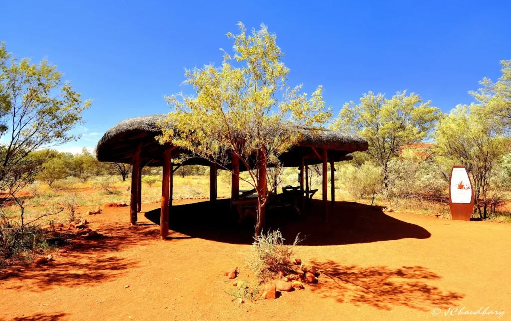
Things to Do in Uluru-Kata Tjuta National Park 🥾
Now for the exciting part! Here’s how to actually experience these magnificent landscapes.
Base and Scenic Walks: Experience Uluru Up Close
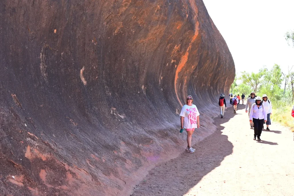
Uluru Base Walk – The Ultimate Experience
The 10.6-kilometer circuit around Uluru is hands down the best way to appreciate this monolith’s scale and diversity. Each section reveals completely different landscapes, rock formations, and cultural sites.
Details:
- Distance: 10.6 km loop
- Time: 3.5-4 hours (allow longer for photo stops and cave exploration)
- Difficulty: Grade 3 (moderate) – flat but long, exposed sections
- Best Start Time: Early morning from Mala carpark, go clockwise
- Facilities: Water taps and toilets at Mala carpark and Kuniya Piti (halfway point)
Highlights Along the Way:
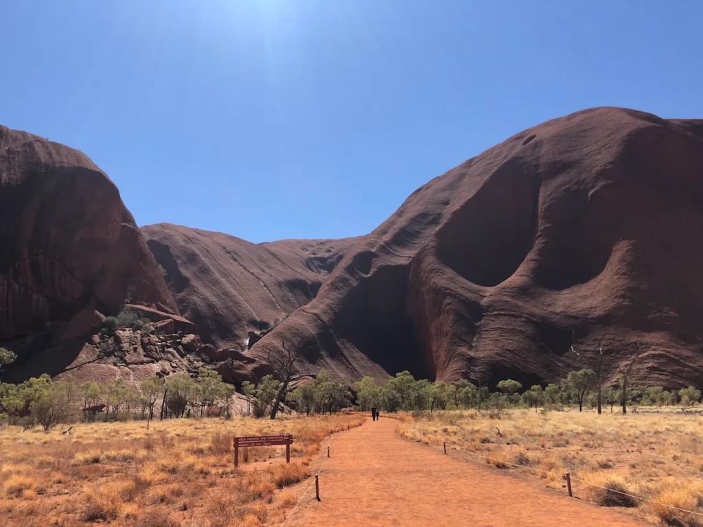
- Kantju Gorge: Sheer walls stained grey from seasonal water flows
- Mutitjulu Waterhole: Permanent waterhole home to Wanampi (ancestral watersnake)
- Rock art sites: Ancient paintings depicting Tjukurpa stories
- Caves: Former shelters with grinding stones and teaching sites
- Diverse ecosystems: Acacia woodlands, native grasses, bloodwoods
Pro Tips from My Tours:
- Start at 7:00 AM to avoid heat and crowds
- Bring 4 liters of water per person (even in winter)
- The Lungkata section (between car parks) offers the most intimate rock views
- Download the self-guided walk brochure from the Cultural Centre
Mala Walk – Cultural Immersion
Details:
- Distance: 2 km return
- Time: 1.5 hours (self-guided) or 2 hours (ranger-guided)
- Difficulty: Easy, mostly flat
- Highlights: Rock art, Kantju Gorge, teaching caves
The free ranger-guided Mala Walk is exceptional – I always recommend it. Rangers share Tjukurpa stories, demonstrate traditional tools, and explain Anangu culture. Tours depart daily:
- October-April: 8:00 AM
- May-September: 10:00 AM
Kuniya Walk – Desert Oasis
Details:
- Distance: 1 km return
- Time: 30-45 minutes
- Difficulty: Easy, wheelchair accessible
- Highlight: Mutitjulu Waterhole, lush vegetation, possible wallaby sightings
This walk leads to one of Uluru’s few permanent water sources. The Kuniya (woma python) and Liru (poisonous snake) creation story is told here through rock formations visible at the waterhole.
Valley of the Winds – Kata Tjuta’s Crown Jewel
Ask any seasoned traveler, and they’ll tell you: this is the most spectacular walk in the entire park. The Valley of the Winds takes you between Kata Tjuta’s towering domes into hidden valleys that few photographs capture.
Full Circuit Details:
- Distance: 7.4 km loop
- Time: 3-4 hours
- Difficulty: Grade 4 (challenging) – steep, rocky sections
- Elevation Gain: Significant climbs and descents
Two Lookout Options:
- Karu Lookout: 2.2 km return, 1 hour – easier option, still spectacular
- Karingana Lookout: Full circuit – the “money shot” with breathtaking valley views
Critical Information:
- The track beyond Karu Lookout closes at 11:00 AM when temperatures reach/exceed 36°C
- No photography of rock formations (cultural sensitivity) – photos of people, flora, fauna are okay
- Two water refill stations along the circuit
- Start no later than 7:00 AM in summer
Why It’s Special: You’ll walk through creek beds, scale rocky slopes, and emerge at viewpoints revealing the martian-like landscape between domes. The sense of wilderness here is profound – at the right times, you might have it entirely to yourself.
Walpa Gorge Walk – The Accessible Alternative
Details:
- Distance: 2.6 km return
- Time: 1 hour
- Difficulty: Easy to moderate, gentle incline
- Best Time: Late afternoon when sun hits the rock faces
This walk leads into a desert oasis between two domes, ending at a seasonal waterhole surrounded by spearwood trees. Much shadier than Valley of the Winds, making it ideal for hot days or families with younger children.
Cultural Respect: Keep both sides of the gorge in frame when photographing – this is a sacred men’s site.
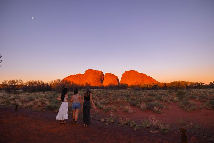
Sunrise & Sunset Viewpoints: Capturing the Magic 📸
The color-changing phenomenon at Uluru-Kata Tjuta is real, not marketing hype. As minerals in the rock interact with changing light angles, you’ll see transformations from purple-brown to fiery orange-red to deep burgundy.
Best Viewing Locations:
For Uluru:
- Talinguru Nyakunytjaku (official sunset viewing area): Southwest side, includes two short wheelchair-accessible walks (Minymaku and Watiku) about women’s and men’s cultural practices
- Sunrise Viewing Area: Less crowded than sunset, magical as the rock emerges from darkness
For Kata Tjuta:
- Kata Tjuta Dune Viewing Area: Halfway between Uluru and Kata Tjuta, offers views of both at once
- Kata Tjuta Sunset Viewing Area: Near the car park, includes picnic facilities
Photography Tips:
- Arrive 30-45 minutes early for sunset (gets crowded)
- Best light occurs 15-20 minutes after sunset (afterglow)
- Sunrise is equally spectacular but far less crowded
- Bring a tripod for low-light conditions
- Respect photography restriction zones (marked with signs)
Cultural Experiences: Connecting with Anangu Heritage 🎨
Uluru-Kata Tjuta Cultural Centre
Located near the base of Uluru, this award-winning center is essential for understanding Anangu culture. Designed in the shape of two ancestral snakes, it features:
- Tjukurpa displays: Creation stories explained through art and artifacts
- Nintiringkupai Gallery: Showcasing contemporary Anangu art
- Maruku Arts: Indigenous-owned enterprise selling authentic art
- Ininti Cafe: Try bush tucker-inspired dishes
- Information desk: Rangers answer questions and provide trail updates
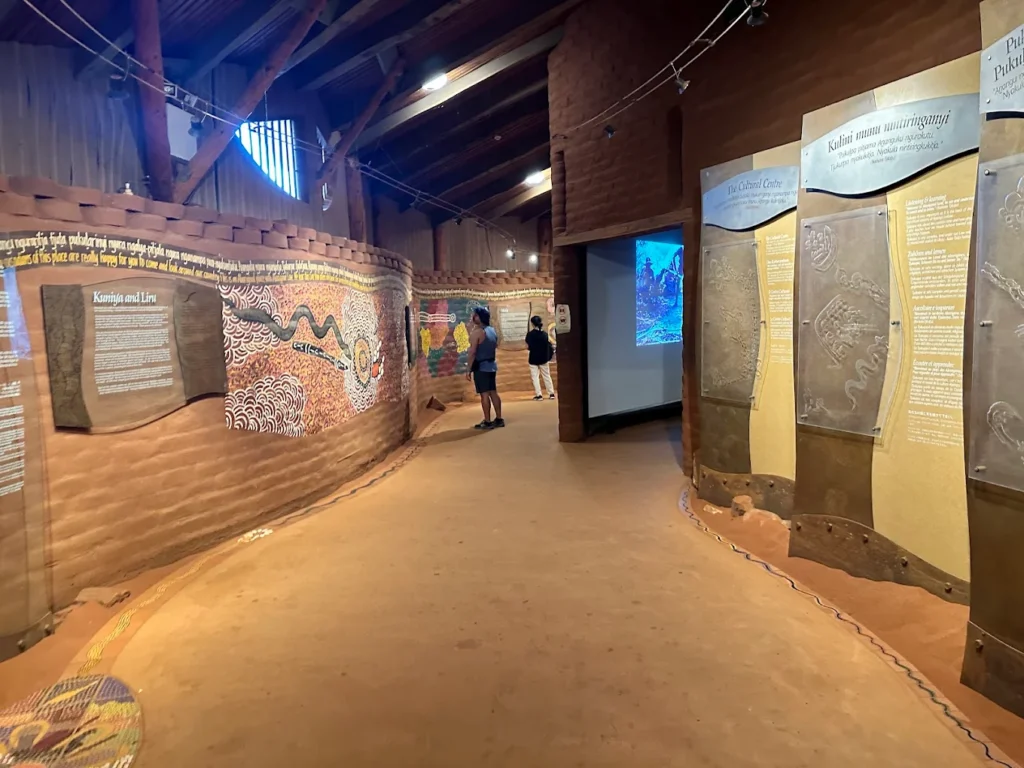
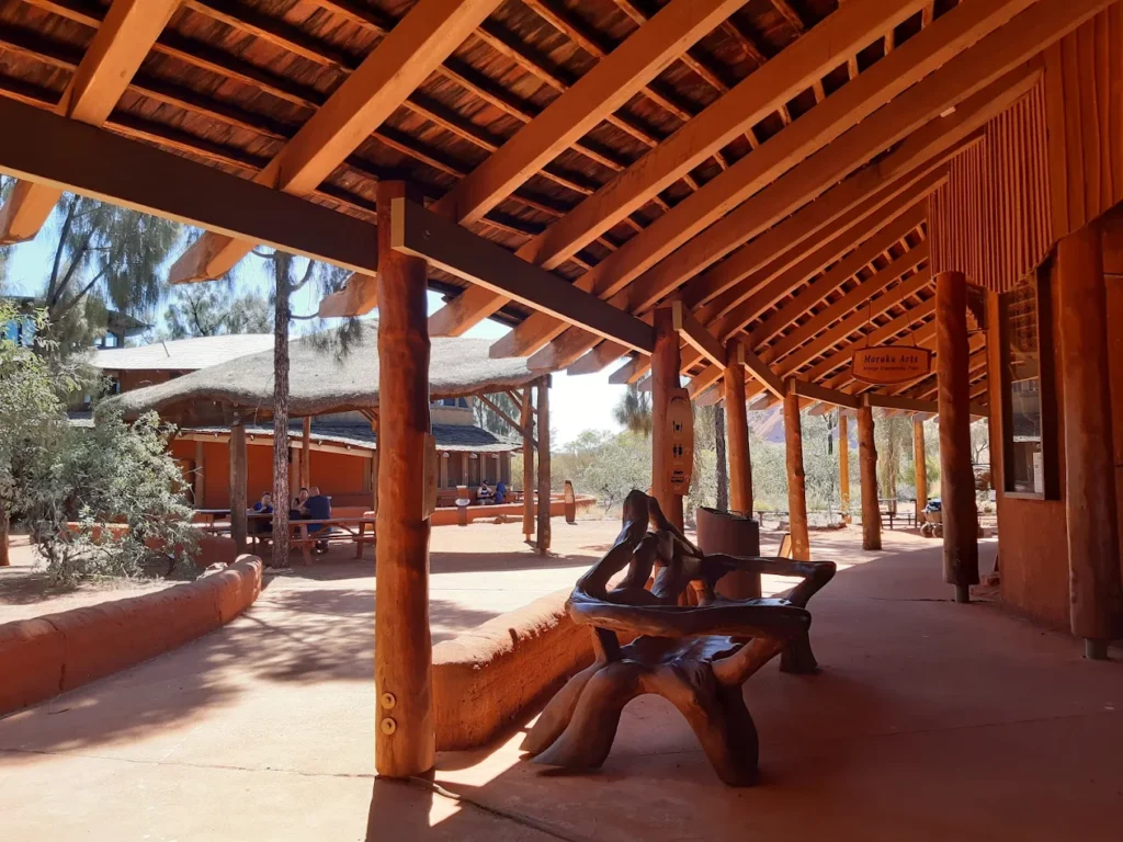
Admission: FREE (included with park pass) Time needed: 1-2 hours minimum
Anangu Tours
For the deepest cultural immersion, book tours led by Anangu guides. These indigenous-owned experiences include:
- Kuniya Walk with cultural interpretation
- Liru Walk with bush tucker demonstration
- Tool-making demonstrations
- Stories told in Pitjantjatjara language with English translation
These tours cost extra but provide perspectives and access you won’t get elsewhere. The knowledge shared comes directly from traditional owners, making it irreplaceable.
Why Are Tourists No Longer Allowed to Climb Uluru? 🚫
On October 26, 2019, climbing Uluru was permanently banned – a decision that sparked global debate but ultimately represented a triumph for indigenous rights and cultural respect.
The Sacred Significance:
For Anangu people, climbing Uluru has always been prohibited under Tjukurpa (traditional law). The climbing route passes through a sacred men’s site tied to the Mala (rufous hare-wallaby) creation story. To understand how inappropriate climbing is, imagine tourists scaling over your church altar, mosque prayer hall, or family cemetery – that’s the equivalent violation for Anangu.
Sammy Wilson, chairman of the park board and senior traditional owner, explained: “It is an extremely important place, not a playground or theme park like Disneyland… The land has law and culture.”
Historical Context:
Climbing began in the 1930s when colonial visitors ignored Anangu requests. In 1964, a chain was installed to “improve safety” – but Anangu never wanted it. Following the historic 1985 Handback, when the Australian Government returned Uluru to traditional owners, discussions about closing the climb intensified.
In 2017, the park board voted unanimously to close the climb when visitor numbers dropped below 20% (it had fallen to 16.2%). The closure date – October 26, 2019 – marked the 34th anniversary of the Handback.
Why It Had to Close:
- Cultural Disrespect: Every climber ignored explicit Anangu requests not to climb
- Deaths and Injuries: At least 38 people died attempting the climb since the 1950s; countless others required rescue
- Environmental Damage: No toilets at summit meant human waste flowed into sacred waterholes below
- Spiritual Duty: Anangu believe they’re responsible for visitor safety on their land – deaths caused immense grief
Post-Closure:
The ban is legally enforced under the Environment Protection and Biodiversity Conservation Act. Attempting to climb now results in fines up to AUD $630 and possible prosecution. Far from hurting tourism, visitor numbers remain strong, with travelers increasingly understanding and respecting the cultural significance.
Better Alternatives: The Base Walk, ranger-guided tours, sunrise experiences, and Anangu-led cultural programs offer far richer experiences than a dangerous scramble up a sacred site.
Uluru-Kata Tjuta National Park Accommodation Guide 🏨
There’s no accommodation inside the park itself – all lodging is in Yulara (also called Ayers Rock Resort), located 18 km from Uluru and 8 km from the park entrance.
Yulara is essentially a purpose-built resort town owned and operated by Voyages Indigenous Tourism Australia. Despite its remote location, it offers surprisingly comprehensive facilities: supermarket, bank, post office, medical clinic, restaurants, and more.
Budget Options
Ayers Rock Campground
- Unpowered sites: From AUD $43 per night (220 sites available)
- Powered sites: From AUD $50 per night (198 sites)
- Facilities: Swimming pool, BBQ areas, outdoor kitchen, laundry, hot showers
- Cabins: Two-bedroom air-conditioned cabins (sleep 2 adults + 4 children) from ~$180-220 per night
Why I recommend it: Great value, social atmosphere, you’re still within the resort with access to all amenities. The campground even has a viewing platform for sunset over Uluru.
Outback Pioneer Hotel & Lodge
- Dorm beds: From ~$50-70 per person per night
- Private rooms: From ~$180-250 per night
- Facilities: Swimming pool, BBQ bar (cook your own meat!), live music
Mid-Range
Desert Gardens Hotel (4.5 stars)
- Garden View rooms: From ~$350-450 per night
- Rock View rooms: From ~$450-600 per night (wake up to Uluru views!)
- Features: Native gardens, multiple pools, excellent restaurants (Arnguli Grill, Mangata Bistro)
Lost Camel Hotel (Boutique)
- Rates: From ~$390-500 per night
- Location: Heart of Town Square (no car needed)
- Style: Contemporary Aboriginal-urban fusion design
- Facilities: Pool, central to restaurants and shops
Emu Walk Apartments (Self-contained)
- Rates: From ~$400-550 per night
- Features: Full kitchens, living areas, 1-2 bedrooms, laundry facilities
- Best for: Families or extended stays wanting to self-cater
Luxury
Sails in the Desert Hotel (5 stars)
- Rates: From ~$500-800+ per night
- Features: Iconic white sail architecture, Red Ochre Spa, gourmet restaurants, pool area with gum trees
- Room types: Superior, deluxe, and family rooms
Longitude 131° (Ultimate Luxury)
- Rates: From ~$2,500-3,500+ per night (all-inclusive)
- Experience: 15 luxury “tents” with Uluru views from your bed
- Includes: All meals, premium beverages, guided experiences with naturalists, private tours
- Exclusive: The Dune Pavilion is the only accommodation with views of both Uluru and Kata Tjuta
Why it’s special: This is glamping at the highest level – think safari luxury meets outback authenticity, with indigenous art, fine dining using Australian ingredients, and deeply immersive experiences.
Booking Tips
- Book 3-6 months ahead for June-September
- Midweek stays (Monday-Thursday) are often cheaper than weekends
- Look for package deals combining accommodation + experiences
- Free shuttle operates between all resort properties every 20 minutes
- All hotels have swimming pools (essential in heat)
Budget Saver: Curtin Springs (92 km from park entrance) offers free camping with paid shower access – only worthwhile if you have a vehicle and don’t mind the drive.
Unique & Lesser-Known Facts About Uluru-Kata Tjuta National Park 🔍
Let me share some fascinating details that even repeat visitors often miss:
The Color-Changing Phenomenon Explained: Uluru doesn’t actually change color – it’s an optical illusion. The rock contains feldspar and iron oxide. At different times of day, varying wavelengths of light interact with these minerals differently. Dawn light (more blue wavelengths) makes it appear purple-grey, midday sun creates the classic rust-red, and sunset (more red wavelengths) intensifies to fiery orange. After rain, when the rock surface is wet, it appears dark charcoal grey.
What Lies Beneath: Uluru and Kata Tjuta are essentially “icebergs” of rock. Seismic surveys suggest Uluru extends 2.5 kilometers underground – meaning only 10-15% is visible. Kata Tjuta likely has even deeper roots.
The Rare Desert Ecosystem: Despite the harsh environment, the park protects remarkable biodiversity:
- 20+ mammal species including the endangered Mulgara (a carnivorous marsupial mouse)
- 178 bird species – more than you’d expect in a desert
- 73 reptile species including the thorny devil and perentie (Australia’s largest monitor lizard)
- 400+ plant species from tiny succulents to majestic desert oak trees
Ancient Waterholes: Sites like Mutitjulu have provided water continuously for tens of thousands of years – making them among the world’s longest-inhabited water sources. Archaeological evidence shows Anangu camps around these waterholes dating back 22,000+ years.
The Mysterious Domes: Scientists still debate how Kata Tjuta’s conglomerate rock formed. The boulders within the rock come from ancient mountain ranges that no longer exist – making Kata Tjuta a geological puzzle containing echoes of vanished landscapes.
Fire Management Innovation: The park’s joint management pioneered “patch burning” techniques that combine traditional Anangu practices with modern conservation. Small, controlled burns in cooler months create a mosaic of habitats, reduce wildfire risk, and support biodiversity. This model is now studied globally.
Rock Art Preservation: Some Uluru cave paintings are estimated to be 3,000-5,000 years old, yet remain visible due to the rock’s protection from elements. The ochre pigments (red from iron oxide, yellow from limonite, white from kaolin) were mixed with water, animal fat, or plant sap.
The Fly Reality: Those infamous summer flies? They’re drawn to moisture (eyes, nose, mouth) because water is so scarce. The Outback fly net isn’t a tourist gimmick – it’s essential survival gear November-March.
Kata Tjuta’s Height Advantage: While Uluru gets all the fame, Kata Tjuta’s tallest point (Mount Olga at 546 meters) actually rises 200 meters higher than Uluru – but spread across multiple domes rather than one monolith, it appears less imposing.
Practical Tips for Travellers ✈️
How to Get There: Transportation Options
By Air – The Fastest Route:
Connellan Airport (AYQ) – also called Ayers Rock Airport – is located just 6 km from Yulara.
Direct Flights Available From:
- Sydney (SYD): ~3.5 hours
- Melbourne (MEL): ~3 hours
- Brisbane (BNE): ~3 hours
- Darwin (DRW): ~2 hours
- Adelaide (ADL): ~2 hours
- Alice Springs (ASP): ~45 minutes
Airlines: Qantas and Virgin Australia operate services Transfer: Free shuttle buses meet all flights to transport you to Ayers Rock Resort
By Road – The Scenic Journey:
From Alice Springs (450 km, approximately 5.5 hours):
- Route: Stuart Highway south, then west on Lasseter Highway
- Road condition: Fully sealed bitumen – no 4WD required
- Fuel stops: Erldunda (200 km south of Alice Springs, last fuel before Yulara)
- Rental cars: Available from Alice Springs airport (Avis, Hertz, Budget, Thrifty)
Scenic Alternative – Red Centre Way:
- Longer route through West MacDonnell Ranges and Kings Canyon
- Allow 2-3 days to enjoy stops
- Absolutely worth it if you have time
By Tour/Bus:
- AAT Kings runs 3-day camping and hotel tours from Alice Springs
- Emu Run offers budget multi-day camping adventures
- Groovy Grape and Wayoutback provide young traveler-focused tours
From Other Major Cities: It’s a 3-day drive minimum from Sydney or Melbourne (yes, really). Australia’s vast! Most visitors fly unless planning an epic outback road trip.
What to Pack: Desert Survival Essentials
Critical Items (Don’t Leave Home Without These):
Sun Protection:
- SPF 50+ sunscreen – reapply every 2 hours
- Broad-brimmed hat (not baseball caps – you need neck protection)
- Polarized sunglasses with UV protection
- Lip balm with SPF
Hydration:
- Reusable water bottle (minimum 2 liters capacity)
- Electrolyte tablets (heat exhaustion is serious)
- 4 liters per person per day for walking in cooler months
- 1 liter per person per hour in summer
Clothing (Layering is Key):
May-September (Winter):
- Warm jacket for mornings/evenings (0-5°C possible)
- Long pants and long-sleeved shirts (sun and cold protection)
- T-shirts and shorts for midday
- Closed-toe walking shoes with good grip
- Warm socks and beanie for sunrise/sunset
October-March (Summer):
- Lightweight, breathable, long-sleeved shirts (cover skin from sun)
- Loose-fitting, light-colored clothing
- Fly nets (absolutely essential November-March)
- Wide-brimmed hat
- Moisture-wicking fabrics
Year-Round:
- Sturdy walking shoes (not sandals – rocky, uneven terrain)
- Camera with extra batteries (opportunities everywhere)
- Small backpack for day walks
- Insect repellent (flies and occasional mosquitoes)
Optional but Recommended:
- Binoculars (birdwatching and distant views)
- Power bank (charging can be limited on walks)
- Tripod (low-light sunrise/sunset photography)
- Red torch/flashlight (astronomers appreciate red light at night)
Safety & Respectful Travel: Essential Guidelines
Heat Safety (This Can Be Life-Threatening):
- Never underestimate desert heat – I’ve seen fit adults hospitalized from heat exhaustion
- Finish all walks by 11:00 AM in summer
- If you feel dizzy, nauseous, or stop sweating in heat → seek shade immediately and hydrate
- Signs of heat stroke: confusion, rapid pulse, hot/dry skin → medical emergency
- Children and elderly are particularly vulnerable
Cultural Respect (The Most Important Section):
Photography Restrictions:
- Absolutely no photos of certain sacred sites (marked with signs)
- No photos of rock formations in Valley of the Winds
- At Walpa Gorge, keep both sides of gorge in frame
- Never photograph Anangu people without permission
- Drone use is prohibited in the national park
Sacred Sites:
- Stay on marked trails (wandering off damages both fragile ecosystems and sacred sites)
- No climbing Uluru (illegal and disrespectful)
- No swimming in waterholes (contamination and spiritual violation)
- No taking rocks, plants, or sand as “souvenirs” (illegal – yes, customs finds them!)
- No touching rock art
Behavior Guidelines:
- Speak quietly near sacred sites
- Don’t play music in the park
- Dispose of waste properly (carry out everything)
- Respect the closing of tracks (there are cultural reasons beyond what’s explained publicly)
Wildlife Safety:
- Don’t approach or feed animals
- Shake out shoes before wearing (spiders, scorpions seek cool spaces)
- Watch where you sit (ants!)
- Most dangerous creature: flies (annoying but not harmful)
- Snakes are rare but present – stay on paths, make noise when walking
Emergency:
- Mobile coverage is limited to Yulara and main park areas
- Emergency radios at trailheads
- Nearest hospital: Alice Springs (450 km away)
- Royal Flying Doctor Service provides emergency medical evacuations
Frequently Asked Questions❓
Is Uluru sacred to indigenous people?
Yes, Uluru is profoundly sacred to the Anangu people, who have been its traditional custodians for over 30,000 years. Under Tjukurpa (Anangu traditional law), Uluru embodies creation stories of ancestral beings who shaped the land. Every cave, waterhole, and rock formation holds spiritual significance, making the entire site a living cultural and spiritual landscape integral to Anangu identity and law.
Can you see both Uluru and Kata Tjuta in one day?
Yes, you can see both Uluru and Kata Tjuta in one day, though it requires early starts and good planning. A typical itinerary: sunrise at Kata Tjuta Dune Viewing Area, Valley of the Winds walk (3-4 hours), lunch break, afternoon visit to Uluru for the Mala Walk or Cultural Centre, and sunset at Talinguru Nyakunytjaku. However, spending 2-3 days allows you to experience both sites at a relaxed pace and explore more trails.
What is the easiest walk in the park?
The Kuniya Walk is the easiest trail, featuring a flat, 1-kilometer return path to Mutitjulu Waterhole that takes 30-45 minutes. It’s wheelchair-accessible and offers beautiful views of lush vegetation, possible wallaby sightings, and one of Uluru’s permanent water sources. The Mala Walk is also relatively easy at 2 kilometers but includes gentle inclines and takes longer (1.5-2 hours).
Are guided tours worth it?
Absolutely! Guided tours, especially those led by Anangu traditional owners, provide cultural context and stories that transform your visit from sightseeing to meaningful cultural immersion. The free ranger-guided Mala Walk is exceptional, explaining Tjukurpa creation stories, rock art, and traditional tool-making. Anangu Tours offers indigenous-owned experiences with stories told in the Pitjantjatjara language and translated – perspectives you cannot get from self-guided exploration.
How many days should I spend at Uluru-Kata Tjuta National Park?
Ideally, spend 2-3 days to properly experience both Uluru and Kata Tjuta. Day 1: Sunrise at Kata Tjuta, Valley of the Winds walk, Cultural Centre visit. Day 2: Sunrise at Uluru, Base Walk or Mala Walk, sunset viewing. Day 3: Leisurely exploration, Walpa Gorge, extra sunrise/sunset, local art galleries. A rushed 1-day visit misses the depth; 4+ days allows for Kings Canyon as well.
Is it worth visiting Kata Tjuta?
Definitely yes! While Kata Tjuta receives less attention than Uluru, many travelers (including myself) find it equally or more spectacular. The Valley of the Winds offers wilderness experiences and dramatic vistas you cannot get at crowded Uluru viewing platforms. Kata Tjuta’s 36 domes create mysterious valleys and gorges with unique geological formations. It’s less touristy, often uncrowded, and provides incredible hiking opportunities.
Can you camp in Uluru-Kata Tjuta National Park?
No, there is no camping permitted inside Uluru-Kata Tjuta National Park. All accommodation is located in Yulara (18 km from Uluru), which includes the Ayers Rock Campground with powered/unpowered sites and air-conditioned cabins. The closest free camping is at Curtin Springs, 92 km from the park entrance (hot showers available for a small fee).
What is the difference between Yulara and Uluru?
Yulara is the service town 18 km from Uluru where all visitor accommodation, restaurants, shops, and facilities are located. Uluru is the massive sandstone rock formation inside Uluru-Kata Tjuta National Park. Think of Yulara as your base camp – you stay there and drive into the park to see Uluru and Kata Tjuta. Yulara is sometimes called Ayers Rock Resort, referring to the collection of hotels and services there.
Do I need a 4WD to visit Uluru?
No, a 4WD is not required. All roads from Alice Springs to Yulara are fully sealed bitumen highways (Stuart and Lasseter Highways). Roads within Uluru-Kata Tjuta National Park to viewing areas, car parks, and trailheads are also sealed. A regular 2WD sedan or campervan works perfectly fine. Only venture off sealed roads if planning remote outback exploration beyond the park.
Are there restaurants in Uluru-Kata Tjuta National Park?
There are no restaurants inside the national park itself. The only dining option within park boundaries is Ininti Cafe at the Cultural Centre (sandwiches, drinks, snacks). All restaurants are located in Yulara/Ayers Rock Resort, ranging from budget (Outback Pioneer BBQ) to fine dining (Tali Wiru, Sounds of Silence). Pack snacks and water for day visits to the park.
Your Journey to Australia’s Spiritual Heart
Uluru-Kata Tjuta National Park represents far more than a tourist destination – it’s a living cultural landscape where ancient Anangu traditions meet modern conservation, where geological wonders tell stories millions of years old, and where you can disconnect from the ordinary world to reconnect with something timeless.
In my 20 years managing tours through Australia’s most iconic destinations, I’ve watched countless travelers arrive thinking they’ll just “see the big rock” and leave utterly transformed by the experience. The crimson dawn breaking over Uluru, the profound silence between Kata Tjuta’s domes, the generosity of Anangu people sharing their culture – these moments change perspectives.
As you plan your 2026 visit, remember that respect forms the foundation of meaningful travel. Purchase your park pass knowing it directly supports Anangu communities. Walk the trails understanding that every formation holds sacred stories. Time your visit wisely for comfort, but most importantly, come with openness to learn.
Whether you’re walking the entire Base Walk, watching your first sunrise over the Red Centre, or listening to Tjukurpa stories in the Cultural Centre, you’re experiencing one of Earth’s most remarkable intersections of nature, culture, and spirit.
Start planning early, pack appropriately, and prepare for an experience that stays with you long after the red dust shakes from your boots.
Welcome to the heart of Australia.
About the Author
Wahid Ali is a seasoned travel professional and operations lead in the tourism industry with extensive experience in crafting travel experiences and destination insights. Based in Mumbai, he heads operations at Astamb Holidays, where he combines practical travel logistics expertise with engaging storytelling to help travelers explore hidden gems across India and beyond. His work blends expert travel planning with a passion for culturally rich and nature-oriented destinations.
Connect with Wahid Ali: LinkedIn Profile
References & Citations
This article is backed by authoritative sources, extensive research, and professional travel experience to ensure accuracy and reliability:
- Parks Australia – Uluru-Kata Tjuta National Park Official Website: Comprehensive information on park passes, opening hours, walks, and cultural protocols
- UNESCO World Heritage Centre: Documentation of Uluru-Kata Tjuta’s dual-listing for cultural and natural significance
- Tourism Australia: Official weather data, seasonal information, and travel planning resources
- Northern Territory Tourism: Accommodation guides, transportation options, and regional experiences
- National Geographic: In-depth coverage of the 2019 climbing ban and cultural significance
- Ayers Rock Resort: Accommodation options, pricing, and visitor facilities
- The Conversation – “Why we are banning tourists from climbing Uluru”: Direct insights from Anangu Traditional Owners
- AllTrails: Detailed trail information, difficulty ratings, and visitor reviews for park walks
- CBS News – Uluru Climb Closure Coverage: Historical documentation of the 2019 ban implementation
- Parks Australia – Climb Closure History: Official documentation of the Handback and management decisions
All information has been verified against current 2025-2026 data and reflects the most up-to-date visitor guidelines, pricing, and cultural protocols for Uluru-Kata Tjuta National Park.
Last Updated: January 2026
Read More Articles;
- Kodaikanal Tourist Places 2026: Top Attractions, Hidden Gems & Travel Guide
- Maldives Water Villa Guide 2026: Price, Best Resorts & Is It Worth It? (Budget to Luxury)
- Indians Traveling Phu Quoc Advisory 2026: Visa Rules, Hidden Risks & Must-Know Travel Guidelines
- Northeast India Tourism Guide 2026: Best Places, Itinerary, Cost & Hidden Gems
- Thailand Hidden Islands Travel Guide 2026: Secret Islands, Budget Itinerary & Crowd-Free Beaches for Indians