...

Hidden Gems

Bhandardara

Bhandardara: Maharashtra’s Hidden Gem – A Comprehensive Travel Guide

Welcome to Bhandardara: An Overview of its Natural Splendor: Escape the ordinary and discover Bhandardara, Maharashtra’s hidden gem! This comprehensive guide unveils the natural splendor, historical sites, and thrilling adventures awaiting you in this picturesque hill station nestled in the Western Ghats. Bhandardara: Your Ultimate Travel Guide to Maharashtra’s Hidden Paradise Bhandardara stands as a picturesque holiday resort village, gracefully nestled within the Western Ghats of India. Located in the Akole tehsil of Ahmednagar district in Maharashtra, it is frequently characterized as Maharashtra’s “hidden gem”.1 This designation stems from its relatively undiscovered allure, despite being enveloped by a landscape of profound natural beauty. The village is situated serenely by the Pravara River, presenting a harmonious blend of natural environment, including cascading waterfalls, majestic mountains, and the tranquil expanse of Wilson Dam and Arthur Lake.3 The pervasive lush greenery and invigorating air contribute to a pristine ambiance, rendering it a truly idyllic and picture-perfect holiday destination.1 Why Bhandardara? Unveiling its Unique Appeal Bhandardara is recognized as a versatile destination, capable of catering to a broad spectrum of travelers. It appeals to nature enthusiasts, adventure seekers, and individuals desiring a peaceful retreat from the demands of urban life.4 The region offers distinctive opportunities for backpacking, engaging in challenging treks, experiencing lakeside camping under star-filled skies, and exploring ancient forts and temples.1 These diverse offerings collectively ensure a remarkable and unforgettable experience for every visitor, solidifying its reputation as a valuable destination for tourism.1 2. Geographical Location & Accessibility Where is Bhandardara? Bhandardara is strategically positioned in the Ahmednagar district of Maharashtra, in close proximity to Igatpuri, within the majestic Sahyadri ranges of the Western Ghats.1 Its geographical coordinates are 19°31′45″N 73°45′5″E, and it is situated at an elevation of 740 meters (2,430 ft) above mean sea level.3 A central feature of the village’s natural setting is its location on the banks of the Pravara River, which is integral to many of its primary attractions, including the notable Wilson Dam and Arthur Lake.3 How to Reach Bhandardara: Your Journey Options Bhandardara is accessible through various modes of transportation, connecting it to major urban centers in Maharashtra. Getting Around Bhandardara: Local Transport Tips Within Bhandardara itself, local transport facilities are somewhat limited. As a smaller hill station, options for getting around are not as extensive as in larger urban areas, primarily consisting of local buses that ply from Igatpuri.10 This limited availability of internal transport means that visitors should plan their mobility carefully. For those who drive to Bhandardara, utilizing their own vehicle for local sightseeing is the most convenient approach. Alternatively, resorts may facilitate cab arrangements upon request for their guests.10 Relying on spontaneous local transport within the village might prove challenging, potentially impacting the overall sightseeing experience. The explicit warnings about narrow roads while driving on the ghats and the scarcity of local transport within Bhandardara underscore the critical importance of pre-arranged transport for local exploration. 3. Best Time to Visit: Unveiling Bhandardara’s Seasonal Charms Overview of Bhandardara’s Climate Bhandardara experiences three distinct primary seasons—summer, monsoon, and winter—each uniquely transforming the landscape and offering varied experiences.14 The timing of a visit significantly influences sightseeing comfort and the availability of specific activities, including season-specific wonders such as the firefly festivals.14 The optimal period for a visit is not a singular timeframe but rather contingent on a traveler’s primary interests and desired activities. This allows for tailored recommendations rather than a universal “best time to visit.” Monsoon Magic (July – September) The monsoon season in Bhandardara is often described as “magical,” as rainfall invigorates the natural environment, leading to lush greenery and spectacular displays of overflowing waterfalls.4 Attractions such as Randha Falls and Umbrella Falls reach their full glory during this period.4 While enchanting for nature lovers, heavy rains and elevated humidity can render trekking trails slippery, necessitating caution.1 Evenings, however, are typically breezy and pleasant, providing an ideal setting for picnics near the swollen waterfalls and dams.1 Average July temperatures range from a high of 27°C (81°F) to a low of 22°C (72°F).15 This month experiences a very high probability of rain (98%), with heavy precipitation averaging around 25.6 mm per day, accompanied by high humidity (98%).15 The detailed monthly weather data, particularly for the monsoon months, provides critical actionable information for travelers. Knowing the high chance of heavy rain, high humidity, and recommended attire such as a sleeveless shirt, raincoat, and rain boots for July enables precise packing and preparation, thereby mitigating potential discomforts and enhancing the overall trip experience.15 Winter Wonderland (October – February) Winter in Bhandardara is widely regarded as the best time to visit by many, offering cool, pleasant weather and crisp, clear skies that are conducive to outdoor adventures and relaxation.1 This period is perfectly suited for embarking on treks to historical forts and majestic peaks like Ratangad, Harishchandragad, and Mount Kalsubai.9 It also presents a charming opportunity for cozy retreats by Arthur Lake, stargazing, and photography.9 Temperatures typically remain below 20°C 1, with December and January experiencing average highs around 28°C and lows between 15-18°C, along with minimal rainfall.16 Summer Escapes (March – June) Summer generally represents a quieter, less crowded period in Bhandardara. While the weather tends to be warmer, with days often hot and humid (averaging a maximum of 36°C), nights can cool down considerably.4 Arthur Lake and Wilson Dam continue to offer refreshing experiences even under warmer skies.14 This season is well-suited for peaceful retreats, discovering secluded spots, engaging in leisurely village walks, and camping near the lakes.9 Occasional pre-monsoon showers in May can contribute to a reduction in temperatures.9 Below is a consolidated overview of Bhandardara’s monthly weather, providing a quick reference for planning purposes: Month Average High Temp (°C / °F) Average Low Temp (°C / °F) Average Rain Days Average Precipitation (mm / inches) Average Relative Humidity (%) Average Clear/Sunny Hours per Day Average Wind Speed (mph / kph) January 28° / 82° 15° / 59° 0 – – 19.2 – February 31° / 88° 17° / 63° 0 –

Bhandardara: Maharashtra’s Hidden Gem – A Comprehensive Travel Guide Read More »

A herd of Indian elephants, including adults and calves, grazing peacefully near a watering hole in the verdant grasslands of Gavi, Kerala.

Gavi, Kerala: An In-Depth Eco-Tourism Guide

Discover Gavi, Kerala: An Untouched Eco-Tourism Paradise Gavi, located deep within Kerala’s Pathanamthitta district, is a secluded village in the Ranni Reserve Forest, forming a critical part of the Periyar Tiger Reserve. Recognized by Alistair International as a must-see eco-tourism site, Gavi offers nature lovers and adventure seekers a pristine escape from tourist-heavy destinations like Munnar or Thekkady. With its biodiversity, rare flora and fauna, off-the-grid vibe, and ethical tourism model, Gavi is the quintessential off-the-beaten-path destination. Location & Geographical Significance Coordinates: 9°26′25.72″N, 77°9′37.25″EElevation: 1,036 meters (3,399 ft) above sea levelDistrict: Pathanamthitta, KeralaProtected Zones: Ranni Reserve Forest and Periyar Tiger ReserveProximity: 14 km from Vandiperiyar, 28 km from Kumily, near Thekkady Gavi lies amidst undisturbed tropical forest, rich in biodiversity. The area includes lakes, cardamom plantations, and scenic viewpoints like Valley View and Sabarimala Viewpoint. Gavi Lake and Kochupamba River enhance its geographical charm. It is one of few eco-tourism zones in India where forest department-led operations preserve and sustain local ecosystems. How to Reach Gavi Mode Nearest Point Distance to Gavi Travel Time Notes Air Cochin Airport (COK) ~190 km ~6 hrs Via Thekkady, jeep preferred Madurai Airport ~140 km ~5 hrs Recommended for Tamil Nadu visitors Rail Kottayam Station ~128 km ~4.5 hrs Good connectivity; taxis/buses to Vandiperiyar Chengannur Station ~120 km ~4 hrs Near Pathanamthitta Road Vandiperiyar 28 km 1 hr Closest access; bumpy forest roads Thekkady 51 km 1.5 hrs Scenic but rugged terrain Forest Entry Point: Vallakkadavu Check PostPermits Required: Yes (Handled if booked via KFDC)Private Vehicles: Allowed up to check post; KFDC jeeps recommended inside forestBus Option: KSRTC operates buses from Pathanamthitta to Gavi Climate & Best Time to Visit Month Avg High (°C) Avg Low (°C) Avg Rainfall (mm) Highlights Jan-Feb 24-25 15-16 23-32 Peak season; dry & cool Mar-May 27-28 17-19 56-168 Warm; fewer tourists Jun-Sep 24-25 17-18 250-400 Monsoon; lush landscapes Oct-Dec 24-25 16-17 77-252 Great for trekking & wildlife Recommendations: Entry Details & Costs Category Fee (INR) Indian Adult 100 Foreign Visitor 200 Children < 13 yrs Free Boating (2 persons) 300 Boating (4 persons) 600 Accommodation Options Within Gavi (KFDC Managed) Booking: gavi.kfdcecotourism.com Nearby Options (Thekkady/Vandiperiyar) Activities & Attractions Activity Duration Approx. Cost (INR) Notes Jeep Safari 2.5 hrs Part of package Limited to 25 vehicles/day Boating 30 mins 300-600 Kochupamba Lake Trekking 1-3 hrs Included Leech precautions needed Bird Watching Ongoing Included 260+ species Cardamom Tour 1 hr Included Visit curing center Sabarimala Viewpoint 30 mins Included Binoculars recommended Animal Museum 30 mins Included Skeletons & bones display Flora & Fauna KFDC Eco-tourism Packages Package Type Inclusions Cost (INR) Full-Day Plantation walk, boating, vehicle safari, lunch 1,500/adult 625/child Boating Only Kochupamba Lake rowing (2 or 4 persons) 300-600 Overnight (any stay) Stay + all activities (trek, boating, safari, meals) ~3,000/person Practical Tips (Checklist) Responsible Tourism Guidelines Nearby Places to Visit FAQ’s Why is Gavi famous? It is known for eco-tourism, rare wildlife, and its role in Periyar Tiger Reserve.Is Gavi worth visiting? Yes, it offers unique offbeat nature experiences, unlike mainstream Kerala destinations. What is Gavi good at? Adventure, wildlife safaris, trekking, birding, and responsible tourism. Is Gavi a hill station? No, but it is at an elevation of 1,036 m and has a cool climate. What animals are in Gavi? Elephants, deer, macaques, Nilgiri tahr, leopards. What is the climate of Gavi? Pleasant year-round; winters are best for tourism. What is the entry time for Gavi? 8:30 AM to 11:00 AM What is there to do in Gavi? Safaris, treks, boating, plantation visits, viewpoints. What are the features of Gavi? Protected forests, eco-accommodations, rare biodiversity. Is one day enough for Gavi? Ideal to stay overnight; a single day may feel rushed. How to plan a trip to Gavi? Book via KFDC, arrange transport to Vandiperiyar, get permits. How to get to Gavi from Trivandrum? Travel via Kottayam or Thekkady by road; taxi or KSRTC bus. Which is the best month to visit Gavi? October to February for most activities. Is car allowed in Gavi? Yes, up to the check post; forest travel requires permits or KFDC vehicles. What is Gavi Safari? A 2.5-hour guided jeep safari in Periyar Reserve. What is special in Gavi? Rich biodiversity, gopher tree, eco-model tourism. What is the ticket price of Gavi? ₹100 (Indians), ₹200 (foreigners), free for children. What is the bus timing from Vandiperiyar to Gavi? KSRTC buses operate daily; confirm locally. What is Gavi’s age? Official tourism began around 2006 under KFDC. Conclusion Gavi is Kerala’s answer to sustainable wilderness tourism. From jeep safaris and jungle camping to birdwatching and misty viewpoints, it blends adventure with conservation. Gavi welcomes mindful travelers who respect nature and contribute to its preservation. Plan your next eco-adventure at Gavi Kerala. Book directly through KFDC Ecotourism, share this guide with fellow travelers, and leave your questions or experiences in the comments! For more articles and updates go to: https://xploreheaven.com/blogs-updates/ Gavi, Kerala Gavi (Malayalam: [ɡɐʋi, ɡeʋi]) is a village in Pathanamthitta district, Kerala, India.The nearest railway station is Chengannur (120 km). It is located

Gavi, Kerala: An In-Depth Eco-Tourism Guide Read More »

khajjiar himachal pradesh

Khajjiar: Your Ultimate Guide to India’s Mini Switzerland

Your Complete Khajjiar Travel Guide (Mini Switzerland Tips) Nestled in the Chamba district of Himachal Pradesh, Khajjiar is renowned for its enchanting beauty—a saucer-shaped meadow surrounded by dense deodar forests, a shimmering lake, and majestic Himalayan vistas. Known as the “Mini Switzerland of India,” this hidden gem exudes both natural charm and cultural heritage. Officially recognized as one of only 160 places worldwide that resemble Switzerland (as marked by the Swiss Ambassador on July 7, 1992), Khajjiar offers travelers an experience that is as rich in history as it is in scenic allure. In this guide, we will explore Khajjiar’s history, attractions, activities, accommodation options, practical travel tips, and seasonal weather patterns. Whether you are planning a day trip from Dalhousie or a longer stay to savor the peaceful ambiance, read on for everything you need to know about Khajjiar Tourism, Khajjiar Sightseeing, and the best time to visit this Himalayan paradise. Introduction: Discover the Magic of Khajjiar Khajjiar captivates visitors with its picturesque landscapes—a vast green meadow with Khajjiar Lake at its heart and a backdrop of the formidable Dhauladhar ranges. Often compared to Switzerland for its immaculate beauty and serene environment, Khajjiar offers an oasis for travelers seeking an escape from bustling city life. From adventure sports such as paragliding and zorbing to peaceful nature walks and visits to ancient temples, there’s something here for everyone. Why Visit Khajjiar? The Allure of India’s Mini Switzerland A Natural Wonderland Khajjiar’s most irresistible draw is its natural beauty. The sweeping green meadows, bordered by dense deodar and pine forests, provide a perfect canvas against the dramatic Himalayan backdrop. The shimmering Khajjiar Lake adds a touch of tranquility, while the region’s ever-changing weather—from misty monsoons to snowy winters—ensures a distinct charm in every season. Rich History and Cultural Significance The history of Khajjiar is deeply intertwined with that of the Chamba region. Once a capital for the Rajput rulers and later influenced by Mughal, Sikh, and British colonial eras, its past is evident in heritage sites such as the 12th-century Khajji Nag Temple. This temple, with its intricate wood carvings and a blend of Hindu and Mughal architecture, offers a window into the spiritual legacy of the area. The tradition of naming the location “Khajjiar” itself stems from myth and history, making it a fascinating destination for cultural explorers. Adventure and Recreational Activities For the active traveler, Khajjiar provides a plethora of activities: A Glimpse into History Khajjiar’s history is as captivating as its landscapes. Historically a favorite summer retreat during the British colonial period, this hill station was developed alongside Dalhousie as an escape from the heat of the plains. The ancient Khajji Nag Temple, dedicated to the serpent deity, dates back to at least the 12th century and reflects the rich cultural syncretism of the region. Over the centuries, the influence of Rajput, Mughal, Sikh, and British administrations has left its mark on the local architecture and traditions, making Khajjiar a repository of historical narratives. Best Time to Visit Khajjiar: Weather and Seasons Understanding Khajjiar Weather is key to planning your visit. The region offers distinct seasonal experiences—each presenting its own charm: Season Months Temperature Range (°C) Weather & Activities Summer April – June 17 – 38 Pleasant, sunny days with cool, crisp nights. Ideal for trekking, paragliding, boating, and sightseeing at Khajjiar Lake. Monsoon July – September 24 – 34 Moderate rainfall gives way to lush greenery and misty hills. Perfect for nature walks, boating, and temple visits (e.g., Khajji Nag Temple). Winter November – March 6 – 27 (can drop sub-zero) Snowfall transforms Khajjiar into a winter wonderland. Great for snow treks, viewing the striking Lord Shiva Statue amidst snow, and experiencing true snowfall. How to Reach Khajjiar Khajjiar is well-connected, and getting there is part of the adventure. By Air By Train By Road Getting Around Khajjiar Within Khajjiar, transportation is simple: Top Attractions in Khajjiar Khajjiar offers a mix of natural beauty, spirituality, and adventure. Here are the must-see sights: 1. Khajjiar Lake 2. Khajji Nag Temple 3. Panch Pandav Tree 4. Kalatop Wildlife Sanctuary 5. Golden Devi Temple 6. Lord Shiva Statue Things to Do in Khajjiar: Activities and Experiences Adventure Sports Trekking and Nature Walks Cultural Immersion Accommodation in Khajjiar Khajjiar offers a range of options to suit every budget: Accommodation Type Examples Description Approximate Cost (INR per night) Luxury Hotels Fortune Khajjiar Plush rooms, modern amenities, scenic views, and premium services. 5,000 – 10,000 Heritage Guesthouses Deodar Manor Traditional charm, home-cooked meals, and cultural immersion in a quaint setting. 3,000 – 6,000 Budget Hotels Hotel Royal Residency, Shining Star Resort Basic amenities, comfortable stays near key attractions. 1,500 – 3,000 Homestays Himalayan Canvas, The Hosteller Khajjiar Authentic local hospitality with meals and guided tours, ideal for an immersive cultural experience. 1,000 – 2,500 Booking Tip:• Book in advance during peak seasons (Summer and Winter) as accommodations fill up quickly. Dining and Local Cuisine While dining options in Khajjiar may be limited compared to larger cities, you are sure to enjoy a delightful culinary experience: Nearby Attractions and Excursions Khajjiar’s location makes it an excellent base for exploring the surrounding region: Dalhousie Chamba Dainkund Peak Practical Travel Tips To ensure a hassle-free and memorable trip to Khajjiar, keep these suggestions in mind: Frequently Asked Questions (FAQs) Q1: What makes Khajjiar known as the “Mini Switzerland of India”?A: Khajjiar is dubbed the “Mini Switzerland of India” due to its striking resemblance to Swiss landscapes. Its lush green meadows, quaint lake, and the surrounding Himalayan backdrop create an ambiance reminiscent of the scenic beauty found in Switzerland. Q2: What is the best time to visit Khajjiar?A: Q3: How can I reach Khajjiar?A: Q4: How many days are enough to explore Khajjiar?A: While a day trip is possible, a 2-3 day visit is ideal to fully enjoy the attractions, activities, and the serene environment of Khajjiar. Q5: What activities are available in Khajjiar?A: You can enjoy a variety of activities including paragliding, zorbing, horse riding,

Khajjiar: Your Ultimate Guide to India’s Mini Switzerland Read More »

Lake Teletskoye, Altai Mountains, Russia, Tourist Destination.

Lake Teletskoye & Altai Travel Blog: Inspiration & Tips

Introduction: A Hidden Paradise Awaits Forget the usual tourist traps! Have you heard whispers of a Siberian secret, a hidden gem sparkling amidst towering mountains and ancient forests? Prepare to be captivated by Lake Teletskoye, Russia’s ‘Little Baikal’ – a place so breathtaking, it will redefine your definition of ‘stunning’. As your feet touch the shores of this pristine alpine lake, you’ll understand why the indigenous people named it “Altyn-Köl” – the Golden Lake. This isn’t just another pretty destination; it’s a UNESCO World Heritage treasure that has somehow remained under the radar of mass tourism, making it the perfect escape for adventurous souls seeking authentic experiences. Stretching 77km through the heart of the rugged Altai Mountains, with depths plunging to 325 meters, Lake Teletskoye stands as one of the 15 deepest lakes on our planet. Yet it’s not just its impressive statistics that will leave you speechless – it’s the raw, untamed beauty that unfolds in every direction. This is Siberia at its most magnificent, and I’m about to share why you need to put this extraordinary destination at the top of your travel bucket list. The Breathtaking Beauty of Lake Teletskoye A Natural Masterpiece Picture this: crystal-clear waters so transparent you can see up to 14 meters below the surface, mirroring the dramatic peaks of the surrounding Altai Mountains. Dense taiga forests cascade down steep slopes, creating a fjord-like landscape that rivals Norway’s famous vistas. The air – crisp, clean, and scented with pine – fills your lungs as you stand in awe of nature’s masterpiece. Lake Teletskoye isn’t just beautiful; it’s otherworldly. The play of light across its surface transforms throughout the day – from the soft golden hues of sunrise reflecting off the northern shore to the fiery spectacle of sunset illuminating the northeastern ridgeline. When the morning mist hovers just above the water, creating an ethereal veil between mountains and lake, you’ll understand why this place is often described as mystical. A Symphony for the Senses The experience of Lake Teletskoye engages all your senses. The gentle lapping of waves against the shore provides a soothing soundtrack, occasionally punctuated by the distant roar of one of the many waterfalls that feed the lake. In spring, the vibrant purple blooms of maralnik (Rhododendron dauricum) create splashes of color against the emerald forests, while the earthy scent of the taiga mingles with the fresh mountain air. Touch the cool, pristine waters – among the clearest in the world – and feel the connection to one of nature’s most unspoiled environments. This is wilderness in its purest form, a place where you can truly disconnect from the chaos of modern life and reconnect with the natural world. A Landscape of Contrasts What makes Lake Teletskoye truly unique is its stunning variety of landscapes within a relatively compact area. The northern end, where most visitors base themselves in the village of Artybash, offers easier access and more developed facilities. But venture south by boat, and you’ll discover a wilder, more remote world where civilization seems to disappear entirely. The lake forms the centerpiece of the Altai Nature Reserve, established in 1932 and now protecting one of Russia’s most important biodiversity hotspots. As part of the “Golden Mountains of Altai” UNESCO World Heritage Site, Lake Teletskoye represents the crown jewel in a region often called “The Country of the Blue Lakes” – home to over 7,000 lakes of various sizes. Adventures Await: What to Do at Lake Teletskoye Essential Boat Cruises No visit to Lake Teletskoye is complete without experiencing its beauty from the water. Boat cruises represent the quintessential Lake Teletskoye experience, offering access to remote areas and spectacular scenery impossible to reach by land. Several operators provide journeys ranging from three to seven hours, with the most popular being a 3-3.5 hour cruise visiting multiple waterfalls. During peak summer, boats depart regularly from two piers on the Artybash side of the lake. Choose between faster hydrofoil vessels for efficiency or traditional boats for a more leisurely appreciation of the stunning landscapes. Standard itineraries include visits to the Estyuba and Kishte waterfalls, along with the famous Korbu waterfall – often described as the “pearl of Lake Teletskoye.” These cruises also typically include viewings of fascinating natural formations like Stone Bay, the Island of Love, and the intriguing Stone Monkey rock formation. As you glide across the crystal-clear waters, knowledgeable guides share insights about the lake’s ecology, history, and the legends that surround this mysterious body of water. Magnificent Waterfalls Lake Teletskoye’s surroundings boast several spectacular waterfalls that draw visitors from around the world: Hiking & Trekking Adventures The mountains surrounding Lake Teletskoye offer hiking opportunities for all levels of experience. Several ecological trails wind through the forests, providing intimate encounters with the region’s remarkable biodiversity. These paths range from gentle walks suitable for families to more challenging treks for experienced hikers. For those seeking panoramic views, consider these notable viewpoints: Water Activities & Beyond Beyond cruises and hiking, Lake Teletskoye offers numerous additional activities: Planning Your Trip to Lake Teletskoye How to Get There Reaching this remote paradise requires some effort, which ultimately adds to its unspoiled charm. The journey typically begins with a flight to Gorno-Altaisk, the capital of the Altai Republic. From there, travelers embark on a roughly 200-kilometer transfer through stunning mountain terrain, a journey that takes approximately four hours in vehicles designed to handle the challenging roads. The final approach to the lake involves a winding descent with an elevation change of one kilometer from summit to base. Upon arrival, visitors must register at a checkpoint entrance, as this is a specially protected natural area. For those traveling from other parts of Russia, some tour operators offer transfers from cities like Byisk, which include stops at cultural attractions such as the museum of Gorno-Altaisk. The journey itself becomes part of the adventure, with breathtaking scenery and mountain passes providing a spectacular introduction to the Altai region. Best Time to Visit Lake Teletskoye offers distinct

Lake Teletskoye & Altai Travel Blog: Inspiration & Tips Read More »

Gurez valley, Kashmir

Gurez Valley Kashmir Travel Blog | Your Ultimate Guide & Latest Updates

Gurez Valley Travel Blog: Explore Kashmir’s Hidden Gem Imagine venturing into a land where towering Himalayan peaks pierce the sky, where meandering rivers whisper ancient secrets, and where a centuries-old culture thrives amidst pristine natural beauty. Tucked away at an altitude of 8,000 feet in northern Jammu and Kashmir, Gurez Valley stands as one of the region’s most enchanting and underexplored destinations. Once shrouded in mystery and off-limits to outsiders for nearly six decades, this remote valley has finally emerged from isolation to reveal its spectacular charm. Gurez Valley is not your typical tourist hotspot. Far removed from the crowded itineraries of mainstream Kashmir, it offers a genuine encounter with nature and culture. Here, you’ll find ancient villages with traditional log and mud houses, a warm and hospitable Dard-Shin community that preserves its unique language and traditions, and landscapes so dramatic that every turn of the road feels like stepping into a living painting. In this comprehensive guide, we invite you to discover why Gurez Valley is a must-visit destination—a secret paradise for adventure seekers, history buffs, and anyone yearning for an authentic Himalayan experience. Get ready to be inspired by its untamed beauty and the timeless allure of a land that remains as wild as it is welcoming. Table of Quick Facts: Gurez Valley at a Glance Why Gurez Valley is a Must-Visit Gurez Valley is a destination that compels the traveler’s heart for many reasons. Here are four compelling factors that make Gurez Valley an unmissable hidden gem in Kashmir: 1. Unparalleled Natural Beauty Gurez Valley is a landscape of dramatic contrasts and breathtaking scenery. Surrounded by the mighty Himalayas, the valley offers a panoramic view of snow-capped peaks, verdant meadows, and pristine rivers. The Kishanganga River, with its crystal-clear waters, winds gracefully through the valley, enhancing the serene ambiance. The valley’s untouched nature, coupled with its high-altitude climate, creates a unique environment that is both invigorating and deeply calming. Whether it’s the wildflowers carpeting the slopes in spring, the lush greenery during summer, or the vibrant autumn hues that transform the valley into a photographer’s paradise, Gurez offers a visual feast that few destinations can match. 2. Rich Cultural Heritage Home to the Dard-Shin people, Gurez Valley boasts a cultural heritage that is as fascinating as its landscapes. The indigenous community, speaking the ancient Shina language and upholding traditions passed down through generations, offers visitors a glimpse into a way of life that remains remarkably unchanged. The local architecture, featuring traditional log and mud houses, and the warm hospitality of the people add to the valley’s authentic charm. Gurez is also linked to legendary figures such as Habba Khatoon, the “Nightingale of Kashmir,” whose legacy lives on in the iconic pyramid-shaped peak named in her honor. The blend of cultural heritage and local folklore transforms your visit into an enriching journey through time. 3. Adventure and Exploration For the intrepid traveler, Gurez Valley is an adventurer’s playground. The journey itself, starting from Srinagar and ascending through winding roads and steep mountain passes like Razdan Pass (which rises to an astonishing 11,672 feet), is an adventure filled with spectacular views. Once in the valley, myriad trekking routes lead through rugged terrain, offering challenges for both novice and experienced hikers. Whether you opt for the gentle Dawar to Habba Khatoon Peak trek or a more strenuous expedition through Tulail Valley, every trail promises rewarding vistas and encounters with nature’s raw power. Outdoor enthusiasts can also indulge in fishing, river rafting, and camping under the vast Himalayan sky. 4. Off-the-Beaten-Path Serenity Unlike many of Kashmir’s more frequented tourist destinations, Gurez Valley remains largely unspoiled by mass tourism. This relative isolation ensures a peaceful and intimate travel experience where you can disconnect from the digital world and reconnect with nature. The sparse population—just a handful of small settlements like Dawar, Bagtore, and Izmarg—adds to the valley’s charm, creating a tranquil atmosphere that is perfect for reflection, photography, and a genuine sense of escape. Here, time seems to slow down, inviting you to savor every moment of the journey and immerse yourself in a landscape that feels like a well-kept secret. Planning Your Gurez Valley Trip: A Practical Guide Embarking on a journey to Gurez Valley requires thoughtful planning, but the rewards are immeasurable. Below is a comprehensive guide to help you plan your visit: Where is Gurez Valley? Gurez Valley is located in the northern region of Jammu and Kashmir, India, at an altitude of around 8,000 feet. It lies approximately 123 km from Srinagar and is nestled in a remote part of the Himalayas, surrounded by towering peaks and lush meadows. The valley’s isolation has helped preserve its pristine beauty and unique culture. How to Reach Gurez Valley From Srinagar: Crossing the Razdan Pass: Best Time to Visit Gurez Valley Based on the research: Accommodation in Gurez Valley Accommodations in Gurez Valley are modest but authentic, providing a true taste of local life. Is Gurez Valley Safe? Gurez Valley is generally considered safe for tourists. The region is under military supervision due to its proximity to the Line of Control (LOC), but this also ensures security and a maintained peace. Standard travel precautions are advised—especially during high-altitude treks or unpredictable weather—but many visitors have safely enjoyed their journeys here. Always check local travel advisories and plan with a reputable tour operator if you’re unfamiliar with mountain travel. Permits: How to Obtain Necessary Documentation Top Things to See and Do in Gurez Valley (Itinerary) Gurez Valley offers a wealth of attractions and activities that cater to a variety of interests. Here are some of the top experiences you should include in your itinerary: 1. Dawar – The Heart of Gurez 2. Habba Khatoon Peak 3. Tulail Valley 4. Bagtore & Izmarg 5. Natural Attractions and Outdoor Adventures Essential Gurez Valley Travel Tips 1. Prepare for the Altitude 2. Pack Wisely 3. Respect Local Culture 4. Connectivity & Facilities 5. Plan Your Itinerary 6. Permits and Documentation Table of Clarity: Gurez

Gurez Valley Kashmir Travel Blog | Your Ultimate Guide & Latest Updates Read More »

Samothrace Island, Greece

Explore Greece & Samothraki: Your Travel Blog for Inspiration & Updates

Discover Samothraki, Greece: Maps, Travel Tips, and the Latest Blog Updates for Your Adventure Nestled in the Northern Aegean, Samothraki, Greece is one of the Mediterranean’s best-kept secrets. Known for its dramatic landscapes, ancient mysteries, and authentic Greek island charm, Samothraki remains a hidden gem for those willing to stray off the beaten path. In this guide, we’ll take you through every step of planning your journey—from choosing the best transportation to exploring local tips and cultural insights—so you can experience the island’s magic firsthand. Throughout this post, you’ll find detailed comparisons, practical advice, and key insights that will help you navigate your trip with ease. Whether you’re a seasoned traveler, an adventure seeker, or a culture enthusiast, this comprehensive guide is designed to make your trip to Samothraki, Greece both enjoyable and memorable. Table of Contents Introduction: Why Visit Samothraki? Samothraki is not your typical Greek island destination. Its allure lies in the untouched beauty and authenticity that few places in the Mediterranean can offer. From its towering mountains—most notably Mount Fengari (locally known as Mount Saos)—to the refreshing waterfalls and secluded natural pools, every corner of this island tells a story of nature’s grandeur and ancient mythologies. Travelers are drawn here not just for the scenery, but also for the immersive experience of local life, the historical significance of its archaeological sites (like the Sanctuary of the Great Gods), and the island’s sustainable approach to tourism. If you’re seeking an escape from the overcrowded tourist hotspots and crave an authentic Greek island adventure, Samothraki, Greece should be at the top of your list. Understanding Samothraki: The Hidden Gem of Greece Geographical and Cultural Overview Located in the northern Aegean Sea, Samothraki spans approximately 178 square kilometers. With a modest population of just over 2,500 residents, the island exudes a sense of intimacy and tranquility rarely found in more commercialized destinations. The island’s dramatic terrain—defined by rugged mountains, deep gorges, and cascading waterfalls—creates a landscape that is as challenging as it is beautiful. The island is steeped in mythology and ancient history. It was once revered as a sacred site with its famous Sanctuary of the Great Gods, where mysterious initiation rituals were performed. The myth of the Winged Victory of Samothrace, now a centerpiece at the Louvre in Paris, further accentuates the island’s historical and cultural resonance. This blend of natural beauty and historical depth makes Samothraki, Greece a destination that captivates both the heart and the mind. For a deeper dive into Samothraki’s history and geographical features, you can explore resources such as the Wikipedia page on Samothrace and this dedicated Samothraki site which provide rich details about the island’s past and present. Planning Your Journey: Transportation Options Getting to Samothraki, Greece might require a bit more planning than visiting some of the more accessible Greek islands. The island’s relative remoteness has helped preserve its unspoiled charm, and it’s this very characteristic that makes the journey an integral part of the experience. Here’s a breakdown of the primary transportation options available: Ferry Travel The most popular way to reach Samothraki is by ferry. Most ferries depart from Alexandroupoli, a well-connected port city in northeastern Greece. The ferry ride typically takes about two hours, offering picturesque views of the Aegean Sea. Although schedules might vary by season, ferries run year-round with increased frequency during the summer months. Key Points for Ferry Travel: Air Travel While there is no airport on Samothraki, air travel can be a viable option if you plan to fly into Greece and then make your way to the island. The nearest airports are located in Alexandroupoli or Thessaloniki, from where you can take a connecting bus or drive to Alexandroupoli for your ferry departure. Tips for Air Travel: By Car and Bus For travelers who prefer driving or using public transportation, there are options to reach Alexandroupoli by car or bus from major Greek cities like Athens or Thessaloniki. This option is ideal for those who enjoy a scenic road trip and the flexibility to explore along the way. Advantages of Car or Bus Travel: On the Island: Local Transportation and Getting Around Once you set foot on Samothraki, your adventure has only just begun. The island’s rugged terrain, characterized by narrow mountain roads and scenic hiking trails, calls for a flexible and adventurous approach to getting around. Local Transport Options For more detailed information on local transportation and tips, check out Ferryhopper’s guide to Samothraki which offers practical insights on navigating the island. Comparing Transportation Options To help you decide on the best mode of travel based on your needs and preferences, here is a quick comparison table summarizing the main transportation methods to Samothraki, Greece: Mode of Transport Duration Cost Pros Cons Ferry ~2 hours Moderate Scenic journey, frequent departures Weather dependent, limited schedule in winter Air + Ground Varies Moderate to High Faster overall travel, good for long distances Requires transfers, additional ground travel costs Car/Bus to Alexandroupoli + Ferry Varies Budget-Friendly Flexibility, scenic road trip opportunity Longer travel time, may require navigation Local Rentals (on island) N/A Moderate Flexibility to explore remote areas Limited to island once you arrive, road conditions This table provides a clear snapshot of your options, allowing you to weigh the benefits and potential drawbacks of each method. By planning your trip according to your personal travel style and budget, you can ensure a seamless journey to this captivating destination. Travel Tips and Practical Considerations 1. Booking in Advance Whether you choose to travel by ferry or combine air travel with ground transport, it’s best to book your tickets well in advance—especially during the high season (June to September). Early booking can help you secure the best fares and preferred travel dates. For ferry schedules, websites like Direct Ferries offer comprehensive details. 2. Weather and Seasonal Considerations Samothraki experiences a Mediterranean climate, but its mountainous terrain means that weather can be unpredictable. Summers are generally hot and dry along the coast, while the mountainous interior

Explore Greece & Samothraki: Your Travel Blog for Inspiration & Updates Read More »

Zigora Valley

Zagoria Valley Travel Blog: Inspiration & Latest Albanian Adventures

Latest Travel Blog Updates: Your Guide to Exploring Zagoria Nature Park Imagine a land where time seems to slow, where mist-shrouded mountains cradle ancient stone villages, and the air carries whispers of forgotten traditions. As European destinations become ever more crowded, a secret corner of Albania stands untouched by mass tourism—Zagoria Valley. Nestled deep between parallel mountain ridges in southern Albania, Zagoria (meaning “behind the mountains”) is a realm of authentic charm and raw natural beauty. In this hidden valley, nature and culture coalesce in an almost mystical harmony. Here, centuries-old stone houses, cobblestone streets, and time-worn Orthodox churches form a living tapestry of history. The valley’s unspoiled landscapes—from lush meadows to rugged mountain trails—invite travelers to embark on a journey not only through space but also through time. This travel blog post is your gateway to discovering why Zagoria Valley is Europe’s most authentic hidden gem—a destination where offbeat travel transforms into a deeply personal adventure filled with genuine local encounters and unforgettable memories. Zagoria’s Secret Charm: Why “Hidden Gem” is an Understatement Zagoria Valley’s status as a hidden gem is not simply due to its remoteness but also because of its unyielding preservation of tradition and nature. Unlike many popular European destinations where modernity has slowly overtaken heritage, Zagoria remains largely untouched. Its isolation has kept mass tourism at bay, allowing local culture and natural landscapes to thrive in their most authentic form. The valley is accessible only through winding, often challenging roads that contribute to its mystique—an aspect that, while limiting, is a blessing in disguise for travelers seeking a truly off-the-beaten-path experience. Here, every village, every ancient stone bridge, and every pastoral scene tells a story steeped in history. The preservation of traditional lifestyles in villages like Sheper, Peshtan, and Limarë is remarkable. Local residents continue age-old customs, from handcrafted stone work to authentic culinary practices passed down through generations. This hidden status not only preserves Zagoria’s unique character but also offers visitors a peaceful retreat from the overwhelming crowds of mainstream Europe. In Zagoria, you can immerse yourself in genuine human connections, experience the slow pace of life, and witness a landscape that remains as wild and enchanting as it was centuries ago. Journey Through Time: Exploring Zagoria’s Soulful Villages Embarking on a journey through Zagoria Valley is like stepping into a living museum where each village holds a distinct chapter of Albania’s history. Let’s take a virtual tour of some key villages and cultural landmarks that define the soul of Zagoria. Hoshovë and Sheper: Gateways to Authenticity In the heart of the valley, the village of Sheper serves as a primary gateway for exploration. Accessible via a gravel road from the Çajupi Plateau, Sheper is often the first stop for travelers venturing into Zagoria. Despite its modest size, the village pulsates with life. Narrow cobblestone streets meander past traditional stone houses that have stood the test of time. Here, every building is a testament to age-old craftsmanship, with locally sourced stone seamlessly integrated into the rugged landscape. A short distance away, Hoshovë enchants visitors with its serene atmosphere and historical charm. Imagine wandering through alleys where time has gently etched its passage on weathered walls and doorframes. Local legends speak of ancient families who once ruled these lands, their stories passed on through generations in hushed tones and festive songs. Peshtan: Where History Comes Alive Peshtan is not merely a village—it is a living archive of the valley’s turbulent past. This village bears witness to significant historical events, including battles fought during World War II. Local guides, such as Mira and her husband—both educators in the village—offer intimate tours that bring these historical narratives to life. They recount tales of valor and sacrifice, of a time when the echoes of conflict mingled with the resilient spirit of the locals. Visiting Peshtan is like watching history unfold before your eyes. Ancient monuments and remnants of wartime fortifications stand side by side with daily village life, reminding you that the past is not far away. The blend of somber history and vibrant community life here provides an experience that is as educational as it is moving. Limarë: The Bridge Between Past and Present Connecting Peshtan to other parts of the valley is Limarë, a village known for its iconic stone bridge over the Deshnica River. Constructed during the nineteenth century by the renowned Albanian leader Ali Pashe Tepelena, the bridge is a masterpiece of engineering and aesthetics. Its robust, weathered arches and meticulously laid stones serve as a tangible link between the rich traditions of Zagoria’s past and the present-day lives of its inhabitants. Walking across this bridge, you can almost hear the echoes of ancient traders and pilgrims who once traversed these paths. The structure stands as a symbol of the ingenuity of past generations and offers panoramic views of the river valley below, framed by the imposing peaks that encircle the region. Cultural Immersion Through Local Architecture and Traditions Zagoria’s villages are adorned with striking Orthodox churches, each a sentinel of faith and history. These churches, built in traditional stone architecture, are more than mere places of worship—they are community centers where local traditions and folklore are nurtured. The delicate carvings on church doors and the faded frescoes inside serve as reminders of a bygone era when spirituality was interwoven with daily life. Moreover, the local residents take pride in their crafts and culinary heritage. Strolling through the villages, you might be invited to sample homemade bread, locally brewed raki, or even participate in age-old crafting techniques. The warmth and hospitality of the Zagorian people create an immersive cultural experience, ensuring that every visitor leaves with a deeper understanding of Albanian mountain life. The Iconic Stone Bridges of Zagoria No exploration of Zagoria would be complete without marveling at its legendary stone bridges. These structures, built to connect isolated villages, are feats of engineering that blend seamlessly into the natural landscape. Each bridge tells its own story—a story of connection, resilience, and the

Zagoria Valley Travel Blog: Inspiration & Latest Albanian Adventures Read More »

Narara Island, Gujrat

Travel Blog Inspiration | Latest Gujarat & Narara Island Adventures

Latest Travel Blog Updates: Exploring Gujarat & the Wonders of Narara Island Imagine stepping onto a beach where the tide rolls back like a curtain, revealing a living mosaic of starfish, neon corals, and crabs scuttling across alien-like rock pools. No, this isn’t the Maldives. This is Narara Island, a 4km² slice of marine magic in Gujarat’s Marine National Park—and you’ve probably never heard of it. While India obsesses over Goa’s beaches and Rajasthan’s forts, Gujarat quietly guards this ecological treasure. Here, low tide transforms the seabed into a walkable wonderland, where octopuses play hide-and-seek in coral gardens and migratory birds stage aerial ballets overhead. Ready to ditch the crowds? Let’s dive in. Why Narara Island is India’s Best-Kept Secret The Only Marine Park Where You Walk on the Ocean Floor Forget snorkeling. At Narara, you’ll stroll through tidal flats during low tide, spotting marine life like a real-life David Attenborough. Pro tip: Wear sturdy sandals—sea cucumbers are squishy. A Time Capsule of Marine Conservation Established in 1982 as India’s first marine sanctuary, this park protects 42 islands and species you won’t find elsewhere: Just 70km from Jamnagar (and 12km from the park office), Narara proves that “hidden gem” doesn’t mean “impossible to reach.” The Allure of Narara Island: An Overview A Glimpse into Narara Island and Marine National Park Narara Island is a standout destination within the Marine National Park near Jamnagar, Gujarat. As one of the 42 islands that form this vast sanctuary, Narara Island is a treasure trove of marine life and natural beauty. Its pristine coral reefs, diverse marine species, and tranquil surroundings create an ideal setting for underwater adventures and nature walks along the shore. The park was established in 1982 to protect the rich marine biodiversity of the Gulf of Kutch and has since become a significant site for conservation efforts in India. Despite its ecological importance and potential as an offbeat travel destination, Narara Island remains relatively undiscovered by mainstream tourism, making it a perfect spot for travelers who seek unique, immersive experiences. Why Undiscovered Destinations Matter In a world where well-trodden tourist paths often lead to overcrowded destinations, exploring offbeat travel spots like Narara Island offers a fresh perspective. These hidden gems allow you to: In Narara Island, every ripple in the water and every burst of coral color tells a story—a story of nature’s resilience, human ingenuity in conservation, and the ever-changing tapestry of life beneath the waves. A Journey Through Time: History and Conservation The Birth of a Sanctuary Established in 1982, Marine National Park was India’s pioneering effort to conserve its marine heritage. Narara Island, as part of this sanctuary, plays a crucial role in protecting the diverse marine flora and fauna of the Gulf of Kutch. The park was created to address the growing threats from overfishing, habitat destruction, and unregulated tourism, ensuring that the underwater ecosystems remain vibrant and resilient for generations to come. For more historical insights, you can refer to the detailed research on Narara Island. Conservation Efforts and Sustainable Tourism Conservation at Narara Island is not just about preservation—it’s also about sustainable interaction. Ongoing initiatives focus on: Visitors are encouraged to adopt responsible travel practices, such as not disturbing marine life, avoiding littering, and following designated paths during guided tours. These actions help maintain the delicate balance of this protected environment. Exploring Narara Island: Geography and Ecosystem Location and Natural Setting Narara Island is part of the expansive Marine National Park in the Gulf of Kutch, off the coast of Jamnagar City in Gujarat. The island’s remote location in this biodiverse region makes it a unique destination for eco-tourists and nature lovers. Its landscape is characterized by: This combination of features makes Narara Island an ideal spot for activities like snorkeling, scuba diving, and guided coral walks, where visitors can witness firsthand the kaleidoscopic life beneath the sea. Rich Marine Biodiversity The marine ecosystem of Narara Island is teeming with life. Some of the fascinating inhabitants include: These diverse ecosystems are interdependent, creating a dynamic environment where every element plays a role in sustaining the rich biodiversity of the region. Experiencing Narara Island: Visitor Insights What to Expect on a Coral Walk Imagine strolling along the sandy shores of Narara Island, where the gentle lapping of waves and the vibrant hues of coral reefs create a sensory feast. A coral walk on Narara Island allows visitors to: These walks are often accompanied by knowledgeable guides who explain the unique features of the local ecosystem, making the experience both educational and visually spectacular. Guided Tours and Their Benefits Guided tours at Narara Island are an excellent way to delve deeper into its ecological and cultural significance. Benefits of joining a guided tour include: Best Time to Visit and Tide Considerations Timing your visit to Narara Island is key to maximizing your experience. Consider these factors: For additional travel tips and the latest updates on tide schedules, consult local resources or reputable travel guides such as Gujarat Tourism. Practical Travel Information for Narara Island How to Reach Narara Island By Air By Road By Boat Entry Fees and Permits Before visiting Narara Island, confirm the latest entry fees and any required permits. These details are subject to change based on local government policies. It’s advisable to check the official Marine National Park website or contact local authorities for up-to-date information. Accommodation and Facilities While Narara Island is primarily a conservation area, there are nearby accommodation options available: Table for Clarity: Key Aspects of Visiting Narara Island Aspect Narara Island, Marine National Park Notes Best Time to Visit October – February Cooler temperatures; ideal for snorkeling and walks Travel Accessibility Nearest Airport: Jamnagar; Accessible by road & boat Requires a short boat ride from the coastal entry point Key Attractions Coral reefs, diverse marine life, birdwatching, eco-walks Unique underwater and shore experiences Flora and Fauna Rich coral ecosystems, seagrass beds, diverse marine species, migratory birds Perfect for nature and wildlife enthusiasts Visitor Facilities Guided tours, eco-friendly lodging, entry permits Check local

Travel Blog Inspiration | Latest Gujarat & Narara Island Adventures Read More »

Chandipur Beach, Odisha

Chandipur Beach, Odisha: The Remarkable Hide and Seek Seascape

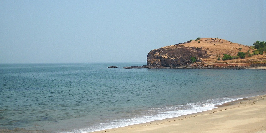
Discover India’s magical disappearing beach where the sea retreats up to 5 kilometers twice daily, offering a rare chance to walk on the ocean floor and experience nature’s most fascinating tidal phenomenon. Introduction: Nature’s Magical Disappearing Act Have you ever witnessed the sea playing hide and seek? At Chandipur Beach in Odisha, this isn’t just a figure of speech—it’s a spectacular natural phenomenon that leaves visitors awestruck. As I stood on the golden sands watching the waves retreat not just meters but kilometers away from the shore, I realized I was experiencing something truly extraordinary. The sea was quite literally disappearing before my eyes, revealing a vast expanse of seabed that would, in just hours, be completely submerged again. Nestled in the Balasore district of eastern India, Chandipur represents one of the most unusual coastal wonders you’ll find anywhere in the world. While India boasts numerous beautiful beaches along its extensive coastline, none can match the peculiar charm of this “vanishing sea” that recedes up to five kilometers during low tide. This natural marvel has rightfully earned Chandipur the nickname “Hide and Seek Beach,” making it a truly offbeat destination for travelers seeking unique experiences beyond the typical tourist circuit. What makes this undiscovered gem even more appealing is the relative lack of crowds compared to India’s more commercialized beaches. Here, you’ll find serene shores lined with swaying casuarina trees, creating the perfect backdrop for an authentic coastal experience that combines natural wonder with cultural richness. The Extraordinary Tidal Phenomenon Explained Science Behind the Vanishing Sea Chandipur’s remarkable tidal patterns aren’t merely a beautiful spectacle—they’re a fascinating lesson in coastal geography and lunar influence. The beach experiences extreme tidal variations that occur twice daily, following the rhythm of lunar cycles. Unlike most beaches with steeper shorelines, Chandipur features an exceptionally gradual gradient that stretches far into the Bay of Bengal. This gentle slope, combined with the specific underwater topography of this section of the bay, creates the perfect conditions for dramatic tidal recession. When the moon’s gravitational pull generates low tide, the water retreats across this gradual incline, visibly withdrawing up to five kilometers from the shore—a distance that would typically take over an hour to walk. The confluence of the Buddhbalanga River with the Bay of Bengal further contributes to these unique topographical features. Local residents have developed an intuitive understanding of these tidal patterns, though the exact timing varies with lunar phases, adding an element of natural unpredictability that enhances the beach’s mystique. A Walking Adventure Like No Other Imagine strolling across what was, just hours earlier, the ocean floor. At Chandipur, this surreal experience becomes reality during low tide. The exposed seabed reveals a textured landscape of ripples, small tidal pools, and distinctive patterns created by marine life. Tiny bubbles pop beneath your feet as you walk, and the sand feels firm yet yielding—a tactile sensation unique to recently exposed ocean floor. As you venture further into this temporary landscape, you’ll discover a miniature ecosystem typically hidden from human eyes. Horseshoe crabs—living fossils that have remained largely unchanged for over 450 million years—can be spotted scuttling across the sand. Red crabs emerge from their burrows, starfish lie motionless in shallow pools, and shells of various shapes and sizes become visible treasures for beachcombers. This opportunity to physically occupy space that alternates between sea and land creates a profound connection with coastal dynamics that transcends typical beach experiences. It’s not just about seeing the tide change—it’s about walking through a landscape that exists in a constant state of transformation. Comparing Chandipur With Other Notable Indian Beaches Beach Location Unique Feature Best Time to Visit Accessibility Crowd Level Accommodation Options Chandipur Odisha Sea recedes up to 5km during low tide November-March 16km from Balasore Railway Station Low Basic to moderate (Panthanivas, local hotels) Puri Beach Odisha Religious significance, Jagannath Temple October-February Well-connected by rail, road High All ranges available Radhanagar Beach Andaman Voted Asia’s best beach, pristine waters October-May Ferry from Port Blair Moderate Limited, mostly resorts Goa Beaches Goa Vibrant nightlife, water sports November-February International airport Very High All ranges from budget to luxury Marina Beach Tamil Nadu World’s second-longest urban beach November-February Within Chennai city Very High City hotels nearby Varkala Beach Kerala Cliff-side beach with natural springs September-March Near Trivandrum Moderate Many options from homestays to resorts The table above highlights how Chandipur stands apart from India’s more famous beaches. While it may not offer the infrastructure or amenities of Goa or the accessibility of Marina Beach, Chandipur compensates with its unique natural phenomenon and relative seclusion—perfect for travelers seeking authentic experiences away from commercial tourism. Beyond the Tides: Chandipur’s Hidden Treasures Rich Biodiversity and Marine Life The alternating exposure and submersion of Chandipur’s seabed creates specialized microhabitats that support unique assemblages of marine organisms. The biological diversity here is remarkable, particularly for those interested in marine ecology. Besides the iconic horseshoe crabs, visitors can observe: This dynamic ecosystem offers a natural laboratory for understanding intertidal ecology and the adaptations of species that thrive in constantly changing environments. For photography enthusiasts, these creatures provide excellent macro photography opportunities against the backdrop of a vast exposed seabed. Spiritual and Historical Significance Chandipur’s appeal extends beyond its natural phenomena into realms of spiritual and historical importance. According to local tradition, this area holds sacred significance as the place where Sage Vishwamitra attained enlightenment, adding a layer of spiritual depth to what might otherwise be perceived as purely a natural wonder. Historically, Chandipur served as an important maritime commercial port in ancient times, functioning as a node in the extensive trading networks that connected eastern India to Southeast Asian regions. This historical significance continued into the modern era, notably during World War II when the Battle of Chandipur in 1942 resulted in a victory for British Indian forces. Physical remnants of this military engagement remain visible in the form of bunkers, pillboxes, and other fortifications scattered throughout the area. In a fascinating juxtaposition of serenity and strategic importance,

Chandipur Beach, Odisha: The Remarkable Hide and Seek Seascape Read More »

Seraphinite AcceleratorOptimized by Seraphinite Accelerator
Turns on site high speed to be attractive for people and search engines.