Hidden Gems

Lake Malawi, Africa

Lake Malawi: Africa’s Cradle of Biodiversity and a Lifeline Under Threat – A Travel Guide

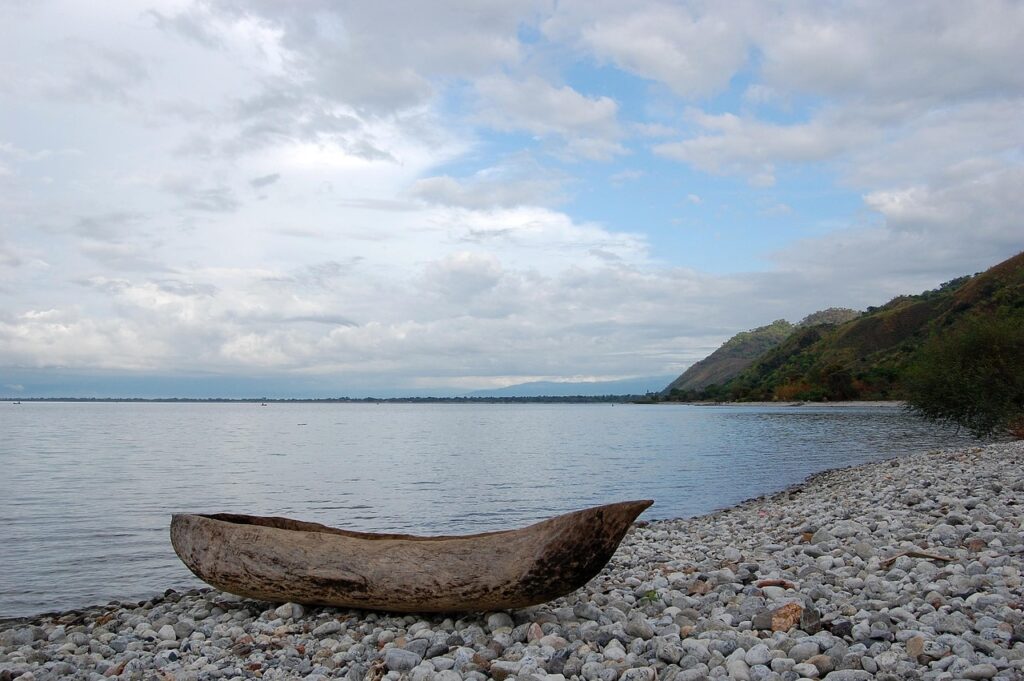
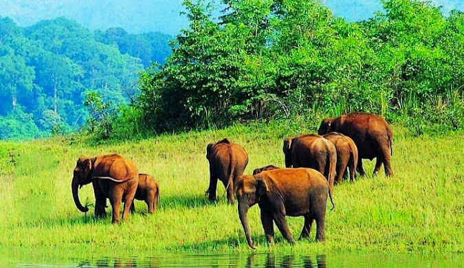
Lake Malawi, a crucial freshwater resource for Malawi, Mozambique, and Tanzania, is facing several pressing environmental challenges. The most significant threats to its exceptional biodiversity and vital fisheries include overfishing, particularly due to illegal fishing methods like the use of fine mesh nets that capture young fish, leading to a decline in fish stocks and overall biodiversity. Pollution from agricultural runoff, domestic waste, and industrial discharge contributes to eutrophication and sedimentation within the lake. Additionally, climate change and deforestation in the surrounding catchment area exacerbate habitat degradation and impact the lake’s water quality. Invasive alien species are also identified as a serious and potentially irreversible threat to the native biodiversity. To address these issues, conservation efforts are multifaceted: For an in-depth exploration of each of these threats, the specific research informing conservation strategies, and the detailed policy implications for Lake Malawi’s future, please continue reading. Lake Malawi Welcome to Lake Malawi, often hailed as the “Jewel of the Rift Valley”! This magnificent body of freshwater, known also as Lake Nyasa in Tanzania and Lago Niassa in Mozambique, is far more than just a lake; it’s a vibrant ecosystem, a historical marvel, and a lifeline for millions. Situated within the East African Rift system, it stands as one of the impressive African Great Lakes. Its global importance stems not only from its sheer size but also from its unparalleled biodiversity. In fact, Lake Malawi is a recognised global biodiversity hotspot, boasting more fish species than any other lake on Earth. A Geographical and Geological Marvel Imagine a lake so ancient and vast that its origins stretch back millions of years. Lake Malawi is an ancient lake and a quintessential rift lake, formed by the titanic tectonic forces associated with the East African Rift Valley. Its basin is a series of tilted earth blocks, known as half-grabens, with an astonishing more than 4 kilometres of sediment beneath its deepest points, a testament to its immense age. This colossal lake is truly a sight to behold. It stretches an impressive 560 to 580 kilometres (350 to 360 miles) long, and up to about 75 kilometres (47 miles) wide at its broadest point. Covering a surface area of approximately 29,600 square kilometres (11,400 sq mi), it proudly ranks as the ninth largest lake by surface area globally. Beneath its shimmering surface, it plunges to a maximum depth of 706 metres (2,316 feet) in its north-central part, making it Africa’s second-deepest and the third-deepest lake in the world. With a total water volume estimated at 8,640 km³ (2,070 cu mi), it holds nearly 7% of the Earth’s available surface freshwater. The lake’s water dynamics are fascinating. Its primary inflow is the Ruhuhu River, with the Songwe River (on the Tanzania-Malawi border) also contributing significantly. However, its sole outflow is the Shire River, which eventually flows into the Zambezi River in Mozambique. A striking characteristic is that over 80% of water loss occurs due to evaporation, far exceeding the outflow from the Shire River. This leads to a very long flushing time, concentrating nutrients and chemicals within the lake. Lake Malawi is also a meromictic lake, meaning its layers of water don’t mix, with waters below 170–200 metres being anoxic. The surface water is generally warm, ranging from 24 to 29 degrees Celsius (75 to 84 degrees Fahrenheit), and is slightly alkaline. As you might imagine, a lake of this scale spans multiple nations. Its shorelines touch Malawi, Mozambique, and Tanzania. Interestingly, the exact position of the Malawi-Tanzania border within the lake has been a point of contention for years. Tanzania claims the border runs through the middle of the lake, while Malawi asserts control over all waters not in Mozambique, right up to the Tanzanian shoreline, citing the Heligoland Treaty of 1890. Malawi currently administers these waters. A Hotspot of Biodiversity: The Cichlid Phenomenon Lake Malawi’s most celebrated feature is its truly unparalleled fish diversity. It is home to more fish species than any other lake on Earth, with estimates ranging from at least 700 to over 1,000 species recorded, predominantly the famous cichlid fish. What makes this even more extraordinary is that an astonishing 99% of these cichlid species are endemic to the lake. This makes Lake Malawi a living laboratory, crucial for understanding evolutionary processes and adaptive radiation. When you gaze into its clear waters, you might spot various cichlid groups like the vibrant mbuna cichlids, usipa, and utaka. Some, like Aulonocara baenschi and Chindongo saulosi, are critically endangered due to their popularity in the ornamental fish trade. Beyond the cichlids, other significant fish families, such as Clariidae, Claroteidae, and Cyprinidae, also inhabit the lake, including the unique genus Bathyclarias. For those who rely on the lake for food, common catches include tilapia, sardines, and catfish. But the lake’s wonders extend beyond fish. Its waters and surrounding areas support a rich diversity of invertebrate life: On land and in the skies around the lake, the wetlands and forests support a vast array of wildlife, including Nile crocodiles, hippopotamuses, monkeys, and a large population of African fish eagles. Even the painted hunting dog, once thought extinct, has been sighted here. Life and Livelihoods: Human Dependence on the Lake For millions living along its shores, Lake Malawi is not just a natural wonder; it is the very backbone of their economic survival. Local communities in Malawi, Mozambique, and Tanzania are profoundly dependent on its resources for both fishing and agriculture. The fisheries are arguably the lake’s most vital asset. They provide an indispensable source of protein and contribute significantly to the regional economy, especially in Malawi. It is widely quoted that fish provides around 70% of the animal protein consumed by Malawians, a statistic that, while significant, dates back to the 1940s and merits updating. In 2015 alone, the fisheries sector directly employed an impressive 60,600 people in Malawi, with an additional 300,000 individuals engaged in related secondary activities such as fish processing, marketing, boat-building, and supplying fishing gear. The lucrative ornamental fish trade

Lake Malawi: Africa’s Cradle of Biodiversity and a Lifeline Under Threat – A Travel Guide Read More »

Bhandardara

Bhandardara: Maharashtra’s Hidden Gem – A Comprehensive Travel Guide

Welcome to Bhandardara: An Overview of its Natural Splendor: Escape the ordinary and discover Bhandardara, Maharashtra’s hidden gem! This comprehensive guide unveils the natural splendor, historical sites, and thrilling adventures awaiting you in this picturesque hill station nestled in the Western Ghats. Bhandardara: Your Ultimate Travel Guide to Maharashtra’s Hidden Paradise Bhandardara stands as a picturesque holiday resort village, gracefully nestled within the Western Ghats of India. Located in the Akole tehsil of Ahmednagar district in Maharashtra, it is frequently characterized as Maharashtra’s “hidden gem”.1 This designation stems from its relatively undiscovered allure, despite being enveloped by a landscape of profound natural beauty. The village is situated serenely by the Pravara River, presenting a harmonious blend of natural environment, including cascading waterfalls, majestic mountains, and the tranquil expanse of Wilson Dam and Arthur Lake.3 The pervasive lush greenery and invigorating air contribute to a pristine ambiance, rendering it a truly idyllic and picture-perfect holiday destination.1 Why Bhandardara? Unveiling its Unique Appeal Bhandardara is recognized as a versatile destination, capable of catering to a broad spectrum of travelers. It appeals to nature enthusiasts, adventure seekers, and individuals desiring a peaceful retreat from the demands of urban life.4 The region offers distinctive opportunities for backpacking, engaging in challenging treks, experiencing lakeside camping under star-filled skies, and exploring ancient forts and temples.1 These diverse offerings collectively ensure a remarkable and unforgettable experience for every visitor, solidifying its reputation as a valuable destination for tourism.1 2. Geographical Location & Accessibility Where is Bhandardara? Bhandardara is strategically positioned in the Ahmednagar district of Maharashtra, in close proximity to Igatpuri, within the majestic Sahyadri ranges of the Western Ghats.1 Its geographical coordinates are 19°31′45″N 73°45′5″E, and it is situated at an elevation of 740 meters (2,430 ft) above mean sea level.3 A central feature of the village’s natural setting is its location on the banks of the Pravara River, which is integral to many of its primary attractions, including the notable Wilson Dam and Arthur Lake.3 How to Reach Bhandardara: Your Journey Options Bhandardara is accessible through various modes of transportation, connecting it to major urban centers in Maharashtra. Getting Around Bhandardara: Local Transport Tips Within Bhandardara itself, local transport facilities are somewhat limited. As a smaller hill station, options for getting around are not as extensive as in larger urban areas, primarily consisting of local buses that ply from Igatpuri.10 This limited availability of internal transport means that visitors should plan their mobility carefully. For those who drive to Bhandardara, utilizing their own vehicle for local sightseeing is the most convenient approach. Alternatively, resorts may facilitate cab arrangements upon request for their guests.10 Relying on spontaneous local transport within the village might prove challenging, potentially impacting the overall sightseeing experience. The explicit warnings about narrow roads while driving on the ghats and the scarcity of local transport within Bhandardara underscore the critical importance of pre-arranged transport for local exploration. 3. Best Time to Visit: Unveiling Bhandardara’s Seasonal Charms Overview of Bhandardara’s Climate Bhandardara experiences three distinct primary seasons—summer, monsoon, and winter—each uniquely transforming the landscape and offering varied experiences.14 The timing of a visit significantly influences sightseeing comfort and the availability of specific activities, including season-specific wonders such as the firefly festivals.14 The optimal period for a visit is not a singular timeframe but rather contingent on a traveler’s primary interests and desired activities. This allows for tailored recommendations rather than a universal “best time to visit.” Monsoon Magic (July – September) The monsoon season in Bhandardara is often described as “magical,” as rainfall invigorates the natural environment, leading to lush greenery and spectacular displays of overflowing waterfalls.4 Attractions such as Randha Falls and Umbrella Falls reach their full glory during this period.4 While enchanting for nature lovers, heavy rains and elevated humidity can render trekking trails slippery, necessitating caution.1 Evenings, however, are typically breezy and pleasant, providing an ideal setting for picnics near the swollen waterfalls and dams.1 Average July temperatures range from a high of 27°C (81°F) to a low of 22°C (72°F).15 This month experiences a very high probability of rain (98%), with heavy precipitation averaging around 25.6 mm per day, accompanied by high humidity (98%).15 The detailed monthly weather data, particularly for the monsoon months, provides critical actionable information for travelers. Knowing the high chance of heavy rain, high humidity, and recommended attire such as a sleeveless shirt, raincoat, and rain boots for July enables precise packing and preparation, thereby mitigating potential discomforts and enhancing the overall trip experience.15 Winter Wonderland (October – February) Winter in Bhandardara is widely regarded as the best time to visit by many, offering cool, pleasant weather and crisp, clear skies that are conducive to outdoor adventures and relaxation.1 This period is perfectly suited for embarking on treks to historical forts and majestic peaks like Ratangad, Harishchandragad, and Mount Kalsubai.9 It also presents a charming opportunity for cozy retreats by Arthur Lake, stargazing, and photography.9 Temperatures typically remain below 20°C 1, with December and January experiencing average highs around 28°C and lows between 15-18°C, along with minimal rainfall.16 Summer Escapes (March – June) Summer generally represents a quieter, less crowded period in Bhandardara. While the weather tends to be warmer, with days often hot and humid (averaging a maximum of 36°C), nights can cool down considerably.4 Arthur Lake and Wilson Dam continue to offer refreshing experiences even under warmer skies.14 This season is well-suited for peaceful retreats, discovering secluded spots, engaging in leisurely village walks, and camping near the lakes.9 Occasional pre-monsoon showers in May can contribute to a reduction in temperatures.9 Below is a consolidated overview of Bhandardara’s monthly weather, providing a quick reference for planning purposes: Month Average High Temp (°C / °F) Average Low Temp (°C / °F) Average Rain Days Average Precipitation (mm / inches) Average Relative Humidity (%) Average Clear/Sunny Hours per Day Average Wind Speed (mph / kph) January 28° / 82° 15° / 59° 0 – – 19.2 – February 31° / 88° 17° / 63° 0 –

Bhandardara: Maharashtra’s Hidden Gem – A Comprehensive Travel Guide Read More »

A herd of Indian elephants, including adults and calves, grazing peacefully near a watering hole in the verdant grasslands of Gavi, Kerala.

Gavi, Kerala: An In-Depth Eco-Tourism Guide

Discover Gavi, Kerala: An Untouched Eco-Tourism Paradise Gavi, located deep within Kerala’s Pathanamthitta district, is a secluded village in the Ranni Reserve Forest, forming a critical part of the Periyar Tiger Reserve. Recognized by Alistair International as a must-see eco-tourism site, Gavi offers nature lovers and adventure seekers a pristine escape from tourist-heavy destinations like Munnar or Thekkady. With its biodiversity, rare flora and fauna, off-the-grid vibe, and ethical tourism model, Gavi is the quintessential off-the-beaten-path destination. Location & Geographical Significance Coordinates: 9°26′25.72″N, 77°9′37.25″EElevation: 1,036 meters (3,399 ft) above sea levelDistrict: Pathanamthitta, KeralaProtected Zones: Ranni Reserve Forest and Periyar Tiger ReserveProximity: 14 km from Vandiperiyar, 28 km from Kumily, near Thekkady Gavi lies amidst undisturbed tropical forest, rich in biodiversity. The area includes lakes, cardamom plantations, and scenic viewpoints like Valley View and Sabarimala Viewpoint. Gavi Lake and Kochupamba River enhance its geographical charm. It is one of few eco-tourism zones in India where forest department-led operations preserve and sustain local ecosystems. How to Reach Gavi, Kerala? Mode Nearest Point Distance to Gavi Travel Time Notes Air Cochin Airport (COK) ~190 km ~6 hrs Via Thekkady, jeep preferred Madurai Airport ~140 km ~5 hrs Recommended for Tamil Nadu visitors Rail Kottayam Station ~128 km ~4.5 hrs Good connectivity; taxis/buses to Vandiperiyar Chengannur Station ~120 km ~4 hrs Near Pathanamthitta Road Vandiperiyar 28 km 1 hr Closest access; bumpy forest roads Thekkady 51 km 1.5 hrs Scenic but rugged terrain Forest Entry Point: Vallakkadavu Check PostPermits Required: Yes (Handled if booked via KFDC)Private Vehicles: Allowed up to check post; KFDC jeeps recommended inside forestBus Option: KSRTC operates buses from Pathanamthitta to Gavi Climate & Best Time to Visit Gavi, Kerala Month Avg High (°C) Avg Low (°C) Avg Rainfall (mm) Highlights Jan-Feb 24-25 15-16 23-32 Peak season; dry & cool Mar-May 27-28 17-19 56-168 Warm; fewer tourists Jun-Sep 24-25 17-18 250-400 Monsoon; lush landscapes Oct-Dec 24-25 16-17 77-252 Great for trekking & wildlife Recommendations: Entry Details & Costs Category Fee (INR) Indian Adult 100 Foreign Visitor 200 Children < 13 yrs Free Boating (2 persons) 300 Boating (4 persons) 600 Accommodation Options Within Gavi (KFDC Managed) Booking: gavi.kfdcecotourism.com Nearby Options (Thekkady/Vandiperiyar) Activities & Attractions Activity Duration Approx. Cost (INR) Notes Jeep Safari 2.5 hrs Part of package Limited to 25 vehicles/day Boating 30 mins 300-600 Kochupamba Lake Trekking 1-3 hrs Included Leech precautions needed Bird Watching Ongoing Included 260+ species Cardamom Tour 1 hr Included Visit curing center Sabarimala Viewpoint 30 mins Included Binoculars recommended Animal Museum 30 mins Included Skeletons & bones display Flora & Fauna KFDC Eco-tourism Packages Package Type Inclusions Cost (INR) Full-Day Plantation walk, boating, vehicle safari, lunch 1,500/adult 625/child Boating Only Kochupamba Lake rowing (2 or 4 persons) 300-600 Overnight (any stay) Stay + all activities (trek, boating, safari, meals) ~3,000/person Practical Tips (Checklist) Responsible Tourism Guidelines Nearby Places to Visit FAQ’s Why is Gavi famous? It is known for eco-tourism, rare wildlife, and its role in Periyar Tiger Reserve.Is Gavi worth visiting? Yes, it offers unique offbeat nature experiences, unlike mainstream Kerala destinations. What is Gavi good at? Adventure, wildlife safaris, trekking, birding, and responsible tourism. Is Gavi a hill station? No, but it is at an elevation of 1,036 m and has a cool climate. What animals are in Gavi? Elephants, deer, macaques, Nilgiri tahr, leopards. What is the climate of Gavi? Pleasant year-round; winters are best for tourism. What is the entry time for Gavi? 8:30 AM to 11:00 AM What is there to do in Gavi? Safaris, treks, boating, plantation visits, viewpoints. What are the features of Gavi? Protected forests, eco-accommodations, rare biodiversity. Is one day enough for Gavi? Ideal to stay overnight; a single day may feel rushed. How to plan a trip to Gavi? Book via KFDC, arrange transport to Vandiperiyar, get permits. How to get to Gavi from Trivandrum? Travel via Kottayam or Thekkady by road; taxi or KSRTC bus. Which is the best month to visit Gavi? October to February for most activities. Is car allowed in Gavi? Yes, up to the check post; forest travel requires permits or KFDC vehicles. What is Gavi Safari? A 2.5-hour guided jeep safari in Periyar Reserve. What is special in Gavi? Rich biodiversity, gopher tree, eco-model tourism. What is the ticket price of Gavi? ₹100 (Indians), ₹200 (foreigners), free for children. What is the bus timing from Vandiperiyar to Gavi? KSRTC buses operate daily; confirm locally. What is Gavi’s age? Official tourism began around 2006 under KFDC. Conclusion Gavi is Kerala’s answer to sustainable wilderness tourism. From jeep safaris and jungle camping to birdwatching and misty viewpoints, it blends adventure with conservation. Gavi welcomes mindful travelers who respect nature and contribute to its preservation. Plan your next eco-adventure at Gavi Kerala. Book directly through KFDC Ecotourism, share this guide with fellow travelers, and leave your questions or experiences in the comments! For more articles and updates go to: https://xploreheaven.com/blogs-updates/ Gavi, Kerala Gavi (Malayalam: [ɡɐʋi, ɡeʋi]) is a village in Pathanamthitta district, Kerala, India.The nearest railway station is Chengannur (120 km). It is located

Gavi, Kerala: An In-Depth Eco-Tourism Guide Read More »