 Skip to content
 Ever wondered what it would look like to see a river carve through solid rock? That’s exactly the story of Niagara Falls—a spectacular tale of ice, water, and time that began over 12,000 years ago. Standing at the edge of this thundering cascade, you’re witnessing one of nature’s most incredible construction projects, where how Niagara Falls was formed involves a perfect storm of geological forces that continue shaping our world today.
This isn’t just another tourist attraction story. The formation of Niagara Falls is a masterclass in geological drama, featuring massive ice sheets, ancient buried valleys, and a recipe of rock layers that created the perfect conditions for one of the world’s most famous waterfalls. By understanding this incredible journey, you’ll discover how glacial melting, the birth of the Great Lakes, and the unique Niagara Escarpment combined to create this natural wonder that continues evolving before our eyes.
Based on well-documented geological findings from leading institutions, this story will take you on a 12,000-year journey that transforms how you see this iconic waterfall forever.
Quick Information Table
| Formation Details | Information |
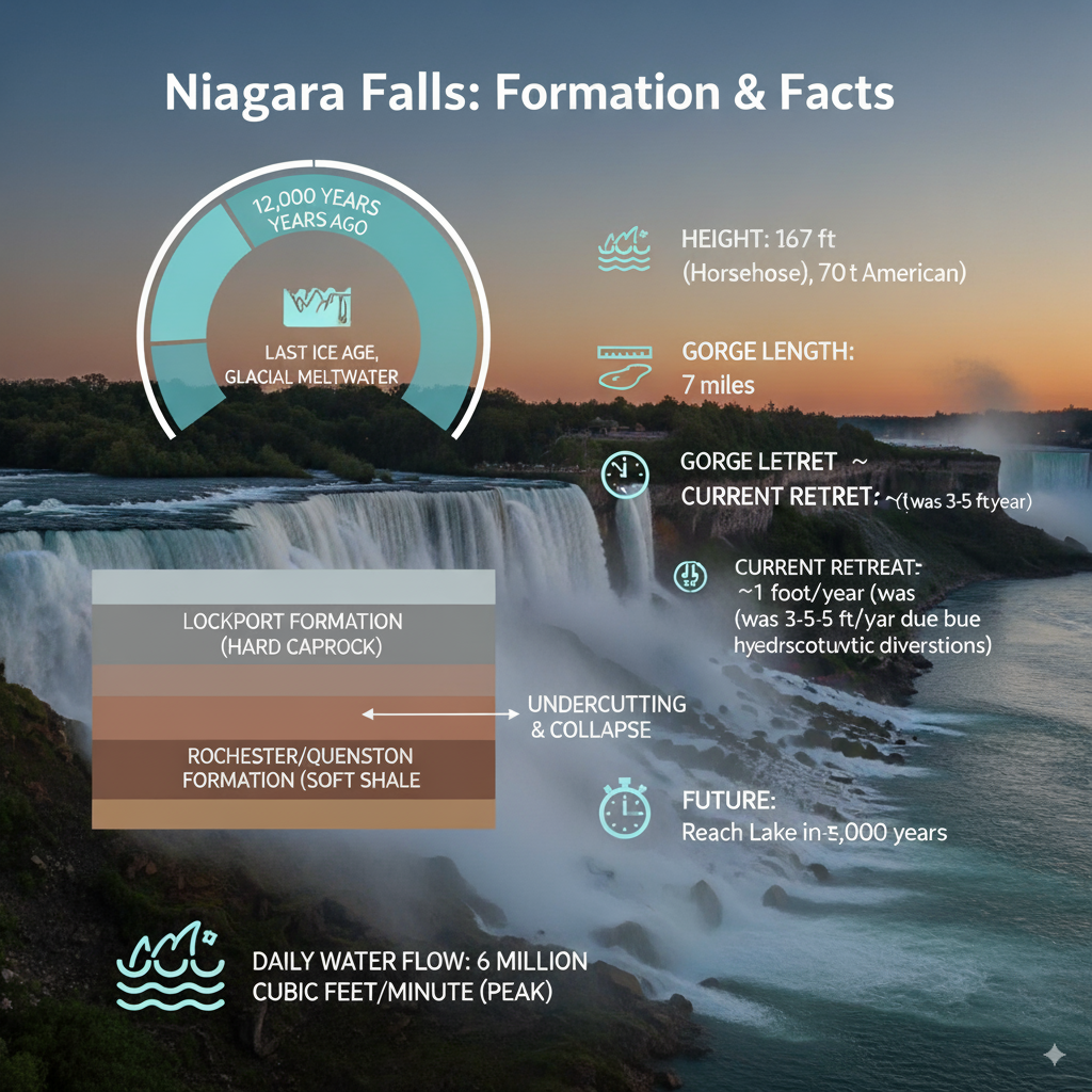
| Age of Niagara Falls | Approximately 12,000 years old |
| Formation Period | End of last Ice Age (Wisconsin Glaciation) |
| Primary Formation Process | Glacial meltwater erosion over Niagara Escarpment |
| Key Rock Layers | Lockport Formation (hard caprock) over Rochester/Queenston Formation (soft shale) |
| Current Retreat Rate | About 1 foot per year (reduced from 3-5 feet due to hydroelectric diversions) |
| Total Gorge Length | 7 miles from Lewiston to current falls location |
| Height of Falls | 167 feet (Horseshoe Falls), 70 feet (American Falls) |
| Water Source | Great Lakes drainage system via Niagara River |
| Future Projection | Will reach Lake Erie in approximately 50,000 years |
| Daily Water Flow | 6 million cubic feet per minute (peak flow) |
The Ancient Landscape: A World Covered in Ice
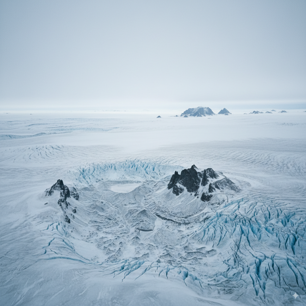
Picture this: 20,000 years ago, where Niagara Falls now thunders, there was nothing but ice. Lots of ice. The massive Wisconsin Glacier, part of the last great Ice Age, stretched across most of northeastern North America like a frozen blanket up to two miles thick. This wasn’t just any ordinary ice sheet—it was a geological bulldozer that completely reshaped the landscape beneath it.
The Wisconsin Glacier did more than just cover the land. As it slowly crept across the region, it carved deep valleys, scraped away hilltops, and completely rearranged the drainage patterns that had existed for millions of years. One of the most fascinating discoveries in understanding how Niagara Falls was formed is the Saint David’s Buried Gorge—a “ghost river” valley that the glacier filled with debris and sediment.
This ancient valley, now hidden beneath layers of glacial deposits, tells us that water was carving paths through this landscape long before our modern Niagara River existed. The glacier essentially hit the reset button on the entire region’s geography, setting the stage for something completely new to emerge once the ice began its final retreat.
The sheer weight of this ice sheet also pressed down on the Earth’s crust, causing the land to sink. This geological process, called isostatic depression, would later play a crucial role in shaping the Great Lakes and the drainage patterns that would eventually create the Niagara River.
A New Beginning: The Ice Melts and a Mighty River Awakens
Around 12,000 years ago, the climate began to warm, and the Wisconsin Glacier started its dramatic retreat. But this wasn’t a gentle melting process—it was an explosive geological event that released unimaginable amounts of water across the landscape. Imagine trying to drain a bathtub the size of several states all at once. That’s the scale of glacial melting that reshaped this region.
As the massive ice sheet melted, it created temporary lakes, raging rivers, and floods that would make today’s most extreme weather events look like gentle spring showers. The meltwater had to go somewhere, and it began filling the deep basins that the glacier had carved during its advance. These basins would become what we now know as the Great Lakes—Erie, Ontario, Huron, Michigan, and Superior.
The formation of these Great Lakes created an entirely new drainage system. Water from the upper Great Lakes now needed to flow toward the Atlantic Ocean, and the most direct route was through the newly formed connection between Lake Erie and Lake Ontario. This connection became the Niagara River, born from the Great Lakes drainage system that the glacier had inadvertently designed.
Here’s where the story gets interesting: this new Niagara River needed to find its way from the higher elevation of Lake Erie (about 571 feet above sea level) down to Lake Ontario (about 245 feet above sea level). That 326-foot elevation difference meant the water would flow with tremendous force—but where exactly it would flow depended on what kind of rock it encountered along the way.
The Niagara Escarpment: Nature’s Perfect Recipe for a Waterfall
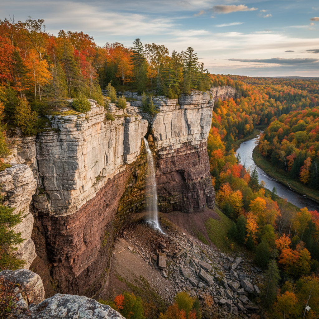
Think of the Niagara Escarpment as a giant layer cake made of different kinds of rock, each with its own personality when it comes to dealing with flowing water. This ancient cliff face, formed hundreds of millions of years ago, stretches for hundreds of miles through Ontario, New York, Wisconsin, and Michigan. But it’s here at Niagara where it created the perfect conditions for a spectacular waterfall.
The “frosting” on this geological layer cake is the Lockport Formation—a tough, hard layer of limestone and dolomite that geologists call caprock. This rock formed about 430 million years ago when this area was covered by a warm, shallow sea. The limestone is incredibly resistant to erosion, which means water has a tough time wearing it away. It’s like nature’s concrete, holding firm against the pounding of millions of gallons of water.
Beneath this hard caprock lies the “cake” itself—softer rock layers, particularly the Rochester Formation, made up of shale and other sedimentary rocks. These softer layers are like geological butter compared to the limestone frosting above them. When water hits these rocks, they crumble and wash away relatively easily.
The Queenston Formation, even deeper in this rock layer cake, consists of red shale that’s also quite soft and easily eroded. This multi-layered setup of hard rock on top and soft rock below is absolutely crucial to understanding how Niagara Falls was formed. Without this specific arrangement, the Niagara River might have just created rapids or a gentle cascade instead of the dramatic vertical drop we see today.
The Niagara Escarpment runs roughly east-west across this region, and when the newly formed Niagara River encountered this cliff face for the first time around 12,000 years ago, it marked the beginning of one of geology’s most spectacular ongoing experiments.
Water vs. Rock: The Great Erosion Battle
Now comes the main event in the story of how Niagara Falls was formed—the incredible process of erosion that continues today. When the Niagara River first cascaded over the Niagara Escarpment, it began an epic battle between water and rock that has been raging for thousands of years.
The process starts with something called undercutting. Picture hollowing out the bottom of a pumpkin—eventually, the top has no support and caves in. That’s exactly what happens at Niagara Falls. The river’s spray and turbulent flow constantly pound against the soft shale layers beneath the hard caprock. This relentless pounding gradually washes away the softer rock, creating caves and hollow spaces behind and underneath the limestone caprock.
As the soft rock erodes away, the hard caprock above loses its foundation. Without support from below, the limestone layer becomes increasingly unstable. Freeze-thaw cycles make the situation worse—water seeps into cracks in the rock, freezes during winter, expands, and literally splits the rock apart from the inside.
Eventually, the undermined caprock can’t hold its own weight anymore. Large chunks crack and collapse into the churning pool below, creating the rockfalls that reshape the waterfall’s edge. This isn’t a gentle process—these rockfalls can involve massive blocks of stone weighing hundreds of tons crashing into the river with tremendous force.
Here’s the remarkable part: every time rocks fall, the waterfall moves backward. The new edge of the falls is now a few feet further upstream than it was before. This process, called headward erosion or upstream retreat, means that Niagara Falls has been slowly moving backward for its entire 12,000-year existence.
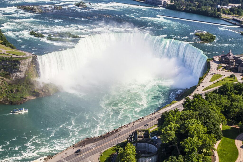
The seven-mile-long Niagara Gorge, stretching from the current location of the falls down to Lewiston, New York, and Queenston, Ontario, is like a geological breadcrumb trail showing exactly where the falls have been over the millennia. The falls started their journey near Lewiston and have been carving their way upstream ever since, leaving behind this spectacular gorge as evidence of their slow-motion migration.
Different sections of the falls erode at different rates. The Horseshoe Falls (the Canadian side) retreats faster than the American Falls because it carries more water volume. The American Falls sometimes gets so little water flow that the erosion nearly stops, while the Horseshoe Falls continues its backward march at a measurable pace.
Slowing Down a Giant: Hydroelectric Power and the Future
The story of how Niagara Falls was formed took a dramatic modern twist in the 20th century when humans decided to harness the very force that created the falls. The construction of hydroelectric power plants on both sides of the border introduced a new player in this ancient geological drama.
Today, massive tunnels and diversions redirect approximately 50-75% of the Niagara River’s flow away from the falls during certain times of the day and year. This water gets channeled through power generation facilities before rejoining the river downstream. The result? The erosion process that has been carving the falls for 12,000 years has dramatically slowed down.
Before human intervention, geologists estimate the falls were retreating upstream at a rate of about 3-5 feet per year. That might not sound like much, but over centuries, it adds up to significant movement. Now, with reduced water flow, the retreat has slowed to approximately one foot per year—a remarkable 80% reduction in the erosion rate.
International agreements between the United States and Canada carefully regulate how much water can be diverted for power generation while still maintaining the falls’ spectacular appearance, especially during tourist season. During daylight hours in the tourist season (April through October), more water flows over the falls to maintain the visual spectacle. At night and during winter months, more water is diverted for power generation.
This human intervention has essentially put the geological brakes on a process that has been ongoing since the end of the last Ice Age. While some might argue we’re interfering with natural processes, others point out that we’re preserving one of the world’s great natural wonders for future generations while generating clean, renewable energy.
The hydroelectric facilities at Niagara represent one of the earliest large-scale renewable energy projects in North America, generating enough clean electricity to power millions of homes. This modern chapter in the Niagara story shows how understanding geological processes can help us work with natural forces rather than against them.
More Than a View: What Niagara Falls Teaches Us
Understanding how Niagara Falls was formed transforms a visit to this natural wonder from simple sightseeing into a journey through deep time. When you stand at the edge of the falls, you’re witnessing the end result of an incredible sequence of geological events that connects the Ice Age, the birth of the Great Lakes, and the ongoing dance between rock and water.
For geologists, Niagara Falls serves as a natural laboratory for studying erosion processes, climate history, and the long-term effects of glaciation. The rocks exposed in the Niagara Gorge provide a cross-section through millions of years of Earth’s history, with each layer telling part of the story of ancient seas, climate changes, and the evolution of life itself.
The falls also play a crucial role in the local ecosystem. The mist and spray create unique microclimates that support rare plants and provide habitat for various bird species. The powerful flow helps oxygenate the water and supports fish populations in both the Niagara River and the Great Lakes system.
From a human perspective, Niagara Falls demonstrates our species’ ability to adapt and work with geological processes rather than simply being victims of them. The story of hydroelectric development here pioneered many techniques now used worldwide for sustainable energy generation.
The geological processes that created Niagara Falls are still active around the world. Understanding this story helps us appreciate how landscapes form and change, how climate affects geological processes, and how human activity can influence natural systems on geological timescales.
Frequently Asked Questions
Q1: How old is Niagara Falls?
Niagara Falls is approximately 12,000 years old, formed at the end of the last Ice Age when glacial meltwater created the Great Lakes drainage system and the Niagara River first flowed over the Niagara Escarpment.
Q2: Are the Falls moving?
Yes! Due to erosion from undercutting of soft rock layers beneath the hard caprock, the falls naturally retreat upstream. However, human intervention for hydroelectric power has slowed this process from 3-5 feet per year to about one foot per year.
Q3: Will Niagara Falls disappear one day?
Geologists predict it will take approximately 50,000 years for the falls to erode all the way back to Lake Erie, assuming current erosion rates continue. So while the falls are constantly changing, they won’t disappear in our lifetime or many generations to come.
Q4: What is the hard rock layer of the falls called?
The tough, erosion-resistant top layer of rock is called the Lockport Formation, composed of limestone and dolomite. Geologists also refer to it as caprock because it caps the softer rock layers below.
Q5: What created the Niagara River?
The Niagara River was formed when the Wisconsin Glacier melted around 12,000 years ago, creating the Great Lakes. Water from Lake Erie needed to drain toward Lake Ontario, creating this 35-mile-long connecting waterway.
Q6: How deep is the water at the base of the falls?
The pool at the base of the Horseshoe Falls is approximately 165 feet deep. This depth is maintained by the constant churning action of the falling water, which prevents sediment from accumulating.
So the next time you see the mighty Niagara, listen closely. You might just hear the 12,000-year-old story it’s still telling—a story of ice, rock, and the relentless power of water that continues to shape our world one drop at a time.
References
For those who want to dive deeper into the geology of Niagara Falls, here are some of the resources we consulted:
- Discover Niagara: Comprehensive geological information and research findings – discoverniagara.org
- New York State Museum: Detailed geological surveys and scientific documentation – nysm.nysed.gov
- Wikipedia – Geology of Niagara Falls: Peer-reviewed geological data and formation timeline – Wikipedia geological resources
This article is based on current geological research and scientific consensus regarding the formation and ongoing evolution of Niagara Falls.
Read More Articles;
- Northeast India Tourism Guide 2026: Best Places, Itinerary, Cost & Hidden Gems
- Thailand Hidden Islands Travel Guide 2026: Secret Islands, Budget Itinerary & Crowd-Free Beaches for Indians
- Sri Lanka Travel Guide 2026 for Indians: ₹50K Budget, 7-Day Itinerary, Visa & Hidden Gems
- Bali Travel Guide 2026: Best Places, Itinerary, Budget & Hidden Gems (Complete Planner)
- Alleppey Tourist Places: 25 Best Places to Visit in Alleppey Backwaters (2026 Travel Guide)
