Skip to content
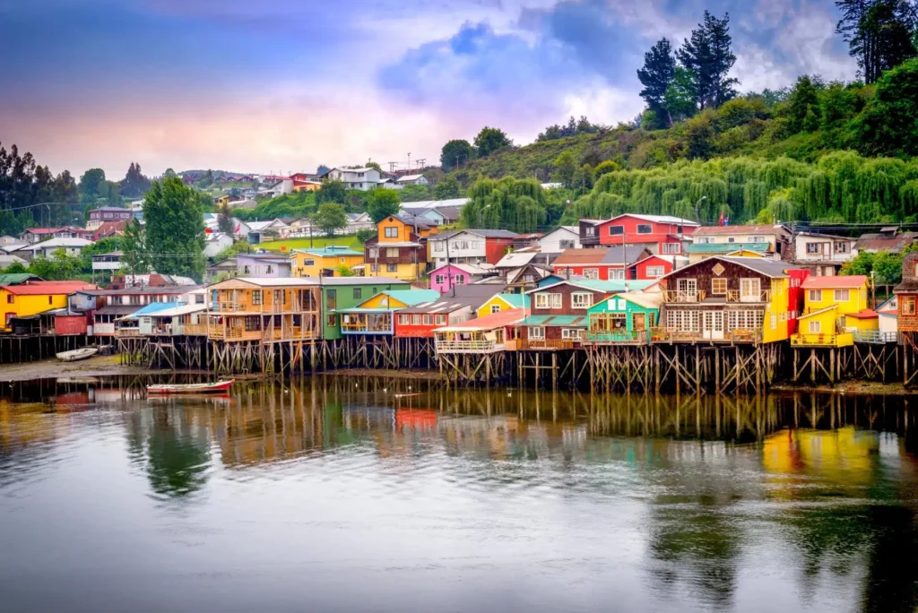
What to Do in Chiloé Island: A Complete Travel Guide
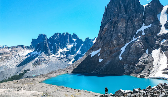
If you’re searching for what to do in Chiloé Island, you’ve just discovered Chile’s most magical destination. This mysterious archipelago off the southern coast combines ancient wooden churches, pristine rainforests, unique penguin colonies, and mouthwatering seafood traditions that you won’t find anywhere else on Earth. I’ve explored countless Chilean destinations, but Chiloé holds a special place in my travel memories. The moment the ferry crosses the Chacao Channel, you’ll feel like you’ve stepped into another world—one where myths and legends still shape daily life, where colorful stilt houses (palafitos) line the waterfront, and where the Mapuche culture blends seamlessly with Spanish colonial heritage. This guide covers everything from UNESCO-listed churches to hidden beaches, helping you plan the perfect Chiloé adventure whether you have 2 days or 2 weeks. Quick Reference: Chiloé Island at a Glance Category Details Location Los Lagos Region, 700 miles south of Santiago Best Time to Visit December to March (summer season) Main Towns Castro, Ancud, Dalcahue, Chonchi, Quellón Must-See Highlights UNESCO wooden churches, Puñihuil penguins, curanto feast Getting There Ferry from Puerto Montt (30 mins) or direct flight to Castro Budget $50-80 USD per day (mid-range) Weather Rainy year-round; pack waterproof gear Why Visit Chiloé Island? 🌧️ Chiloé Island isn’t your typical Chilean destination—and that’s exactly why it’s incredible. While most travelers rush from Santiago to Patagonia, this 118-mile-long island rewards those who take the detour with experiences you simply can’t find elsewhere. The Chiloé archipelago, Chile sits at the northern edge of Patagonia, separated from mainland Chile by the Chacao Channel. What makes it truly special is its cultural isolation. For centuries, Chiloé developed its own distinct identity, blending Mapuche culture Chiloé traditions with Spanish Jesuit influences. This cultural fusion created unique architectural styles, folklore filled with witches and ghost ships, and culinary traditions that predate European contact. Here’s what makes Chiloé unforgettable: the weather. Locals joke about experiencing “four seasons in a day,” and they’re not exaggerating. The maritime climate brings frequent rain, mist, and dramatic cloud formations that create an almost mystical atmosphere. Bring layers and waterproof gear—you’ll need them. But this constant moisture also nourishes the Valdivian temperate rainforest, one of Earth’s rarest ecosystems, covering the western side of the island. The landscape shifts dramatically as you explore. The eastern coast features gentle hills, colorful fishing villages, and calm inland seas perfect for kayaking. The western coast? Wild, rugged cliffs pounded by Pacific waves, with wind-bent forests that feel prehistoric. And down south, Tantauco Park Chiloé protects 291,000 acres of nearly untouched wilderness where Darwin’s foxes and pudú deer still roam. Top Experiences on Chiloé Island You Can’t Miss 🏛️ Visit the UNESCO Wooden Churches ⛪ The wooden churches Chiloé UNESCO sites represent Latin America’s most unique ecclesiastical architecture. Between the 17th and 19th centuries, Jesuit missionaries established a “Circular Mission” system throughout the archipelago, traveling by boat to evangelize indigenous communities. When they needed permanent structures, local Chilote carpenters—masters at building wooden boats—applied their shipbuilding techniques to create churches without a single nail. Sixteen of these wooden churches earned UNESCO World Heritage status in 2000, but over 150 still stand across the islands. The oldest is Santa María de Loreto in Achao (built in the 1730s), while the most photographed is San Francisco de Castro, with its striking yellow and purple facade overlooking the Plaza de Armas. What’s remarkable about these churches isn’t just their construction—it’s how they blend European Baroque elements with indigenous craftsmanship. The vaulted ceilings mimic the ribs of boats, and the wooden shingles (made from alerce, coigüe, and larch) withstand Chiloé’s intense humidity. Many churches feature bright exterior colors—yellows, blues, oranges—that pop against the gray skies and green landscapes. Pro tip: Visit Nuestra Señora del Patrocinio in Tenaún for the most Instagram-worthy shot. Its blue facade with painted stars is absolutely stunning, especially during golden hour. The churches in Dalcahue and Nercón (just 4 km from Castro) are also easily accessible and less crowded than Castro’s main church. For photography enthusiasts, early morning offers the best light for capturing these architectural gems without tour groups. Most churches are open daily, though some smaller ones may only open for Sunday mass. Always dress respectfully when entering—these are active places of worship, not just tourist attractions. Reference: UNESCO World Heritage Centre Wildlife & Nature: Penguins and Primeval Forests 🐧 Penguin Colony at Islotes de Puñihuil When wondering what to do in Chiloé Island, visiting the penguin colony Chiloé Island at Puñihuil tops most travelers’ lists—and for excellent reason. This is the only place on Earth where Humboldt and Magellanic penguins nest side by side, creating a unique wildlife spectacle. The Islotes de Puñihuil Natural Monument, declared protected in 1999, consists of three rocky islets about 27 km southwest of Ancud. From October to March, thousands of penguins arrive to breed and raise their chicks. By January, you’ll see adorable penguin chicks waddling around alongside their parents. Boat tours depart from Puñihuil Beach and last about 30 minutes, circling the islets while guides explain penguin behavior and point out other wildlife. You’ll also spot red-legged cormorants, Dominican gulls, Chilean dolphins, and occasionally sea otters (chungungos). The boats maintain a respectful distance from the nesting areas—bring binoculars or a zoom lens for close-up views. Cost: 10,000 Chilean pesos ($10 USD) for adults, 5,000 pesos ($5 USD) for children Best time: November through March, with January being peak chick season Getting there: Drive 26 km from Ancud (40 minutes) or take a tour from Castro, Puerto Montt, or Puerto Varas Reference: Go Patagonic – Puñihuil Guide Tantauco Park: Into the Rainforest For serious nature lovers, Tantauco Park Chiloé offers Chile’s most remote and biodiverse hiking destination outside Torres del Paine. This 291,000-acre private reserve protects pristine Valdivian temperate rainforest, ancient Guaitecas cypress groves, and endangered species like Darwin’s fox and the tiny pudú deer. The park features 140 km of well-maintained trails ranging from easy day hikes to challenging multi-day treks. The famous Sendero Transversal (Transversal Trail) is a 52-km, 5-day
What to Do in Chiloé Island: A Complete Travel Guide Read More »