Skip to content
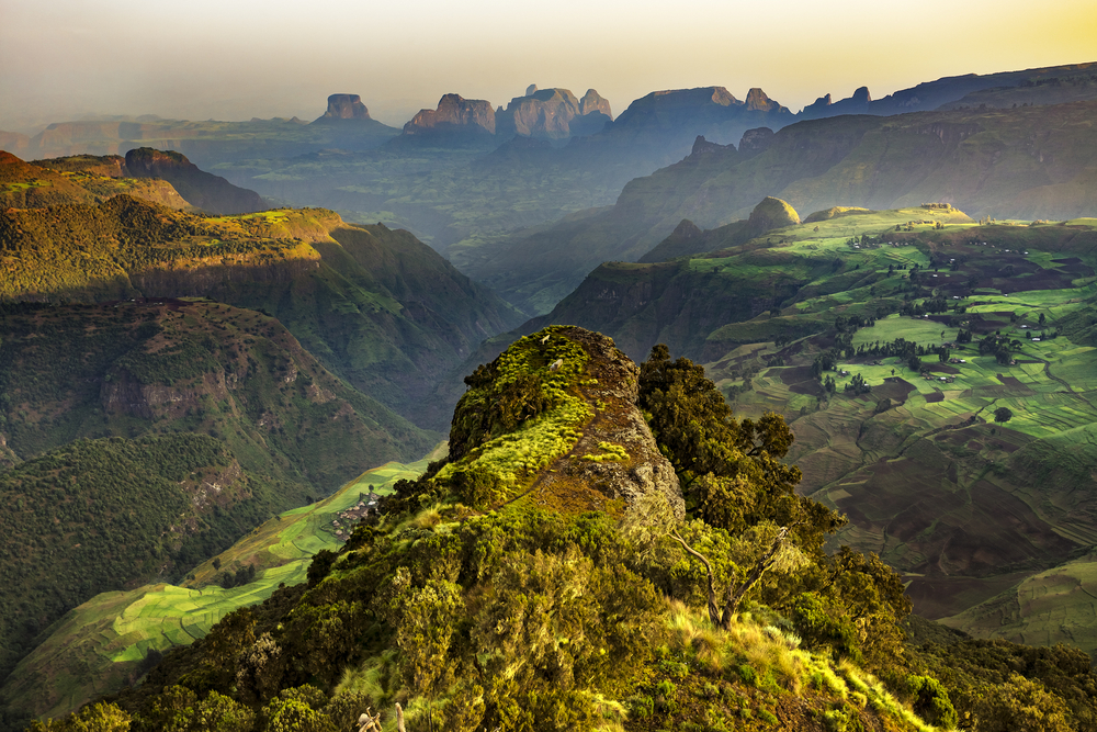
What Animals Live in Bale Mountains Ethiopia? Complete Wildlife Guide
Standing at dawn on the windswept Sanetti Plateau, you might spot something extraordinary—a rust-colored wolf silhouetted against Africa’s largest Afro-alpine moorland. This isn’t just any wildlife encounter. The Bale Mountains Ethiopia harbor one of Earth’s most remarkable concentrations of endemic species, creatures found absolutely nowhere else on the planet. Stretching across southeastern Ethiopia, this UNESCO World Heritage Site candidate rises from 1,500 meters in the misty Harenna Forest to over 4,000 meters on the frozen plateau, creating a “lost world” where evolution took a unique path. The Bale Mountains aren’t just mountains—they’re living laboratories where rare Ethiopian Wolves hunt Giant Molerats, Mountain Nyalas browse ancient woodlands, and Bale Monkeys swing through bamboo forests that time forgot. Quick Reference: Bale Mountains Wildlife at a Glance 🗺️ Category Key Information Location Southeastern Ethiopia, Oromia Region Altitude Range 1,500m – 4,377m (Tullu Dimtu peak) Main Habitats Afro-alpine Plateau, Montane Woodlands, Harenna Forest Flagship Species Ethiopian Wolf, Mountain Nyala, Bale Monkey Total Mammal Species 78+ species (29 endemic to Ethiopia) Bird Species 300+ species (16 endemic) Best Wildlife Months October – January (dry season) UNESCO Status World Heritage Site Tentative List Conservation Priority Critical (home to world’s rarest canid) Unique Feature Highest endemism rate for any mountain ecosystem globally Flagship Species — The Icons of Bale 🐺 Ethiopian Wolf (Canis simensis) Imagine a fox that evolved into a wolf—that’s essentially what you’re looking at when you spot an Ethiopian Wolf. With its long legs built for the high-altitude chase, russet-red coat blazing against dark moorland, and distinctive white throat markings, this creature looks like it wandered out of a wildlife photographer’s dream. But here’s what makes your heart skip: fewer than 500 individuals exist on Earth, making this the world’s most endangered canid species. You’ll find them on the Sanetti Plateau, usually at dawn or dusk, nose-down in a hunting crouch. What are they hunting? Giant Molerats—those bizarre, buck-toothed rodents that pop up from underground burrows like whack-a-mole targets. The Ethiopian Wolf has perfected a hunting technique over millennia: patient stalking followed by a lightning-fast pounce. This predator-prey relationship isn’t just fascinating—it’s the backbone of the entire Afro-alpine ecosystem [Source: Ethiopian Wolf Conservation Programme]. Your best chance of spotting one? Drive the road crossing Sanetti Plateau between 6-8 AM. They’re surprisingly tolerant of vehicles when you maintain respectful distance, often hunting within 50 meters of the road. During mating season (August-November), you might even witness pack dynamics, with subordinate wolves helping raise pups in a communal den [Source: IUCN Red List – Ethiopian Wolf]. Mountain Nyala (Tragelaphus buxtoni) Picture an antelope the size of a large horse, draped in shaggy chocolate-brown fur, with males sporting magnificent spiral horns that corkscrew up to 118 centimeters. The Mountain Nyala is Ethiopia’s answer to the kudu, but bigger, rarer, and infinitely more elusive. These gentle giants are endemic to Ethiopia’s highlands, with the Bale Mountains hosting the largest population. Mountain Nyalas prefer the transition zones—where montane woodlands meet forest edges, particularly around 3,000-3,400 meters elevation. They’re browsers, not grazers, delicately selecting leaves, shoots, and lichens with lips as precise as surgical instruments. Males are solitary wanderers for most of the year, only joining female herds during the November-December breeding season. Females travel in small groups of 4-6 individuals, often with calves hiding in thick vegetation. Spotting them requires patience and local knowledge. The Dinsho area, near park headquarters, offers your best odds, especially early morning when they venture into open glades to feed. Move slowly, speak softly, and you’ll witness behaviors that few outsiders ever see—the territorial displays of dominant males, the protective vigilance of mothers, the playful curiosity of young calves [Source: African Wildlife Foundation – Mountain Nyala]. Lesser-Known Mammals — Rodents, Primates & More 🐒 Bale Monkey (Chlorocebus djamdjamensis) Here’s something most visitors miss entirely: deep in the Harenna Forest, a unique primate species swings through bamboo canopies in troops of 20-30 individuals. The Bale Monkey, also called the Bale Mountains Vervet, isn’t just another monkey—it’s a bamboo specialist found nowhere else. Unlike their lowland cousins, Bale Monkeys have adapted to life at 2,400-3,400 meters, where temperatures drop to freezing at night. Their diet consists heavily of bamboo shoots, leaves, and seeds, supplemented by forest fruits when available. Watch them closely and you’ll notice their thick fur coats, smaller body size compared to lowland vervets, and distinctive social behaviors adapted to dense forest living. The Harenna Forest’s southern slopes provide the best viewing opportunities. Trek the Katcha Trail or the route toward Rira, and listen for their sharp alarm calls echoing through the canopy. They’re most active mid-morning when sunlight penetrates the forest, warming their preferred feeding zones. What makes them truly special? They represent an evolutionary adaptation to high-altitude forest life that scientists are still studying [Source: Primate Conservation – Bale Monkey Research]. Giant Molerat (Tachyoryctes macrocephalus) You might think a rat deserves less attention than wolves and antelopes. You’d be wrong. The Giant Molerat is the unsung hero of the Bale Mountains Ethiopia ecosystem, and here’s why: without them, the Ethiopian Wolves wouldn’t survive. These bizarre creatures look like someone mixed a beaver’s teeth with a potato, added tiny eyes (they’re nearly blind), and created an underground earth-moving machine. Weighing up to 900 grams, they’re the largest molerats in Africa. They spend 99% of their lives underground, excavating elaborate tunnel systems up to 3 meters deep, pushing up fresh soil mounds that dot the plateau like miniature volcanoes. Here’s where it gets fascinating: Giant Molerats are the primary food source for Ethiopian Wolves, comprising up to 96% of their diet on the Sanetti Plateau. But their importance goes beyond being prey. Their constant digging aerates the soil, prevents vegetation from becoming too woody, and essentially maintains the entire Afro-alpine heathland ecosystem. They’re ecosystem engineers in the truest sense [Source: Journal of Zoology – Molerat Ecology Studies]. You won’t see them easily—they’re underground. But you’ll see their fresh earth mounds everywhere on the plateau, and if you’re incredibly patient and lucky, you might
What Animals Live in Bale Mountains Ethiopia? Complete Wildlife Guide Read More »