Which Time Is Best to Visit Lambasingi? Your Ultimate Guide to Lambasingi Snowfall
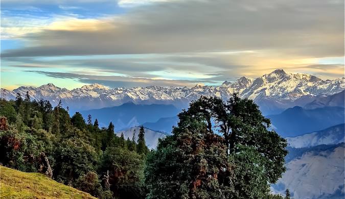
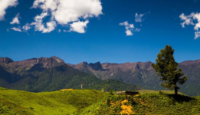
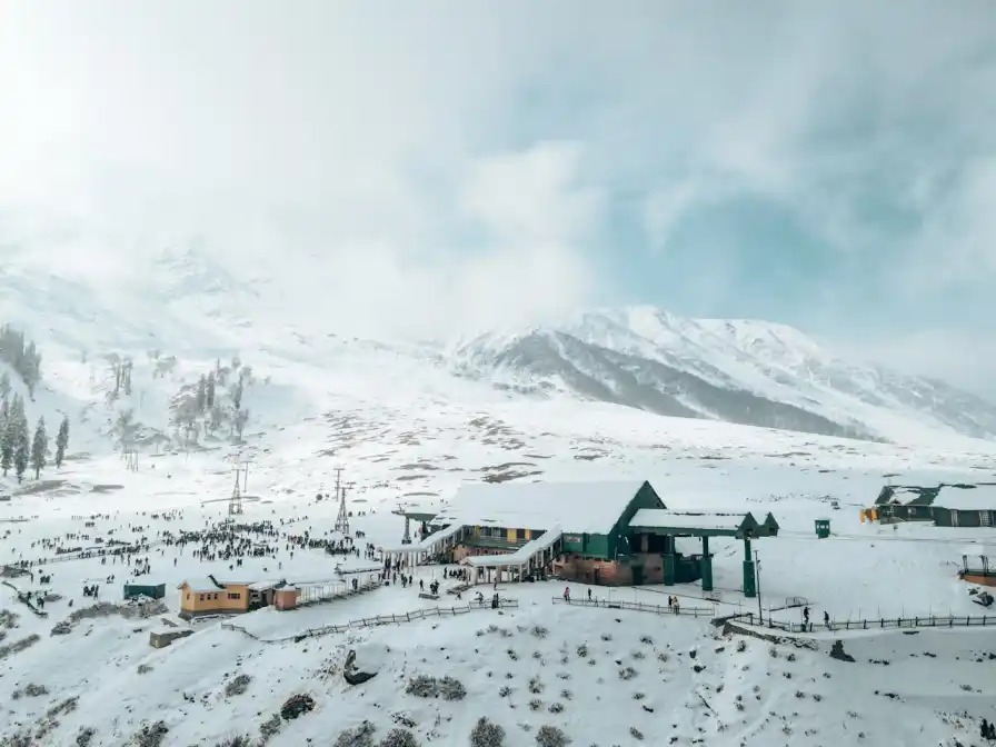
Picture this: You’re standing in South India, wrapped in layers of warm clothing, watching your breath turn into clouds of mist as the sun rises over frost-covered fields. Sounds impossible? Welcome to Lambasingi, affectionately called the “Kashmir of the South” – a hidden gem in Andhra Pradesh where temperatures can drop so low that you might just witness something magical. If you’ve been dreaming of experiencing a snow in South India or at least some bone-chilling cold without flying to the Himalayas, you’re in the right place. This guide will walk you through everything you need to know: which time is best to visit Lambasingi, what makes this place so uniquely cold, how to plan your adventure, and the insider secrets that’ll make your trip unforgettable. Quick Answer: The best time to visit Lambasingi for potential snowfall is from mid-December to January, when temperatures can dip close to zero degrees Celsius, and you have the highest chance of witnessing frost or rare snowfall. The absolute sweet spot? The last week of December to the first week of January. Understanding Lambasingi’s Climate & Snowfall Phenomenon Let’s get real about what makes Lambasingi so special. This tiny village sits at an elevation of about 1,000 meters (3,280 feet) in the Eastern Ghats of Andhra Pradesh. While that might not sound super high compared to Himalayan peaks, it’s the perfect altitude combined with unique geographical factors that create this cold places in Andhra Pradesh wonder. Why Is Lambasingi So Cold? The village is surrounded by dense forests and coffee plantations that trap moisture. When the winter winds blow through the valleys, they create a microclimate that’s significantly colder than surrounding areas. The high humidity combined with dropping temperatures creates the perfect conditions for frost formation – and on rare, magical occasions, actual snowfall. The Truth About Lambasingi Snowfall Here’s what you need to know: actual snowfall in Lambasingi is extremely rare. According to India Meteorological Department records, the last documented snowfall occurred in 2016, and before that, there were only a handful of instances in the past few decades. What you’re much more likely to experience is: Think of it as nature’s way of giving you a winter wonderland experience without the guarantee of actual snow. The frost-covered fields look absolutely stunning and create an atmosphere that feels worlds away from typical South Indian weather. Monthly Temperature Guide for Lambasingi Month Minimum Temp (°C) Maximum Temp (°C) Humidity Frost Probability November 8-10 20-22 75% Low December 2-5 18-20 80% High January 0-4 17-19 85% Very High February 5-8 20-22 70% Medium Data compiled from local weather stations and tourism reports Which Time Is Best to Visit Lambasingi? Month-by-Month Breakdown Let’s break down the Lambasingi winter climate so you can pick the perfect time for your visit. November: The Warm-Up Month Temperature Range: 8°C to 22°C November is when the cold places in Andhra Pradesh start living up to their reputation. The weather begins getting chilly, especially after sunset. This is the shoulder season, which means: Pros: Cons: Insider Tip: If you’re okay with cool weather (not freezing) and want to avoid crowds, early November is fantastic for exploring the region. December: Winter Arrives in Full Force Temperature Range: 2°C to 20°C This is where things get exciting! December is when Lambasingi transforms into the cold paradise everyone talks about. The Lambasingi December January temperature drops significantly, and you’ll start seeing frost regularly. First Half of December (Dec 1-15): Second Half of December (Dec 16-31): Pros: Cons: January: The Coldest Month Temperature Range: 0°C to 19°C January is the coldest month in Lambasingi, and if you’re chasing that rare snowfall in southern India dream, this is your best bet. Early January (first two weeks) is particularly special. Early January (Jan 1-15): Late January (Jan 16-31): Pros: Cons: February: The Transition Month Temperature Range: 5°C to 22°C By February, winter starts loosening its grip on Lambasingi. While still cooler than most South Indian destinations, the extreme cold begins to fade. Pros: Cons: The Absolute Best Time: My Insider Recommendation After talking to locals, analyzing weather patterns, and considering traveler experiences, here’s my recommendation: Plan your visit between December 25th and January 10th. This window gives you: Pro Tip: Check with local homestay owners on social media about current weather conditions 3-4 days before your trip. They’ll give you the most accurate, real-time updates about frost and cold conditions. Planning Your Trip: How to Reach Lambasingi Getting to this Andhra Pradesh hill station requires some planning, but the journey is part of the adventure! From Visakhapatnam (Nearest Major City) Distance: Approximately 100 km Travel Time: 3-3.5 hours Route: Visakhapatnam → Anakapalle → Lambasingi This is the most popular route. Visakhapatnam has excellent connectivity by air, rail, and road. By Air: Visakhapatnam Airport is the nearest airport (about 90 km away). You can hire a taxi from the airport, which costs around ₹2,500-3,500 for the trip. By Train: Visakhapatnam Railway Station is well-connected to major cities. From the station, hire a cab or take a bus to Lambasingi. By Road: The drive from Vizag is scenic, passing through tribal villages and dense forests. The roads are generally good, but expect some winding ghats as you climb higher. From Bangalore Distance: Approximately 900 km Travel Time: 15-16 hours by road, or fly to Vizag (1.5 hours) + 3.5 hours drive Best Option: Fly to Visakhapatnam and then drive to Lambasingi. Direct road trips are long but doable if you enjoy road travel. From Chennai Distance: Approximately 800 km Travel Time: 14-15 hours by road, or fly to Vizag Best Option: Similar to Bangalore – fly to Visakhapatnam for convenience, then take a road trip to Lambasingi. From Hyderabad Distance: Approximately 650 km Travel Time: 12-13 hours by road Route: Hyderabad → Vijayawada → Rajahmundry → Anakapalle → Lambasingi This is a popular weekend getaway option for Hyderabad residents. Local Transport & Road Conditions Important: There are no direct buses to Lambasingi village. The nearest bus stop is
Which Time Is Best to Visit Lambasingi? Your Ultimate Guide to Lambasingi Snowfall Read More »