Mountain Destination

Madeira Travel Guide 2026: Top Things to Do, Best Itineraries & Insider Tips

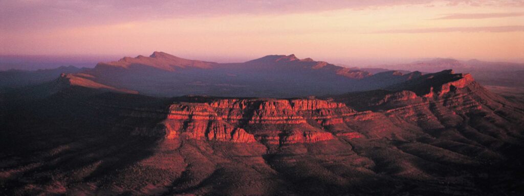
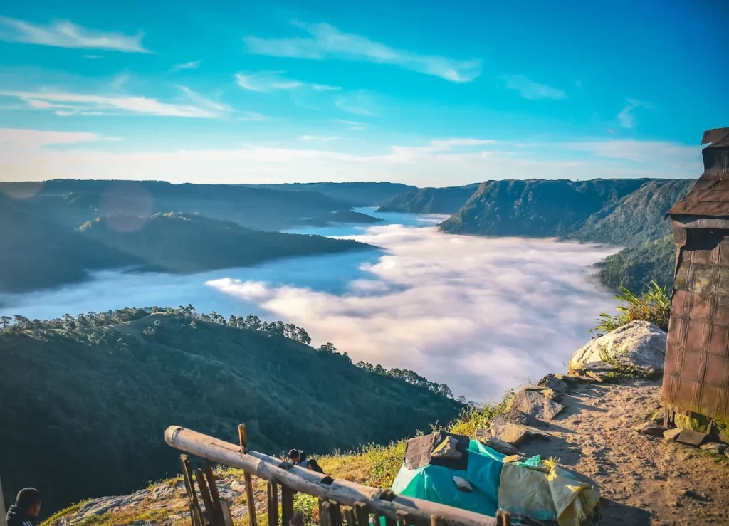
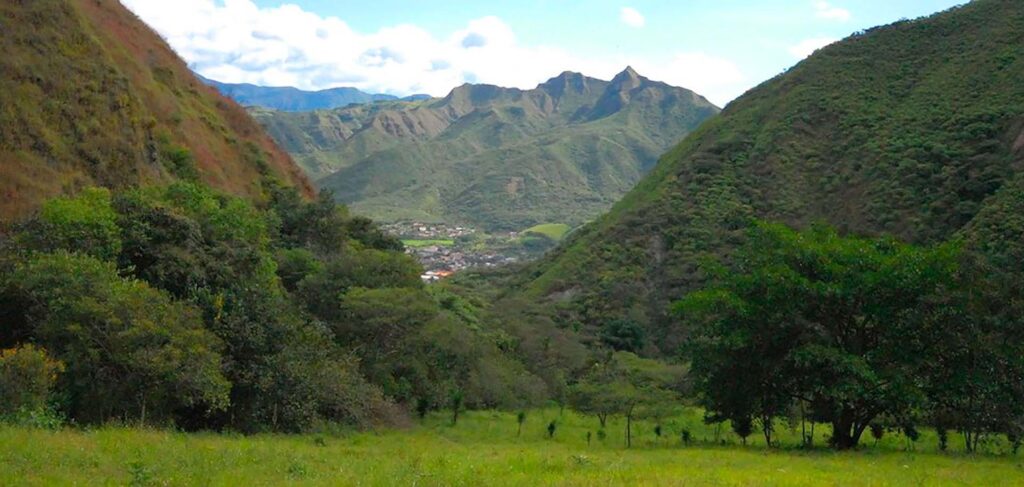
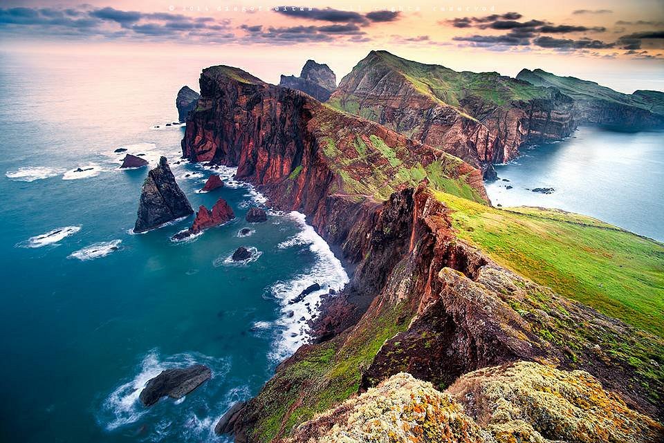
Picture this: An island where you can hike above the clouds at sunrise and swim in volcanic lava pools by sunset. Where the Madeira travel guide you’re holding tells you about a place that just beat destinations worldwide to become TripAdvisor’s #1 Trending Destination for 2026. I’m Wahid Ali, Operations Lead at Astamb Holidays in Mumbai, and in my 20 years managing tours to incredible places, Madeira keeps surprising me with how it balances adventure with accessibility. But here’s what’s different in 2026: New hiking permit requirements have just kicked in (yes, you now need to book and pay for popular trails), flight capacity from the UK has jumped 17%, and the island that was once a “retiree haven” is now pulling in digital nomads, adventure seekers, and families who want something beyond cookie-cutter beach resorts. The rules have changed, the crowds are building—but if you plan smart, 2026 is the perfect year to experience Madeira before everyone else catches on. What Makes Madeira the #1 Trending Travel Destination in 2026? Madeira claimed the world’s top trending destination spot in 2026 because it offers dramatic volcanic landscapes, year-round mild weather, and authentic Portuguese culture without the overwhelming crowds of Spain’s Canary Islands or Greece’s hotspots. Based on over 8 million traveler reviews, TripAdvisor recognized Madeira for consistently strong feedback across hotels, attractions, and restaurants throughout 2025. Here’s why the island is having its moment: It’s evolved from a cruise ship stopover into an adventure capital. In the morning, you’re scaling 1,818-meter peaks like Pico do Arieiro. By afternoon, you’re canyoning through waterfalls. The shift I’ve noticed managing tours? Madeira now attracts the 30-60+ demographic looking for active holidays, not just passive sunshine. With Portugal’s digital nomad visa program and Funchal’s growing coworking scene, remote workers are sticking around for months, not days. The island’s appeal also lies in what it doesn’t have: mass tourism infrastructure. No mega-resorts lining every beach. No all-inclusive complexes. Just authentic villages, locally-run restaurants, and trails that genuinely challenge you. It’s the “Hawaii of Europe” without Hawaii’s price tag or crowds. Madeira Travel Overview: Climate, Culture & First Impressions Climate: The “Eternal Spring” Reality Madeira maintains subtropical temperatures ranging from 15-16°C (59-61°F) in winter to 25-26°C (77-79°F) in summer, earning its “Eternal Spring” nickname. But don’t mistake “mild” for “monotonous”—the island has microclimates. The north coast receives more rain and wind than the sheltered southern coast where Funchal sits. Mountains above 1,500 meters can see fog and even occasional winter snow. Season Temperature Range Rainfall Best For Winter (Dec-Feb) 15-20°C (59-68°F) Moderate-High Hiking, avoiding crowds Spring (Mar-May) 16-22°C (61-72°F) Low-Moderate Flower Festival, perfect weather Summer (Jun-Sep) 22-26°C (72-79°F) Very Low Swimming, outdoor activities Autumn (Oct-Nov) 20-24°C (68-75°F) Low-Moderate Wine harvest, shoulder season From my experience managing tours, April-May and September-October offer the sweet spot: warm weather, minimal rain, and fewer tourists than the July-August peak. Culture & First Impressions Madeira blends Portuguese mainland traditions with island isolation. You’ll hear Portuguese everywhere (though English is widely spoken in tourist areas), taste fortified wines that predate sherry, and see Santana’s triangular thatched houses that look like they’re from a fairytale. The vibe? Relaxed but not sleepy. Safe—Portugal ranks as one of Europe’s safest countries—but steep. Seriously, everything in Funchal is uphill or downhill. Best Places to Visit in Madeira (Top Attractions) Funchal & Botanical Garden Start in the capital. The Monte Palace Tropical Garden (covering 70,000 m²) captivates with exotic flora, Japanese koi ponds, and Monte Palace Museum. Get there via the Funchal-Monte Cable Car—the 20-minute ride offers sweeping city views. One-way costs €12.50 for adults, round-trip €18. Pro tip from the tours I run: Don’t wear denim on this trip. If you plan the famous Monte Toboggan ride back down (those wicker basket sleds steered by carreiros in white uniforms), you’ll get sweaty. And yes, it’s touristy—but genuinely fun. Cabo Girão Skywalk At 580 meters above sea level, Cabo Girão is Europe’s highest sea cliff. The glass floor viewing platform costs just €2 per person (free for residents and kids under 12). You’ll either love the adrenaline rush or hate the vertigo. Either way, grab an aperol spritz at the cliff-top café afterward. Pico do Arieiro & Pico Ruivo Madeira’s third-highest peak (1,818m) offers sunrise views that justify the 5:30 AM wake-up call. The PR1 trail connecting Pico do Arieiro to Pico Ruivo (1,862m, the island’s highest) is the “stairway to heaven” hike everyone talks about. Critical 2026 Update: This trail closed in August 2024 for safety improvements and reopens April 2026. When it does, new fees apply: €10.50 for independent hikers, €7 if you book through a licensed operator. Porto Moniz Natural Pools On the northwest coast, volcanic rock formations create natural swimming pools filled with Atlantic Ocean water. It’s swimmable year-round thanks to Madeira’s climate, though summer (June-September) is warmest. Entry is free, though parking nearby runs €3-5. Santana Traditional Houses The triangular A-frame thatched houses (Casas de Santana) with red doors are Madeira’s most photographed structures. They’re not just tourist props—locals lived in these until the 1980s. Santana itself makes a great lunch stop when exploring the north coast. Top Unique Local Experiences & Hidden Gems Monte Toboggan Ride (Carros de Cesto) Since the 1850s, these wicker basket sleds have transported locals (and now tourists) down 2 km of Monte’s steep streets. Two drivers in traditional white outfits and straw hats steer using their rubber-soled boots as brakes. It costs around €25-30 per person for a 10-minute ride. Tourist trap? Absolutely. Worth it? Also yes. Authentic Food Markets Mercado dos Lavradores in Funchal is the main farmers market—vibrant, fragrant, but prices reflect its popularity. Expect vendors to charge tourists more than locals for fruit. For better value, visit smaller village markets or the Ponta do Sol market on Saturdays. Off-Beat Local Taverns Skip hotel bars for poncha. Real poncha comes from rustic tabernas like Taberna da Poncha in Serra de Água—a tiny stone hut plastered with business cards from past visitors. The owner

Madeira Travel Guide 2026: Top Things to Do, Best Itineraries & Insider Tips Read More »

Ikara-Flinders Ranges — Complete Travel Guide for 2026

Picture standing on ancient rock that’s older than the Himalayas, watching the sunrise paint red cliffs in shades of gold. That’s the Ikara-Flinders Ranges — and it’s calling your name for 2026. I’m Wahid Ali, and in my 20 years managing tours at Astamb Holidays, I’ve sent countless travellers to Australia’s outback. But the Ikara-Flinders Ranges National Park holds a special place in my recommendations. Why? Because it delivers what most people only dream about: genuine wilderness, deep Aboriginal culture, and landscapes that make you feel tiny in the best possible way. This isn’t your typical tourist trap. The Flinders Ranges stretch across 95,000 hectares of South Australia’s outback, about 430 kilometres north of Adelaide. Here’s everything you need to know before you go. What Is Ikara-Flinders Ranges? The Ikara-Flinders Ranges National Park sits in South Australia’s outback, roughly 5 hours’ drive from Adelaide. Think rugged mountain ranges, deep gorges carved over millions of years, and wildlife you won’t see anywhere else. The landscape here started forming 800 million years ago — making it one of Earth’s oldest mountain ranges. You’re literally walking through geological history. What does Ikara mean in Aboriginal language? Ikara means “meeting place” in the Adnyamathanha language. The word specifically refers to Wilpena Pound, which has served as a traditional gathering spot for the Adnyamathanha people for thousands of years. The Adnyamathanha people — whose name translates to “rock people” or “hills people” — have called this land home for over 49,000 years. In 2016, the park was officially renamed to honour this heritage. Today, it’s co-managed by Parks South Australia and the Adnyamathanha Traditional Lands Association, ensuring their stories and sacred sites are properly protected. Quick Facts Details Official Name Ikara-Flinders Ranges National Park Size 95,000 hectares (234,717 acres) Distance from Adelaide 430 km (267 miles) Drive Time 5 hours (non-stop) Traditional Owners Adnyamathanha people Established January 1, 1945 Why Visit Ikara-Flinders Ranges? Here’s what makes this place different from your average national park: The geology is mind-blowing. These mountains are older than the Himalayas. The park contains Ediacaran fossils — some of the oldest evidence of complex life on Earth. Scientists from around the world come here to study rocks that tell stories from 650 million years ago. It’s culturally significant. This isn’t just a pretty landscape. Sacred sites like Arkaroo Rock and Sacred Canyon hold ancient rock art and carvings dating back tens of thousands of years. The Adnyamathanha community shares their stories through guided tours, and trust me — you’ll never look at the land the same way after hearing creation stories told by traditional custodians. The experiences are unique. Where else can you: Lonely Planet recently highlighted the Flinders Ranges as a must-visit destination, but honestly, locals have known this secret for decades. Best Time to Visit Ikara-Flinders Ranges Timing is everything in the outback. Get it wrong, and you’ll be miserable. Get it right, and you’ll have the trip of a lifetime. What is the best time of year to go to the Flinders Ranges? The best time to visit is April to October (autumn through spring), with August to October being ideal for wildflowers and comfortable hiking temperatures. Daytime temperatures range from 15°C to 25°C (59°F to 77°F), perfect for bushwalking without melting. Here’s my honest breakdown by season: Autumn (March-May): Brilliant choice. Days are warm (20-30°C), nights are cool but not freezing. The landscape shows off in oranges, reds, and browns. Easter can get busy, so book ahead. Winter (June-August): This is peak season for good reason. Days are clear and sunny (13-18°C), perfect for hiking. Nights drop to near 0°C, so pack warm layers. Campfires are allowed (bring your own wood — collection is prohibited). Wildlife is active, and you’ll spot more animals near water sources. The trade-off? Higher accommodation prices and more tourists, especially during school holidays. Spring (September-November): Wildflower season! After winter rains, the desert blooms in yellows, purples, and reds. September and October offer the best of both worlds — warm days, wildflowers, and decent availability. Just note: fire ban season typically starts mid-October. Summer (December-February): Only for the brave or foolish. Temperatures regularly hit 33-40°C+. Many hiking trails close for safety between December and March. If you must visit in summer, restrict activities to early morning and late evening. Seriously — the outback sun is no joke. Pro tip from my tour operations experience: Book April-May or September if you want fewer crowds but still excellent weather. July-August is beautiful but expect company. How Big Is Ikara-Flinders Ranges? The park covers 95,000 hectares — or if you prefer, about 370 square kilometres. To put that in perspective, that’s roughly 1.5 times the size of Singapore. But here’s what that really means for travellers: You can’t “do” this park in a day. The terrain is vast and varied. You’ve got: How many days do you need? Minimum 2-3 days to see the highlights. Give yourself 4-5 days if you want to really explore and do some longer hikes. A week lets you add in Arkaroola Wilderness Sanctuary to the north. Where to Go & What to Do Let me walk you through the must-see spots and hidden gems: Wilpena Pound (Ikara) This is the star attraction. Wilpena Pound is a massive natural amphitheatre — imagine mountains forming a near-perfect oval 17 kilometres long and 8 kilometres wide. From the outside, it looks like a line of peaks. From inside, you realize you’re in this enormous basin. The only way to get your vehicle inside is via the Wilpena Pound Resort shuttle (runs at 9am, 11am, 1pm, and 3pm). Otherwise, it’s a 3-hour, 8-kilometre return walk to the lookout. St Mary Peak (1,170 metres) is the highest point in the Flinders Ranges. The hike is challenging (20 kilometres return, 8-10 hours), but the views are extraordinary. Important cultural note: The Adnyamathanha people ask that you stop at Tanderra Saddle rather than summiting, as the peak holds sacred significance. Brachina and Bunyeroo Gorges The Brachina

Ikara-Flinders Ranges — Complete Travel Guide for 2026 Read More »

Uluru-Kata Tjuta National Park — Complete Travel Guide 2026

Standing at the edge of Australia’s Red Centre, watching the sunrise paint Uluru-Kata Tjuta National Park in shades of crimson and gold, I’m reminded why this place captivates millions. As someone who manages travel operations and has organized countless tours to this World Heritage-listed park, I can tell you that Uluru-Kata Tjuta National Park offers more than stunning photos – it delivers a soul-stirring connection to ancient Anangu culture and landscapes that have existed for millennia. Here’s the thing: planning a trip to Uluru-Kata Tjuta National Park requires more than just booking flights. You need insider knowledge about entry fees, the best walking trails, cultural sensitivities, and practical logistics. After years of helping travelers experience the Red Centre properly, I’ve put together everything you need to know for an unforgettable 2026 visit. What Is Uluru-Kata Tjuta National Park? 🏜️ Located in Australia’s Northern Territory, approximately 450 kilometers southwest of Alice Springs, Uluru-Kata Tjuta National Park is a dual-listed UNESCO World Heritage site recognized for both its outstanding natural and cultural values. This designation – one of only a handful worldwide – honors the park’s geological significance and its deep spiritual importance to the Anangu people, who have been the traditional custodians of this land for over 30,000 years. The park spans 1,325 square kilometers of red desert, home to two of Australia’s most iconic natural landmarks: Uluru (the massive sandstone monolith) and Kata Tjuta (a collection of 36 weathered rock domes). Park Feature Details Size 1,325 square kilometers Nearest Town Yulara (18 km from Uluru) Climate Type Semi-arid desert UNESCO Status Dual-listed (1987 for natural, 1994 for cultural) Traditional Owners Anangu (Pitjantjatjara and Yankunytjatjara people) Elevation – Uluru 348 meters above ground Elevation – Kata Tjuta 546 meters above ground (tallest dome) Annual Visitors Approximately 250,000+ The park operates under joint management between Parks Australia and the Anangu traditional owners – a model that has set international standards for indigenous land management since the historic 1985 Handback, when the Australian Government returned ownership to its rightful custodians. Uluru vs Kata Tjuta — Are They the Same Thing? This is one of the most common questions I get from travelers. While both are part of the same national park, Uluru and Kata Tjuta are distinctly different geological formations with their own unique characteristics. Uluru is a single massive sandstone monolith – essentially one enormous rock rising 348 meters above the desert floor with a circumference of 9.4 kilometers. What you see is actually just the tip; geologists estimate that most of Uluru extends several kilometers underground. The rock is approximately 550 million years old and was formed through the compression of ancient sand dunes. Kata Tjuta, whose name means “many heads” in the local Anangu language, consists of 36 separate dome formations spread across more than 20 square kilometers. The tallest dome, Mount Olga, rises 546 meters – actually 200 meters higher than Uluru. These domes are made of conglomerate rock (a mixture of boulders, pebbles, and sand cemented together) and are estimated to be around 500 million years old. Think of it this way: Uluru is like a single, smooth cathedral dome, while Kata Tjuta is a cluster of weathered, rounded peaks that create mysterious valleys and gorges between them. Why Is Uluru-Kata Tjuta National Park So Famous? 🌟 Beyond the obvious visual drama, Uluru-Kata Tjuta National Park holds profound significance that transcends typical tourist attractions. In my experience planning tours, understanding this “why” transforms a simple sightseeing trip into a meaningful journey. Geological Wonder: These formations represent one of Earth’s most remarkable geological stories. The sandstone of Uluru contains minerals that oxidize (rust) when exposed to air, creating that famous red color. At sunrise and sunset, the changing angle of sunlight amplifies different mineral compositions, making the rock appear to glow in shades ranging from deep purple to brilliant orange-red. Spiritual Heart: For the Anangu people, this landscape embodies Tjukurpa – their traditional law, culture, and creation stories. Tjukurpa explains how ancestral beings shaped the land, created the waterholes, and established the laws that govern Anangu life. Every cave, waterhole, and rock formation has stories attached, making the entire park a living cultural textbook. According to Anangu Tjukurpa, during the creation period, ancestral beings traveled across the land, hunting, fighting, loving, and teaching. As they moved, they created the landscape features we see today. The Mala (rufous hare-wallaby) people camped at Uluru, the Kuniya (woma python) fought the Liru (poisonous snake) at Mutitjulu Waterhole, and these stories are preserved in the rock art and landscape itself. Global Icon Status: Uluru has become one of the world’s most photographed natural landmarks, featured in countless films, documentaries, and travel campaigns. It represents Australia’s ancient heart and has become a pilgrimage site for travelers seeking connection with nature and indigenous culture. Scientific Importance: The park protects rare desert ecosystems, including over 400 plant species and numerous threatened animals like the Great Desert Skink and Mulgara. The joint management model has pioneered fire management techniques that balance traditional Anangu burning practices with modern conservation science. Visitor Planning Essentials (Logistics Focus) 📋 Let me share the practical details that can make or break your visit. As someone who coordinates logistics daily, I know these specifics matter. Uluru-Kata Tjuta National Park Entry Fee 💰 All visitors require a park pass to enter Uluru-Kata Tjuta National Park. Here’s what you need to know for 2026: Pass Details: How to Purchase: Where Money Goes: This is important to understand. 100% of park pass revenue is reinvested directly into: You cannot use a Northern Territory parks pass here – Uluru-Kata Tjuta National Park is federally managed by Parks Australia, requiring its own separate pass. Uluru-Kata Tjuta National Park Opening Hours ⏰ The park operates year-round with seasonal hour variations: Season Opening Hours Note December-February (Summer) 5:00 AM – 9:00 PM Extremely hot; walks close early March-May (Autumn) 5:00 AM – 8:00 PM Ideal conditions June-August (Winter) 6:30 AM – 7:30 PM Cold nights, perfect days September-November (Spring)

Uluru-Kata Tjuta National Park — Complete Travel Guide 2026 Read More »

Nongjrong, Meghalaya: The Ultimate 2026 Travel Guide to India’s Most Spectacular Cloud Viewpoint

Picture this: You’re standing at the edge of a cliff at 5:30 AM, wrapped in layers against the biting cold, watching the first rays of sunlight pierce through the darkness. Below you isn’t the ground—it’s an endless ocean of clouds stretching to the horizon, with distant peaks emerging like islands in a celestial sea. This isn’t a dream or a heavily edited Instagram post. This is Nongjrong, Meghalaya—a tiny Khasi village in the East Khasi Hills that has quietly become one of India’s most breathtaking sunrise destinations. I’m Wahid Ali, Operations Lead at Astamb Holidays and a travel professional with over 20 years of experience crafting itineraries across India’s hidden corners. When Anand Mahindra shared images of Nongjrong’s cloud inversion phenomenon on social media in recent years, it sparked a wave of curiosity. Suddenly, travelers were asking us: “Where is this place? How do we get there? Is it real?” The answer is yes—it’s very real, and in my experience managing tours to Meghalaya, Nongjrong offers something truly rare: a spectacular natural phenomenon without the crowds that plague similar spots. This 2026 travel guide is designed to give you everything you need—from the 3 AM wake-up call logistics to understanding why those clouds gather below you. Whether you’re planning a sunrise day trip from Shillong or building a multi-day offbeat circuit through East Khasi Hills, I’ll share the practical insights we’ve gathered from sending dozens of groups to this remarkable viewpoint. Let’s get you above the clouds. What Is Nongjrong Famous For? ☁️ Direct Answer: Nongjrong is famous for its spectacular cloud inversion phenomenon and sunrise viewpoint, where visitors stand above a sea of clouds with the sun rising over distant Himalayan foothills. The “Sea of Clouds” at Nongjrong isn’t just a poetic description—it’s a meteorological event that transforms the valley below into what looks like an endless white ocean. During the cooler months (particularly October through February), cold air settles in the valleys while warmer air sits above, creating a temperature inversion. The moisture in the valley forms clouds that fill the low-lying areas completely, leaving the higher viewpoints—like Nongjrong—floating above this ethereal landscape. What sets Nongjrong apart from better-known spots like Laitlum Canyons or Mawlynnong? Three things: In my experience organizing tours, the emotional response from travelers at Nongjrong is unlike almost anywhere else. There’s something profound about standing literally above the clouds—it shifts your perspective in ways a mountain view or waterfall simply can’t match. Location & Geographic Context 📍 Nongjrong is a small village located in the East Khasi Hills district of Meghalaya, approximately 30 kilometers northeast of the district headquarters at Jowai (also known as Jwai). Administratively, it falls under the Amlarem subdivision, positioning it in the southeastern section of the Khasi Hills plateau. How Far Is Nongjrong from Shillong? Direct Answer: Nongjrong is approximately 55 kilometers from Shillong, taking about 2.5 to 3 hours by road under normal conditions. The coordinates of the main viewpoint are approximately 25.4°N, 92.3°E, placing it at an elevation of around 1,400 to 1,500 meters above sea level—high enough to stay above the cloud layer but accessible by standard vehicles. Distance & Travel Time Reference Table Starting Point Distance Travel Time Road Condition Shillong 55 km 2.5-3 hours Good (NH-6 + village roads) Guwahati 160 km 5-5.5 hours Good (NH-6 majority) Jowai 30 km 1-1.5 hours Moderate (village roads) Dawki 85 km 3-3.5 hours Good to moderate Cherrapunji 95 km 3.5-4 hours Good The village sits along a ridge that provides natural elevation advantage—this is why the clouds form below rather than around the viewpoint, creating that signature “floating above the world” feeling that makes Nongjrong so special. How to Reach Nongjrong 🚗 Getting to Nongjrong requires planning, particularly if you want to catch the sunrise. Here’s the breakdown based on what we’ve learned from multiple tours: By Air ✈️ The nearest airport is Shillong Airport (Umroi), located about 70 kilometers from Nongjrong (3-3.5 hours drive). However, this airport has limited connectivity. Most travelers fly into Lokpriya Gopinath Bordoloi International Airport, Guwahati (160 km, 5-5.5 hours), which offers far better flight options and connections to major Indian cities. Pro Tip from Experience: If you’re flying into Guwahati specifically for a Nongjrong sunrise, arrive the previous evening and stay in Shillong. The 5+ hour drive from Guwahati to Nongjrong would require leaving around midnight—exhausting and not recommended. By Train 🚂 Guwahati Railway Station is the nearest major railhead. From there, hire a taxi or take a shared cab to Shillong (approximately 100 km, 3 hours), then continue to Nongjrong. By Road (The Real Journey) This is where the rubber meets the road—literally. Here are your options: Option 1: Self-Drive If you’re comfortable with mountain roads and have experience with Indian hill driving, self-driving is rewarding. The route from Shillong: Road conditions are generally good on the highway, but the final stretch involves narrower roads. A sedan can make it, but an SUV provides more comfort and confidence. Option 2: Hired Taxi (Recommended for First-Timers) This is what we arrange for 95% of our Astamb Holidays clients. Hiring a local taxi from Shillong costs approximately: Critical Timing Advice: To catch the sunrise (approximately 5:45-6:15 AM depending on season), you need to leave Shillong by 3:00 AM. The driver needs to account for: Most local drivers are experienced with early morning Nongjrong runs and know the roads well. Option 3: Shared Cabs from Jowai If you’re basing yourself in Jowai (which I sometimes recommend for deeper East Khasi Hills exploration), shared cabs occasionally run to nearby villages. However, for sunrise timing, a private hire is more reliable. Navigation Notes Best Time to Visit & The Sunrise Experience 🌅 Seasonality: When Do the Clouds Appear? Direct Answer: The best time to visit Nongjrong for the cloud inversion phenomenon is October through February, with November to January offering the most consistent cloud formations. Here’s the seasonal breakdown: Peak Season (November-January): Good Season (October & February): Off-Season (March-September): The Science Behind the Clouds (Simply

Nongjrong, Meghalaya: The Ultimate 2026 Travel Guide to India’s Most Spectacular Cloud Viewpoint Read More »

Kaas Plateau Travel Guide 2026: Best Time to Visit, Bloom Season, How to Reach & FAQs

Imagine standing on a vast expanse where nature paints the ground in every color imaginable—crimson reds, sunshine yellows, deep purples, and soft whites stretching as far as your eyes can see. This isn’t a fantasy; this is Kaas Plateau, Maharashtra’s very own Valley of Flowers! Nestled in the majestic Western Ghats near Satara, this UNESCO World Natural Heritage Site transforms into a living, breathing canvas every monsoon season, hosting over 850+ species of flowers that bloom in spectacular fashion. As someone who has guided countless travelers through India’s hidden gems at Astamb Holidays, I can confidently say that Kaas Plateau offers one of the most magical natural experiences you’ll ever witness. This comprehensive 2026 travel guide will give you everything you need to plan your perfect visit—from the exact bloom dates to booking tips, travel routes, and insider secrets that only come from years of ground experience. What is Kaas Plateau? Kaas Plateau, locally known as Kaas Pathar (where “Pathar” means plateau in Marathi), is a biodiversity hotspot that sits at approximately 1,200 meters (3,937 feet) above sea level. Located about 25 kilometers from Satara city in Maharashtra, this extraordinary plateau lies within the ecologically rich Western Ghats, one of the world’s eight “hottest biodiversity hotspots.” What makes Kaas Plateau truly special? In 2012, it earned the prestigious designation of a UNESCO World Natural Heritage Site due to its remarkable ecosystem and unique geological features. The plateau showcases an ancient laterite formation that dates back millions of years, creating the perfect conditions for an incredible diversity of plant life that you won’t find anywhere else on Earth. The name “Kaas” comes from the Kaas tree (Elaeocarpus glandulosus), which once dominated the region. Today, while these trees are less common, the plateau has gained worldwide fame for something even more spectacular—its seasonal flower carpet that attracts nature lovers, photographers, and botanists from across the globe. Quick Facts About Kaas Plateau: Detail Information Location Near Satara, Maharashtra, Western Ghats Elevation 1,200 meters (3,937 feet) above sea level Distance from Satara 25 kilometers (approx. 45 minutes drive) Distance from Pune 130 kilometers (approx. 3 hours drive) Distance from Mumbai 290 kilometers (approx. 6 hours drive) UNESCO Status World Natural Heritage Site (since 2012) Flora Diversity 850+ species of flowering plants Best Known As Valley of Flowers of Maharashtra 🌺 Why Visit Kaas Plateau? (The Magic Awaits) The Mesmerizing Valley of Flowers Experience Kaas Plateau isn’t just another tourist spot—it’s a living botanical museum that transforms dramatically with the seasons. During the bloom season, the entire plateau becomes a spectacular carpet of wildflowers that change composition and color almost daily. Walking through this natural wonderland feels like stepping into a painter’s dream, where every footstep reveals new colors, patterns, and fragrances. What truly sets Kaas Plateau apart is the sheer variety of flowers blooming simultaneously. You might spot delicate purple smithias alongside cheerful yellow sonki flowers, vibrant red toothcup blossoms next to clusters of rare insectivorous plants. The plateau hosts everything from tiny ground-hugging species to taller flowering plants, creating layers of color that photographers and nature enthusiasts absolutely adore. Incredible Biodiversity & Ecosystem The plateau’s biodiversity is staggering. With 850+ documented species of flowering plants, including many endemic varieties found nowhere else on the planet, Kaas Plateau represents one of India’s most important conservation areas. The ecosystem includes: Beyond flowers, you’ll encounter fascinating wildlife including various butterfly species, beetles, grasshoppers, and numerous bird species that thrive in this protected ecosystem. The fragile laterite soil and seasonal water pools create microhabitats that support an intricate web of life. Beyond the Plateau: Nearby Natural Wonders Your Kaas Plateau adventure shouldn’t end at the flower fields. The surrounding Satara region offers several breathtaking attractions that perfectly complement your visit: 🏞️ Kaas Lake: Just 2 kilometers from the plateau entrance, this serene lake offers stunning reflections of the surrounding hills. During the monsoon season, the lake reaches its fullest, creating picture-perfect moments, especially during sunrise and sunset. It’s an ideal spot for a peaceful break and some contemplative photography. 💧 Thoseghar Waterfalls: Located approximately 20 kilometers from Kaas Plateau, Thoseghar is a magnificent cascading waterfall system where water plunges from a height of 500 meters through multiple tiers. During peak monsoon (July-August), the falls are at their most powerful and dramatic. The viewpoints offer spectacular panoramas of the water crashing into the valley below, surrounded by lush green hills. 🌊 Vajrai Waterfall: Known as one of India’s tallest waterfalls, Vajrai Waterfall drops from an impressive height of 853 feet (260 meters). Located about 25 kilometers from Kaas, this three-tiered wonder is best visited during or immediately after the monsoon season when water flow is at its peak. The surrounding Sahyadri ranges create a dramatic backdrop that makes the journey absolutely worth it. Pro Tip from My Experience: Plan a 2-day itinerary to fully experience the region. Visit Kaas Plateau early morning on Day 1, explore Kaas Lake by afternoon, stay overnight in Satara town, and then visit the waterfalls on Day 2. This way, you won’t feel rushed and can truly soak in the natural beauty of the entire area. 📅 Best Time to Visit Kaas Plateau (Timing is Everything!) The Golden Window: Bloom Season Here’s the most important information for planning your trip: The best time to visit Kaas Plateau is from late August to early October, with mid-September being the absolute peak bloom period. This is when the plateau transforms into its legendary carpet of flowers, and the biodiversity is at its most vibrant. Bloom Season Breakdown: Time Period Bloom Status What to Expect Late August (20-31 Aug) Early Bloom (40-50%) First wave of flowers appear; fewer crowds, pleasant weather Early September (1-15 Sept) Peak Bloom (80-90%) Maximum variety and density; vibrant colors everywhere Mid September (15-25 Sept) ABSOLUTE PEAK (95-100%) Best time! All species in full bloom; incredible diversity Late September (25-30 Sept) Late Peak (70-80%) Still spectacular; certain species fade while others emerge Early October (1-15 Oct) Declining (40-60%) Many flowers have

Kaas Plateau Travel Guide 2026: Best Time to Visit, Bloom Season, How to Reach & FAQs Read More »

Samaipata Bolivia Things to Do: Complete Travel Guide 2025–2026 (History, Nature, Local Gems & Insider Tips)

You know that feeling when you stumble into a place that just gets you? That’s Samaipata. This little mountain town sits right where the Andes decide to kiss the Amazon jungle, and honestly, it’s one of those places you plan to stay for two days and end up camping out for a week. If you’re searching for authentic Samaipata Bolivia things to do that go beyond the typical tourist circus, you’ve landed in the right place. No crowds fighting for selfie spots. No aggressive tour hawkers. Just crisp mountain air, ancient rock carvings, waterfalls cold enough to make you yelp, and a vibe that’s equal parts backpacker chill and Bolivian authenticity. Here’s the thing: Samaipata isn’t trying to impress anyone. The town square has more dogs napping in the sun than cars. The expat community runs cute cafés where you can get decent espresso (a miracle in rural Bolivia). And when you want adventure? You’re literally surrounded by cloud forests, pre-Inca ruins, and swimming holes that feel like your own private discovery. This guide covers everything you need: how to actually get there (the shared taxi situation is real), when to visit without getting soaked, the history behind those massive rock carvings, nature trails that’ll make your Instagram followers jealous, and the kind of insider tips that only come from spending real time in a place. Whether you’ve got three days or a full week, I’ll break down exactly how to experience Samaipata the right way. How to Get to Samaipata & When to Visit Getting There: The Shared Taxi Dance Samaipata sits about 120 kilometers southwest of Santa Cruz de la Sierra, Bolivia’s biggest city. Forget buses if you value your sanity and lower back. The move here is taking a “truffi” – these shared taxis that leave when they’re full (which is very Bolivian, very unpredictable, and somehow always works out). Head to the corner of Avenida Omar Chávez and Soliz de Olguín in Santa Cruz. Look for the cluster of white vans with drivers yelling “¡Samaipata! ¡Samaipata!” You’ll pay around 30-40 Bolivianos (about $4-6 USD). The ride takes 2.5 to 3 hours depending on whether your driver thinks he’s auditioning for Fast & Furious or actually respects the curves. The scenery shifts dramatically – you start in tropical lowlands and climb into pine-covered mountains. Crack a window and smell that change in the air. Pro tip: Truffis leave throughout the morning, but the sweet spot is 8-10 AM. Go too late and you might wait around. Too early and, well, nothing in Bolivia really starts before 8 AM anyway. Best Time to Visit Samaipata The dry season runs from May through October, and that’s your golden window. Clear skies, minimal mud on the trails, and temperatures that hover around 20-25°C (68-77°F) during the day. Nights get chilly though – we’re talking 5-10°C (41-50°F). You’ll want layers. November through April brings the wet season. It’s not a total write-off – the waterfalls are more impressive and everything’s absurdly green – but hiking becomes a muddy wrestling match. If you’re coming for Amboró National Park, stick to dry season unless you enjoy slipping down trails. Samaipata weather is that tricky mountain situation where you can experience four seasons in one day. Morning frost, afternoon sun that burns through your sunscreen, evening chill that has you hunting for your fleece. Pack accordingly. What to Pack: The Real List Top Things to Do in Samaipata Visit El Fuerte de Samaipata — History & Archaeology Let’s clear something up first: El Fuerte de Samaipata isn’t actually a fortress. The Spanish called it that because they have no imagination. This massive carved rock – the largest of its kind in the world – was a ceremonial center used by the Chané people (pre-Inca) and later the Incas themselves. UNESCO recognized it as a World Heritage Site in 1998, which is fancy talk for “this place is legitimately important.” The site sits about 9 kilometers from town. You can walk it (uphill, allow 2+ hours), bike it (rent in town for 30-40 BOB/day), or catch a ride with a tour. Entry costs 50 Bolivianos for foreigners. What makes El Fuerte de Samaipata history fascinating is what you’re actually looking at. The massive rock face is carved with channels, seats, geometric shapes, and animal representations. The most famous is the “Cascabel” – a serpent design that winds across the stone. These weren’t random doodles. They were sacred ceremonial spaces, possibly connected to water rituals and astronomical observations. The experience hits different early morning. You get there around 8 AM and the place is yours. The light is softer. You can run your hands along those ancient grooves (carefully – erosion is real) and actually process what it took to carve this. No metal tools. Just stone on stone and an incredible amount of intention. From the upper platform, the view spreads across the Samaipata Valley toward the cloud forest. On clear days, you can see layers of mountains fading into blue distance. Bring water – there’s minimal shade – and give yourself at least 2 hours to explore properly. Important: Stay on marked paths. The rock is sandstone, which means it erodes easily. Tourism is slowly damaging the carvings, so be a conscious visitor. Explore Nature — Amboró National Park & Surrounding Trails Here’s where Samaipata gets wild. Amboró National Park protects one of the most biodiverse areas on the planet. We’re talking the exact meeting point of three ecosystems: Andes mountains, Amazon rainforest, and the Chaco. That means you can see spectacled bears, jaguars, over 800 bird species, and more insects than you can possibly identify. The park’s cloud forest section near Samaipata is absolutely otherworldly. Giant tree ferns create canopies overhead. Everything is draped in moss. The air smells like wet earth and growing things. If you’ve seen Jurassic Park, that’s the vibe – you half expect a dinosaur to crash through the foliage. Critical info: You cannot enter Amboró alone. It’s

Samaipata Bolivia Things to Do: Complete Travel Guide 2025–2026 (History, Nature, Local Gems & Insider Tips) Read More »

Vilcabamba Ecuador – The Lost City Where Longevity Meets Hidden Adventure

I still remember the first time I stepped off the bus in Vilcabamba, Ecuador – The Lost City, my lungs filling with air so crisp it felt medicinal. The emerald peaks of Mandango rose sharply against the impossibly blue Andean sky, and an elderly woman—easily in her nineties—strode past me carrying a basket of papayas without breaking stride. This wasn’t the tourist-packed Ecuador I’d expected. This was something else entirely: a place where time moved differently, where legends of people living to 120 weren’t just folklore but a tourism claim that sparked decades of scientific curiosity. Whether you’re a wellness seeker hunting for the world’s healthiest lifestyle, a hiker craving undiscovered trails, or a digital nomad searching for affordable paradise, Vilcabamba, Ecuador – The Lost City offers something rare in our hyperconnected world—a chance to truly disconnect and rediscover what living well actually means. At XploreHeaven.com, we specialize in unearthing hidden gems that most guidebooks skip over, and this sacred valley in southern Ecuador might be our most intriguing find yet. Quick Facts: About Vilcabamba, Ecuador – The Lost City at a Glance Detail Information Location Loja Province, Southern Ecuador Elevation 1,500 meters (4,921 feet) Climate Eternal Spring (15-26°C / 59-79°F year-round) Distance from Loja 45 km (28 miles), 1.5 hours by bus Distance from Quito 650 km (404 miles), 12-14 hours by bus or 1-hour flight to Loja + transfer Currency US Dollar Best Time to Visit June to September (dry season) Famous For Longevity legends, hiking, wellness retreats, expat community Primary Language Spanish (some English in expat areas) Population Approximately 5,000 (including surrounding areas) Where Is Vilcabamba Ecuador – The Lost City? Vilcabamba, Ecuador – The Lost City sits tucked away in the Loja Province, cradled between the rugged foothills of the Andes Ecuador hidden valley system. About 45 kilometers south of the colonial city of Loja, this sacred valley feels like it exists outside the normal flow of time. The name itself—derived from the Quechua word “Huillcopamba” meaning “sacred valley”—hints at the reverence indigenous communities held for this land. Getting here requires commitment, which is precisely why it remains unspoiled. From Quito, you’ll either endure a scenic but lengthy 12-14 hour bus journey through mountain passes and cloud forests, or you can fly to Loja (about an hour) and catch a local bus or taxi for the final leg. The road from Loja winds through eucalyptus groves and past small farms where horses graze freely. Cell service becomes spotty. The modern world starts to fade. The valley itself stretches along the banks of the Chamba River, surrounded by peaks that shift from green to gold depending on the season. At 1,500 meters elevation, you’re high enough to enjoy cool mountain air without the harsh altitude effects of places like Quito or Cusco. The climate here earned Vilcabamba its nickname: the land of eternal spring. Why “The Lost City”? Let me clear something up right away: Vilcabamba, Ecuador – The Lost City isn’t a ruins site like Machu Picchu or the actual Lost City (Ciudad Perdida) in Colombia. There are no ancient stone temples hidden in the jungle here. Instead, the “Lost City” moniker captures something more subtle—a sense of being forgotten by time, a place that modernity somehow overlooked. When I walked through the town square on my first evening, I understood. Old men in worn ponchos sat on benches, sharing jokes in Quechua-inflected Spanish. A farmer led his donkey down the cobblestone street. The only “chain” establishment was a single pharmacy. This wasn’t curated for Instagram—this was authentic smalltown Andean life continuing as it has for generations. The indigenous Palta people inhabited these valleys long before Spanish conquest, and their descendants still farm the surrounding hillsides. The Spanish colonizers largely bypassed Vilcabamba because it lacked precious metals and proved difficult to access. This isolation preserved traditional agricultural practices and a slower pace of life that would later attract both scientists and seekers. In the 1970s, when National Geographic and other outlets began publishing stories about the Valley of Longevity, the world suddenly took notice of this secluded paradise. Yet even today, it remains wonderfully off the beaten path—a true hidden gem for travelers willing to venture beyond the Galapagos-Quito-Cuenca circuit. The Longevity Myth & Science Here’s where things get fascinating—and where I need to separate fact from marketing hype. The Legend: Starting in the 1950s, stories emerged about residents of Vilcabamba routinely living to 120, 130, even 140 years old. Dr. Miguel Salvador of Quito reportedly found dozens of centenarians in the valley. By the 1970s, journalists and researchers flooded in, dubbing it the Valley of Longevity and comparing it to other “Blue Zones” like Okinawa and Sardinia. The Reality: Later scientific investigations—including work by Dr. Alexander Leaf from Harvard and demographic studies in the 1980s—revealed a less miraculous but still interesting truth [Link to Source: National Institutes of Health longevity studies]. Many age claims were exaggerated, often because residents lacked official birth certificates and conflated their ages with those of deceased relatives sharing the same name. The 140-year-old grandfather? Probably closer to 90. But here’s what remains true: The elderly population in Vilcabamba exhibits remarkable vitality. I met Don Miguel, who claimed to be 103 (likely closer to 85), still tending his coffee plants and walking two miles daily to visit his grandchildren. The combination of factors—clean mineral-rich water from mountain streams, an active lifestyle farming steep hillsides, a plant-based diet heavy on legumes and corn, strong social bonds, and that perfect climate—creates genuine health benefits. Modern researchers now focus on these lifestyle factors rather than record-breaking ages [Link to Source: Journal of Public Health Studies]. The longevity study Vilcabamba legacy isn’t about superhuman genetics but about how traditional mountain living naturally promotes wellness—a lesson increasingly valuable in our sedentary, processed-food world. Nature, Climate & Environment That Support Well-being The moment you arrive in Vilcabamba, you feel it—the air tastes different. Cleaner. Almost sweet. The Eternal Spring Climate delivers consistent temperatures between 15-26°C (59-79°F)

Vilcabamba Ecuador – The Lost City Where Longevity Meets Hidden Adventure Read More »

What to Do in Barichara, Colombia: Ultimate Guide to Colombia’s Most Beautiful Town

Picture this: you’re walking down ancient cobblestone streets bathed in golden afternoon light, with white adobe walls rising on either side and the distant Andean mountains painting the horizon. Welcome to Barichara, a place so stunning that Colombia officially declared it the country’s most beautiful town. If you’re wondering what to do in Barichara Colombia, you’ve landed in exactly the right spot. Nestled in the Santander region at 1,300 meters above sea level, Barichara isn’t just another colonial town – it’s a living museum where time moves differently. The name itself comes from the indigenous Guane language, meaning “a good place to rest,” and trust me, that’s exactly what this magical village delivers. Whether you’re a solo traveler seeking peaceful wandering, a family looking for cultural immersion, or an adventure enthusiast ready to hike ancient trails, this guide covers everything you need to plan the perfect Barichara travel experience. Ready to discover why travelers keep calling this hidden gem their favorite Colombian destination? Let’s dive in! Here is let’s Dive in – What to Do in Barichara Stroll Through a Living Museum: The Colonial Heart of Barichara Walking through Barichara’s colonial charm feels like stepping onto a movie set – in fact, this town inspired settings in Disney’s Encanto! Every corner reveals another postcard-perfect scene: terracotta roofs contrast brilliantly against whitewashed walls, hand-carved wooden doors frame blooming bougainvillea, and those famous golden-hued stones pave every street. The heart of town centers around Parque Principal, where locals gather on benches beneath shade trees and the magnificent Cathedral of the Immaculate Conception dominates the skyline. Built in 1838 entirely from locally quarried sandstone, this cathedral transforms into pure magic during sunset when the stone glows orange-gold. The polychrome wooden altarpiece inside, covered in gold leaf, is absolutely worth stepping inside to admire. Don’t miss the Capilla de Santa Bárbara, perched on a hill in the upper part of town. This 17th-century Romanesque chapel offers sweeping views over Barichara’s red rooftops and the surrounding canyon. The interior features fascinating sculptures of turtles and the sun, symbolizing domestic devotion. Meanwhile, the smaller Capilla de San Antonio provides another peaceful spot for reflection and photography. Pro Photography Tips: The best light for capturing Barichara’s architecture happens during the golden hours – arrive at Santa Bárbara around 6:30 AM for sunrise shots with minimal tourists, or head to El Mirador viewpoint around 5:30 PM to catch the town bathed in warm evening light. The streets of Calle del Encanto offer particularly charming doorways and balconies for detail shots. Historical Significance: In 1978, Colombia declared Barichara a Monumento Nacional, and in 2010 it received the prestigious designation of Pueblo Patrimonio (Heritage Town). The entire historic center is protected, preserving the traditional construction methods that have used local stone, clay tiles, and tapia pisada (rammed earth) for centuries. The town’s residents, affectionately called “patiamarillos” (yellow feet) because the ochre dust from the stone stains their shoes, take immense pride in maintaining their architectural heritage. Step Back in Time: Hiking the Historic Camino Real to Guane If there’s one activity that defines the Barichara experience, it’s hiking the legendary Camino Real to Guane. This isn’t just a scenic trail – it’s walking on history itself, following stones laid down centuries ago by the indigenous Guane people and later restored in 1864 by German engineer George von Lenguerke. Trail Details: What to Expect: The trail winds through stunning Colombian countryside with vibrant green meadows, unusual cacti, grazing white cows, and incredible views of the Suárez River Canyon. Bird lovers will spot numerous species flitting through the dry forest ecosystem. The entire path is paved with large flat stones, though they can be uneven and slippery after rain. Trail Hacks & Essential Tips: Best Time to Start: Begin your hike between 7:00-9:00 AM to avoid the intense midday heat. The trail is completely exposed with minimal shade, and temperatures can soar by noon. What to Pack: One-Way or Round-Trip? Most travelers hike from Barichara to Guane (downhill) and take the bus back. Hiking uphill from Guane to Barichara is significantly more challenging, especially in the heat. Save your energy for exploring! Returning to Barichara: Buses depart from Guane’s main plaza (near the church) approximately every hour, costing around 4,000 COP ($1 USD) for the 20-minute ride back to Barichara. The last bus typically leaves around 6:00 PM, so plan accordingly. Discovering Guane: Colombia’s Tiniest Treasure If you thought Barichara was small and charming, Guane will absolutely steal your heart. This pueblo consists of just a few streets around a central plaza, but what it lacks in size, it makes up for in authenticity and tranquility. What to Do in Guane: Extended Camino Real: For serious hikers, the Camino Real continues beyond Guane through Villanueva, Jordan, and eventually Los Santos – a challenging 35-kilometer, multi-day trek through remote countryside. Only attempt this with proper preparation and supplies. Chasing Horizons: Barichara’s Most Breathtaking Viewpoints Barichara’s location on a ridge overlooking the Suárez River Canyon creates some of the most spectacular vistas in the entire Santander department. Here are the must-visit viewpoints: El Mirador Located at the western edge of town, this viewpoint delivers panoramic views across the canyon and distant Andes mountains. The sunset here is legendary – arrive around 5:30 PM to watch the sky explode in shades of orange and pink while the town’s sandstone walls glow golden. Bring a blanket and some local snacks for an unforgettable evening. Mirador Salto del Mico A short walk from town center, this viewpoint provides excellent photo opportunities overlooking the valley. The name means “Monkey’s Leap Lookout,” though you’re more likely to spot impressive bird species than monkeys. The surrounding trails offer peaceful nature walks through dry forest ecosystems. Calle del Encanto Vantage Point Less crowded than the main viewpoints, this street offers charming perspectives of colonial architecture framed by mountain backdrops. Perfect for morning photography when the light is soft and the streets are quiet. Sunrise Viewpoint Walk For early risers, start

What to Do in Barichara, Colombia: Ultimate Guide to Colombia’s Most Beautiful Town Read More »

Ultimate Uyuni Salt Flats Travel Guide

Uyuni Salt Flats Travel Guide Imagine standing on a sea of white that stretches to infinity, where the sky kisses the ground in a perfect, dazzling mirror. You’re not dreaming—you’re in Bolivia’s Salar de Uyuni, the world’s largest salt desert. If you’re planning a trip to this otherworldly wonder, this uyuni salt flats travel guide will walk you through everything you need to know, from the mirror effect to altitude sickness prep, photography tricks to tour selection. Let’s get started on planning your adventure! Quick Reference: Uyuni Salt Flats Travel Guide Essentials Category Details Location Southwest Bolivia, Potosí Department Size 10,582 square kilometers (4,086 square miles) Altitude 3,656 meters (11,995 feet) above sea level Best Time for Mirror Effect January – April (rainy season) Best Time for Dry Season May – November Average Tour Cost (1-Day) $20-$40 USD Average Tour Cost (3-Day) $100-$150 USD Nearest Town Uyuni Main Starting Points Uyuni (Bolivia), San Pedro de Atacama (Chile), Tupiza (Bolivia) Currency Boliviano (BOB) – approximately 6.97 BOB = 1 USD Essential Gear Sunglasses, 50+ SPF sunscreen, layers, warm sleeping bag Altitude Medication Acetazolamide (Diamox) or Sorojchi pills What & Where Are the Uyuni Salt Flats? 🌍 The Salar de Uyuni isn’t just another pretty landscape—it’s a geological marvel that’ll blow your mind. This uyuni salt flats travel guide starts with the basics: what you’re actually looking at when you step onto that blinding white surface. Bolivia’s salt flats sit in the Daniel Campos Province of Potosí, right near the crest of the Andes Mountains. At 10,582 square kilometers, it’s the world’s largest salt flat—so massive you can see it from space! The entire landscape holds an estimated 10 billion tonnes of salt, with layers sandwiched between sedimentary deposits reaching 10 meters deep at the center. But here’s the fascinating part: millions of years ago, this wasn’t a desert of salt at all. The area was covered by prehistoric lakes—Lago Minchín and Lago Tauca—which eventually evaporated, leaving behind this stunning white crust. Today, beneath all that salt lies something even more valuable: approximately 70% of the world’s lithium reserves, the stuff that powers your smartphone and electric car. The salt flats sit at a breathtaking 3,656 meters (11,995 feet) above sea level, which means altitude is something you’ll need to take seriously (more on that later). The landscape is so flat that it’s actually used to calibrate satellites—talk about precision! Best Time to Visit & Weather Conditions 🌤️ Timing your trip right can make or break your Salar de Uyuni experience. Here’s the thing: there’s no single “best” time because it depends on what you want to see. Chasing the Mirror Effect (Rainy Season) 💧 When: December to April (peak: January – March) If you’ve seen those jaw-dropping photos where the sky and ground become one, you’re looking at the mirror effect. This happens during Bolivia’s rainy season when a thin layer of water (just a few inches) covers the salt flats, creating the world’s largest natural mirror. Pros: Cons: The Pure White Adventure (Dry Season) ☀️ When: May to November (peak: June – August) During the dry season, the water evaporates, revealing the iconic hexagonal salt patterns that look like nature’s own honeycomb design. The landscape transforms into an endless white desert under crystal-clear blue skies. Pros: Cons: The Secret Sweet Spot 🎯 Want the best of both worlds? Visit during the shoulder months—late March/early April or late November. You might catch both the mirror effect in some areas AND dry salt patterns in others. Plus, you’ll dodge the biggest crowds and sometimes score better deals on tours! How to Get There & Starting Point Options 🚌✈️ Getting to the Uyuni salt flats requires some planning, but don’t worry—it’s totally doable! Here’s your complete breakdown. Starting from La Paz (Most Common Route) La Paz sits about 570 kilometers from Uyuni, and most travelers use this route. Option 1: Overnight Bus (Most Popular) Option 2: Flight Starting from San Pedro de Atacama, Chile 🇨🇱 This route is popular for travelers coming from northern Chile or combining Bolivia with Chilean adventures. Option 1: Multi-Day Tour (Recommended) Option 2: Bus (Not Recommended) Comparison: Uyuni vs. San Pedro Starting Points Factor Starting in Uyuni Starting in San Pedro de Atacama Cost Cheaper ($20-150) More expensive ($150-250) Acclimatization Better if coming from La Paz (also high altitude) Challenging jump from 2,400m to 4,200m+ overnight Tour Options More variety (1-day to 4-day) Mainly 3-4 day options Border Hassles None Visa requirements for some nationalities Best For Budget travelers, more flexibility Coming from Chile, scenic route through lagoons From Tupiza (Argentina Route) If you’re traveling up from Argentina (via Villazón border), Tupiza makes an excellent starting point. The town sits at a lower altitude (2,800 meters), making it easier to acclimatize. Most operators recommend 4-day tours from Tupiza, with the Uyuni salt flats visited on the final day. Choosing the Right Tour (3-4 Day Itinerary) 🚙 Let’s be honest: you can’t explore the Salar de Uyuni independently. The lack of roads, extreme remoteness, and harsh conditions make tours absolutely necessary. But here’s how to pick a good one. Tour Length Options 1-Day Tours ($20-40 USD) 3-Day Tours ($100-150 USD) – Most Popular 4-Day Tours ($180+ USD) The Critical Safety Checklist ✅ Before booking ANY tour, ask these questions: Red Flags to Avoid: Recommended Operators (based on traveler reviews): Classic 3-Day Itinerary Breakdown Day 1: Train Cemetery → Colchani → Salt Museum → Uyuni Salt Flats → Incahuasi Island (giant cacti!) → Sunset → Overnight in basic refuge (Colcha K area) Day 2: Chiguana Salt Flat → Flamingo-filled lagoons (Cañapa, Hedionda) → Siloli Desert → Árbol de Piedra (rock tree) → Overnight near Laguna Colorada Day 3: Sunrise at Laguna Colorada → Sol de Mañana geysers → Hot springs → Laguna Verde → Optional drop-off at Chilean border or return to Uyuni What to Pack & How to Prepare (Altitude, Gear & Clothing) 🎒 This section could literally save your trip. I’m going to be very specific because

Ultimate Uyuni Salt Flats Travel Guide Read More »

What to Do in Salta: The Ultimate 2025 Travel Guide to Salta City & Beyond

Picture this: cobblestone streets lined with colonial buildings painted in sunset colors, mountain peaks touching cotton-candy clouds, and the sound of folk guitars drifting from candlelit doorways. Welcome to Salta la Linda—Salta the Beautiful—a city that sits pretty in Argentina’s northwest corner and refuses to follow the rules of typical South American travel. Most travelers zoom straight to Patagonia or Buenos Aires, but those in the know? They head north to Salta. This isn’t just another pretty colonial city (though it absolutely is that). It’s your gateway to some of the most jaw-dropping landscapes in Argentina—think rainbow mountains, endless salt flats that mess with your sense of reality, and wine valleys tucked between red-rock canyons. This guide covers everything you need to know about what to do in Salta, from wandering the city’s historic plazas to planning epic day trips into the surrounding Andes. Whether you’re here for three days or three weeks, we’ve got the insider scoop on attractions, logistics, local experiences, and those secret spots that make travel magical. Quick Salta Travel Information Category Details Best Time to Visit April-May & September-November (shoulder seasons) Airport Code SLA (Martín Miguel de Güemes International Airport) Altitude City: 1,187m (3,894 ft) / Excursions: Up to 4,170m (13,680 ft) Recommended Stay 4-6 days (2 city + 2-4 excursions) Currency Argentine Peso (ARS) – bring USD for better exchange rates Must-Try Empanadas Salteñas, Locro stew, Torrontés wine Don’t Miss Peña folklórica show, MAAM museum, Quebrada de las Conchas Budget Range Backpacker: $30-50/day | Mid-Range: $70-120/day | Luxury: $150+/day Getting to and Getting Around Salta How to Reach Salta Flying into Salta (SLA) is your easiest bet. Direct flights connect from Buenos Aires (2-hour flight), plus seasonal connections from other Argentine cities. The airport sits about 10 kilometers from downtown, making transfers quick and painless. If you’re doing the overland adventure thing, long-distance buses run from Buenos Aires (20+ hours—not for the faint of heart), Tucumán (4 hours), and other northern cities. Argentina’s bus system is surprisingly comfortable with reclining seats and meal service, but time-wise, flying makes way more sense unless you’re on a serious budget. Getting Around: Your Options Decoded Here’s where trip planning gets interesting. Salta city attractions are totally walkable—you can cover the historic center on foot in a day. But those incredible day trips? You’ve got choices: Rental Car (Best for Freedom Seekers)Renting a car gives you complete control over your schedule. The roads around Salta are generally good, though mountain passes require confidence with switchbacks and altitude. Gas stations exist but get sparse once you head into remote areas. This works beautifully if you want to stop every five minutes for photos (and trust me, you will). Organized Tours (Best for Ease)Nearly every hotel and hostel can book you on guided day trips. You’ll share a minibus with other travelers, hit all the highlights, and learn from local guides. The downside? Fixed schedules and less flexibility. Tours typically run 12-14 hours for the full-day excursions. Public Transport (Budget Option)Buses connect Salta to major towns like Cafayate and Cachi, but they don’t stop at scenic viewpoints along the way. You’ll miss photo ops at places like Quebrada de las Conchas. Only recommended if you’re seriously stretching pesos. Our Take: First-timers and solo travelers often prefer tours for the first excursion, then rent a car if they want more freedom. Families and groups find rental cars more economical when you split costs. Weather Watch Salta enjoys sunshine about 300 days a year, but seasons matter. Summer (December-February) brings afternoon rain and higher temperatures. Winter (June-August) delivers crystal-clear skies but chilly nights—especially at altitude. The sweet spot? April-May and September-November offer comfortable temps, fewer crowds, and perfect road conditions for exploring. Top Things to Do in Salta (City) – Your 1-Day Itinerary Morning: Museum Magic at MAAM Start your day at the Museo Arqueológico de Alta Montaña (MAAM)—possibly the most fascinating museum you’ve never heard of. This isn’t your dusty artifact warehouse. MAAM houses three incredibly preserved Inca children discovered at 6,700 meters on volcanic peaks, naturally mummified by extreme cold and altitude. The museum tells their story with respect and scientific rigor, explaining Inca capacocha ceremonies and high-altitude archaeology. It’s profound, moving, and completely unique. Plan for 60-90 minutes here. Check the official MAAM website for current hours and rotating exhibits—only one child is displayed at a time to ensure preservation. Late Morning: Colonial Center Circuit From MAAM, wander over to Plaza 9 de Julio, Salta’s beating heart. This isn’t just any plaza—it’s one of Argentina’s most beautiful, surrounded by orange trees and colonial architecture that’ll have your camera working overtime. Hit these spots around the plaza: Grab lunch at one of the cafes lining the plaza. Order empanadas salteñas—these aren’t your average empanadas. Salta-style means they’re smaller, perfectly spiced with cumin, and stuffed with beef, potatoes, and hard-boiled egg. Afternoon: Rise to Cerro San Bernardo After lunch, take the teleférico (cable car) up Cerro San Bernardo for panoramic views over the entire Lerma Valley. The city spreads below you in a patchwork of terracotta roofs and green plazas, with mountains rising dramatically in every direction. Feeling energetic? Skip the cable car and hike the 1,070 steps instead. The trail winds through gardens and past stations of the cross. It takes about 45 minutes and rewards you with that smug “I earned this view” feeling. Evening: Peña Folklórica Experience Here’s where Salta really shows its personality. A peña folklórica is a folk-music dinner show, but calling it that undersells the experience. These intimate venues pulse with traditional Argentine music—zambas, chacareras, and the haunting sound of bombo drums mixed with guitars. Locals pack these places on weekends, singing along and sometimes spontaneously joining the dancing. Try La Casona del Molino or Peña Gauchos de Güemes. You’ll eat regional dishes like locro (a hearty stew), humita (corn tamales), and tamales salteños while musicians rotate through sets. Pro tip: Peñas get crowded on Friday and Saturday nights—make reservations or arrive early. The

What to Do in Salta: The Ultimate 2025 Travel Guide to Salta City & Beyond Read More »