Skip to content
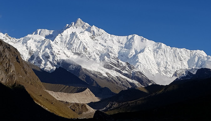
Northeast India Tourism Guide 2026: Best Places, Itinerary, Cost & Hidden Gems
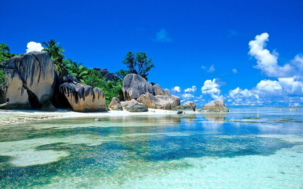
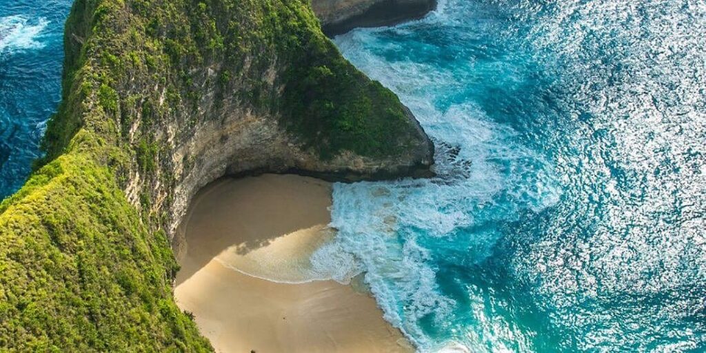
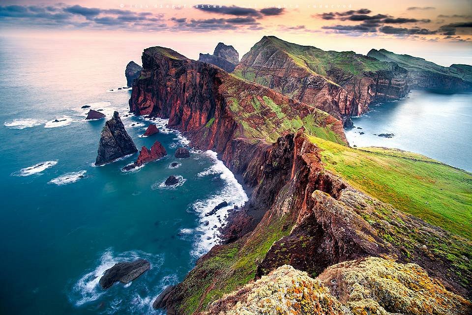
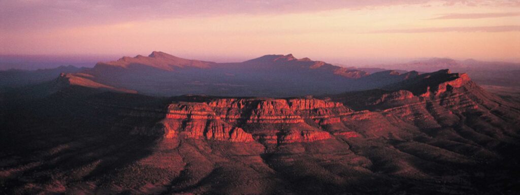
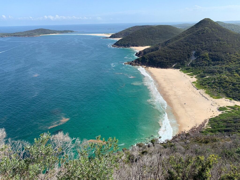
Every year at Astamb Holidays, I handle hundreds of tour requests. And lately, one region keeps coming up again and again: Northeast India. People are tired of crowded hill stations. They want something raw, real, and worth the journey. After personally scouting routes through Assam, Meghalaya, Arunachal Pradesh, Nagaland, and Sikkim, I can tell you this — northeast india tourism is not just a trend. It is a quiet revolution in how Indians travel. This guide is everything I would tell a close friend planning their first Northeast trip in 2026. What is Northeast India Tourism and Why It Is Trending in 2026? Northeast India tourism refers to travel across the eight states collectively known as the Seven Sisters (Assam, Meghalaya, Arunachal Pradesh, Nagaland, Mizoram, Manipur, Tripura) plus Sikkim. In 2026, this region is seeing one of its sharpest rises in search interest and footfall. The short answer: Indian travelers are shifting away from mass-tourism. They want slower trips with real cultural depth. Northeast India delivers exactly that — no commercial malls, no tourist traps, and landscapes that still look like a geography textbook illustration. New rail connections, better roads, and a growing network of local homestays are making the region more accessible than at any point before. The biggest pull is simple: you get more for less. Why Northeast India Tourism is Perfect for Indian Travelers If you are an Indian traveler, this region has four big advantages that other destinations simply cannot match: The Seven Sisters together hold over 50% of India’s bird species, nearly 40% of its flowering plants, and are home to flagship wildlife including the one-horned rhinoceros and the Hoolock gibbon — Asia’s only ape. For a wildlife or nature lover, this region is irreplaceable. Northeast India Tourism – Best Places to Visit in 2026 Assam – Rhinos, Rivers & Tea Gardens Assam is the natural entry point into Northeast India. Most flights land at Guwahati, which sits on the banks of the mighty Brahmaputra River. A ferry ride on the Brahmaputra at sunset is one of those moments you do not quickly forget. Kaziranga National Park is the centerpiece of any Assam trip. It is a UNESCO World Heritage Site and home to the world’s largest population of Indian one-horned rhinoceroses. Book your jungle safari early — morning slots fill up fast. Expect to pay ₹350 to ₹600 per person for the entry and elephant safari. Majuli Island is equally worth your time. It is one of the world’s largest river islands, sitting right in the middle of the Brahmaputra. The Vaishnavite monasteries (called satras) here are unique to Assam’s culture. The ferry ride to Majuli takes about 1 to 1.5 hours from Jorhat. Plan at least 2 nights here to see mask-making, traditional dance, and village life. Best for: Wildlife, river culture, tea tourism Meghalaya – Clouds, Caves & Living Bridges Meghalaya translates to “abode of clouds,” and it earns that name. Shillong, the state capital, is one of Northeast India’s most comfortable base cities. You get cafes, live music, and friendly locals — all without the chaos of a typical tourist town. Cherrapunji (now officially called Sohra) is one of the wettest places on earth and is about 54 km from Shillong. The Nohkalikai Falls here drop a stunning 340 meters — one of India’s tallest. The Mawsmai Caves are a short drive away and great for families. The Double Decker Living Root Bridge in Nongriat village is a bucket-list item. These bridges are grown — not built — from the aerial roots of Ficus Elastica trees by the local Khasi community over hundreds of years. The trek is about 3,000 steps each way, and takes roughly 3 hours round trip. Go early. Carry water. Dawki and the Umngot River offer some of the clearest water you will ever see in India. Boats appear to float in thin air. And Mawlynnong, just 90 km from Shillong, has been recognized as Asia’s cleanest village — a title it takes seriously. Best for: Nature, trekking, culture, photography Arunachal Pradesh – The Land of the Dawn-lit Mountains Arunachal Pradesh is where Northeast India goes from beautiful to breathtaking. The state shares borders with China, Bhutan, and Myanmar, and that geography shows in its monasteries, tribes, and mountain scenery. Tawang is the crown jewel. At 3,048 meters above sea level, the Tawang Monastery is the largest monastery in India and one of the largest in the world. The drive from Bomdila to Tawang is one of the most dramatic road journeys in the country — passing through the Sela Pass at nearly 4,200 meters. Ziro Valley, home to the Apatani tribe, is a UNESCO-nominated landscape of terraced rice fields and pine forests. The Ziro Music Festival held every September draws indie music lovers from across the country. ⚠️ Note: You need an Inner Line Permit (ILP) to enter Arunachal Pradesh. Apply online at arunachalilp.com at least 5–7 days in advance. Best for: Adventure, culture, Himalayan landscapes Sikkim – Gateway to the Himalayas Sikkim is the most organized of all Northeast states for tourism. Gangtok, the capital, has good food options, clean hotels, and a well-marked tourist trail. Rumtek Monastery and the Nathu La Pass (shared Indo-China border) are major draws. For trekkers, the Goecha La Trek near Yuksom offers close views of Kangchenjunga, the world’s third-highest peak. No ILP is needed to enter Sikkim as an Indian citizen, but some inner zones like Nathu La and Gurudongmar Lake require additional permits (easily arranged through your hotel or local agent). Best for: Trekking, monasteries, mountain views Northeast India Tourism – Hidden Gems You Must Visit These are the spots I personally recommend when clients ask me for something beyond the usual: What is the Best Time to Visit Northeast India? The ideal time for most travelers is October to April. Skies are clear, roads are passable, and wildlife is visible. Avoid the peak monsoon months of June to August for most states (though Meghalaya lovers actually
Northeast India Tourism Guide 2026: Best Places, Itinerary, Cost & Hidden Gems Read More »