Things to Do in Port Stephens – Best Attractions, Itineraries & Insider Tips
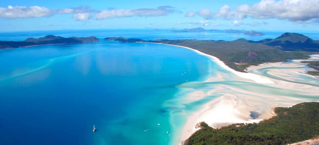
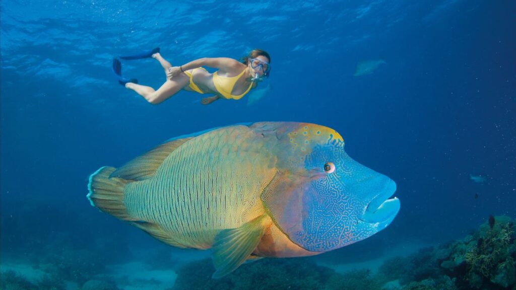
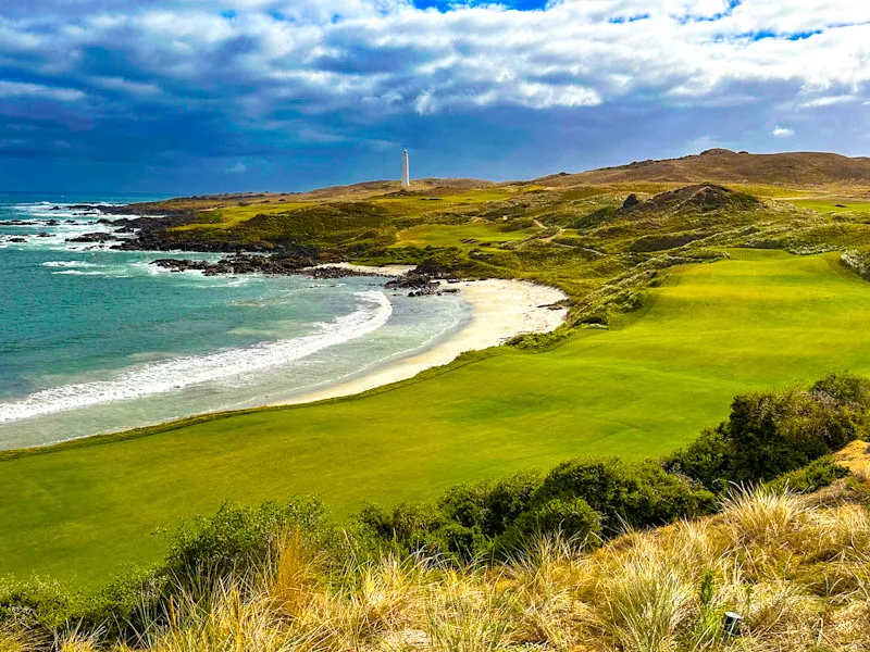
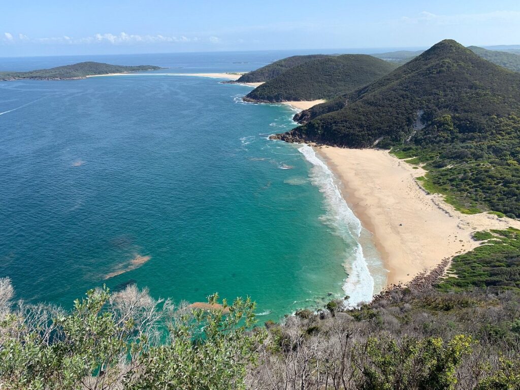
Picture this: 26 pristine beaches, the largest moving sand dunes in the Southern Hemisphere, and over 140 resident bottlenose dolphins waiting to welcome you. That’s Port Stephens – your ultimate coastal escape just 2.5 hours north of Sydney. If you’re wondering about things to do in Port Stephens, you’re in for a treat. I’ve spent years crafting travel experiences across NSW, and this sparkling harbour never fails to impress. From free beach days to thrilling wildlife encounters, romantic sunsets to family adventures, this guide covers everything you need to plan the perfect trip. Whether you’re a budget traveler, adventure seeker, or planning a family getaway, Port Stephens delivers unforgettable experiences without the Sydney crowds. Why Port Stephens is Worth Visiting 🌊 Is Port Stephens worth going to? Absolutely, and here’s why. Port Stephens isn’t just another beach destination. This 134-square-kilometer natural harbour – three times larger than Sydney Harbour – offers a unique combination of marine wildlife, adventure activities, and coastal beauty that’s hard to match anywhere else in NSW. Here’s what makes it special: In my experience managing tours across Australia, Port Stephens consistently ranks as one of the most versatile destinations. You can fill an entire week here or enjoy a perfect day trip from Sydney. The bay’s calm waters make it ideal for families, while adventure activities like sandboarding and dolphin swimming attract thrill-seekers from around the world. The best part? Unlike crowded Sydney beaches, Port Stephens retains its laid-back coastal charm. You’ll find space to breathe, genuine local hospitality, and that authentic Australian beach experience. How to Spend a Day in Port Stephens ⏰ How do I spend a day in Port Stephens? Here’s my tried-and-tested 1-Day Itinerary that captures the best of what this region offers. 06:00 AM – Sunrise at Zenith Beach Start early to beat the crowds. Drive to Zenith Beach via Zenith Beach Loop Road off Nelson Bay Road. This sheltered beach between Tomaree Mountain and Stephens Peak glows beautifully at sunrise. The aquamarine water and golden sand create perfect photo opportunities. Pack a thermos of coffee and enjoy the tranquility before the day begins. 08:00 AM – Tomaree Head Summit Hike Just 5 minutes from Zenith Beach, tackle the Tomaree Head Summit Walk. This 2.2 km return hike takes 45-60 minutes and rewards you with 360-degree views from 161 meters above sea level. You’ll see all of Port Stephens spread below, offshore islands, and if you’re lucky, dolphins playing in the waves. Wear proper hiking shoes – the track includes steep sections and stairs. 10:30 AM – Dolphin or Whale Watching Cruise Head to d’Albora Marina in Nelson Bay for a 1.5-2 hour cruise. Multiple operators like Moonshadow TQC Cruises, Imagine Cruises, and Aquamarine Adventures offer daily departures. Expect to pay $50-$65 for dolphin watching (year-round) or $60-$75 for whale watching (May-November). The success rate for dolphin sightings is an impressive 99%. 01:00 PM – Lunch in Nelson Bay Refuel at one of Nelson Bay’s waterfront restaurants. I recommend Little Beach Boathouse for fresh seafood with harbor views, or grab fish and chips from a local takeaway and enjoy them at Dutchmans Beach Reserve. 02:30 PM – Stockton Sand Dunes Adventure Drive 15 minutes to Birubi Beach in Anna Bay. You have two options here: The 32 km of undulating sand dunes create a surreal desert landscape. Some dunes reach heights of 50 meters! 05:00 PM – Sunset at Gan Gan Lookout End your day at Gan Gan Hill Lookout in Nelson Bay. This easily accessible viewpoint offers sweeping panoramic views of the entire Port Stephens region. Watch the sun set over the water while planning your return visit. The golden hour light here is absolutely magical. 07:00 PM – Dinner with a View Finish with dinner at Rick Stein at Bannisters in Soldiers Point for a special treat, or try Seabreeze Hotel in Nelson Bay for excellent bistro food with water views. Make sure to try the local oysters – they’re some of the freshest you’ll find anywhere. Things to Do in Port Stephens – Must-See Attractions 🏖️ Beaches & Coastal Walks Port Stephens’ 26 beaches each have their own personality. Here are the ones you can’t miss: Zenith Beach sits at the foot of Tomaree Mountain, sheltered by headlands creating gentle surf perfect for swimming. The brilliant aquamarine water and soft white sand make it one of the most photogenic beaches in NSW. Fingal Bay features a stunning C-shaped beach stretching over 1 kilometer. At low tide, a sandbar connects the mainland to Shark Island – you can walk across, but check tide times and exercise caution. The beach is popular with surfers and offers spectacular views of Fingal Island and its 1862-built lighthouse. Shoal Bay curves 2.5 kilometers from Nelson Head to Tomaree Head. This calm harbor-facing beach is ideal for families, kayaking, and stand-up paddleboarding. The crystal-clear water lets you see the sandy bottom even from your kayak. One Mile Beach offers a wilder experience with striking rocky coastline framing the surf beach. It’s great for surfers and long beach walks. The southern end tends to have gentler, longer waves perfect for learning to surf. Birubi Beach at Anna Bay marks the start of the massive Stockton Beach. This patrolled surf beach offers both swimming and access to the famous sand dunes. The beach cafe, Crest Birubi Beach, serves excellent coffee with ocean views. Stand-up paddleboarding (SUP) and surf lessons are available at most major beaches. Check with Port Stephens Surf School for lessons starting from $75 per person. Wildlife & Marine Experiences 🐬 Dolphin Spotting (Year-Round) Port Stephens earned its title as “Dolphin Capital of Australia” for good reason. Over 140 bottlenose dolphins live in these waters year-round. You’ll spot them from shore at Nelson Bay, Shoal Bay, and Fingal Bay, but boat tours offer closer encounters. Daily dolphin watching cruises depart from d’Albora Marina in Nelson Bay. Most tours last 1.5-2 hours and include boom net swimming – a unique experience where you’re towed
Things to Do in Port Stephens – Best Attractions, Itineraries & Insider Tips Read More »