Adventure & Outdoor Travel

Okinawa Japan Travel Guide 2026: Culture, Beaches & Seasonal Blossoms (Ultimate Itinerary + Local Tips)

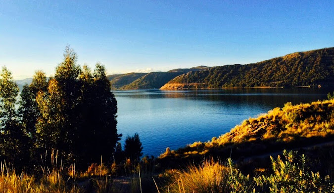
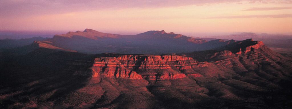
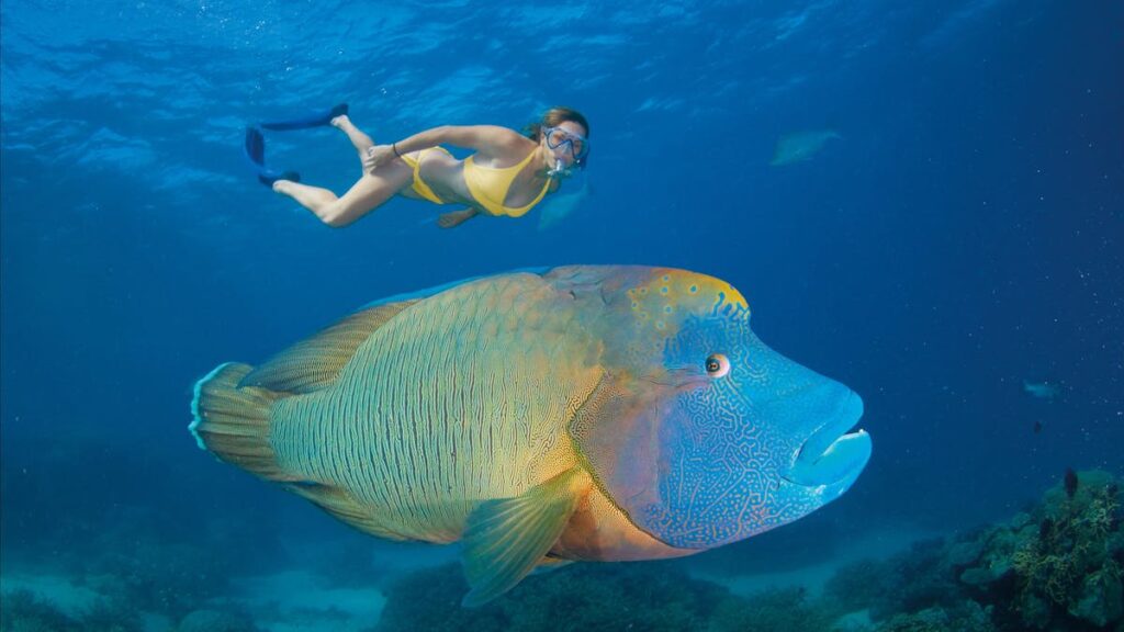
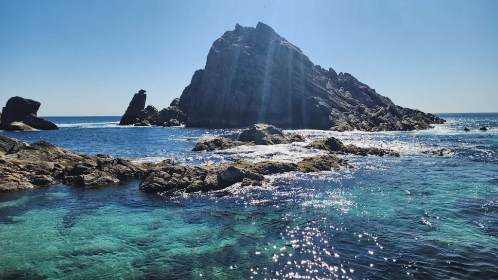
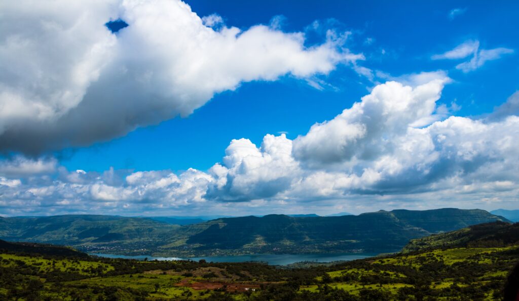
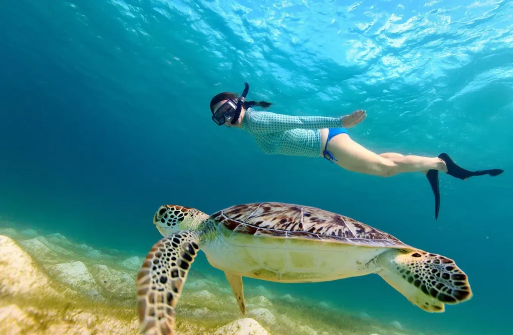
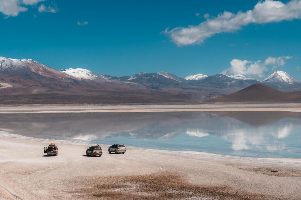
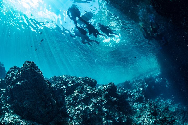
By Wahid Ali | Xplore Heaven | Updated: February 2026 Most people hear “Japan” and picture neon signs, bullet trains, and temple-dotted mountains. Okinawa Japan travel gives you something completely different — 160 islands spread across turquoise water, a subtropical climate that refuses to follow the mainland’s rulebook, and a living culture shaped by the ancient Ryukyu Kingdom that has nothing to do with samurai or sushi. People compare Okinawa to Hawaii — and sure, the beaches hold up. But Hawaii doesn’t come with UNESCO-listed castle ruins, a unique language, Bingata textile art that’s hundreds of years old, or food that borrows from China, Japan, and America all at once. And let’s be real — Okinawa is significantly more affordable than Hawaii, especially if you plan smart. At Astamb Holidays, we’ve routed hundreds of travellers through this archipelago, and every time, they come back wanting more. This Okinawa travel guide covers everything: the best time to visit, which islands to hit, what to eat, how to get around, and a 7-day itinerary you can actually use. 🌊 Why Okinawa Should Be on Your Travel Map Okinawa sits at the very southern tip of Japan, closer to Taiwan than to Tokyo. That geography shapes everything — the weather, the food, the people, and the pace of life. The beaches are genuinely world-class. The water around the Kerama Islands — known internationally as “Kerama Blue” — has some of the most stunning underwater visibility in Asia. Coral reefs here host manta rays, sea turtles, whale sharks, and more than 200 species of coral. Divers fly in from around the world specifically for this. The history goes deep. Okinawa was an independent kingdom — the Ryukyu Kingdom — for over 400 years before becoming part of Japan in 1879. That history shows up everywhere: in the food, the music, the pottery, the spiritual sites. You won’t find this version of Japan anywhere else. The “Blue Zone” factor. Okinawa is one of the world’s 5 Blue Zones — regions where people routinely live past 100 years old. Researchers attribute this to the plant-heavy local diet, active community culture, and a concept called ikigai (a strong sense of purpose). When you eat here, you’re literally tasting one of the healthiest food cultures on the planet. For travellers tired of the same Tokyo-Kyoto loop, Okinawa is the reset button Japan didn’t tell you about. 🌸 Best Time to Visit Okinawa — Seasonal & Blossoms Focus 🌸 Early Bloom & Cherry Blossom Season in Okinawa The best time to see cherry blossoms in Okinawa is mid-January to mid-February — weeks before they appear anywhere else in Japan. The variety here is Kanhizakura, a deep pink, almost tropical-looking bloom that grows on the hills of Nakijin Castle Ruins and Nago City. The famous Nago Cherry Blossom Festival draws crowds every year in late January. These blooms look nothing like the pale pink clouds of Tokyo’s Yoshino sakura. They’re vivid, full-coloured, and surrounded by subtropical greenery. If you want cherry blossoms without the mainland madness, January–February in Okinawa is your answer. 📌 Visit Okinawa Japan Official Site has updated bloom schedules and festival dates every season. ☀️ Okinawa Weather Month by Month — Seasonal Matrix Month Avg. Temp Conditions Best For January 17–21°C Mild, dry, breezy Cherry blossoms, whale watching, hiking February 17–23°C Mild, occasional rain Sakura festivals, diving, culture March 19–27°C Warming up, short rain showers Beach season opens, snorkelling begins April 22–29°C Warm, pleasant Hari boat races, outdoor sightseeing May 25–30°C Rainy season starts (tsuyu) Cultural sites; avoid Golden Week crowds June 28–32°C Hot, humid, rainy season ends late June Hydrangea gardens, beginning of dive season July 30–33°C Hot, humid, typhoon possible Beaches, snorkelling, Eisa Festival August 30–33°C Peak summer, typhoon risk highest Peak beach season — book in advance September 28–31°C Still warm, typhoon risk reducing Thinning crowds, manta ray season October 24–28°C Comfortable, drier Naha Tug-of-War Festival, cultural events November 20–24°C Cooling, pleasant Diving, outdoor activities, fewer tourists December 17–21°C Mild winter Whale watching begins, pottery festivals Typhoon season runs from July through September, peaking in August. About 3–4 typhoons make significant contact with Okinawa each year. If you travel during this window, buy travel insurance and stay flexible. The sweet spots: March–May and October–November. You get good weather, manageable crowds, and fair prices. 🥁 Okinawa Local Festivals — Calendar Highlights Okinawa’s festival culture is loud, colourful, and deeply rooted in Ryukyuan tradition. 🏝️ Top Islands & Regions to Explore 🏯 Okinawa Main Island (Okinawa Honto) The main island is where most travellers start — and for good reason. Naha, the capital, packs in culture, food, history, and nightlife along a 2km stretch of Kokusai Street (International Street). Shuri Castle in Naha is the big draw. The original Ryukyu Kingdom royal palace, built in the 14th century, was declared a UNESCO World Heritage Site in 2000 and devastated by fire in October 2019. The great news for 2026 travellers: the exterior of the iconic red Seiden main hall is now fully restored, and the castle is expected to fully reopen by autumn 2026. You can already visit the grounds, observe the final reconstruction stages from dedicated viewing decks, and experience the history in real time. Paid entry is ¥400 to view the reconstruction process up close. Sefa Utaki, located in southern Okinawa, is a sacred forest site and another UNESCO-listed Gusuku property. This ancient spiritual grove was the most important sacred space in the Ryukyu Kingdom. Walking through the limestone formations here feels genuinely removed from modern life. Cape Manzamo on the west coast offers some of the most photographed sea views on the island — dramatic limestone cliffs dropping straight into electric-blue water. Sunset here is something else. 🤿 Kerama Islands — Snorkelling & Diving in “Kerama Blue” Just 30–40 minutes by high-speed ferry from Naha’s Tomari Port, the Kerama Islands are accessible as a day trip or overnight stay. Zamami Island, Tokashiki Island, and Aka Island are the most visited. The water

Okinawa Japan Travel Guide 2026: Culture, Beaches & Seasonal Blossoms (Ultimate Itinerary + Local Tips) Read More »

Isla Suasi: The Complete Guide to Peru’s Private Lake Titicaca Island

Picture this: you’re standing on the only private island in Lake Titicaca, watching rare vicuñas graze peacefully while the sun sets behind the Bolivian mountains. No crowds, no noise – just you and one of the most beautiful places on Earth. This is Isla Suasi, and after 20 years of organizing tours across Peru, I can tell you with complete certainty that this hidden gem offers something truly special. Isla Suasi is Peru’s best-kept secret for travelers seeking authentic connection with nature and complete disconnection from the modern world. While most tourists crowd onto the floating Uros Islands or rush through Taquile on day trips, smart travelers discover this 43-hectare paradise in the northeastern corner of Lake Titicaca. Let me share everything you need to know about planning your trip to this magical island – from a travel professional who has sent hundreds of clients there. What Is Isla Suasi? 🏝️ Isla Suasi is the only privately owned island on Lake Titicaca, covering approximately 106 acres (43 hectares) in the northeastern section of the world’s highest navigable lake. Unlike the touristy floating islands, this is a real, solid island with natural terrain, gardens, and wildlife. Quick Facts About Isla Suasi Feature Details Location Northeastern Lake Titicaca, Peru Size 43 hectares (106 acres) Altitude 3,810 meters (12,500 feet) above sea level Distance from Puno Approximately 70 kilometers by boat Ownership Private island with single eco-lodge Power Source 100% solar-powered Accommodation 24 rooms + 1 Andean Cottage Wildlife Vicuñas, alpacas, hummingbirds, Andean gulls Best Feature Complete privacy and tranquility The island was developed over 20 years ago by Marta Giraldo, who started with just one room and has grown it into a beloved eco-retreat. From my experience managing tours to Lake Titicaca, I always tell clients that Isla Suasi represents what travel should be – meaningful, peaceful, and genuinely transformative. Where Is Isla Suasi Located? 📍 Isla Suasi sits in the northeastern part of Lake Titicaca, near the Capachica Peninsula. To give you geographic context, the island is approximately 70 kilometers from Puno by boat and roughly 1 kilometer from the mainland shore. Here’s what makes the location special: you’re essentially in the heart of Lake Titicaca but away from the heavily trafficked tourist routes. While Uros and Taquile islands are on the well-worn path from Puno, Isla Suasi requires a 3-4 hour boat journey – which actually works in your favor. This distance keeps crowds away and preserves the island’s peaceful atmosphere. The island offers stunning views across the 3,200 square miles of Lake Titicaca, with the snow-capped Bolivian mountains visible on clear days. From my years of sending clients here, I’ve learned that this remote location is precisely what makes Isla Suasi worth the journey. Why Visit Isla Suasi? (Key Attractions) ✨ After organizing countless Lake Titicaca tours, I can honestly say Isla Suasi offers something no other destination in the region can match: genuine serenity without compromise on comfort or experience. The “Disconnect to Reconnect” Experience Isla Suasi operates on a philosophy I deeply respect – helping travelers disconnect from modern distractions to reconnect with nature and themselves. There’s no TV in rooms (intentional), limited WiFi (lobby only), and no electrical outlets in guest rooms. Before you panic, let me explain why this is brilliant: rooms have charging stations in common areas, staff light wood-burning stoves each evening, and they place hot water bottles in your bed before you return from dinner. From my experience in travel planning, I always recommend to my clients: embrace this. You’re here to experience Lake Titicaca, not your phone screen. Comparing Isla Suasi to Other Lake Titicaca Islands Let me be honest with you, as someone who books these tours regularly: Uros Floating Islands are fascinating for their construction – 42+ reed islands created by the Uros people. However, they’re crowded, commercialized, and frankly, many islands exist purely for tourism. You’ll get the standard presentation, quick tour, heavy sales pitch for handicrafts, and be back on the boat within 45 minutes. Taquile Island offers authentic culture with its UNESCO-recognized textile traditions. The Quechua-speaking community of 2,200 people maintains genuine customs. But it’s still a day-trip destination. You’ll climb steep stairs (4,050 meters elevation), eat lunch at an assigned restaurant, buy textiles, and leave. Beautiful? Absolutely. Peaceful? Not exactly. Isla Suasi, on the other hand, gives you time. You stay overnight (or multiple nights), explore at your own pace, and actually relax. There are only 24 rooms total, meaning you might share the island with just 10-20 other guests – or during low season, you could have the place nearly to yourself. Feature Uros Islands Taquile Island Isla Suasi Visit Type 30-minute stop 3-4 hour day trip Overnight stay Crowd Level Very high Moderate-High Very low Authenticity Staged for tourists Authentic culture Natural experience Activities Reed boat rides Textile shopping, hiking Kayaking, wildlife, hiking, relaxation Accommodation Day trip only Homestays available Luxury eco-lodge Privacy None Limited Complete How to Reach Isla Suasi from Puno or Juliaca 🚤 Alright, let’s talk logistics – this is where my operations background comes in handy. Getting to Isla Suasi requires planning, but it’s straightforward if you know what to expect. The Standard Boat Route (Most Common) Departure: Early morning from Puno main pier (typically 6:30-7:00 AM)Duration: 3.5-4.5 hours by speedboat (including stops)Route: Puno → Uros Islands → Taquile Island → Isla Suasi Yes, you’ll stop at Uros (15-30 minutes) and Taquile (1-2 hours) along the way. Most operators include these stops because it maximizes your experience. You’ll arrive at Isla Suasi around 12:00-1:00 PM, just in time for their welcome BBQ lunch. The speedboats seat 20-40 passengers and are equipped with life jackets, first aid kits, oxygen (important at this altitude!), and comfortable seats. From my experience managing these logistics, I always recommend to my clients: bring layers! The morning can be cold on the water, but by midday the sun is intense. The Return Journey (Options) Option 1: Return by Boat – Same route back to

Isla Suasi: The Complete Guide to Peru’s Private Lake Titicaca Island Read More »

Ikara-Flinders Ranges — Complete Travel Guide for 2026

Picture standing on ancient rock that’s older than the Himalayas, watching the sunrise paint red cliffs in shades of gold. That’s the Ikara-Flinders Ranges — and it’s calling your name for 2026. I’m Wahid Ali, and in my 20 years managing tours at Astamb Holidays, I’ve sent countless travellers to Australia’s outback. But the Ikara-Flinders Ranges National Park holds a special place in my recommendations. Why? Because it delivers what most people only dream about: genuine wilderness, deep Aboriginal culture, and landscapes that make you feel tiny in the best possible way. This isn’t your typical tourist trap. The Flinders Ranges stretch across 95,000 hectares of South Australia’s outback, about 430 kilometres north of Adelaide. Here’s everything you need to know before you go. What Is Ikara-Flinders Ranges? The Ikara-Flinders Ranges National Park sits in South Australia’s outback, roughly 5 hours’ drive from Adelaide. Think rugged mountain ranges, deep gorges carved over millions of years, and wildlife you won’t see anywhere else. The landscape here started forming 800 million years ago — making it one of Earth’s oldest mountain ranges. You’re literally walking through geological history. What does Ikara mean in Aboriginal language? Ikara means “meeting place” in the Adnyamathanha language. The word specifically refers to Wilpena Pound, which has served as a traditional gathering spot for the Adnyamathanha people for thousands of years. The Adnyamathanha people — whose name translates to “rock people” or “hills people” — have called this land home for over 49,000 years. In 2016, the park was officially renamed to honour this heritage. Today, it’s co-managed by Parks South Australia and the Adnyamathanha Traditional Lands Association, ensuring their stories and sacred sites are properly protected. Quick Facts Details Official Name Ikara-Flinders Ranges National Park Size 95,000 hectares (234,717 acres) Distance from Adelaide 430 km (267 miles) Drive Time 5 hours (non-stop) Traditional Owners Adnyamathanha people Established January 1, 1945 Why Visit Ikara-Flinders Ranges? Here’s what makes this place different from your average national park: The geology is mind-blowing. These mountains are older than the Himalayas. The park contains Ediacaran fossils — some of the oldest evidence of complex life on Earth. Scientists from around the world come here to study rocks that tell stories from 650 million years ago. It’s culturally significant. This isn’t just a pretty landscape. Sacred sites like Arkaroo Rock and Sacred Canyon hold ancient rock art and carvings dating back tens of thousands of years. The Adnyamathanha community shares their stories through guided tours, and trust me — you’ll never look at the land the same way after hearing creation stories told by traditional custodians. The experiences are unique. Where else can you: Lonely Planet recently highlighted the Flinders Ranges as a must-visit destination, but honestly, locals have known this secret for decades. Best Time to Visit Ikara-Flinders Ranges Timing is everything in the outback. Get it wrong, and you’ll be miserable. Get it right, and you’ll have the trip of a lifetime. What is the best time of year to go to the Flinders Ranges? The best time to visit is April to October (autumn through spring), with August to October being ideal for wildflowers and comfortable hiking temperatures. Daytime temperatures range from 15°C to 25°C (59°F to 77°F), perfect for bushwalking without melting. Here’s my honest breakdown by season: Autumn (March-May): Brilliant choice. Days are warm (20-30°C), nights are cool but not freezing. The landscape shows off in oranges, reds, and browns. Easter can get busy, so book ahead. Winter (June-August): This is peak season for good reason. Days are clear and sunny (13-18°C), perfect for hiking. Nights drop to near 0°C, so pack warm layers. Campfires are allowed (bring your own wood — collection is prohibited). Wildlife is active, and you’ll spot more animals near water sources. The trade-off? Higher accommodation prices and more tourists, especially during school holidays. Spring (September-November): Wildflower season! After winter rains, the desert blooms in yellows, purples, and reds. September and October offer the best of both worlds — warm days, wildflowers, and decent availability. Just note: fire ban season typically starts mid-October. Summer (December-February): Only for the brave or foolish. Temperatures regularly hit 33-40°C+. Many hiking trails close for safety between December and March. If you must visit in summer, restrict activities to early morning and late evening. Seriously — the outback sun is no joke. Pro tip from my tour operations experience: Book April-May or September if you want fewer crowds but still excellent weather. July-August is beautiful but expect company. How Big Is Ikara-Flinders Ranges? The park covers 95,000 hectares — or if you prefer, about 370 square kilometres. To put that in perspective, that’s roughly 1.5 times the size of Singapore. But here’s what that really means for travellers: You can’t “do” this park in a day. The terrain is vast and varied. You’ve got: How many days do you need? Minimum 2-3 days to see the highlights. Give yourself 4-5 days if you want to really explore and do some longer hikes. A week lets you add in Arkaroola Wilderness Sanctuary to the north. Where to Go & What to Do Let me walk you through the must-see spots and hidden gems: Wilpena Pound (Ikara) This is the star attraction. Wilpena Pound is a massive natural amphitheatre — imagine mountains forming a near-perfect oval 17 kilometres long and 8 kilometres wide. From the outside, it looks like a line of peaks. From inside, you realize you’re in this enormous basin. The only way to get your vehicle inside is via the Wilpena Pound Resort shuttle (runs at 9am, 11am, 1pm, and 3pm). Otherwise, it’s a 3-hour, 8-kilometre return walk to the lookout. St Mary Peak (1,170 metres) is the highest point in the Flinders Ranges. The hike is challenging (20 kilometres return, 8-10 hours), but the views are extraordinary. Important cultural note: The Adnyamathanha people ask that you stop at Tanderra Saddle rather than summiting, as the peak holds sacred significance. Brachina and Bunyeroo Gorges The Brachina

Ikara-Flinders Ranges — Complete Travel Guide for 2026 Read More »

Ultimate Great Barrier Reef Snorkeling, Tours & Scuba Diving Guide — Costs, Best Times, Safety & Facts

Picture this: you’re floating above a kaleidoscope of coral gardens, schools of rainbow-colored fish dart around you, and a sea turtle glides past like it’s the most natural thing in the world. That’s what experiencing great barrier reef snorkeling feels like — and trust me, after 20 years of sending travelers to every corner of Australia, I can tell you this is one place that actually lives up to the hype. I’m Wahid Ali, and I’ve been in the tourism game long enough to know when a destination delivers and when it disappoints. The Great Barrier Reef delivers. Every single time. Whether you’re planning your first underwater adventure with great barrier reef tours or you’re a seasoned diver ready for some world-class great barrier reef scuba diving, this guide will walk you through everything you need to know — the real costs, the best times to visit, safety tips that actually matter, and great barrier reef facts that go beyond the tourist brochures. In my years heading operations at Astamb Holidays in Mumbai, I’ve seen countless clients return from the reef with stories that give me goosebumps. But I’ve also seen travelers make rookie mistakes that cost them time, money, and memories. Let’s make sure you’re in the first group. 🌊 What Is the Great Barrier Reef? Quick Facts You Must Know The Great Barrier Reef is the world’s largest living structure, spanning 2,300 kilometers (1,400 miles) along Queensland’s northeast coast and covering 344,000 square kilometers — that’s roughly the size of Italy or Japan. Let me break down what makes this place so extraordinary: Location: Off the coast of Queensland, Australia, stretching from the northern tip near Cape York down to Bundaberg in the south. Size and Scale: We’re talking about 2,900 individual reefs and over 900 islands. It’s so massive you can see it from space — literally the only living structure visible from orbit. Biodiversity: The reef is home to over 1,500 species of fish, 400 types of coral, 4,000 types of mollusks, and 240 species of birds. You’ll find six of the world’s seven species of marine turtle here, plus dolphins, whales, sharks, and the stunning manta rays. UNESCO World Heritage Status: Listed since 1981 as a World Heritage Site, the reef is protected by the Great Barrier Reef Marine Park Authority (GBRMPA), which manages this incredible ecosystem. Current Environmental Status: I won’t sugarcoat it — the reef has faced six mass bleaching events since 2016, including back-to-back events in 2024 and 2025. However, coral cover remains near its long-term average due to recovery periods between events. The reef is resilient but facing real challenges from climate change. Quick Reef Facts Details Total Length 2,300 km (1,400 miles) Total Area 344,000 sq km (133,000 sq miles) Number of Reefs 2,900+ individual reefs Number of Islands 900+ islands Fish Species 1,500+ species Coral Types 400+ hard and soft coral species UNESCO Status World Heritage Site since 1981 Water Temperature 23°C-29°C (73°F-84°F) year-round Source: Great Barrier Reef Marine Park Authority 🤿 Great Barrier Reef Snorkeling: Experience, Tips & Spots Let me paint you a picture from my client feedback: you slip into the warm water, adjust your mask, and suddenly you’re in a completely different world. The water is so clear you can see 15-30 meters ahead on a good day. Below you, coral formations create underwater cities where fish communities go about their daily business. What Snorkeling the Reef Actually Feels Like: The first breath through your snorkel feels strange if you’re new to this, but within minutes, you’ll forget you’re breathing through a tube. The water temperature averages 24°C-28°C (75°F-82°F) depending on the season — warm enough that you won’t freeze but cool enough to be refreshing. You’ll float effortlessly thanks to your life vest, and that’s when the magic happens. Best Snorkeling Spots on the Great Barrier Reef: Based on years of client experiences and operator feedback, here are the top locations: 1. Agincourt Reef (Port Douglas) ⭐⭐⭐⭐⭐ Image Source: https://www.queensland.com/in/en/home 2. Moore Reef (Cairns) ⭐⭐⭐⭐⭐ Image Source: https://cairns-tours.com/ 3. Norman Reef (Cairns) ⭐⭐⭐⭐⭐ Image Source: https://cairns-tours.com/ 4. Flynn Reef (Cairns) ⭐⭐⭐⭐ Image Source: https://cairns-tours.com/ Essential Snorkeling Gear (Usually Provided): Pro Tips from 20 Years of Experience: 🚢 Great Barrier Reef Tours: How to Choose the Best One This is where travelers get overwhelmed — there are literally hundreds of tour operators between Cairns and Port Douglas. Here’s how to cut through the noise and find your perfect reef experience. Understanding Reef Tour Types: 1. Day Tours to Outer Reef (Most Popular) 2. Pontoon Platform Tours 3. Small Group Tours 4. Liveaboard Tours (Overnight) Cairns vs. Port Douglas Departures: Factor Cairns Port Douglas Tour Options 50+ operators 15+ operators Travel Time to Outer Reef 60-90 minutes 90 minutes Reef Sites Norman, Flynn, Moore, Hastings Agincourt, Opal, Low Isles Crowd Level Higher (busier season) Lower (more exclusive feel) Price Range $179-$325 AUD $260-$410 AUD Departure Vibe Busy marina, big city energy Relaxed tropical village Best For More options, budget-friendly Quieter experience, premium feel Outer Reef vs. Inner Reef — What’s the Difference? Outer Reef: Inner Reef & Islands: What’s Actually Included in Most Tours: What Costs Extra: 🤿 Great Barrier Reef Scuba Diving Options for All Levels Here’s where it gets really exciting. If snorkeling is watching a movie on your phone, scuba diving the Great Barrier Reef is watching it in IMAX 3D. You’re not just looking down at the reef — you’re in it, moving through it, breathing underwater while fish swim inches from your face. Introductory Dives (No Experience Needed): What it involves: You’ll get a 30-minute briefing on boat, practice in shallow water or on the platform, then descend with an instructor holding your hand (literally). The instructor controls everything — you just breathe and enjoy. It’s called a “Discover Scuba Dive” or “Resort Dive.” Who it’s perfect for: Anyone nervous about diving but wanting to try. You’ll be amazed at how natural breathing underwater feels after the first few breaths.

Ultimate Great Barrier Reef Snorkeling, Tours & Scuba Diving Guide — Costs, Best Times, Safety & Facts Read More »

Things to Do in Margaret River: The Ultimate Guide to Attractions, Activities & Travel Tips (2026)

Picture this: You’re standing on a limestone cliff 270 kilometers south of Perth, watching world-class surfers carve through crystal-clear Indian Ocean waves while vineyards stretch behind you into ancient karri forests. This isn’t a dream—it’s Margaret River, and in 2026, it’s calling your name with more incredible experiences than ever before. As someone who’s been managing tours in Australia’s South West for 20 years, I can tell you that things to do in Margaret River extend far beyond the postcard-perfect scenery. From exploring 100+ underground limestone caves formed over 1 million years ago to tasting world-renowned wines at 90+ cellar doors, this region delivers the perfect blend of adventure, luxury, and natural wonder. Whether you’re planning to walk the legendary 135-kilometer Cape to Cape Track, dive into ancient caves like Lake Cave and Mammoth Cave, or simply sip Chardonnay while watching the sunset over Sugarloaf Rock, Margaret River offers something extraordinary for every traveler. Things to Do in Margaret River include exploring 90+ world-class wineries, surfing at legendary breaks like Prevelly Beach, discovering ancient limestone caves (Lake Cave, Mammoth Cave, Jewel Cave), hiking the 135km Cape to Cape Track, visiting the Boranup Karri Forest, and experiencing Wadandi Aboriginal culture through guided tours. The region combines premium wine tasting, spectacular coastal scenery, adventure activities, and fresh gourmet produce into one unforgettable destination. This 2026 guide is backed by the latest information, current costs, hidden gems I’ve discovered while operating tours here, and insider secrets that’ll help you experience Margaret River like a local—not a tourist. 🍷 Why Is Margaret River So Famous? When people ask me what makes Margaret River special, I tell them about the “Triple Threat” that put this region on the world map. World-Class Wine That Rivals Bordeaux Margaret River produces less than 3% of Australia’s total wine output but accounts for over 20% of the country’s premium wine market. That’s incredible! The region’s 138+ wineries specialize in Cabernet Sauvignon and Chardonnay, with over 65 wineries rated 5-star by Halliday Wine Companion. In my experience managing wine tours, I’ve seen firsthand how the Mediterranean climate, ocean breezes from the Indian Ocean, and unique terracotta soils create perfect conditions for grape growing. Founding wineries like Vasse Felix (established 1967), Leeuwin Estate, and Cullen Wines (Australia’s first 100% carbon-neutral winery) set the standard. Today, boutique producers like Passel Estate, Victory Point, and Cape Naturaliste Vineyard offer intimate tastings where you’ll often meet the winemakers themselves. Legendary Surf That Draws World Champions Before Margaret River became famous for wine, surfers discovered its 75+ world-class breaks spanning 130 kilometers of coastline. The Margaret River Pro (held annually in April/May) attracts top World Surf League competitors to Surfers Point (Main Break) in Prevelly—one of the most challenging waves in competitive surfing. Popular breaks include: Ancient Caves Holding Earth’s Secrets Beneath the Leeuwin-Naturaliste Ridge lie over 150 limestone caves formed approximately 1 million years ago. Four spectacular “show caves” are open to the public: Indigenous Wadandi Culture & Deep Connection to Country For over 60,000 years, the Wadandi (Saltwater) people have been the traditional custodians of this land, known as Wadandi Boodja. Their cultural knowledge runs incredibly deep, with six seasonal calendars (Birak, Bunuru, Djeran, Makuru, Djilba, and Kambarang) still used today to live in harmony with the land. I highly recommend booking a Koomal Dreaming tour with Wadandi custodian Josh ‘Koomal’ Whiteland, who shares stories, traditional practices, and the significance of sites like Ngilgi Cave in Wadandi culture. These experiences add profound depth to your understanding of the region’s natural and cultural heritage. For more details: https://saltwaterbusselton.com.au/ 🌤️ Best Time to Visit Margaret River (2026 Seasonal Guide) Margaret River is beautiful year-round, but timing your visit right can save you money and help you avoid crowds. Here’s my breakdown based on 20 years of operating tours here: Season Months Temperature Crowd Level Price Range Best For What to Pack Summer (Peak) Dec–Mar 22°C–30°C (72°F–86°F) HIGH $$$$ Beach activities, swimming, festivals Sunscreen (SPF 30+), swimwear, hat, light clothing Autumn Apr–May 12°C–24°C (54°F–75°F) MEDIUM $$$ Wine tasting, Margaret River Pro surfing competition, harvest season Layers, light jacket, sunglasses Winter (Off-peak) Jun–Aug 8°C–18°C (46°F–64°F) LOW $$ Whale watching, cozy winery visits, best value Warm jacket, rain gear, hiking boots Spring (Ideal) Sep–Nov 9°C–24°C (48°F–75°F) MEDIUM $$$ Wildflowers, whale watching, perfect hiking weather Layers, rain jacket, camera, binoculars Pro Insider Tips: 2026 Special Events: 🚗 How Long Does It Take to Drive From Perth to Margaret River? The drive from Perth to Margaret River is one of Western Australia’s most scenic road trips—and one I’ve done countless times organizing tours. Distance: 270–280 kilometers (168–174 miles)Drive Time: 3–3.5 hours without stopsRoute: Take Kwinana Freeway → Forrest Highway → Bussell Highway into Margaret River The journey is straightforward on fully sealed roads, making it perfect for a long weekend getaway or the start of a longer South West adventure. 3 Must-Stop Spots on the Drive 🛑 From my experience managing transfers and tours, these three stops will break up your journey perfectly: 1. Busselton Jetty (2 hours 20 minutes from Perth)The longest timber-piled jetty in the Southern Hemisphere at 1.8 kilometers! Walk the jetty for free or take the train to the end ($14 adults, $7 children). The Underwater Observatory at the jetty’s end offers incredible views of marine life without getting wet ($35 adults, $17 children). 2. Bunbury Dolphin Discovery Centre (1.5 hours from Perth)Spot wild bottlenose dolphins from the beach or jetty. The Discovery Centre offers interactive exhibits ($15 adults, $8 children). If you’re lucky, dolphins swim right up to the shore! 3. Vineyard 28 in Yarloop (1.5 hours from Perth)A hidden gem! This boutique winery specializes in Italian grape varieties like Pignoletto, Arneis, Dolcetto, and Nebbiolo—rare finds in Western Australia. Perfect for a mid-journey wine tasting and grazing board. Bonus Stop: Lake Clifton Thrombolites—ancient living fossils lining the lake shore, resembling Earth’s earliest life forms. A fascinating 5-minute stop with a boardwalk for easy viewing. 🏖️ Top Things to Do in Margaret River, Western Australia

Things to Do in Margaret River: The Ultimate Guide to Attractions, Activities & Travel Tips (2026) Read More »

Kaas Plateau Travel Guide 2026: Best Time to Visit, Bloom Season, How to Reach & FAQs

Imagine standing on a vast expanse where nature paints the ground in every color imaginable—crimson reds, sunshine yellows, deep purples, and soft whites stretching as far as your eyes can see. This isn’t a fantasy; this is Kaas Plateau, Maharashtra’s very own Valley of Flowers! Nestled in the majestic Western Ghats near Satara, this UNESCO World Natural Heritage Site transforms into a living, breathing canvas every monsoon season, hosting over 850+ species of flowers that bloom in spectacular fashion. As someone who has guided countless travelers through India’s hidden gems at Astamb Holidays, I can confidently say that Kaas Plateau offers one of the most magical natural experiences you’ll ever witness. This comprehensive 2026 travel guide will give you everything you need to plan your perfect visit—from the exact bloom dates to booking tips, travel routes, and insider secrets that only come from years of ground experience. What is Kaas Plateau? Kaas Plateau, locally known as Kaas Pathar (where “Pathar” means plateau in Marathi), is a biodiversity hotspot that sits at approximately 1,200 meters (3,937 feet) above sea level. Located about 25 kilometers from Satara city in Maharashtra, this extraordinary plateau lies within the ecologically rich Western Ghats, one of the world’s eight “hottest biodiversity hotspots.” What makes Kaas Plateau truly special? In 2012, it earned the prestigious designation of a UNESCO World Natural Heritage Site due to its remarkable ecosystem and unique geological features. The plateau showcases an ancient laterite formation that dates back millions of years, creating the perfect conditions for an incredible diversity of plant life that you won’t find anywhere else on Earth. The name “Kaas” comes from the Kaas tree (Elaeocarpus glandulosus), which once dominated the region. Today, while these trees are less common, the plateau has gained worldwide fame for something even more spectacular—its seasonal flower carpet that attracts nature lovers, photographers, and botanists from across the globe. Quick Facts About Kaas Plateau: Detail Information Location Near Satara, Maharashtra, Western Ghats Elevation 1,200 meters (3,937 feet) above sea level Distance from Satara 25 kilometers (approx. 45 minutes drive) Distance from Pune 130 kilometers (approx. 3 hours drive) Distance from Mumbai 290 kilometers (approx. 6 hours drive) UNESCO Status World Natural Heritage Site (since 2012) Flora Diversity 850+ species of flowering plants Best Known As Valley of Flowers of Maharashtra 🌺 Why Visit Kaas Plateau? (The Magic Awaits) The Mesmerizing Valley of Flowers Experience Kaas Plateau isn’t just another tourist spot—it’s a living botanical museum that transforms dramatically with the seasons. During the bloom season, the entire plateau becomes a spectacular carpet of wildflowers that change composition and color almost daily. Walking through this natural wonderland feels like stepping into a painter’s dream, where every footstep reveals new colors, patterns, and fragrances. What truly sets Kaas Plateau apart is the sheer variety of flowers blooming simultaneously. You might spot delicate purple smithias alongside cheerful yellow sonki flowers, vibrant red toothcup blossoms next to clusters of rare insectivorous plants. The plateau hosts everything from tiny ground-hugging species to taller flowering plants, creating layers of color that photographers and nature enthusiasts absolutely adore. Incredible Biodiversity & Ecosystem The plateau’s biodiversity is staggering. With 850+ documented species of flowering plants, including many endemic varieties found nowhere else on the planet, Kaas Plateau represents one of India’s most important conservation areas. The ecosystem includes: Beyond flowers, you’ll encounter fascinating wildlife including various butterfly species, beetles, grasshoppers, and numerous bird species that thrive in this protected ecosystem. The fragile laterite soil and seasonal water pools create microhabitats that support an intricate web of life. Beyond the Plateau: Nearby Natural Wonders Your Kaas Plateau adventure shouldn’t end at the flower fields. The surrounding Satara region offers several breathtaking attractions that perfectly complement your visit: 🏞️ Kaas Lake: Just 2 kilometers from the plateau entrance, this serene lake offers stunning reflections of the surrounding hills. During the monsoon season, the lake reaches its fullest, creating picture-perfect moments, especially during sunrise and sunset. It’s an ideal spot for a peaceful break and some contemplative photography. 💧 Thoseghar Waterfalls: Located approximately 20 kilometers from Kaas Plateau, Thoseghar is a magnificent cascading waterfall system where water plunges from a height of 500 meters through multiple tiers. During peak monsoon (July-August), the falls are at their most powerful and dramatic. The viewpoints offer spectacular panoramas of the water crashing into the valley below, surrounded by lush green hills. 🌊 Vajrai Waterfall: Known as one of India’s tallest waterfalls, Vajrai Waterfall drops from an impressive height of 853 feet (260 meters). Located about 25 kilometers from Kaas, this three-tiered wonder is best visited during or immediately after the monsoon season when water flow is at its peak. The surrounding Sahyadri ranges create a dramatic backdrop that makes the journey absolutely worth it. Pro Tip from My Experience: Plan a 2-day itinerary to fully experience the region. Visit Kaas Plateau early morning on Day 1, explore Kaas Lake by afternoon, stay overnight in Satara town, and then visit the waterfalls on Day 2. This way, you won’t feel rushed and can truly soak in the natural beauty of the entire area. 📅 Best Time to Visit Kaas Plateau (Timing is Everything!) The Golden Window: Bloom Season Here’s the most important information for planning your trip: The best time to visit Kaas Plateau is from late August to early October, with mid-September being the absolute peak bloom period. This is when the plateau transforms into its legendary carpet of flowers, and the biodiversity is at its most vibrant. Bloom Season Breakdown: Time Period Bloom Status What to Expect Late August (20-31 Aug) Early Bloom (40-50%) First wave of flowers appear; fewer crowds, pleasant weather Early September (1-15 Sept) Peak Bloom (80-90%) Maximum variety and density; vibrant colors everywhere Mid September (15-25 Sept) ABSOLUTE PEAK (95-100%) Best time! All species in full bloom; incredible diversity Late September (25-30 Sept) Late Peak (70-80%) Still spectacular; certain species fade while others emerge Early October (1-15 Oct) Declining (40-60%) Many flowers have

Kaas Plateau Travel Guide 2026: Best Time to Visit, Bloom Season, How to Reach & FAQs Read More »

What Is the Quirimbas Archipelago Mozambique Known For? Complete Travel & Nature Guide

Introduction to the Quirimbas Archipelago Mozambique 🌊 Imagine stepping onto powdery white sand where your footprints are the only ones for miles. Picture crystal-clear turquoise waters hiding vibrant coral gardens teeming with sea turtles and rare dugongs. Welcome to the Quirimbas Archipelago Mozambique—one of Africa’s best-kept secrets and a paradise that most travelers haven’t even heard of yet. Stretching along 250 kilometers of Northern Mozambique’s coastline in the Cabo Delgado province, the Quirimbas Archipelago consists of 32 stunning coral islands that rise from the warm Indian Ocean. These aren’t your typical tourist-packed tropical islands. The Mozambique Indian Ocean coral islands remain blissfully undiscovered, offering an authentic escape where nature reigns supreme and ancient cultures thrive undisturbed. What makes this archipelago truly extraordinary? It’s the perfect blend of untouched natural beauty, incredible marine biodiversity, and rich Swahili-Portuguese history that you won’t find anywhere else. From the crumbling colonial forts of Ibo Island to the exclusive diving havens of Vamizi and Medjumbe, each island tells its own captivating story. Unlike the Maldives or Seychelles, the Quirimbas remain refreshingly uncommercialized. Here, you can witness endangered sea turtles nesting on moonlit beaches, spot the elusive dugong grazing in shallow seagrass beds, and explore coral reefs so pristine they seem painted by nature’s finest artist. The archipelago is protected as part of the Quirimbas National Park, ensuring these wonders remain preserved for generations to come. Whether you’re a marine life enthusiast, history buff, luxury traveler, or adventurer seeking the road less traveled, the Quirimbas Archipelago Mozambique delivers experiences that money often can’t buy elsewhere—genuine connection with nature and culture in their purest forms. Quick Reference Guide: Quirimbas Archipelago Mozambique Essential Information Details Location Northern Mozambique, Cabo Delgado Province, Indian Ocean Number of Islands 32 coral islands stretching 250km Best Time to Visit May to November (dry season) Main Gateway Pemba (connecting flights from Maputo) Key Islands Ibo, Vamizi, Medjumbe, Matemo, Quirimba Protected Status Quirimbas National Park, UNESCO Tentative List Famous For Pristine coral reefs, 5 turtle species, dugongs, Swahili-Portuguese history Activities Diving, snorkeling, dhow cruises, cultural tours, wildlife watching Travel Style Eco-luxury resorts to rustic island stays Language Portuguese (official), Makua, Swahili, English at resorts Currency Mozambican Metical (MZN) The Natural Wonders: Biodiversity & Marine Life 🐢 The Quirimbas Archipelago isn’t just beautiful—it’s a living laboratory of biodiversity that rivals anywhere on Earth. The moment you dip below the surface, you’ll understand why marine biologists get so excited about this place. Coral Reefs: Underwater Rainforests The coral reefs surrounding these islands are nothing short of spectacular. Stretching for miles, these underwater ecosystems showcase over 375 species of fish and nearly 50 types of coral. The water clarity here is exceptional—visibility often exceeds 30 meters, making it a photographer’s dream and a diver’s paradise. What sets these reefs apart is their pristine health. Unlike many global reef systems suffering from bleaching and pollution, the Quirimbas reefs remain vibrant thanks to minimal human impact and strong conservation efforts. The Quirimbas National Park biodiversity protection measures have created natural sanctuaries where marine life flourishes without disruption [SOURCE LINK: UNESCO]. The Magnificent Five: Sea Turtle Species Here’s where the Quirimbas truly shines—this archipelago hosts all five species of sea turtles found in the Indian Ocean: 🐢 Loggerhead Turtles – The most commonly spotted, these gentle giants nest on remote beaches from November to March. Their reddish-brown shells and massive heads make them easy to identify. 🐢 Green Turtles – Named for the greenish color of their fat (not their shells), these herbivores graze on seagrass beds in shallow lagoons. You’ll often see them surfacing for air during snorkeling trips. 🐢 Hawksbill Turtles – With their distinctive bird-like beaks and beautifully patterned shells, hawksbills are the reef specialists, feeding on sponges tucked into coral crevices. 🐢 Leatherback Turtles – The ocean giants! These massive creatures can weigh over 900 kilograms and dive to incredible depths. Spotting one is a once-in-a-lifetime moment. 🐢 Olive Ridley Turtles – The smallest and most abundant sea turtle species globally, though less common here than their cousins. Images Source: https://www.mozambiquetravel.com/blog/turtle-conservation-in-mozambique/ The beaches of Vamizi Island and several uninhabited islands serve as critical nesting sites, monitored by conservation teams who protect eggs from poachers and predators [SOURCE LINK: Marine Megafauna Foundation]. The Shy Dugong: Ocean’s Gentle Gardener Perhaps the most special resident of the Quirimbas is the dugong—a marine mammal so rare that many divers never see one in their lifetime. These gentle “sea cows” graze on seagrass meadows in shallow protected bays, particularly around Vamizi and the southern islands. Dugongs are critically endangered throughout their range, but the Quirimbas harbors one of the healthier populations along Africa’s east coast. Estimated numbers suggest around 200 individuals use these waters, though spotting them requires patience and luck [SOURCE LINK: Save Our Seas Foundation]. They’re shy creatures, usually feeding in early morning or late afternoon when boat traffic is minimal. Seasonal Marine Visitors Between June and November, the archipelago welcomes magnificent humpback whales migrating from Antarctic feeding grounds to warmer breeding waters. Watching a 40-ton whale breach against the backdrop of tropical islands is pure magic. Dolphins are year-round residents, with spinner, bottlenose, and humpback dolphins frequently bow-riding alongside dhows and boats. Their playful nature adds joy to every boat journey. Beyond the Water: Island Wildlife While the marine life steals the spotlight, the terrestrial ecosystems shouldn’t be overlooked. The islands and adjacent mainland support: Source: https://www.mozambique.co.za/Mozambique_Wildlife-travel/mozambique-birding-hotspots.html The mangrove forests deserve special mention—these twisted, salt-tolerant trees create nurseries for countless fish species while protecting coastlines from erosion and storms. The Quirimbas contains some of East Africa’s most extensive and healthy mangrove systems [SOURCE LINK: WWF]. Quirimbas National Park: Conservation & Protected Status 🌿 Created in 2002, Quirimbas National Park represents one of Africa’s most ambitious conservation projects, protecting an astounding 7,500 square kilometers of marine and terrestrial ecosystems. This includes 11 of the 32 islands plus a significant chunk of coastal mainland in Cabo Delgado province. A Model of Community-Led Conservation What makes this park truly revolutionary

What Is the Quirimbas Archipelago Mozambique Known For? Complete Travel & Nature Guide Read More »

Facts About Zakouma National Park — Wildlife, History & Conservation Triumph in Chad

Picture this: endless golden savannas stretching to the horizon, massive elephant herds kicking up dust clouds, and the world’s rarest giraffes grazing peacefully under the African sun. This isn’t a scene from the past—it’s happening right now at Zakouma National Park in Chad, one of Africa’s most remarkable conservation comebacks. If you’re searching for facts about Zakouma National Park, you’ve landed in the right place. This Central African treasure has transformed from a wildlife crisis zone into a shining example of what dedicated conservation can achieve. Tucked away in southeastern Chad, Zakouma represents something increasingly rare: a genuinely wild African experience where nature still calls the shots. The park’s story reads like a Hollywood script—complete with a devastating tragedy, heroes who refused to give up, and a triumphant recovery that continues today. 🦒 Zakouma at a Glance Quick Facts Details Location Southeastern Chad, Salamat Region Size 3,000 square kilometers (1,158 square miles) Established 1963 Ecosystem Type Sudano-Sahelian savanna Main Water Source Bahr Salamat River Management African Parks (since 2010) Signature Species Kordofan giraffe, African bush elephant Best Time to Visit November to April (Dry Season) Peak Wildlife Viewing March-April Access Point N’Djamena (capital city) Accommodation Tinga Camp (luxury tented camp) 🌍 Where Nature Still Runs Wild: Understanding Zakouma’s Unique Ecosystem Zakouma National Park stands as the last intact Sudano-Sahelian savanna ecosystem on Earth. Let that sink in for a moment—the last one. When you visit Zakouma, you’re not just seeing another African park; you’re experiencing a landscape that exists nowhere else in this pristine form. The park sprawls across 3,000 square kilometers of southeastern Chad, where the Bahr Salamat River breathes life into an otherwise harsh environment. During the wet season, this river transforms the landscape into a patchwork of seasonal floodplains and marshes. Come the dry months, these same floodplains become vital gathering spots for wildlife—creating some of the most spectacular animal concentrations you’ll find anywhere in Africa. The landscape shifts between open grasslands, acacia woodlands, and those crucial seasonal wetlands. This variety creates perfect conditions for an incredible range of species. The park sits within the Greater Zakouma Ecosystem, which includes the Siniaka-Minia Faunal Reserve to the south, giving wildlife even more room to roam and thrive. What makes Zakouma’s ecosystem truly special is its authentic wildness. There are no paved roads, no sprawling lodges, no crowds of safari vehicles. Just you, the animals, and Africa the way it’s meant to be experienced. 🐘 The Wildlife Stars of Zakouma The Elephant Miracle Here’s where Zakouma’s story gets really powerful. Back in the 1970s, roughly 22,000 African bush elephants roamed these lands. Then came the dark years of poaching. By 2010, that number had crashed to a heartbreaking 454 individuals. The 2006 elephant slaughter remains one of the most tragic events in African conservation history, when armed poachers killed hundreds of elephants in brutal raids. But this story doesn’t end in tragedy—it transforms into triumph. Since African Parks took over management in 2010, Zakouma’s elephant population has made an incredible recovery. Today, herds number over 500, with calves being born every year. Even more impressive? The park has achieved nearly a decade of zero-poaching incidents. That’s not luck—that’s the result of dedicated anti-poaching teams, cutting-edge technology, and genuine community partnership. Watching Zakouma’s elephant herds today feels like witnessing a resurrection. These aren’t scattered, fearful groups hiding in the bush. We’re talking about confident, growing herds that move freely across the savanna, with young elephants playing and learning from their elders just as nature intended. The Last Giraffe Stronghold If the elephant story impresses you, wait until you hear about the Kordofan giraffe. Zakouma holds roughly 70% of the entire wild Kordofan giraffe population—making this park absolutely critical for the subspecies’ survival. Current estimates put the park’s giraffe population between 1,380 and 1,500 individuals. Outside Zakouma, these gentle giants are vanishing across their former range. This makes every giraffe birth in the park a victory not just for Zakouma, but for the entire subspecies. Watching these towering beauties move gracefully across the Sudano-Sahelian savanna ranks among Africa’s most moving wildlife experiences. Beyond the Mega-Mammals While elephants and giraffes steal the spotlight (and rightfully so), Zakouma hosts an impressive supporting cast: African buffalo gather in huge herds during the dry season, sometimes numbering in the thousands. African lions prowl the grasslands, their populations steadily growing as prey numbers increase. You’ll spot various antelope species, including roan antelope, topi, and hartebeest. Bird lovers, prepare to have your minds blown. Between November and April, massive flocks of Red-billed quelea descend on Zakouma—we’re talking millions of birds creating swirling, shape-shifting clouds in the sky. It’s a natural spectacle that rivals any mammal migration. 💪 From Crisis to Conservation Triumph: Zakouma’s Incredible Journey The Dark Days To truly appreciate Zakouma today, you need to understand where it’s been. The mid-2000s represented the park’s darkest hour. Heavily armed poaching gangs, often crossing from Sudan, targeted elephants for their ivory with military precision. The 2006 elephant slaughter saw coordinated attacks that killed hundreds of elephants in single raids. Rangers faced impossible odds—outgunned, under-resourced, and sometimes outnumbered. Wildlife populations crashed. The international community watched in horror as one of Africa’s great parks teetered on the edge of collapse. The Turning Point In 2010, the Chadian government made a bold decision: partner with African Parks, a nonprofit conservation organization known for turning around failing parks across Africa. This wasn’t just a management change—it was a complete transformation of how Zakouma operated. African Parks brought serious resources, professional training, and most importantly, a comprehensive approach that went far beyond just fighting poachers. They understood that lasting conservation success required winning hearts and minds, not just battles. Building the Success The anti-poaching strategy African Parks implemented combined multiple elements: Professional ranger training transformed park guards into a highly skilled force. Modern equipment—radios, vehicles, aircraft for aerial surveillance—gave rangers the tools they needed. Intelligence networks helped predict and prevent poaching attempts before they happened. But here’s what really made the difference:

Facts About Zakouma National Park — Wildlife, History & Conservation Triumph in Chad Read More »

Why Is Madidi National Park Dangerous? Risks, Reality & Safety Guide for Jungle Travelers

If you’ve been researching why is Madidi National Park dangerous, you’re already showing the kind of smart caution that keeps jungle travelers safe. Madidi National Park in Bolivia is one of Earth’s most biodiverse protected areas, home to over 1,000 bird species, jaguars, giant otters, and ecosystems that shift from steaming Amazon lowlands to icy Andean peaks. But this remarkable wilderness comes with serious risks that demand respect, preparation, and honest conversation. This guide breaks down the real dangers—from venomous wildlife and jungle diseases to accessibility challenges and human threats—while showing you how to experience Madidi responsibly and safely. Table of Contents Section Key Topics Covered Quick Risk Summary Wildlife, health, accessibility, environmental, human threats Geographic Complexity Altitude variation, climate zones, terrain challenges Wild Animals & Jungle Hazards Jaguars, poison dart frogs, venomous snakes, fire ants Health Risks & Diseases Malaria, yellow fever, parasites, medical evacuation Accessibility & Remoteness Transport difficulties, communication gaps, guide necessity Human & Environmental Threats Dam projects, illegal mining, logging, mercury contamination Real Stories & Case Studies Yossi Ghinsberg survival story, documented incidents Risk Timing & Zones Seasonal differences, terrain variations, traveler types Safety Tips Vaccinations, gear, insurance, choosing operators Conservation Ethics Indigenous communities, responsible tourism impact Comparison with Other Parks How Madidi stacks up against Tambopata, Manu FAQs Quick answers to common safety questions Quick Risk Summary — What Makes Madidi Dangerous (At a Glance) Let’s start with clarity. Madidi National Park safety risks fall into five main categories: Wildlife Hazards: Jaguars, pumas, venomous snakes (including fer-de-lance and bushmaster), poison dart frogs, fire ants, caimans, and stingrays inhabit the park. Most wildlife avoids humans, but encounters happen in low-visibility jungle conditions. Health Threats: Malaria and yellow fever are present. Waterborne parasites, dengue, and leishmaniasis pose additional risks. Medical facilities are hours or days away from most park areas. Environmental Extremes: Altitude ranges from 200 meters in the Amazon lowlands to nearly 6,000 meters in the Andean highlands create unpredictable weather, flash floods during rainy season, and challenging terrain. Accessibility Challenges: No roads penetrate most of the park. River transport from Rurrenabaque takes 3-6 hours minimum. Zero mobile phone or internet coverage exists in the interior. Evacuation requires boat travel followed by small aircraft. Human-Driven Dangers: The proposed Bala Dam project threatens flooding, illegal gold mining contaminates water with mercury, and logging operations create conflict zones near park boundaries. Understanding these risks doesn’t mean avoiding Madidi—it means approaching this extraordinary place with the preparation it deserves. Geographic & Environmental Complexity of Madidi — From Andes to Amazon 🏔️ Here’s what makes Madidi National Park’s geography so challenging: this isn’t your typical jungle. The park spans an extraordinary elevation range from 180-200 meters above sea level in the steaming Amazon lowlands to nearly 6,000 meters in the glacier-covered peaks of the Apolobamba Range. That’s a height difference equivalent to climbing from sea level almost to the summit of Mount Kilimanjaro—all within one protected area. This dramatic altitude variation between the Andes and Amazon creates multiple climate zones stacked on top of each other. The climate shifts from cold alpine conditions at high elevations to moderate temperatures at mid-levels and tropical heat in the northern lowlands. You could start your morning needing a winter jacket in cloud forest and finish the afternoon dripping sweat in humid rainforest. The park protects several distinct ecosystems: tropical rainforest along the Tuichi and Beni Rivers, cloud forests clinging to mountain slopes, Yungas subtropical forests bridging the Andes and lowlands, and even montane dry forests where grasslands meet scrubland [Source: Wildlife Conservation Society / Madidi National Park Documentation]. Each ecosystem brings its own hazards—flash floods in lowland areas, altitude sickness and cold exposure in highlands, and reduced visibility in dense cloud forest. Annual precipitation averages around 716mm in some areas but can reach 4,000mm in others, creating unpredictable micro-climates. The rainy season from October to March transforms rivers into raging torrents, while the dry season from May to September makes wildlife viewing easier but doesn’t eliminate danger. Cold fronts called “surazos” occasionally sweep up from the south during June-July, dropping temperatures from 25-33°C to as low as 7-10°C in the lowlands—a potentially deadly temperature swing if you’re unprepared. The terrain complexity adds another layer of risk. Steep slopes, meandering rivers, swamps, and dense jungle create navigation challenges even for experienced guides. There are no roads penetrating the interior—only river routes that can take 3-6 hours by motorboat from Rurrenabaque just to reach the park entrance [Source: Madidi Ecolodge / National Park Access Documentation]. This geographic diversity is precisely what makes Madidi the world’s most biodiverse national park, but it also means you’re dealing with multiple environments, each demanding different safety protocols and gear. Wild Animals, Poisonous Species & Jungle Hazards 🐆 Let’s talk about the real wildlife threats in Madidi rainforest. The danger isn’t usually what Hollywood shows you—it’s what you don’t see coming. Jaguars and Pumas: Stealth Predators Madidi is home to jaguars, pumas, sloths, and spectacled bears among its 272 recorded mammal species Andean Trails. Jaguar attacks on humans are rare, with experts citing jaguars as the least likely of all big cats to kill and eat humans Wikipedia. Most attacks happen when the animal is cornered or wounded. However, attacks by jaguars in Amazon regions, while less frequent than those from pumas or other big cats, are more common than previously recognized and demonstrate a real risk in certain areas Sage JournalsResearchGate. The real danger isn’t aggression—it’s visibility. Jaguars are ambush predators that wait in cover, often attacking from trees and blind spots. In Madidi’s dense jungle where visibility drops to mere feet, you could pass within meters of a jaguar and never know it. Pumas pose similar stealth risks. Jaguars are notoriously secretive creatures that avoid humans, with attacks being extremely rare Panthera, but the keyword is “avoid”—not “don’t exist in the same space.” When trails cut through hunting territory, encounters become possible. The Truth About Poison Dart Frogs The poison dart frog in Madidi gets sensationalized, but

Why Is Madidi National Park Dangerous? Risks, Reality & Safety Guide for Jungle Travelers Read More »

Ultimate Uyuni Salt Flats Travel Guide

Uyuni Salt Flats Travel Guide Imagine standing on a sea of white that stretches to infinity, where the sky kisses the ground in a perfect, dazzling mirror. You’re not dreaming—you’re in Bolivia’s Salar de Uyuni, the world’s largest salt desert. If you’re planning a trip to this otherworldly wonder, this uyuni salt flats travel guide will walk you through everything you need to know, from the mirror effect to altitude sickness prep, photography tricks to tour selection. Let’s get started on planning your adventure! Quick Reference: Uyuni Salt Flats Travel Guide Essentials Category Details Location Southwest Bolivia, Potosí Department Size 10,582 square kilometers (4,086 square miles) Altitude 3,656 meters (11,995 feet) above sea level Best Time for Mirror Effect January – April (rainy season) Best Time for Dry Season May – November Average Tour Cost (1-Day) $20-$40 USD Average Tour Cost (3-Day) $100-$150 USD Nearest Town Uyuni Main Starting Points Uyuni (Bolivia), San Pedro de Atacama (Chile), Tupiza (Bolivia) Currency Boliviano (BOB) – approximately 6.97 BOB = 1 USD Essential Gear Sunglasses, 50+ SPF sunscreen, layers, warm sleeping bag Altitude Medication Acetazolamide (Diamox) or Sorojchi pills What & Where Are the Uyuni Salt Flats? 🌍 The Salar de Uyuni isn’t just another pretty landscape—it’s a geological marvel that’ll blow your mind. This uyuni salt flats travel guide starts with the basics: what you’re actually looking at when you step onto that blinding white surface. Bolivia’s salt flats sit in the Daniel Campos Province of Potosí, right near the crest of the Andes Mountains. At 10,582 square kilometers, it’s the world’s largest salt flat—so massive you can see it from space! The entire landscape holds an estimated 10 billion tonnes of salt, with layers sandwiched between sedimentary deposits reaching 10 meters deep at the center. But here’s the fascinating part: millions of years ago, this wasn’t a desert of salt at all. The area was covered by prehistoric lakes—Lago Minchín and Lago Tauca—which eventually evaporated, leaving behind this stunning white crust. Today, beneath all that salt lies something even more valuable: approximately 70% of the world’s lithium reserves, the stuff that powers your smartphone and electric car. The salt flats sit at a breathtaking 3,656 meters (11,995 feet) above sea level, which means altitude is something you’ll need to take seriously (more on that later). The landscape is so flat that it’s actually used to calibrate satellites—talk about precision! Best Time to Visit & Weather Conditions 🌤️ Timing your trip right can make or break your Salar de Uyuni experience. Here’s the thing: there’s no single “best” time because it depends on what you want to see. Chasing the Mirror Effect (Rainy Season) 💧 When: December to April (peak: January – March) If you’ve seen those jaw-dropping photos where the sky and ground become one, you’re looking at the mirror effect. This happens during Bolivia’s rainy season when a thin layer of water (just a few inches) covers the salt flats, creating the world’s largest natural mirror. Pros: Cons: The Pure White Adventure (Dry Season) ☀️ When: May to November (peak: June – August) During the dry season, the water evaporates, revealing the iconic hexagonal salt patterns that look like nature’s own honeycomb design. The landscape transforms into an endless white desert under crystal-clear blue skies. Pros: Cons: The Secret Sweet Spot 🎯 Want the best of both worlds? Visit during the shoulder months—late March/early April or late November. You might catch both the mirror effect in some areas AND dry salt patterns in others. Plus, you’ll dodge the biggest crowds and sometimes score better deals on tours! How to Get There & Starting Point Options 🚌✈️ Getting to the Uyuni salt flats requires some planning, but don’t worry—it’s totally doable! Here’s your complete breakdown. Starting from La Paz (Most Common Route) La Paz sits about 570 kilometers from Uyuni, and most travelers use this route. Option 1: Overnight Bus (Most Popular) Option 2: Flight Starting from San Pedro de Atacama, Chile 🇨🇱 This route is popular for travelers coming from northern Chile or combining Bolivia with Chilean adventures. Option 1: Multi-Day Tour (Recommended) Option 2: Bus (Not Recommended) Comparison: Uyuni vs. San Pedro Starting Points Factor Starting in Uyuni Starting in San Pedro de Atacama Cost Cheaper ($20-150) More expensive ($150-250) Acclimatization Better if coming from La Paz (also high altitude) Challenging jump from 2,400m to 4,200m+ overnight Tour Options More variety (1-day to 4-day) Mainly 3-4 day options Border Hassles None Visa requirements for some nationalities Best For Budget travelers, more flexibility Coming from Chile, scenic route through lagoons From Tupiza (Argentina Route) If you’re traveling up from Argentina (via Villazón border), Tupiza makes an excellent starting point. The town sits at a lower altitude (2,800 meters), making it easier to acclimatize. Most operators recommend 4-day tours from Tupiza, with the Uyuni salt flats visited on the final day. Choosing the Right Tour (3-4 Day Itinerary) 🚙 Let’s be honest: you can’t explore the Salar de Uyuni independently. The lack of roads, extreme remoteness, and harsh conditions make tours absolutely necessary. But here’s how to pick a good one. Tour Length Options 1-Day Tours ($20-40 USD) 3-Day Tours ($100-150 USD) – Most Popular 4-Day Tours ($180+ USD) The Critical Safety Checklist ✅ Before booking ANY tour, ask these questions: Red Flags to Avoid: Recommended Operators (based on traveler reviews): Classic 3-Day Itinerary Breakdown Day 1: Train Cemetery → Colchani → Salt Museum → Uyuni Salt Flats → Incahuasi Island (giant cacti!) → Sunset → Overnight in basic refuge (Colcha K area) Day 2: Chiguana Salt Flat → Flamingo-filled lagoons (Cañapa, Hedionda) → Siloli Desert → Árbol de Piedra (rock tree) → Overnight near Laguna Colorada Day 3: Sunrise at Laguna Colorada → Sol de Mañana geysers → Hot springs → Laguna Verde → Optional drop-off at Chilean border or return to Uyuni What to Pack & How to Prepare (Altitude, Gear & Clothing) 🎒 This section could literally save your trip. I’m going to be very specific because

Ultimate Uyuni Salt Flats Travel Guide Read More »