Adventure & Outdoor Travel

Namibia Tour Guide 2026: Best Safari, Road Trip Itinerary, Travel Tips & Hidden Gems

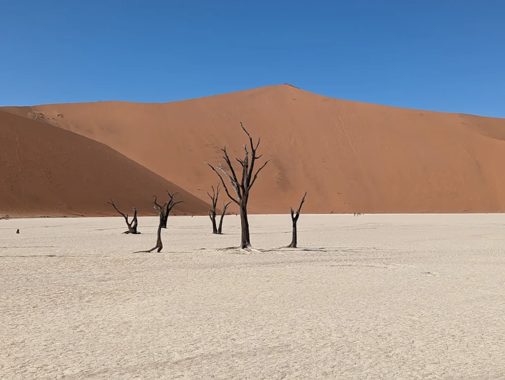
By Wahid Ali | Operations Lead & Travel Professional, Astamb Holidays | Mumbai Published on XploreHeaven.com | Updated: May 2026 Running holiday operations out of Mumbai, I spend a good part of my day helping travelers choose destinations that will genuinely stay with them. Most clients start by asking about Kenya or Tanzania — the familiar names, the ones they’ve seen on travel shows. But the clients who trust me enough to try a Namibia tour? They come back different. Quieter. Like they’ve seen something the rest of the world hasn’t quite caught up to yet. And honestly — they have. Namibia is vast, unhurried, and strikingly beautiful in a way that’s hard to prepare for. No traffic jams on safari roads. No crowds at a sunrise dune. Just wide-open desert, ancient landscapes, and wildlife living entirely on their own terms. In 2026, Namibia is finally getting the global attention it has always deserved. If you’ve been thinking about this trip, this guide will help you plan it right — with honest logistics, cultural context, and the kind of ground-level detail that only comes from years of crafting itineraries for destinations like this one. Why Is a Namibia Tour So Popular in 2026? Quick Answer: A Namibia tour is popular in 2026 because it offers self-drive freedom, world-class wildlife, extraordinary photography opportunities, and some of the darkest skies on Earth — all with far fewer tourists than East Africa. It’s the go-to destination for adventure travelers who want a genuine, uncrowded African experience. The numbers tell the story. Namibia recorded 863,872 tourist arrivals in 2023, an 87.4% increase from 2022 — a clear signal that the world is discovering what serious travelers have known for years. That momentum hasn’t stopped. Here’s what’s driving the surge in 2026: Africa’s safari tourism market generated USD 18 billion in 2023, with forecasts predicting it will nearly double to USD 34.5 billion by 2033, growing at a solid CAGR of 6.7%. Namibia is one of the biggest beneficiaries of this shift. What Are the Best Places To Visit on a Namibia Tour? Quick Answer: The must-visit stops on a Namibia tour are Sossusvlei, Deadvlei, Etosha National Park, Swakopmund, Skeleton Coast, Fish River Canyon, and Damaraland. Each offers something completely different — from red dunes and salt pans to desert wildlife and coastal fog. 1. Sossusvlei & Deadvlei This is the icon. The image most people associate with Namibia — those towering red-orange dunes against a white clay pan and black, dead camel thorn trees. 2. Etosha National Park Namibia’s wildlife crown jewel. Etosha is centered around a massive salt pan — during dry season, animals gather at waterholes in extraordinary numbers. 3. Swakopmund A quirky coastal town that feels like a German village dropped into a desert. It’s the adventure hub of Namibia — sandboarding, quad biking, kayaking with seals, and the best seafood in the country. 4. Skeleton Coast One of the most remote and culturally haunting stretches of coastline I’ve ever built an itinerary around. Shipwrecks, whale bones, massive Cape fur seal colonies, and desert-adapted lions. This isn’t a polished tourist attraction — it’s a raw, almost otherworldly edge of the continent. 5. Fish River Canyon The second-largest canyon in the world after the Grand Canyon, and criminally undervisited. 6. Damaraland This is where you find desert-adapted elephants and ancient rock engravings at Twyfelfontein (a UNESCO World Heritage Site). The landscapes are Mars-like. Completely surreal. 7. Spitzkoppe Often called the “Matterhorn of Namibia.” A granite inselberg rising out of the flat desert. Incredible for bouldering, rock art, and camping under a sky so full of stars you’ll feel dizzy. What Is the Best Namibia Tour Itinerary? Quick Answer: The ideal Namibia tour itinerary is 10 to 14 days. A 7-day trip is possible but rushed. A 14-day itinerary lets you cover the south (Sossusvlei), coast (Swakopmund/Skeleton Coast), and north (Etosha) without the stress of long daily drives. 7-Day Namibia Tour Itinerary (Fast-Paced — Best for Time-Limited Travelers) Day Route Driving Time Day 1 Arrive Windhoek → Drive to Sesriem ~5 hours Day 2 Sossusvlei & Deadvlei (sunrise) → Sesriem night — Day 3 Sesriem → Swakopmund via Solitaire ~4.5 hours Day 4 Swakopmund activities (sandboarding, seals) — Day 5 Swakopmund → Etosha South Gate ~5 hours Day 6 Full day Etosha game drive — Day 7 Etosha → Windhoek (fly home) ~5 hours 10-Day Namibia Tour Itinerary (The Sweet Spot) Day Route Highlights Day 1 Arrive Windhoek, stock provisions Rest, groceries Day 2 Windhoek → Sesriem Solitaire detour Day 3 Sossusvlei & Deadvlei (sunrise + sunset) Two photo sessions Day 4 Sesriem → Swakopmund Welwitschia Drive stop Day 5 Swakopmund Adventures + Walvis Bay Day 6 Swakopmund → Spitzkoppe Sunset at the rocks Day 7 Spitzkoppe → Damaraland/Twyfelfontein Rock art + elephant tracking Day 8 Damaraland → Etosha (south) Afternoon game drive Day 9 Full day Etosha Waterhole night session Day 10 Etosha → Windhoek Depart 14-Day Namibia Tour Itinerary (The Full Circuit) Add Fish River Canyon (Days 1–3), then work north through Lüderitz, Sossusvlei, Swakopmund, Skeleton Coast, Damaraland, and Etosha. This is the itinerary I personally recommend for first-timers who want to do it properly. Realistic driving note: Gravel roads in Namibia average 60–80 km/h max. Tarmac is rare outside main routes. Always add 30% more time than Google Maps tells you. Is a Self-Drive Namibia Tour Worth It? Quick Answer: Yes — absolutely. A self-drive Namibia tour saves you $100–$200 per person per day versus a guided tour. The roads are well-signed, the distances are manageable with planning, and the freedom you get is worth every kilometer. Here’s the honest breakdown: 4×4 vs SUV — What Do You Actually Need? Vehicle Type Best For Roads Covered Cost (per day) Standard 4×4 (e.g., Toyota Hilux) Full Namibia circuit All roads including sand ~$100–$150 USD High-clearance SUV Main routes only Tarmac + good gravel ~$80–$120 USD Budget sedan Windhoek only Tarmac only ~$40–$60 USD My honest advice? Get the 4×4. Sossusvlei’s

Namibia Tour Guide 2026: Best Safari, Road Trip Itinerary, Travel Tips & Hidden Gems Read More »

Yosemite National Park Travel Guide 2026: Best Things to Do, Itinerary & Travel Tips

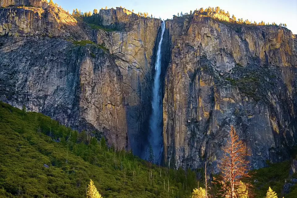
By Wahid Ali | Operations Lead, Astamb Holidays, Mumbai | LinkedIn | Published on xploreheaven.com I’ve helped plan trips to some of the most jaw-dropping places on the planet — from the backwaters of Kerala to the glaciers of Patagonia. But when clients ask me about a single destination that stops people in their tracks the moment they arrive, I always say Yosemite National Park. There’s nothing quite like your first look at that valley. The air feels different. Time slows down. And your phone suddenly feels completely irrelevant. This guide is built from real industry experience, updated research, and a genuine love for helping travelers get the most out of every hour they spend in Yosemite National Park. Whether you’ve got one day or one week, I’ve got your plan sorted — with all the 2026 updates you need, honest crowd advice, and the kinds of tips that don’t make it into mainstream travel lists. 🏔️ Why Is Yosemite National Park So Famous? Yosemite National Park is famous for its sheer granite cliffs, thundering waterfalls, ancient giant sequoia forests, and some of the most dramatic valley scenery on Earth. Located in California’s Sierra Nevada mountains, it covers 748,000 acres and welcomes roughly 4 to 5 million visitors every year. The park was recognized as a UNESCO World Heritage Site in 1984 — a designation that acknowledges its outstanding universal value both as a natural landscape and an ecological habitat. But honestly, you don’t need a UNESCO label to feel the magic. Stand at Tunnel View for the first time and the granite walls just speak for themselves. What makes Yosemite truly special is the combination of scale and accessibility. Within just a few miles, you can look up at El Capitan — a vertical granite wall rising 3,000 feet from the valley floor — and then stroll through a peaceful meadow where deer graze without paying you any attention at all. Half Dome, the park’s most iconic rock formation, rises 8,839 feet above sea level. It draws hikers, climbers, and photographers from all over the world. Yosemite Falls, one of North America’s tallest waterfalls, drops 2,425 feet in a spectacular three-tiered cascade best seen in spring. And then there’s Mariposa Grove, home to nearly 500 giant sequoias, some over 2,000 years old. In my two decades in travel, I’ve noticed that Yosemite has a rare quality — it moves people emotionally in a way that very few places do. Clients come back from their first visit and tell me it changed something in them. I believe it. 🗺️ Getting to Yosemite — Location & Logistics Where Is Yosemite National Park? Yosemite National Park sits in east-central California, straddling the western slopes of the Sierra Nevada. The main hub is Yosemite Valley, located in the western part of the park. Distances from Major Cities Departure City Distance to Yosemite Valley Drive Time (Approx.) San Francisco, CA ~170 miles 3.5 – 4 hours Los Angeles, CA ~310 miles 5.5 – 6.5 hours Las Vegas, NV ~385 miles 6 – 7 hours Sacramento, CA ~165 miles 3 – 3.5 hours San Jose, CA ~150 miles 3 – 3.5 hours Nearest Airports Best Driving Routes Pro Tip from Wahid: Download Google Maps offline before you leave your gateway city. Cell signal disappears well before you reach the park boundary. I’ve seen travelers standing at a junction with zero bars and no idea which way to turn. Don’t be that person. Public Transportation Options The Yosemite Area Regional Transportation System (YARTS) runs buses from gateway towns including Merced, Sonora, Mariposa, and Mammoth Lakes directly into Yosemite Valley. This is genuinely one of the best ways to visit in 2026, especially with no reservation system in place. Less parking stress, more scenery. Once inside the park, the free Yosemite Valley Shuttle runs year-round between major stops in the valley. It’s efficient, reliable, and saves you the headache of looking for parking at trailheads. 📅 When to Visit Yosemite — Seasonal Planning What Is the Best Time to Visit Yosemite? The best time to visit Yosemite National Park depends on your priorities. Spring (April–June) offers peak waterfall flow and wildflowers. Summer (July–August) gives full trail access but maximum crowds. Fall (September–November) brings golden colors and quieter trails. Winter (December–March) is magical with snow but comes with road closures. Season-by-Season Breakdown 🌸 Spring (April – June) This is, without a doubt, my personal favorite time to visit. The waterfalls are absolutely roaring from snowmelt — Yosemite Falls, Bridalveil Fall, and Vernal Fall are at their dramatic best. Wildflowers carpet the meadows. And while Memorial Day weekend gets busy, most of April and May are still manageable. ☀️ Summer (July – August) Summer is peak season, plain and simple. Every trail is open, the weather is warm and reliable, and families are out in full force. But it’s also the time when parking lots fill by 8 AM and trailheads feel like airport terminals. 🍂 Fall (September – November) If I had to recommend one season for solo travelers and photographers, it would be fall. The crowds thin out noticeably after Labor Day. The light turns golden and gorgeous. Black oaks and bigleaf maples put on a brilliant color show in October. ❄️ Winter (December – March) Yosemite in winter is breathtaking in a completely different way. Snow-dusted Half Dome, frozen waterfalls, and nearly empty trails create an almost surreal atmosphere. Badger Pass Ski Area offers skiing and snowshoeing. Best Season Based on Traveler Type Traveler Type Best Season Why Families with kids Summer (June–Aug) All trails open, warm weather, full facilities Serious hikers Spring or Fall Cooler temps, fewer crowds, better conditions Photographers Spring & Fall Peak waterfall flow + golden foliage + soft light Budget travelers Fall & Winter Off-peak rates, fewer people Snow & Winter lovers Dec–Feb Snowpack, skiing at Badger Pass, Firefall event First-time visitors May or September Good balance of access, weather, and crowd levels Wildlife watchers Spring & Fall Most active

Yosemite National Park Travel Guide 2026: Best Things to Do, Itinerary & Travel Tips Read More »

Sri Lanka Travel Guide 2026 for Indians: ₹50K Budget, 7-Day Itinerary, Visa & Hidden Gems

Every week at Astamb Holidays, I get the same question from clients: “Wahid bhai, which is the best first international trip that won’t break the bank?” My answer, without blinking, is Sri Lanka. The sri lanka travel guide you’re reading right now is not a copy-paste job. This is 20 years of travel industry experience, dozens of group departures to Colombo, and real conversations with people who came back absolutely floored by this island. In 2026, Sri Lanka has quietly become the #1 “abroad trip” for Indian travelers — and honestly, it makes perfect sense. You get lush tea plantations, ancient UNESCO World Heritage Sites, Indian Ocean beaches, and jaw-dropping wildlife — all within a 2–4 hour flight and under ₹50,000 if you plan smart. Let’s get into it. 🌏 Why Sri Lanka is Perfect for Indian Travelers in 2026 Sri Lanka sits just 80 km south of Tamil Nadu. That alone makes it one of the most accessible international destinations for anyone in India. But proximity is just the start. The cultural connection runs deep. You’ll find Buddhist and Hindu temples side by side, rice and curry on every menu, and locals who are genuinely warm toward Indian visitors. The Indian Rupee vs LKR conversation is also friendly — ₹1 equals roughly LKR 3.7, which means your money stretches well on the ground. Here’s why 2026 is the right year to go: 🛂 Sri Lanka Travel Guide – Entry Requirements & Visa for Indians Let me clear up the confusion around this, because I’ve seen clients panic unnecessarily. As of early 2026, Indian citizens need an Electronic Travel Authorization (ETA) to enter Sri Lanka. Here’s the step-by-step process: Step 1: Visit the official Sri Lanka ETA portal: www.eta.gov.lk Step 2: Fill in your personal and travel details accurately. Step 3: Upload the required documents: Step 4: Pay the ETA fee. The standard Tourist ETA costs USD 20 (approx. ₹1,700) for a 30-day stay with double entry. Note: Sri Lanka periodically announces fee waiver schemes for Indians, so always check the official portal before applying. Step 5: Approval typically comes within 24–48 hours. Carry a printout or digital copy when you travel. ⚠️ Important: Apply directly on the official government website eta.gov.lk only. Third-party agents often charge extra fees for the same service. Quick Visa Facts: Detail Info ETA Type Tourist ETA Stay Duration Up to 30 days Entry Type Double Entry Processing Time 24–48 hours Fee (2026) USD 20 (~₹1,700) Extension Possible? Yes, up to 270 days total 💰 Sri Lanka Travel Guide – Trip Cost from India (Budget Breakdown) This is what most people come to me for. Here’s a realistic, honest breakdown for a 7-day trip: Expense Category 🎒 Backpacker (₹40K–50K) 🏨 Mid-Range (~₹80K) 💎 Luxury (₹1.5L+) Flights (Return) ₹12,000–18,000 ₹18,000–25,000 ₹25,000–40,000+ Accommodation (6 nights) ₹6,000–9,000 (hostels/guesthouses) ₹18,000–30,000 (3-star hotels) ₹60,000+ (boutique resorts) Food (daily ~₹500–800) ₹3,500–5,600 ₹7,000–10,000 ₹15,000–25,000 Local Transport ₹3,000–5,000 (trains + tuk-tuks) ₹8,000–12,000 (mix of taxi + trains) ₹20,000+ (private car) Sightseeing & Entry Fees ₹3,000–5,000 ₹6,000–10,000 ₹15,000–20,000 Visa (ETA) ~₹1,700 ~₹1,700 ~₹1,700 Travel Insurance ₹800–1,200 ₹1,200–2,000 ₹2,000–5,000 TOTAL (Per Person) ₹29,000–45,600 ₹60,000–91,000 ₹1,40,000+ Pro Tip from Wahid: Book flights 3–4 months in advance and avoid travel in the last week of December. Prices can spike by 30–50% during peak holiday dates. From Chennai or Kochi, you’ll consistently find the cheapest fares. ☀️ What is the Best Time to Visit Sri Lanka? Here’s something most basic travel blogs don’t explain properly — Sri Lanka has two separate monsoons that affect different parts of the island at different times. The Two Monsoons, Simply Explained: 🌧️ Yala Monsoon (May to August/September): Hits the South and West coasts — that means Colombo, Galle, Mirissa, and the Hill Country get rain. 🌧️ Maha Monsoon (October to January): Hits the North and East coasts — Trincomalee and Arugam Bay get affected here. What does this mean for you? There’s always a dry part of the island, no matter when you travel! Best Time For… Months to Visit West Coast + Colombo + Hill Country December to April East Coast (Trincomalee, Arugam Bay) May to September Yala National Park Safari February to October Sigiriya + Cultural Triangle December to April (best), but accessible year-round Whale Watching (Mirissa) November to April My recommendation for Indian travelers: January to March is the sweet spot. The entire south and west coast is dry and sunny, the Hill Country is cool and green, and Yala safaris are operating at full strength. December is peak season — great weather but higher prices. 🗺️ The Ultimate 7-Day Sri Lanka Itinerary for Indians This is the route I personally recommend to our clients at Astamb Holidays. It covers the best of culture, hills, wildlife, and beaches without feeling rushed. Route: Colombo → Kandy → Ella → Nuwara Eliya → Yala → Mirissa → Galle Day 1: Colombo – Arrive, Explore, Eat Fly into Bandaranaike International Airport and head straight to Colombo. Don’t just check in and sleep — this city rewards the curious. Explore Pettah Market for street shopping and local snacks. Walk along Galle Face Green at sunset. Try kottu roti from a local spot — ₹150–200 for a filling meal. Pro Tip: Download the PickMe app before you leave India. It’s Sri Lanka’s version of Uber and saves you from negotiating tuk-tuk fares in Colombo. Day 2: Colombo to Kandy (3 Hours) Hire a private cab or take the intercity train from Colombo Fort Station to Kandy. The ride itself gets scenic as you climb into the hills. In Kandy, visit the sacred Temple of the Tooth Relic (Sri Dalada Maligawa) — one of the most important Buddhist sites in the world. Stroll around Kandy Lake in the evening. The city is calm, charming, and very walkable. Pro Tip: If you’re visiting in July or August, try to time your trip with the Kandy Esala Perahera festival — a grand procession of elephants and traditional dancers. It’s one of Asia’s most spectacular events. Day

Sri Lanka Travel Guide 2026 for Indians: ₹50K Budget, 7-Day Itinerary, Visa & Hidden Gems Read More »

Alleppey Tourist Places: 25 Best Places to Visit in Alleppey Backwaters (2026 Travel Guide)

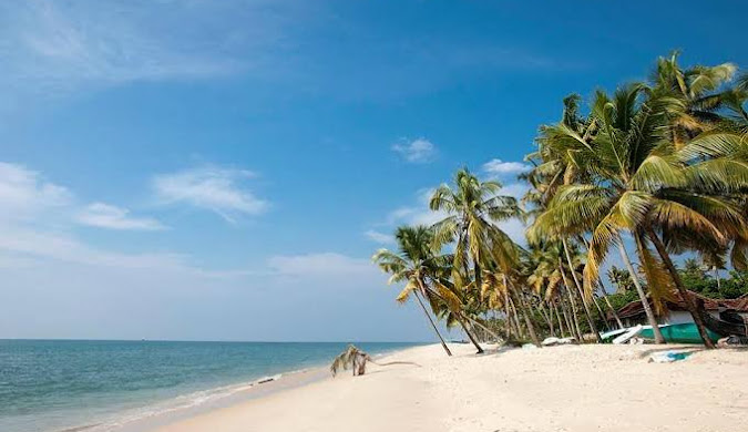
I’ve been organizing Kerala tours from Mumbai for over 20 years, and I still feel a quiet excitement every single time I say the words — Alleppey backwaters. There’s something about this place that works on you slowly. It doesn’t dazzle you all at once like a city does. Instead, it draws you in — one canal, one paddy field, one toddy shop at a time. If you’re researching alleppey tourist places for your next trip, you’ve landed in the right guide. I’m Wahid Ali, Operations Lead at Astamb Holidays, Mumbai, and in this 2026 travel guide, I’ll walk you through the 25 best places to visit in Alleppey, honest houseboat pricing, practical itinerary tips, hidden spots most tour groups skip, and everything in between. Whether you’re planning a romantic getaway, a family holiday, or a solo escape — Alleppey has something that will stick with you long after you’re home. 📌 Quick Reference: Alleppey at a Glance 📌 Detail Information Location Alappuzha, Kerala, India Also Known As Venice of the East; Alleppey Best Time to Visit October – February (Peak Season) Houseboat Price ₹9,000 – ₹1,05,000 per boat (per day/night) Nearest Airport Cochin International Airport (~84 km) Nearest Railway Station Alleppey Railway Station (in town) Ideal Trip Duration 2 – 3 Days Famous For Backwater Houseboats, Snake Boat Race, Kerala Cuisine Language Malayalam (English widely understood) 🌊 Why Alleppey Is Famous for Backwater Tourism Alleppey (officially Alappuzha) sits about 84 km south of Kochi on the shores of the Laccadive Sea. Lord Curzon, the British Viceroy of India, famously called it the “Venice of the East” — and the name has stuck for over a century, because frankly, it fits. What makes this place extraordinary is its geography. The town is essentially built on a network of canals, lakes, and lagoons. The Vembanad Lake, the longest lake in India, runs through its heart. And then there’s the Kuttanad region — a vast stretch of backwaters below sea level, where rice is grown on fields reclaimed from the water itself. The Alleppey backwater ecosystem spans over 900 km of interconnected waterways. When you float through this on a traditional kettuvallam (houseboat), you’re not just sightseeing — you’re stepping into a way of life that hasn’t changed much in centuries. Add the famous Nehru Trophy Snake Boat Race, the beautiful temples, the Portuguese-era churches, and the most soulful Kerala cuisine you’ll ever eat — and you begin to understand why Alleppey is one of the top 10 tourist destinations in India. 🗺️ 25 Best Alleppey Tourist Places You Must Visit 1. 🛶 Alleppey Backwaters There’s no conversation about Alleppey that doesn’t start here. The backwaters are the whole reason most people make the trip. Stretching across the Alappuzha district, this web of canals and lakes connects villages, paddy fields, and coconut groves in the most beautiful way imaginable. Book a houseboat or at minimum a shikara canoe ride. Morning cruises give you the best light — golden, calm, and free of the afternoon heat. I always tell my Mumbai clients: sit on the deck with a cup of chai and just watch. You’ll see kids rowing canoes to school, women washing clothes on the ghats, and fishermen throwing their nets at dawn. 📍 Best time: October to February | Entry: Free (boat charges apply) 2. 🏖️ Alappuzha Beach One of the best beaches in South India, Alappuzha Beach is a wide stretch of sand where multiple water bodies — lagoons, rivers, and the Arabian Sea — meet in one place. The famous 150-year-old pier juts out into the sea, crumbling but magnificent. The beach isn’t the Maldives. It’s not meant to be. It’s a working, living beach — fishermen haul in their catch at sunrise, families fly kites in the evenings, and the Alappuzha Lighthouse watches over it all. I love the raw energy of this place. 📍 Best time: Early morning or sunset | Entry: Free 3. 💧 Vembanad Lake Vembanad Lake is the largest lake in Kerala and the longest in India — stretching over 96 km. It’s the lifeline of Alleppey. Most houseboat routes pass through it, and the famous Nehru Trophy Boat Race is held here on Punnamada Lake, which is an extension of Vembanad. At sunrise, the lake is glass-still. You can sometimes see otters and water birds alongside the houseboats. The Thanneermukkom Bund, the longest lake bridge in India, cuts across Vembanad and is an interesting engineering landmark worth crossing. 4. 🌅 Marari Beach About 11 km north of Alleppey town, Marari Beach is the quieter, cleaner cousin of Alappuzha Beach. It’s named after the local fishing village Mararikulam. Palm trees lean dramatically over the sand, and the water is calmer here — perfect for a swim or an evening walk. National Geographic once rated this among the World’s Top Five Hammock Beaches. I’ve spent some genuinely relaxed hours here after intense tour operations, just sitting under a palm and doing absolutely nothing. Families love it, and so do honeymooners. 📍 Distance from Alleppey: ~11 km | Entry: Free 5. 🦜 Pathiramanal Island Pathiramanal means “Sands of the Night” in Malayalam. It’s a small, uninhabited island sitting right in Vembanad Lake, accessible only by boat. What makes it special: it hosts around 91 local bird species and 50 migratory bird species, making it a paradise for birdwatchers. Because it’s uninhabited, there are no hawkers or tourist stalls — just birds, trees, and silence. Siberian ducks, storks, and herons gather here between November and March. Bring binoculars. Seriously. 📍 Access: By boat from Alleppey | Best time: Nov – March for migratory birds 6. 🌾 Kuttanad — Rice Bowl of Kerala Kuttanad is one of the few places in the world where farming happens below sea level. Spread across parts of Alappuzha and Kottayam districts, this is where Kerala grows most of its rice, in fields literally reclaimed from backwater lakes. Travelling through Kuttanad by boat is a completely different experience from the usual canal

Alleppey Tourist Places: 25 Best Places to Visit in Alleppey Backwaters (2026 Travel Guide) Read More »

Is Sardinia Worth Visiting? Complete Travel Guide to Sardinia, Italy

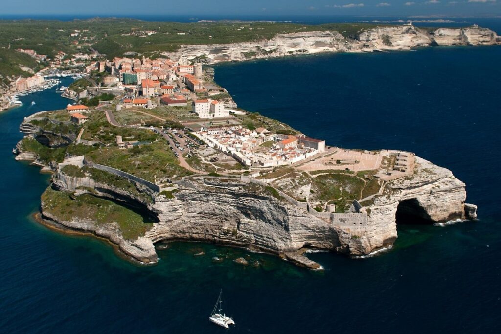
By Wahid Ali | Operations Lead, Astamb Holidays, Mumbai | Published on xploreheaven.com Let me be honest with you. When clients at Astamb Holidays ask me, “Wahid, should I skip Sardinia and just go to Amalfi?” — I tell them the same thing every time: you’d be making a mistake. Is Sardinia worth visiting? In my 20 years of planning trips across the Mediterranean, few islands have left my clients as genuinely speechless as this one. The water colour is almost unreal, the food is seriously underrated, and the history will knock you sideways. But let’s get into it properly — because you deserve more than just hype. 🔍 Featured Snippet: Is Sardinia Worth Visiting? Yes, Sardinia is absolutely worth visiting in 2026. Italy’s second-largest island offers Caribbean-quality beaches, ancient Nuragic history dating back to 1800 BC, and authentic cuisine — all at prices far lower than the Amalfi Coast. It rewards travellers who rent a car and explore beyond the crowds. 🌊 Is Sardinia Worth Visiting for Travelers in 2026? Short answer: Yes — and 2026 might be the best year yet. Sardinia is continuing its path of tourism maturation in 2026, with a growing focus on attracting visitors year-round — the island no longer wants to be just a summer destination for luxury beach seekers, but aims to diversify travel routes and offer alternative activities even beyond summer. That means less overcrowding in spring and autumn, more local experiences on offer, and better value for your money if you time it right. One thing I always tell first-timers: don’t go in August unless you’re okay with paying peak prices and sharing the best beaches with half of Italy. May, June, and September are the sweet spots. The water is warm, the crowds are thinner, and your budget will stretch much further. In the category of overall attractiveness, Sardinia ranks 30th out of 979 islands worldwide in 2026, scoring around 86 out of 100 points — driven by its wealth of activities, accommodation quality, restaurants, and infrastructure. 🗺️ Where Is Sardinia and Why Is It Famous? Sardinia (Sardegna in Italian) is the second-largest island in the Mediterranean after Sicily, located 200 km west of mainland Italy — roughly at the same latitude as Rome. Interestingly, southern Sardinia is as close to the coast of Africa as it is to the Italian mainland. It sits south of the French island of Corsica and has three international airports: Cagliari, Olbia, and Alghero. So why is Sardinia famous? Three big reasons: As D.H. Lawrence once wrote in his travel book Sea and Sardinia — “Sardinia is different.” And he was right. The island blends white beaches, turquoise waters, leisurely lunches, traditional villages, and shepherds tending their flocks in rugged mountains — all in one place. 🏆 Why Is Sardinia Worth Visiting? (The 17 Reasons) 🏖️ Reason 1–4: Crystal-Clear Mediterranean Beaches Trust me on this — the first time you see Cala Goloritzé, you will question whether you’re still in Europe. Cala Goloritzé was designated a national monument in 1995 and was awarded the title of the world’s most beautiful beach in 2025. Reachable only on foot via a panoramic trail descending from the Golgo plateau, it features a famous stone arch that frames its crystal-clear turquoise waters. Other beaches that will leave you stunned: Sardinia’s turquoise waters and white-sand beaches genuinely rival those in the Caribbean, with the added bonus of rugged hilltops dotted with ancient villages just a short drive away. 🏛️ Reason 5–6: Ancient Nuragic History This is the reason most travellers miss — and it’s a big one. The Nuragic civilization developed in Sardinia during the Bronze Age, starting around 1800 BC. Today, more than 7,000 nuraghe (stone tower-fortresses) dot the Sardinian landscape. Among the most famous is Su Nuraxi at Barumini, which is a UNESCO World Heritage Site. The Nuragic civilization outlived its Minoan and Mycenaean counterparts, with some scholars dating its existence from the 18th century BCE to the 6th century CE. One mistake travellers make is skipping Su Nuraxi because it’s a bit inland. Don’t do it. It’s one of the most atmospheric ancient sites in the whole Mediterranean — and there are almost no crowds. 🍽️ Reason 7–9: Authentic Sardinian Cuisine I have eaten my way through a lot of Italy. Sardinian food hits differently. Signature dishes include Culurgiones (a ravioli stuffed with ricotta), Porceddu (spit-roasted suckling pig), and Macarrones de busa — a popular local pasta. Many restaurants offer cooking classes so you can recreate these dishes at home. Don’t miss: Research by Professor Luca Deiana from the University of Sassari has found a strong link between moderate Cannonau consumption and the exceptional longevity of centenarians living in Sardinia’s Blue Zone. 🚗 Reason 10–12: Scenic Road Trips and Coastal Drives Sardinia is made for road trips. I genuinely recommend renting a car from day one. The drive along the SS125 — known as the “Orientale Sarda” — cuts through dramatic gorges, hugs cliff edges above turquoise coves, and connects the east coast from Cagliari all the way north to Olbia. It’s one of the most beautiful drives in Europe, full stop. Other iconic routes: 🕊️ Reason 13–17: Less Crowded Than Other Italian Destinations This is a big one for my clients who are tired of pushing through crowds in Positano or fighting for space on the Amalfi Coast. Sardinia has only 1.5 million inhabitants compared to Sicily’s 5 million, and most of the island’s interior is largely uninhabited. The coast has many small towns and villages, but much of the island is gloriously empty. You also get: 📍 What Are the Best Places to Visit in Sardinia? ⛵ Costa Smeralda — Luxury & Yachts The Costa Smeralda (Emerald Coast) in the northeast is Sardinia’s glam capital. Think superyachts, celebrity-spotting, and crystal-clear bays lined with pink granite boulders. Porto Cervo in Costa Smeralda is known for its upscale resorts, designer boutiques, and gourmet restaurants — the place to be for luxurious, glamorous travel. I

Is Sardinia Worth Visiting? Complete Travel Guide to Sardinia, Italy Read More »

What to Do in Gozo: 25 Best Things to Do in Gozo Malta (Hidden Gems + Local Tips)

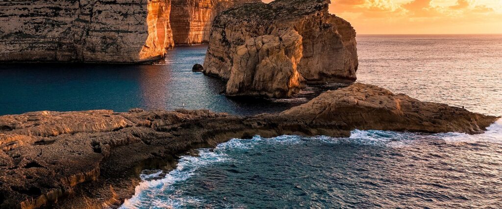
By Wahid Ali | Travel Operations Expert, Astamb Holidays | XploreHeaven.com I’ve helped thousands of travelers plan their Malta holidays at Astamb Holidays, and the question I get asked most often is — “Is Gozo worth the extra ferry ride?” My answer is always the same: Gozo is not just worth it. It’s the best part of Malta. What to do in Gozo is one of the most searched travel questions for good reason. Gozo, Malta’s greener, quieter sister island, packs ancient temples, vivid beaches, hidden caves, world-class dive sites, and charming stone villages into just 67 square kilometres. If you want fewer tourist crowds and more soul, this is your island. This guide covers the 25 best things to do in Gozo Malta, from iconic landmarks to the hidden gems that most travelers never find. 🌟 Why Gozo Is One of Europe’s Trending Mediterranean Islands Gozo has exploded on social media in the last few years — and for good reason. Every corner of this island is a photo waiting to happen. From the geometric salt pans of Marsalforn at golden hour to the turquoise waters at Ramla Bay, Instagram and TikTok feeds have turned this once-overlooked island into a must-visit Mediterranean destination. But the real reason experienced travelers prefer Gozo over the main island of Malta is simple: it feels genuinely different. Malta can feel dense and urban. Gozo feels like stepping back into a slower, more authentic way of life. Fields are still hand-tilled. Fishermen still sit for hours in their luzzu boats. Village squares are quiet on weekday mornings. In my years running tours at Astamb Holidays, travelers who include Gozo in their Malta itinerary consistently rate it as the highlight of their trip. The island’s rustic charm, combined with dramatic cliffs and crystal-clear water, makes it one of Europe’s most rewarding short-break destinations right now. 🗺️ What to Do in Gozo for First-Time Visitors Gozo offers a mix of historical sites, scenic beaches, and natural landscapes. Popular activities include visiting the Citadel in Victoria, relaxing at Ramla Bay, exploring Dwejra Bay, hiking coastal cliffs, and discovering hidden gems like Tal-Mixta Cave and the Marsalforn salt pans. Whether you have one day or a full week, this island rewards curious travelers. Start with the Cittadella for sweeping views, then head to the coast. Each village in Gozo has its own personality, and even a short drive reveals prehistoric temples, baroque churches, and secret coves that feel entirely your own. 🏛️ Best Historical Attractions to Visit in Gozo 1. Explore the Citadel in Victoria (Cittadella) The Citadel in Victoria — also called the Cittadella — is the centerpiece of Gozo island things to do. This medieval fortress sits high on a hill in Victoria (Rabat), Gozo’s capital, and offers 360-degree views of the entire island and the Mediterranean beyond. Inside the walls, you’ll find the Cathedral of the Assumption, the old prison, and several small museums. Walk the full perimeter of the bastions — it takes about 20 minutes and is completely worth it. Go early in the morning before the tour groups arrive. By 9:30 AM on a summer day, it fills up fast. 📌 Tip: Entry to the Citadel walls is free. Individual museums charge a small fee. Check the Heritage Malta website for updated hours and ticket prices. 2. Visit the Ġgantija Temples If there’s one Gozo attraction that genuinely stops people in their tracks, it’s the Ġgantija Temples in Xaghra. Built around 3,600 BCE, these megalithic structures are older than both the Egyptian Pyramids and Stonehenge — making them among the oldest free-standing structures on Earth. The name comes from the Maltese word for giant, because locals once believed only giants could have built something so massive. The site is listed as a UNESCO World Heritage Site and the attached museum is excellent. Budget at least 1.5 hours here. 📌 Tip: Wear comfortable shoes — the ground is uneven. You can visit using the Discover Gozo Combo Ticket from Heritage Malta, which covers multiple sites and saves money. 3. Discover Ta’ Kola Windmill The Ta’ Kola Windmill in Xaghra is one of the best-preserved grain windmills in Malta. It dates back to 1725 and gives you a real sense of how Gozitans lived centuries ago. The interior has been beautifully restored and is open to the public. A short visit, but genuinely interesting — especially for families. 4. Visit Ta’ Pinu Basilica Ta’ Pinu Basilica, located between Gharb and San Lawrenz, is one of the most important religious sites in the entire Maltese archipelago. The story behind it is remarkable: in 1883, a local woman named Carmela Grima reportedly heard a miraculous voice calling her from this small chapel. After several reported miracles, the current neo-Romanesque basilica was built between 1920 and 1931. Today, pilgrims come from across the world. The walls inside are lined with votive offerings — crutches, photographs, letters — from people who claim miracles happened after praying here. Even if you’re not religious, the atmosphere inside is deeply moving. 🌊 Best Natural Wonders and Scenic Places in Gozo 5. Dwejra Bay and the Blue Hole Dwejra Bay on Gozo’s west coast is where the famous Azure Window once stood before it collapsed in a storm in March 2017. But Dwejra is far from finished. The area is now famous for the Blue Hole — a natural underwater sinkhole about 15 metres deep and 10 metres wide, rated as one of the top scuba diving spots in Europe. The Blue Hole connects to the open sea via a natural limestone arch about 6 metres underwater. Divers report seeing groupers, octopuses, and barracudas here regularly. Even if you’re not diving, the rocky landscape around Dwejra is dramatic and worth a long visit. 📌 Tip: Check sea conditions before diving here. Strong winds can create rough currents. The site is best in April–October. 6. Inland Sea Lagoon Right next to Dwejra Bay is the Inland Sea — a small lagoon connected

What to Do in Gozo: 25 Best Things to Do in Gozo Malta (Hidden Gems + Local Tips) Read More »

Okinawa Japan Travel Guide 2026: Culture, Beaches & Seasonal Blossoms (Ultimate Itinerary + Local Tips)

By Wahid Ali | Xplore Heaven | Updated: February 2026 Most people hear “Japan” and picture neon signs, bullet trains, and temple-dotted mountains. Okinawa Japan travel gives you something completely different — 160 islands spread across turquoise water, a subtropical climate that refuses to follow the mainland’s rulebook, and a living culture shaped by the ancient Ryukyu Kingdom that has nothing to do with samurai or sushi. People compare Okinawa to Hawaii — and sure, the beaches hold up. But Hawaii doesn’t come with UNESCO-listed castle ruins, a unique language, Bingata textile art that’s hundreds of years old, or food that borrows from China, Japan, and America all at once. And let’s be real — Okinawa is significantly more affordable than Hawaii, especially if you plan smart. At Astamb Holidays, we’ve routed hundreds of travellers through this archipelago, and every time, they come back wanting more. This Okinawa travel guide covers everything: the best time to visit, which islands to hit, what to eat, how to get around, and a 7-day itinerary you can actually use. 🌊 Why Okinawa Should Be on Your Travel Map Okinawa sits at the very southern tip of Japan, closer to Taiwan than to Tokyo. That geography shapes everything — the weather, the food, the people, and the pace of life. The beaches are genuinely world-class. The water around the Kerama Islands — known internationally as “Kerama Blue” — has some of the most stunning underwater visibility in Asia. Coral reefs here host manta rays, sea turtles, whale sharks, and more than 200 species of coral. Divers fly in from around the world specifically for this. The history goes deep. Okinawa was an independent kingdom — the Ryukyu Kingdom — for over 400 years before becoming part of Japan in 1879. That history shows up everywhere: in the food, the music, the pottery, the spiritual sites. You won’t find this version of Japan anywhere else. The “Blue Zone” factor. Okinawa is one of the world’s 5 Blue Zones — regions where people routinely live past 100 years old. Researchers attribute this to the plant-heavy local diet, active community culture, and a concept called ikigai (a strong sense of purpose). When you eat here, you’re literally tasting one of the healthiest food cultures on the planet. For travellers tired of the same Tokyo-Kyoto loop, Okinawa is the reset button Japan didn’t tell you about. 🌸 Best Time to Visit Okinawa — Seasonal & Blossoms Focus 🌸 Early Bloom & Cherry Blossom Season in Okinawa The best time to see cherry blossoms in Okinawa is mid-January to mid-February — weeks before they appear anywhere else in Japan. The variety here is Kanhizakura, a deep pink, almost tropical-looking bloom that grows on the hills of Nakijin Castle Ruins and Nago City. The famous Nago Cherry Blossom Festival draws crowds every year in late January. These blooms look nothing like the pale pink clouds of Tokyo’s Yoshino sakura. They’re vivid, full-coloured, and surrounded by subtropical greenery. If you want cherry blossoms without the mainland madness, January–February in Okinawa is your answer. 📌 Visit Okinawa Japan Official Site has updated bloom schedules and festival dates every season. ☀️ Okinawa Weather Month by Month — Seasonal Matrix Month Avg. Temp Conditions Best For January 17–21°C Mild, dry, breezy Cherry blossoms, whale watching, hiking February 17–23°C Mild, occasional rain Sakura festivals, diving, culture March 19–27°C Warming up, short rain showers Beach season opens, snorkelling begins April 22–29°C Warm, pleasant Hari boat races, outdoor sightseeing May 25–30°C Rainy season starts (tsuyu) Cultural sites; avoid Golden Week crowds June 28–32°C Hot, humid, rainy season ends late June Hydrangea gardens, beginning of dive season July 30–33°C Hot, humid, typhoon possible Beaches, snorkelling, Eisa Festival August 30–33°C Peak summer, typhoon risk highest Peak beach season — book in advance September 28–31°C Still warm, typhoon risk reducing Thinning crowds, manta ray season October 24–28°C Comfortable, drier Naha Tug-of-War Festival, cultural events November 20–24°C Cooling, pleasant Diving, outdoor activities, fewer tourists December 17–21°C Mild winter Whale watching begins, pottery festivals Typhoon season runs from July through September, peaking in August. About 3–4 typhoons make significant contact with Okinawa each year. If you travel during this window, buy travel insurance and stay flexible. The sweet spots: March–May and October–November. You get good weather, manageable crowds, and fair prices. 🥁 Okinawa Local Festivals — Calendar Highlights Okinawa’s festival culture is loud, colourful, and deeply rooted in Ryukyuan tradition. 🏝️ Top Islands & Regions to Explore 🏯 Okinawa Main Island (Okinawa Honto) The main island is where most travellers start — and for good reason. Naha, the capital, packs in culture, food, history, and nightlife along a 2km stretch of Kokusai Street (International Street). Shuri Castle in Naha is the big draw. The original Ryukyu Kingdom royal palace, built in the 14th century, was declared a UNESCO World Heritage Site in 2000 and devastated by fire in October 2019. The great news for 2026 travellers: the exterior of the iconic red Seiden main hall is now fully restored, and the castle is expected to fully reopen by autumn 2026. You can already visit the grounds, observe the final reconstruction stages from dedicated viewing decks, and experience the history in real time. Paid entry is ¥400 to view the reconstruction process up close. Sefa Utaki, located in southern Okinawa, is a sacred forest site and another UNESCO-listed Gusuku property. This ancient spiritual grove was the most important sacred space in the Ryukyu Kingdom. Walking through the limestone formations here feels genuinely removed from modern life. Cape Manzamo on the west coast offers some of the most photographed sea views on the island — dramatic limestone cliffs dropping straight into electric-blue water. Sunset here is something else. 🤿 Kerama Islands — Snorkelling & Diving in “Kerama Blue” Just 30–40 minutes by high-speed ferry from Naha’s Tomari Port, the Kerama Islands are accessible as a day trip or overnight stay. Zamami Island, Tokashiki Island, and Aka Island are the most visited. The water

Okinawa Japan Travel Guide 2026: Culture, Beaches & Seasonal Blossoms (Ultimate Itinerary + Local Tips) Read More »

Isla Suasi: The Complete Guide to Peru’s Private Lake Titicaca Island

Picture this: you’re standing on the only private island in Lake Titicaca, watching rare vicuñas graze peacefully while the sun sets behind the Bolivian mountains. No crowds, no noise – just you and one of the most beautiful places on Earth. This is Isla Suasi, and after 20 years of organizing tours across Peru, I can tell you with complete certainty that this hidden gem offers something truly special. Isla Suasi is Peru’s best-kept secret for travelers seeking authentic connection with nature and complete disconnection from the modern world. While most tourists crowd onto the floating Uros Islands or rush through Taquile on day trips, smart travelers discover this 43-hectare paradise in the northeastern corner of Lake Titicaca. Let me share everything you need to know about planning your trip to this magical island – from a travel professional who has sent hundreds of clients there. What Is Isla Suasi? 🏝️ Isla Suasi is the only privately owned island on Lake Titicaca, covering approximately 106 acres (43 hectares) in the northeastern section of the world’s highest navigable lake. Unlike the touristy floating islands, this is a real, solid island with natural terrain, gardens, and wildlife. Quick Facts About Isla Suasi Feature Details Location Northeastern Lake Titicaca, Peru Size 43 hectares (106 acres) Altitude 3,810 meters (12,500 feet) above sea level Distance from Puno Approximately 70 kilometers by boat Ownership Private island with single eco-lodge Power Source 100% solar-powered Accommodation 24 rooms + 1 Andean Cottage Wildlife Vicuñas, alpacas, hummingbirds, Andean gulls Best Feature Complete privacy and tranquility The island was developed over 20 years ago by Marta Giraldo, who started with just one room and has grown it into a beloved eco-retreat. From my experience managing tours to Lake Titicaca, I always tell clients that Isla Suasi represents what travel should be – meaningful, peaceful, and genuinely transformative. Where Is Isla Suasi Located? 📍 Isla Suasi sits in the northeastern part of Lake Titicaca, near the Capachica Peninsula. To give you geographic context, the island is approximately 70 kilometers from Puno by boat and roughly 1 kilometer from the mainland shore. Here’s what makes the location special: you’re essentially in the heart of Lake Titicaca but away from the heavily trafficked tourist routes. While Uros and Taquile islands are on the well-worn path from Puno, Isla Suasi requires a 3-4 hour boat journey – which actually works in your favor. This distance keeps crowds away and preserves the island’s peaceful atmosphere. The island offers stunning views across the 3,200 square miles of Lake Titicaca, with the snow-capped Bolivian mountains visible on clear days. From my years of sending clients here, I’ve learned that this remote location is precisely what makes Isla Suasi worth the journey. Why Visit Isla Suasi? (Key Attractions) ✨ After organizing countless Lake Titicaca tours, I can honestly say Isla Suasi offers something no other destination in the region can match: genuine serenity without compromise on comfort or experience. The “Disconnect to Reconnect” Experience Isla Suasi operates on a philosophy I deeply respect – helping travelers disconnect from modern distractions to reconnect with nature and themselves. There’s no TV in rooms (intentional), limited WiFi (lobby only), and no electrical outlets in guest rooms. Before you panic, let me explain why this is brilliant: rooms have charging stations in common areas, staff light wood-burning stoves each evening, and they place hot water bottles in your bed before you return from dinner. From my experience in travel planning, I always recommend to my clients: embrace this. You’re here to experience Lake Titicaca, not your phone screen. Comparing Isla Suasi to Other Lake Titicaca Islands Let me be honest with you, as someone who books these tours regularly: Uros Floating Islands are fascinating for their construction – 42+ reed islands created by the Uros people. However, they’re crowded, commercialized, and frankly, many islands exist purely for tourism. You’ll get the standard presentation, quick tour, heavy sales pitch for handicrafts, and be back on the boat within 45 minutes. Taquile Island offers authentic culture with its UNESCO-recognized textile traditions. The Quechua-speaking community of 2,200 people maintains genuine customs. But it’s still a day-trip destination. You’ll climb steep stairs (4,050 meters elevation), eat lunch at an assigned restaurant, buy textiles, and leave. Beautiful? Absolutely. Peaceful? Not exactly. Isla Suasi, on the other hand, gives you time. You stay overnight (or multiple nights), explore at your own pace, and actually relax. There are only 24 rooms total, meaning you might share the island with just 10-20 other guests – or during low season, you could have the place nearly to yourself. Feature Uros Islands Taquile Island Isla Suasi Visit Type 30-minute stop 3-4 hour day trip Overnight stay Crowd Level Very high Moderate-High Very low Authenticity Staged for tourists Authentic culture Natural experience Activities Reed boat rides Textile shopping, hiking Kayaking, wildlife, hiking, relaxation Accommodation Day trip only Homestays available Luxury eco-lodge Privacy None Limited Complete How to Reach Isla Suasi from Puno or Juliaca 🚤 Alright, let’s talk logistics – this is where my operations background comes in handy. Getting to Isla Suasi requires planning, but it’s straightforward if you know what to expect. The Standard Boat Route (Most Common) Departure: Early morning from Puno main pier (typically 6:30-7:00 AM)Duration: 3.5-4.5 hours by speedboat (including stops)Route: Puno → Uros Islands → Taquile Island → Isla Suasi Yes, you’ll stop at Uros (15-30 minutes) and Taquile (1-2 hours) along the way. Most operators include these stops because it maximizes your experience. You’ll arrive at Isla Suasi around 12:00-1:00 PM, just in time for their welcome BBQ lunch. The speedboats seat 20-40 passengers and are equipped with life jackets, first aid kits, oxygen (important at this altitude!), and comfortable seats. From my experience managing these logistics, I always recommend to my clients: bring layers! The morning can be cold on the water, but by midday the sun is intense. The Return Journey (Options) Option 1: Return by Boat – Same route back to

Isla Suasi: The Complete Guide to Peru’s Private Lake Titicaca Island Read More »

Ikara-Flinders Ranges — Complete Travel Guide for 2026

Picture standing on ancient rock that’s older than the Himalayas, watching the sunrise paint red cliffs in shades of gold. That’s the Ikara-Flinders Ranges — and it’s calling your name for 2026. I’m Wahid Ali, and in my 20 years managing tours at Astamb Holidays, I’ve sent countless travellers to Australia’s outback. But the Ikara-Flinders Ranges National Park holds a special place in my recommendations. Why? Because it delivers what most people only dream about: genuine wilderness, deep Aboriginal culture, and landscapes that make you feel tiny in the best possible way. This isn’t your typical tourist trap. The Flinders Ranges stretch across 95,000 hectares of South Australia’s outback, about 430 kilometres north of Adelaide. Here’s everything you need to know before you go. What Is Ikara-Flinders Ranges? The Ikara-Flinders Ranges National Park sits in South Australia’s outback, roughly 5 hours’ drive from Adelaide. Think rugged mountain ranges, deep gorges carved over millions of years, and wildlife you won’t see anywhere else. The landscape here started forming 800 million years ago — making it one of Earth’s oldest mountain ranges. You’re literally walking through geological history. What does Ikara mean in Aboriginal language? Ikara means “meeting place” in the Adnyamathanha language. The word specifically refers to Wilpena Pound, which has served as a traditional gathering spot for the Adnyamathanha people for thousands of years. The Adnyamathanha people — whose name translates to “rock people” or “hills people” — have called this land home for over 49,000 years. In 2016, the park was officially renamed to honour this heritage. Today, it’s co-managed by Parks South Australia and the Adnyamathanha Traditional Lands Association, ensuring their stories and sacred sites are properly protected. Quick Facts Details Official Name Ikara-Flinders Ranges National Park Size 95,000 hectares (234,717 acres) Distance from Adelaide 430 km (267 miles) Drive Time 5 hours (non-stop) Traditional Owners Adnyamathanha people Established January 1, 1945 Why Visit Ikara-Flinders Ranges? Here’s what makes this place different from your average national park: The geology is mind-blowing. These mountains are older than the Himalayas. The park contains Ediacaran fossils — some of the oldest evidence of complex life on Earth. Scientists from around the world come here to study rocks that tell stories from 650 million years ago. It’s culturally significant. This isn’t just a pretty landscape. Sacred sites like Arkaroo Rock and Sacred Canyon hold ancient rock art and carvings dating back tens of thousands of years. The Adnyamathanha community shares their stories through guided tours, and trust me — you’ll never look at the land the same way after hearing creation stories told by traditional custodians. The experiences are unique. Where else can you: Lonely Planet recently highlighted the Flinders Ranges as a must-visit destination, but honestly, locals have known this secret for decades. Best Time to Visit Ikara-Flinders Ranges Timing is everything in the outback. Get it wrong, and you’ll be miserable. Get it right, and you’ll have the trip of a lifetime. What is the best time of year to go to the Flinders Ranges? The best time to visit is April to October (autumn through spring), with August to October being ideal for wildflowers and comfortable hiking temperatures. Daytime temperatures range from 15°C to 25°C (59°F to 77°F), perfect for bushwalking without melting. Here’s my honest breakdown by season: Autumn (March-May): Brilliant choice. Days are warm (20-30°C), nights are cool but not freezing. The landscape shows off in oranges, reds, and browns. Easter can get busy, so book ahead. Winter (June-August): This is peak season for good reason. Days are clear and sunny (13-18°C), perfect for hiking. Nights drop to near 0°C, so pack warm layers. Campfires are allowed (bring your own wood — collection is prohibited). Wildlife is active, and you’ll spot more animals near water sources. The trade-off? Higher accommodation prices and more tourists, especially during school holidays. Spring (September-November): Wildflower season! After winter rains, the desert blooms in yellows, purples, and reds. September and October offer the best of both worlds — warm days, wildflowers, and decent availability. Just note: fire ban season typically starts mid-October. Summer (December-February): Only for the brave or foolish. Temperatures regularly hit 33-40°C+. Many hiking trails close for safety between December and March. If you must visit in summer, restrict activities to early morning and late evening. Seriously — the outback sun is no joke. Pro tip from my tour operations experience: Book April-May or September if you want fewer crowds but still excellent weather. July-August is beautiful but expect company. How Big Is Ikara-Flinders Ranges? The park covers 95,000 hectares — or if you prefer, about 370 square kilometres. To put that in perspective, that’s roughly 1.5 times the size of Singapore. But here’s what that really means for travellers: You can’t “do” this park in a day. The terrain is vast and varied. You’ve got: How many days do you need? Minimum 2-3 days to see the highlights. Give yourself 4-5 days if you want to really explore and do some longer hikes. A week lets you add in Arkaroola Wilderness Sanctuary to the north. Where to Go & What to Do Let me walk you through the must-see spots and hidden gems: Wilpena Pound (Ikara) This is the star attraction. Wilpena Pound is a massive natural amphitheatre — imagine mountains forming a near-perfect oval 17 kilometres long and 8 kilometres wide. From the outside, it looks like a line of peaks. From inside, you realize you’re in this enormous basin. The only way to get your vehicle inside is via the Wilpena Pound Resort shuttle (runs at 9am, 11am, 1pm, and 3pm). Otherwise, it’s a 3-hour, 8-kilometre return walk to the lookout. St Mary Peak (1,170 metres) is the highest point in the Flinders Ranges. The hike is challenging (20 kilometres return, 8-10 hours), but the views are extraordinary. Important cultural note: The Adnyamathanha people ask that you stop at Tanderra Saddle rather than summiting, as the peak holds sacred significance. Brachina and Bunyeroo Gorges The Brachina

Ikara-Flinders Ranges — Complete Travel Guide for 2026 Read More »

Ultimate Great Barrier Reef Snorkeling, Tours & Scuba Diving Guide — Costs, Best Times, Safety & Facts

Picture this: you’re floating above a kaleidoscope of coral gardens, schools of rainbow-colored fish dart around you, and a sea turtle glides past like it’s the most natural thing in the world. That’s what experiencing great barrier reef snorkeling feels like — and trust me, after 20 years of sending travelers to every corner of Australia, I can tell you this is one place that actually lives up to the hype. I’m Wahid Ali, and I’ve been in the tourism game long enough to know when a destination delivers and when it disappoints. The Great Barrier Reef delivers. Every single time. Whether you’re planning your first underwater adventure with great barrier reef tours or you’re a seasoned diver ready for some world-class great barrier reef scuba diving, this guide will walk you through everything you need to know — the real costs, the best times to visit, safety tips that actually matter, and great barrier reef facts that go beyond the tourist brochures. In my years heading operations at Astamb Holidays in Mumbai, I’ve seen countless clients return from the reef with stories that give me goosebumps. But I’ve also seen travelers make rookie mistakes that cost them time, money, and memories. Let’s make sure you’re in the first group. 🌊 What Is the Great Barrier Reef? Quick Facts You Must Know The Great Barrier Reef is the world’s largest living structure, spanning 2,300 kilometers (1,400 miles) along Queensland’s northeast coast and covering 344,000 square kilometers — that’s roughly the size of Italy or Japan. Let me break down what makes this place so extraordinary: Location: Off the coast of Queensland, Australia, stretching from the northern tip near Cape York down to Bundaberg in the south. Size and Scale: We’re talking about 2,900 individual reefs and over 900 islands. It’s so massive you can see it from space — literally the only living structure visible from orbit. Biodiversity: The reef is home to over 1,500 species of fish, 400 types of coral, 4,000 types of mollusks, and 240 species of birds. You’ll find six of the world’s seven species of marine turtle here, plus dolphins, whales, sharks, and the stunning manta rays. UNESCO World Heritage Status: Listed since 1981 as a World Heritage Site, the reef is protected by the Great Barrier Reef Marine Park Authority (GBRMPA), which manages this incredible ecosystem. Current Environmental Status: I won’t sugarcoat it — the reef has faced six mass bleaching events since 2016, including back-to-back events in 2024 and 2025. However, coral cover remains near its long-term average due to recovery periods between events. The reef is resilient but facing real challenges from climate change. Quick Reef Facts Details Total Length 2,300 km (1,400 miles) Total Area 344,000 sq km (133,000 sq miles) Number of Reefs 2,900+ individual reefs Number of Islands 900+ islands Fish Species 1,500+ species Coral Types 400+ hard and soft coral species UNESCO Status World Heritage Site since 1981 Water Temperature 23°C-29°C (73°F-84°F) year-round Source: Great Barrier Reef Marine Park Authority 🤿 Great Barrier Reef Snorkeling: Experience, Tips & Spots Let me paint you a picture from my client feedback: you slip into the warm water, adjust your mask, and suddenly you’re in a completely different world. The water is so clear you can see 15-30 meters ahead on a good day. Below you, coral formations create underwater cities where fish communities go about their daily business. What Snorkeling the Reef Actually Feels Like: The first breath through your snorkel feels strange if you’re new to this, but within minutes, you’ll forget you’re breathing through a tube. The water temperature averages 24°C-28°C (75°F-82°F) depending on the season — warm enough that you won’t freeze but cool enough to be refreshing. You’ll float effortlessly thanks to your life vest, and that’s when the magic happens. Best Snorkeling Spots on the Great Barrier Reef: Based on years of client experiences and operator feedback, here are the top locations: 1. Agincourt Reef (Port Douglas) ⭐⭐⭐⭐⭐ Image Source: https://www.queensland.com/in/en/home 2. Moore Reef (Cairns) ⭐⭐⭐⭐⭐ Image Source: https://cairns-tours.com/ 3. Norman Reef (Cairns) ⭐⭐⭐⭐⭐ Image Source: https://cairns-tours.com/ 4. Flynn Reef (Cairns) ⭐⭐⭐⭐ Image Source: https://cairns-tours.com/ Essential Snorkeling Gear (Usually Provided): Pro Tips from 20 Years of Experience: 🚢 Great Barrier Reef Tours: How to Choose the Best One This is where travelers get overwhelmed — there are literally hundreds of tour operators between Cairns and Port Douglas. Here’s how to cut through the noise and find your perfect reef experience. Understanding Reef Tour Types: 1. Day Tours to Outer Reef (Most Popular) 2. Pontoon Platform Tours 3. Small Group Tours 4. Liveaboard Tours (Overnight) Cairns vs. Port Douglas Departures: Factor Cairns Port Douglas Tour Options 50+ operators 15+ operators Travel Time to Outer Reef 60-90 minutes 90 minutes Reef Sites Norman, Flynn, Moore, Hastings Agincourt, Opal, Low Isles Crowd Level Higher (busier season) Lower (more exclusive feel) Price Range $179-$325 AUD $260-$410 AUD Departure Vibe Busy marina, big city energy Relaxed tropical village Best For More options, budget-friendly Quieter experience, premium feel Outer Reef vs. Inner Reef — What’s the Difference? Outer Reef: Inner Reef & Islands: What’s Actually Included in Most Tours: What Costs Extra: 🤿 Great Barrier Reef Scuba Diving Options for All Levels Here’s where it gets really exciting. If snorkeling is watching a movie on your phone, scuba diving the Great Barrier Reef is watching it in IMAX 3D. You’re not just looking down at the reef — you’re in it, moving through it, breathing underwater while fish swim inches from your face. Introductory Dives (No Experience Needed): What it involves: You’ll get a 30-minute briefing on boat, practice in shallow water or on the platform, then descend with an instructor holding your hand (literally). The instructor controls everything — you just breathe and enjoy. It’s called a “Discover Scuba Dive” or “Resort Dive.” Who it’s perfect for: Anyone nervous about diving but wanting to try. You’ll be amazed at how natural breathing underwater feels after the first few breaths.

Ultimate Great Barrier Reef Snorkeling, Tours & Scuba Diving Guide — Costs, Best Times, Safety & Facts Read More »