When American Express Travel released its 2026 Trending Destinations list, the travel industry paid attention. The Indian Himalayas didn’t just appear on that list — they claimed the top spot, signalling a genuine shift in how the world’s most discerning travelers think about adventure, meaning, and exploration.
This isn’t a flash-in-the-pan trend. Over the past few years, I’ve watched the character of Himalayan travel change from my work at Astamb Holidays. The inquiries have evolved. Travelers used to ask for a week in Leh with a couple of monastery visits and a photo at Pangong Tso. Now, they’re asking how long they need to properly acclimatize before crossing Khardung La, whether they can stay with a herder family in the Nubra Valley, and which high-altitude route lets them walk an ancient Silk Road trade trail.
That change in the questions tells you everything.
The Indian Himalayas span over 2,500 kilometers across India’s northern and northeastern states — from the dry cold deserts of Ladakh and the raw ridgelines of Spiti Valley, to the sacred river confluences of Uttarakhand, the rain-soaked biodiversity of Sikkim, and the alpine meadows of Kashmir’s Sonamarg and Pahalgam. Each of these corridors represents a distinct ecological, cultural, and physical experience. None of them are easy. All of them are worth it.
What’s driving this surge in global interest is precisely the friction. The thin air at 4,000 meters. The roads the Border Roads Organisation (BRO) keeps alive against brutal odds. The homestay in a mud-brick house with no reliable hot water but an extraordinary view of snow-covered ridges from a hand-stitched quilt. Travel is moving — definitively — away from sanitized convenience toward genuine immersion. The Indian Himalayas are the most complete expression of that shift on the planet right now.
This guide covers everything you need to plan your journey responsibly: region by region breakdowns, Inner Line Permit (ILP) requirements, acclimatization protocols, eco-tourism considerations, and the practical details that don’t make it into the glossy brochures.
🌐 Deciphering the Shift: Why the Indian Himalayas Top the 2026 Travel Lists
The American Express Travel 2026 Trending Destinations Announcement
The American Express Travel 2026 Trending Destinations report draws on real booking behaviour — premium cardmember travel patterns and insights from experienced travel consultants. It’s a data-informed read of where high-value, internationally mobile travelers are choosing to go.
The Indian Himalayas topped that list not because of a marketing campaign, but because bookings were already moving in that direction. Modern travelers — particularly in the 35–55 age bracket with disposable income and serious travel experience — are actively turning away from saturated European circuits and predictable Southeast Asian beach holidays. They want places where arrival itself is an event.
Flying into Leh’s Kushok Bakula Rimpochhe Airport at 3,256 meters, watching mountain ridges press against both sides of the aircraft, is exactly that kind of arrival. No resort pool photo can replicate it.
The report reflects a broader reorientation: high-altitude, culturally immersive, off-infrastructure travel is no longer a niche preference. It is the premium product.
From Checklist Tourism to Deep Experiential Immersion
The old model of Himalayan tourism was coverage-based. Hit Leh, check. See Hemis Monastery, check. Drive to Pangong, take the photo, drive back.
The new model is residency-based. Travelers are spending 10 to 14 days in a single valley. They’re learning to identify edible plants with a village elder in Spiti. They’re waking up at 4 a.m. to watch butter lamps being lit in a monastery courtyard before the monks begin morning prayers.
This slow-travel philosophy and offbeat exploration isn’t a trend born from Instagram. It’s a correction. People who’ve ticked off a dozen countries are coming back to places where the experience demands something of them — patience, physical effort, cultural humility.
In Uttarakhand, revitalized trade routes like the Milam Glacier Trek through the Kumaon Himalayas are drawing trekkers who want multi-day wilderness immersion with genuine historical weight, not just a summit selfie.
In Sikkim’s Yuksom, the entry point for Kanchenjunga Base Camp treks, you can spend a week walking through rhododendron forests and reaching high-altitude lakes that most people will never see. That kind of experience has become the actual point.
Sustainable and Community-Led Eco-Tourism
The surge in interest has put pressure on fragile high-altitude ecosystems. Both state governments and local communities have responded, sometimes imperfectly but with clear intent.
Hemis National Park in Ladakh is the largest national park in India and one of the best places on Earth to track the snow leopard. Conservation programs run in partnership with the Snow Leopard Trust have turned local communities from passive bystanders into active stakeholders. Herder families now participate in wildlife monitoring, and some offer homestay accommodation specifically tied to snow leopard territory camps.
Sikkim went plastic-ban-first at the state level and has maintained a reputation as India’s most ecologically conscious travel destination. The community-run homestay network in West Sikkim — particularly around Pelling, Yuksom, and the Dzongri trail corridor — ensures that tourism revenue circulates within village economies rather than flowing to outside resort chains.
This is the model the Himalayas need. And increasingly, it’s the model informed travelers are actively seeking out.
🗺️ The Regional Diversity of the Indian Himalayas: Where to Travel in 2026
Ladakh: The Cold Desert of High Passes and Monasteries
Ladakh operates at a scale that requires recalibration. The landscape is what happens when you strip the Himalayas of moisture — a rain-shadow desert at 3,500 meters, where the sky is a specific shade of blue you won’t find anywhere else and the mountains shift from rust-red to deep violet depending on the hour.
Leh is the operational hub, connected to Manali via the Manali–Leh Highway (472 km) and to Srinagar via the Srinagar–Leh National Highway 1 (434 km). The Atal Tunnel, completed by the BRO in 2020, changed the calculus for Manali access by keeping the Rohtang Pass route viable year-round, though the upper stretches still close in deep winter.
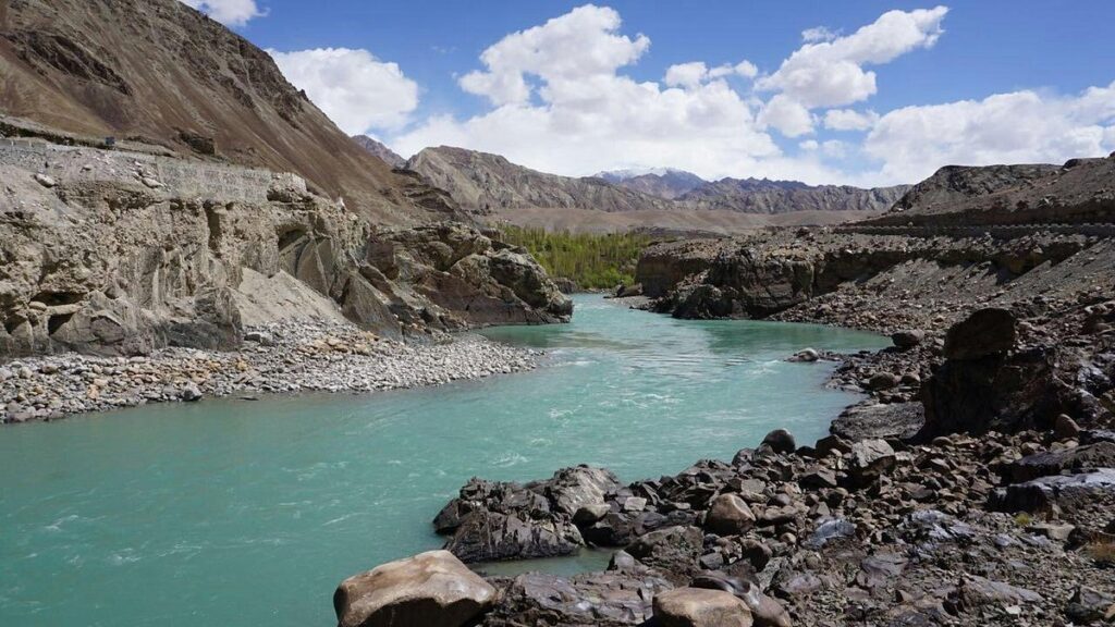
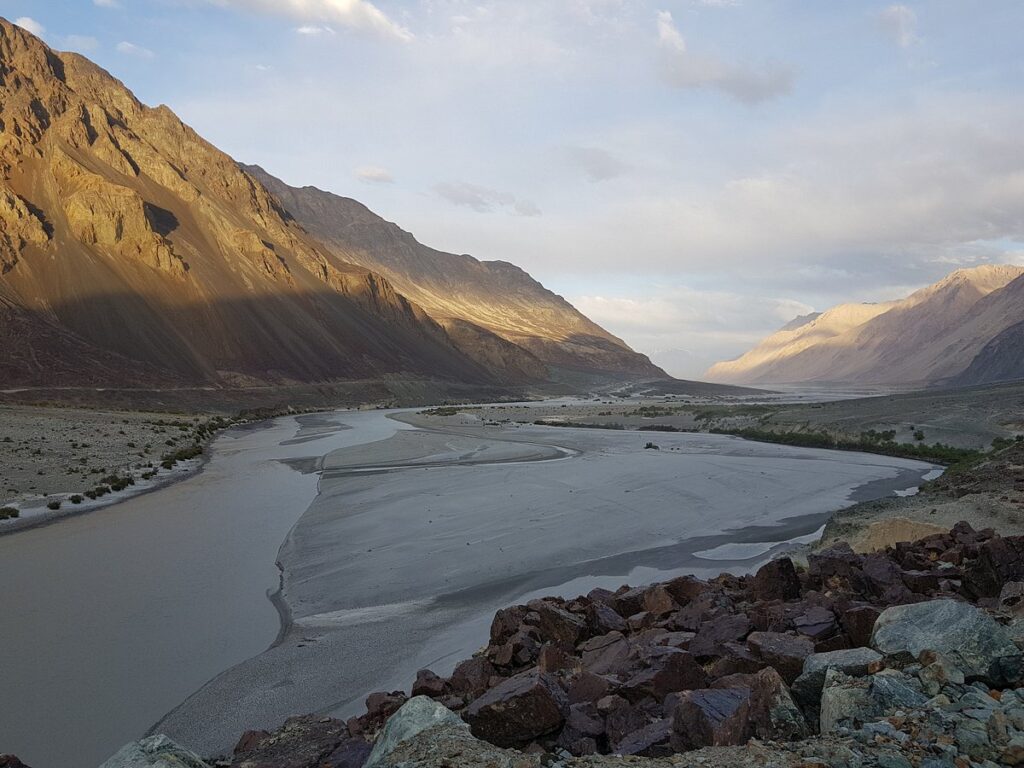
The classic Ladakh circuit runs from Leh toward Khardung La (5,359 meters) — one of the highest motorable passes in the world — down into Nubra Valley, where sand dunes share geography with Bactrian camels and the Siachen Glacier’s meltwater feeds the Shyok River. Permits are required for Nubra Valley, Pangong Tso, and Tso Moriri lake — all protected area zones near the Line of Actual Control.
📍 Local Insight Tip: Flying directly into Leh and attempting Khardung La the next morning is how altitude sickness happens. Give yourself at least 48 hours of complete rest at Leh altitude before any ascent. I’ve rerouted guests mid-trip because this advice wasn’t followed — Wahid Ali, Astamb Holidays.
Hemis Monastery, founded in the 17th century, hosts the Hemis Festival (usually June–July) — a two-day masked dance celebration that is one of the most atmospheric cultural events in the Himalayas. Thiksey Monastery, with its hillside architecture often compared to the Potala Palace in Lhasa, is best seen at 6 a.m. during morning prayers.
Pangong Tso at 4,350 meters is a 134-km-long saltwater lake that shifts through colors — turquoise, emerald, cobalt — across a single afternoon. The section accessible from Spangmik village on the Indian side has been heavily visited; the better, quieter experience is an early morning at Man village, further east along the shore.
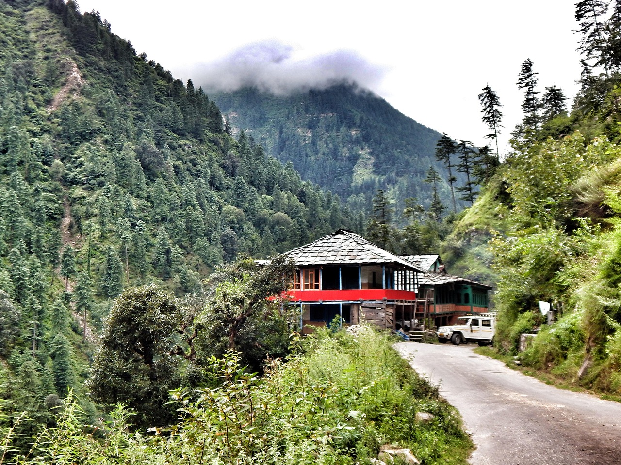
Himachal Pradesh: Spiti’s Raw Ridges and Dharamshala’s Spiritual Centers
The contrast within Himachal Pradesh is jarring and deliberate. Travel north from the pine-forested district of Dharamshala — home to the Tibetan government-in-exile and the Dalai Lama’s residence in McLeod Ganj — and the landscape progressively desiccates until you arrive in Spiti Valley, which looks less like northern India and more like the surface of a distant planet.
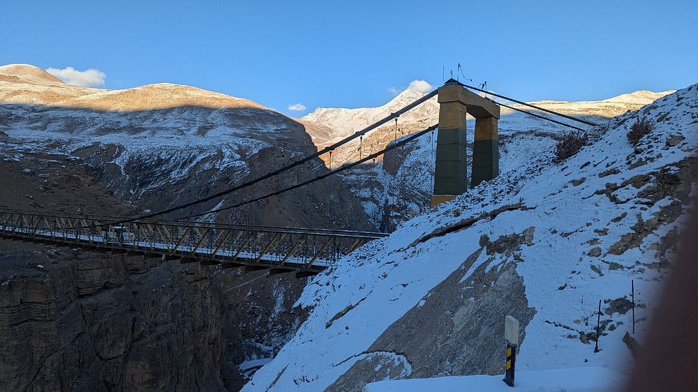
Spiti sits at a base elevation of roughly 3,800 meters. The roads in from Kinnaur via the Hindustan-Tibet Highway (NH-5) involve narrow ledges above the Spiti River gorge — sections where the tarmac ends, the cliff drops, and the BRO’s painted rock slogans (“Mountains are pleasure if you drive with leisure”) are not ironic. The route from Manali via Kunzum La (4,590 meters) is seasonally accessible, typically from June to September.
Key Monastery, perched above the main Spiti Valley at 4,166 meters, is a working Gelugpa Buddhist institution. The monastery was founded in the 11th century and has been damaged and rebuilt multiple times — the current structures are a layered accumulation of centuries, not a restoration project. Staying in the monastery guesthouse at Key village for two to three nights gives you access to morning and evening prayer sessions, which are open to respectful visitors.
Tabo Monastery in the lower Spiti Valley is older — founded in 996 CE — and contains some of the most important Buddhist murals and stucco sculptures in the Himalayan world. The Archaeological Survey of India has designated it a protected monument. The interiors are dim and the paintings are fragmentary in places, but the effect of being inside a 1,000-year-old living monastery is difficult to describe.
📍 Local Insight Tip: Spiti roads are genuinely unpredictable. In the summers of both 2023 and 2024, cloudbursts wiped out sections of the Pin Valley road for days at a time. Always carry two to three extra days of flexibility in your itinerary buffer — and a hard copy of your emergency contacts — Wahid Ali, Astamb Holidays.
Dharamshala and the adjacent Bir Billing (India’s paragliding capital) offer a gentler entry point into Himachal. The Triund Trek above McLeod Ganj is a well-worn but genuinely beautiful day-hike through oak and rhododendron to a ridge with 180-degree Dhauladhar views.
Uttarakhand: Garhwal Trails, the Valley of Flowers, and Sacred Confluences
Uttarakhand’s contribution to the Himalayan landscape is one of water. The Garhwal Himalayas are where the Ganges, Yamuna, Bhagirathi, Alaknanda, and Mandakini rivers originate or converge — at Gangotri, Yamunotri, Kedarnath, and Badrinath, which together form the Char Dham pilgrimage circuit.
These are not tourist sites with tourism infrastructure. Kedarnath at 3,583 meters, reachable by a 16-km trek from Gaurikund, draws hundreds of thousands of pilgrims annually. The 2013 Kedarnath floods reshaped the valley and remain a reference point for understanding how extreme weather events interact with high-altitude infrastructure. The rebuilt shrine and the surrounding landscape carry that weight.
For trekkers, Uttarakhand’s centrepiece is the Valley of Flowers National Park — a UNESCO World Heritage Site shared with Nanda Devi National Park. The valley blooms from late July through mid-August, when over 500 species of alpine flowers carpet a 87.5 sq km basin at 3,352 to 3,658 meters. The approach is from Govindghat, reached via Joshimath, and involves a 14-km trek to Ghangaria base camp.
📍 Local Insight Tip: The Valley of Flowers is a National Park — camping inside is prohibited and you must be back at Ghangaria before 5 p.m. The entry fee applies daily. Don’t rush it; the bloom is different on day two than day one as light and cloud change the colour palette completely — Wahid Ali, Astamb Holidays.
The Bugyals — high-altitude alpine meadows at 3,300 to 3,600 meters — are a quieter, equally beautiful option. Dayara Bugyal near Uttarkashi and Bedni Bugyal on the Roopkund trail are accessible without the permit overhead of a national park and see a fraction of the visitor traffic.
Uttarakhand’s revitalized trade routes — particularly the Milam Glacier Trek and the Kuari Pass Trek (also called the Curzon Trail, after Lord Curzon who walked it in 1905) — are being repositioned by sustainable tourism advocates as high-value, low-volume wilderness routes. They deserve the attention.
Sikkim & North East India: Rain-Kissed Valleys and the Shadow of Kanchenjunga
Sikkim is India’s smallest state and among its most ecologically distinctive. The state sits against the eastern Himalayas, where monsoon systems deliver serious rainfall — upward of 3,500 mm annually in parts of South Sikkim — creating a biodiversity corridor that includes over 550 orchid species, 600 butterfly species, and large populations of the red panda.
Kanchenjunga, at 8,586 meters, is the world’s third-highest peak and Sikkim’s presiding presence. The Kanchenjunga Base Camp Trek from Yuksom is an 8 to 12-day high-altitude route through forests and alpine zones that most trekkers outside India haven’t found yet. The approach via Dzongri, Thansing, and Goecha La (4,940 meters) delivers some of the most dramatic close-up views of a major Himalayan peak available to non-technical climbers anywhere in India.
Foreign nationals require an Inner Line Permit (ILP) for Sikkim, and additional Protected Area Permits (PAP) for high-altitude trek zones. These can be arranged through registered tour operators in Gangtok or in advance through the Sikkim Tourism portal.
📍 Local Insight Tip: October to early November is the clearest window for Kanchenjunga views. The spring window (mid-March to May) is excellent for rhododendron bloom but cloud cover builds by mid-morning at elevation — Wahid Ali, Astamb Holidays.
Arunachal Pradesh — particularly the Tawang Valley with its 400-year-old Tawang Monastery, the largest Buddhist monastery in India — represents the next frontier of serious Himalayan travel. All visitors require both a Restricted Area Permit (RAP) and an Inner Line Permit (ILP). Getting there involves a scenic road journey over Sela Pass (4,170 meters), which remains one of the most dramatic mountain drives in India’s northeast.
Kashmir: Alpine Meadows, Glacial Lakes, and High-Pass Treks
Kashmir requires nuance. Travel advisories, political context, and ground conditions have varied significantly over the years. As of late 2025, the Kashmir Valley — particularly Srinagar, Pahalgam, Sonamarg, and Gulmarg — has seen a strong recovery in tourism infrastructure and visitor numbers. Standard travel precautions apply, and checking the latest advisories from India’s Ministry of External Affairs before travel is standard practice.
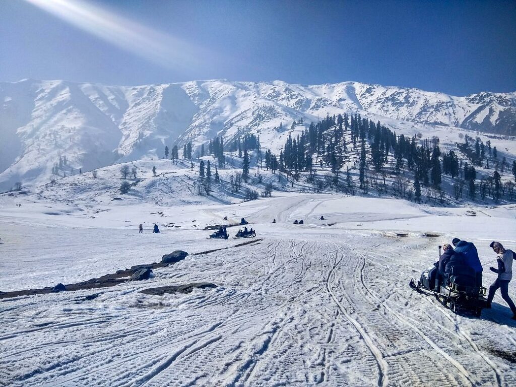
The landscape of Kashmir’s higher zones is defined by sweep. Pahalgam at 2,440 meters serves as the base for the Amarnath Yatra pilgrimage and as the trailhead for some of the most scenic multi-day routes in the western Himalayas. Gulmarg — the site of one of the world’s highest gondola ski lifts — operates year-round for skiers in winter and alpine meadow walkers in summer.
The Great Lakes Trek is Kashmir’s finest multi-day wilderness route. The 65-70 km circuit from Sonamarg to Naranag (or vice versa) passes through seven high-altitude glacial lakes — Vishansar, Krishansar, Gadsar, Satsar, Gangabal, and Nundkol — at elevations between 3,500 and 4,100 meters. The trail crosses multiple high passes including Nichnai Pass (4,100m) and Gadsar Pass (4,200m).
The Great Lakes Trek operates in a narrow summer window of July to mid-September. Snow can arrive on the passes as early as late August, and the trail requires physical fitness, proper gear, and ideally a licensed guide. It is world-class wilderness trekking that most international travelers have never heard of — which is precisely what makes it worth doing right now.
📊 Regional Comparison Matrix: Navigating the Indian Himalayas
| Region / Valley | Average Base Elevation | Peak Season | Entry Permit Required? | Ideal For | Key Technical Challenge |
|---|---|---|---|---|---|
| Ladakh | 3,500m (11,500 ft) | June to September | Yes (PAP for border lakes) | Monastic culture, barren high-altitude deserts, lake trekking | Severe cold-start acclimatization on arrival |
| Spiti Valley | 3,800m (12,500 ft) | June to September | Yes (foreign nationals via Kinnaur/Sumdo) | Remote isolation, fossil hunting, raw road trips | Highly unpredictable dirt roads and landslide zones |
| Valley of Flowers | 3,300m to 3,650m | July to August | Yes (National Park entry fee) | Alpine flora photography, beginner-to-intermediate trekking | Muddy trails and continuous rain during peak bloom |
| West Sikkim | 2,000m to 4,000m | Oct–Nov / Mar–May | Yes (ILP for Sikkim; PAP for treks) | Kanchenjunga views, rhododendron forests, ethnic culture | High humidity, steep climbs, dense forest navigation |
| Kashmir Great Lakes | 3,500m to 4,200m | July to mid-September | No (Indian nationals); advisories apply | High alpine lakes, wilderness trekking, mountain photography | High passes, weather volatility, remote rescue logistics |
| Arunachal Pradesh | 2,000m to 4,200m | March to May / Sept–Nov | Yes (RAP + ILP required) | Remote Buddhist culture, dramatic mountain roads | Multi-permit logistics, limited road infrastructure |
🏔️ The Modern Expedition Checklist: Preparing for the Indian Himalayas
High-Altitude Acclimatization and Wilderness Medical Safety
Acute Mountain Sickness (AMS) begins when the body’s oxygen uptake can’t keep pace with the altitude gain. The threshold for most people is around 2,500 meters, though individual sensitivity varies significantly. At 3,500 meters (Leh altitude), symptoms including headache, nausea, dizziness, and disrupted sleep are common in the first 24 to 48 hours.
The cardinal rule: ascend gradually. Once above 3,000 meters, the standard guideline is to increase sleeping altitude by no more than 300 to 500 meters per day. If you’re driving from Manali to Leh over two days on the Manali-Leh Highway, you’re doing this correctly. If you fly directly into Leh, your first two days must be complete rest — no treks, no high-altitude day trips, no strenuous activity.
Hydration matters disproportionately at altitude. Aim for 3 to 4 liters of water daily. Avoid alcohol for the first 48 hours at elevation — it accelerates dehydration and masks early AMS symptoms.
Acetazolamide (Diamox) at 125mg twice daily is a commonly prescribed prophylactic that stimulates breathing rate and speeds acclimatization. It requires a doctor’s prescription in India. If you’re predisposed to AMS or have had altitude issues before, speak to a wilderness medicine physician before departure. Consult our detailed breakdown on wilderness safety protocols and emergency communication before planning any high-altitude route.
Key AMS warning signs that require immediate descent:
- Severe headache that doesn’t improve with hydration or paracetamol
- Ataxia (loss of balance or coordination)
- Altered mental state or confusion
- Breathlessness at rest
- Wet, gurgling cough (sign of High Altitude Pulmonary Edema — a medical emergency)
Descent of 300 to 500 meters is almost always immediately effective. Never ignore symptoms and push higher.
Inner Line Permits (ILP), Border Logistics, and Protected Area Regulations
The Indian Himalayas involve a significant amount of border zone bureaucracy — partly because large sections of this region share international boundaries with China, Pakistan, and Bhutan. Permits are non-negotiable and enforced at checkpoints.
For Indian nationals:
| Region | Permit Type | Where to Obtain | Approx. Fee (INR) |
|---|---|---|---|
| Nubra Valley, Ladakh | Protected Area Permit | Online (e-permit portal) or Leh DC office | ₹400 per person |
| Pangong Tso, Tso Moriri | Protected Area Permit | Online or Leh DC office | ₹400 per person |
| Sikkim (all zones) | Inner Line Permit | Online (Sikkim e-ILP portal) | Free for Indian nationals |
| Kanchenjunga Trek (Sikkim) | Trekking Permit + PAP | Via registered Sikkim tour operator | ₹200–₹600 per day |
| Arunachal Pradesh | Inner Line Permit | Online (Arunachal ILP portal) | ₹100–₹200 |
For foreign nationals:
- Ladakh (Nubra, Pangong, Tso Moriri, Hanle): Protected Area Permits required; must apply in Leh through a registered operator in groups of minimum 2 persons.
- Sikkim: ILP required; available from the Foreigners Registration Offices (FRO) in Siliguri, Kolkata, Delhi, or online.
- Arunachal Pradesh: Restricted Area Permit (RAP) + ILP. Apply in advance; processing takes 3 to 5 working days. Not all nationalities are eligible — Chinese, Pakistani, and a few other nationals require additional clearances.
- Spiti Valley: Foreign nationals traveling via the Kinnaur–Sumdo route (Tibet border zone) require an ILP.
Always carry photocopies and digital backups of all permits. Checkpoints are regular and officers do cross-verify against databases.
Packing and Gear for High Altitudes
High-altitude Himalayan travel requires a systematic approach to clothing. The three-layer system is the standard:
- Base layer: Moisture-wicking merino wool or synthetic fabric. Avoid cotton — it holds sweat against the skin and accelerates hypothermia at elevation.
- Mid layer: Fleece or down insulation. A 600-fill down jacket is adequate for most summer-season Ladakh and Spiti travel; increase to 700-fill or a hybrid jacket for anything above 4,500 meters in September.
- Outer layer: A windproof, waterproof shell. In Uttarakhand during monsoon season, waterproofing is critical. In Ladakh, wind protection matters more than rain resistance.
Non-negotiable gear items:
- UV-400 glacier sunglasses — High-altitude UV exposure is severe; snow blindness is a real risk above 4,000m
- Sturdy ankle-supporting trekking boots — broken-in, not new
- Personal water purification — SteriPen UV purifiers or iodine tablets; reduces plastic waste significantly
- Blister management kit — moleskin, antiseptic
- Emergency communication device — a rented Garmin InReach is worth carrying on any remote multi-day route
- High-SPF lip balm and sunscreen (SPF 50+) — altitude amplifies UV exposure
For a complete breakdown of equipment selection for different Himalayan terrain types, see our guide on evaluating gear and choosing the right trekking equipment.
🌱 Eco-Tourism and Sustainable Stewardship in the Mountains
Waste Reduction and “Leave No Trace” Principles
Solid waste management in high-altitude environments is a genuine crisis. Leh has a functioning municipal waste system. Spiti, Nubra, and Kanchenjunga corridor do not. Plastic bottles, food wrappers, and trekking detritus accumulate at campsites and along trail edges in ways that are visible from a distance.
Leave No Trace in the Himalayan context means:
- Pack out everything non-biodegradable. There is no mountain fairy collecting your empty protein bar wrapper at 4,500 meters.
- Use refillable water bottles and filtration. Every plastic bottle you carry up is a bottle you must carry down.
- Camp on established surfaces. Fragile alpine vegetation takes years to recover from a single night of heavy trampling.
- Human waste disposal: Use established toilet facilities at campsites. In the absence of facilities, bury waste at least 30 meters from any water source and 15cm deep.
- Do not pick flowers, collect stones, or disturb cultural artifacts. This applies emphatically in the Valley of Flowers and around monastery complexes.
Several Ladakh-based operators now run “clean treks” where participants carry a small additional load of trail litter on the exit day. It’s a simple, effective model worth choosing when booking guided treks.
Supporting Local Economies: Homestays vs. Commercial Resorts
The economic argument for homestays isn’t just ethical — it’s practical. A family-run homestay in Turtuk village (Ladakh), a monk-supervised guesthouse at Key village (Spiti), or a community homestay in Yuksom (Sikkim) delivers something no luxury resort can replicate: a direct relationship with the place you’re in.
Homestay accommodation in the Himalayan region typically costs between ₹800 and ₹2,500 per person per night including meals. Meals are almost always home-cooked — thukpa, tsampa porridge, butter tea, momos — using locally sourced produce. You are eating the actual food of the region, not a hotel’s interpretation of it.
Commercial resorts in Leh and Srinagar serve an important market segment and have made quality improvements. But for every night you spend at a boutique eco-camp rather than a franchise hotel, the revenue stays within the community.
Himachal Pradesh’s HPTDC homestay network and Sikkim’s community homestay registration system both provide vetted options with clear quality standards. Booking through registered local operators also ensures your permit logistics are handled by people who know the checkpoints.
🧭 Experiencing the Indian Himalayas with XploreHeaven
The Indian Himalayas in 2026 are at a specific moment in their travel history — recognized globally, not yet overwhelmed. That window won’t stay open indefinitely.
What makes this region genuinely different from other high-profile adventure destinations is the depth of what’s available. A week in Ladakh and a week in Spiti are different experiences from the same week in two Scandinavian cities. The cultural, ecological, and physical distance between Nubra Valley and the Valley of Flowers is not just geographic — it’s textural.
Arriving well-prepared makes the difference between a journey that expands your frame of reference and one that becomes a stressful logistics problem at 4,000 meters. That means acclimatizing properly, carrying the right gear, obtaining permits in advance, and choosing accommodation and operators who have real stakes in the destination’s future.
At Astamb Holidays, we’ve worked with travelers across this entire corridor — from first-time Ladakh visitors to experienced trekkers attempting the Kanchenjunga circuit. The constant across all of them: the ones who slow down, ask questions, and allow room for the unexpected come home changed in ways they didn’t anticipate.
XploreHeaven’s curated guides can help you plan the specifics — itineraries matched to your fitness level and timeline, gear recommendations calibrated to season and terrain, and real-time advisory context for border zones and permit requirements. Start with the region that calls to you. Then go deeper than you planned.
❓ Frequently Asked Questions About the Indian Himalayas
Q: What is the best month to visit the Indian Himalayas?
The answer depends on the region. For high-altitude arid zones like Ladakh and Spiti Valley, the accessible window is June to September, when passes like Khardung La and Kunzum La are clear of snow. For Eastern Himalayan regions like Sikkim, or lower-altitude trekking in Uttarakhand, the best periods are March to May (spring blooms, clear views) and October to November (crisp autumn visibility, minimal rain). Kashmir’s Great Lakes Trek operates specifically between July and mid-September.
Q: Do I need an Inner Line Permit (ILP) to travel in the Indian Himalayas?
Yes, for several zones. Nubra Valley and Pangong Tso (Ladakh), parts of Spiti Valley near the Tibetan border, all of Sikkim, and Arunachal Pradesh require permits for both Indian and foreign nationals. Some permits are obtainable online through state portals; others require processing through registered local tour operators in Leh, Shimla, or Gangtok. Always check the current regulations before travel, as border zone permit rules change periodically.
Q: How can I prevent altitude sickness (AMS) when visiting Leh or Spiti?
The most effective approach is gradual acclimatization. If flying into Leh (3,500m), rest completely for the first 36 to 48 hours. If traveling by road, don’t increase sleeping altitude by more than 300 to 500 meters per day once above 3,000m. Stay well-hydrated, avoid alcohol in the first 48 hours, and speak to a doctor about Acetazolamide (Diamox) if you have a history of AMS. If symptoms worsen despite rest, descend immediately — no view is worth compromising your health.
Q: What does “Leave No Trace” mean for trekking in the Himalayas?
Leave No Trace is a set of outdoor ethics guidelines designed to minimize human impact on fragile ecosystems. In the Himalayas, this means carrying out all non-biodegradable waste including plastic bottles and packaging, camping only on established surfaces, disposing of human waste at least 30 meters from water sources, and not disturbing natural objects, plants, or cultural artifacts. In UNESCO-designated areas like the Valley of Flowers, these rules are legally enforced.
Q: Is the Kashmir Great Lakes Trek safe for first-time trekkers?
The Great Lakes Trek is a moderately challenging route — appropriate for travelers with prior multi-day trekking experience but not a technical mountaineering background. Daily stages range from 10 to 18 km with significant elevation changes. High passes above 4,000 meters require physical fitness and proper acclimatization. Weather can change rapidly. First-timers should complete the trek with a licensed local guide and should have done at least one prior 4–5 day high-altitude trek before attempting the circuit.
Q: What is the approximate budget for a two-week Ladakh trip from Mumbai?
A realistic mid-range budget for 14 days in Ladakh traveling from Mumbai:
| Expense Head | Approximate Cost (INR) |
|---|---|
| Return flights (Mumbai–Leh) | ₹12,000 – ₹22,000 |
| Accommodation (homestay/mid-range) | ₹1,000 – ₹2,500/night |
| Local transport (private cab with driver) | ₹3,500 – ₹5,000/day |
| Meals (local restaurants / dhabas) | ₹500 – ₹1,000/day |
| Permits (all zones) | ₹2,000 – ₹4,000 |
| Guide + entry fees | ₹3,000 – ₹5,000 |
| Total (approximate) | ₹55,000 – ₹90,000 per person |
Costs increase significantly with luxury tent camps, premium experiences, or specialized trekking guides.
👤 About the Author
Wahid Ali is a seasoned travel professional and Operations Lead at Astamb Holidays, Mumbai. With extensive experience in crafting travel experiences and destination insights, Wahid combines practical travel logistics expertise with engaging storytelling to help travelers explore hidden gems across India and beyond. His work blends expert travel planning with a passion for culturally rich and nature-oriented destinations.
Connect with Wahid Ali on LinkedIn | xploreheaven.com
📚 References
This article is backed by authoritative sources and research.
- American Express Travel 2026 Trending Destinations Report — American Express
- Leh-Ladakh Tourism — Official Jammu & Kashmir Tourism Portal
- Atal Tunnel — Border Roads Organisation (BRO), Ministry of Defence, India
- Nanda Devi and Valley of Flowers National Parks — UNESCO World Heritage Centre
- Inner Line Permit for Sikkim — Sikkim Tourism Official Portal
- Arunachal Pradesh Restricted Area and Inner Line Permit — Arunachal Pradesh Government
- Snow Leopard Conservation in Hemis National Park — Snow Leopard Trust
- Acute Mountain Sickness — Wilderness Medical Society Clinical Practice Guidelines
- Leave No Trace Seven Principles — Leave No Trace Center for Outdoor Ethics
- Kanchenjunga (8,586m) — National Geographic Encyclopedic Entry
- Valley of Flowers National Park — Wildlife Institute of India
- Great Lakes Kashmir Trek Route Information — Jammu & Kashmir Tourism
- Spiti Valley Road Conditions and BRO Advisories — Border Roads Organisation
- Tabo Monastery Heritage — Archaeological Survey of India
- Community Homestay Network, Sikkim — Responsible Tourism Initiative, Sikkim
Disclaimer: Travel conditions, permit requirements, and safety advisories in border zones can change. Always verify current entry requirements and check the latest travel advisories from India’s Ministry of External Affairs and your home country’s foreign affairs department before travel.