Hidden Gems

Why Indian Travelers Are Choosing Offbeat Destinations Over Tourist Hotspots

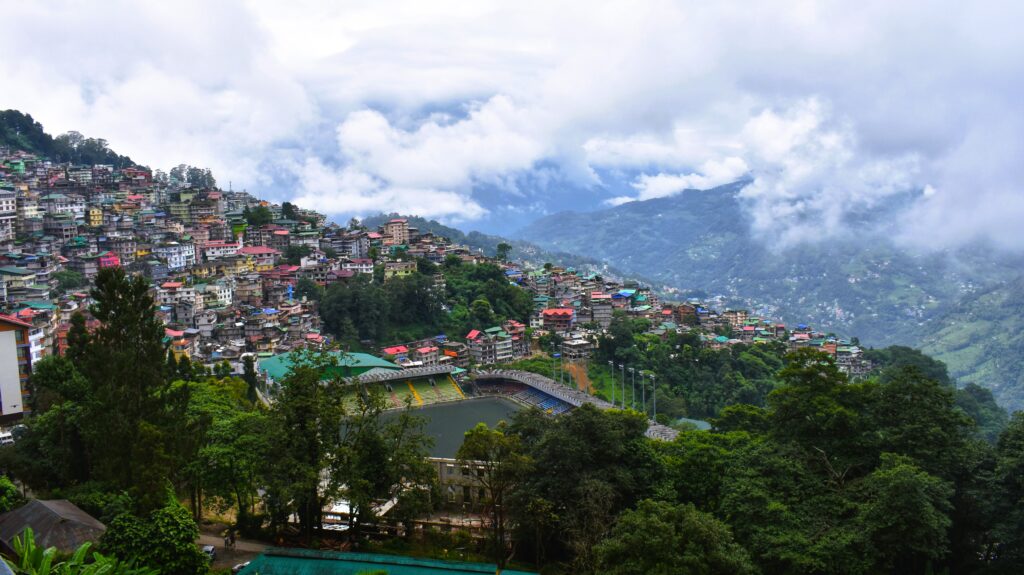
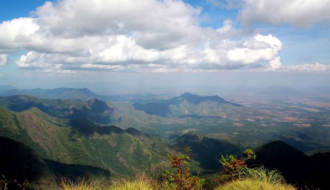
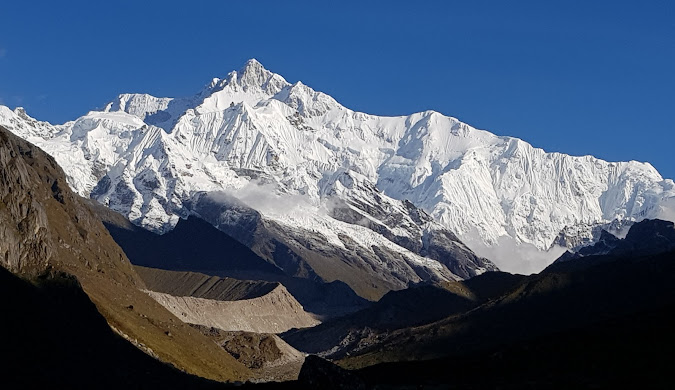
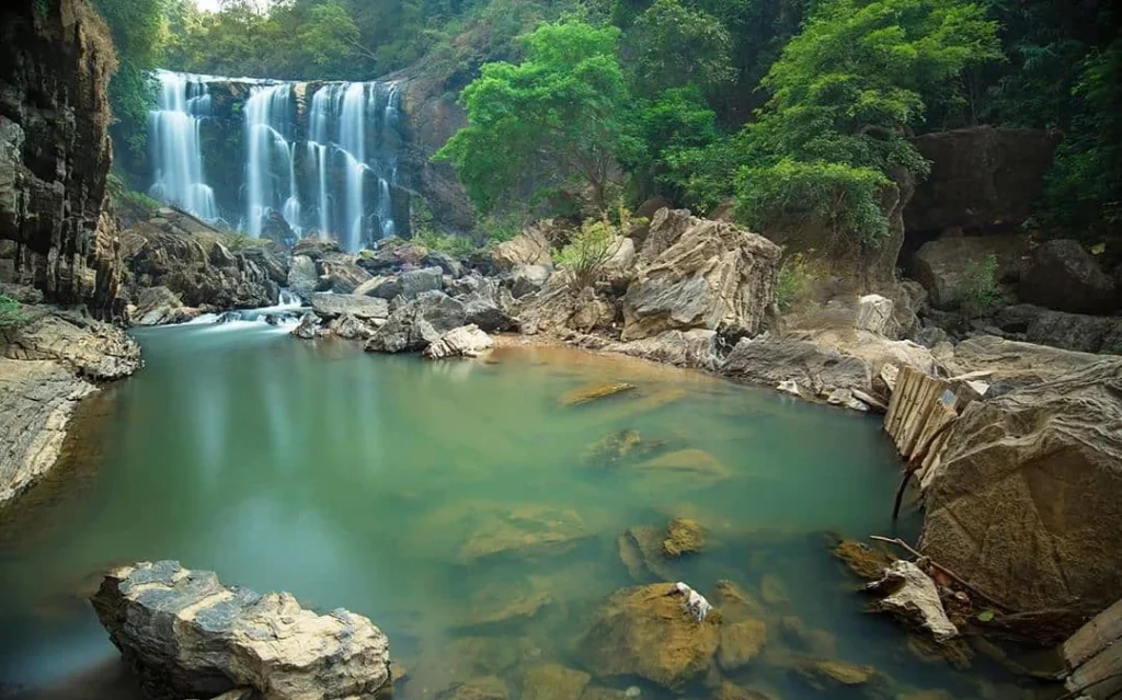
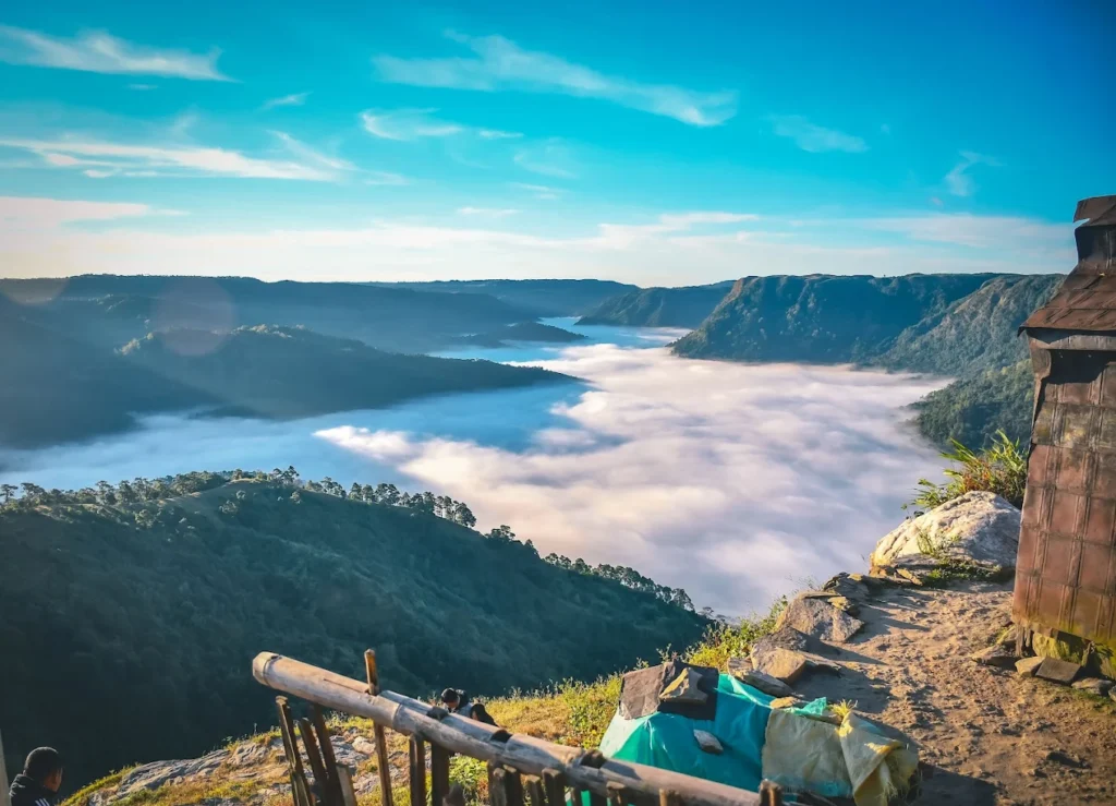
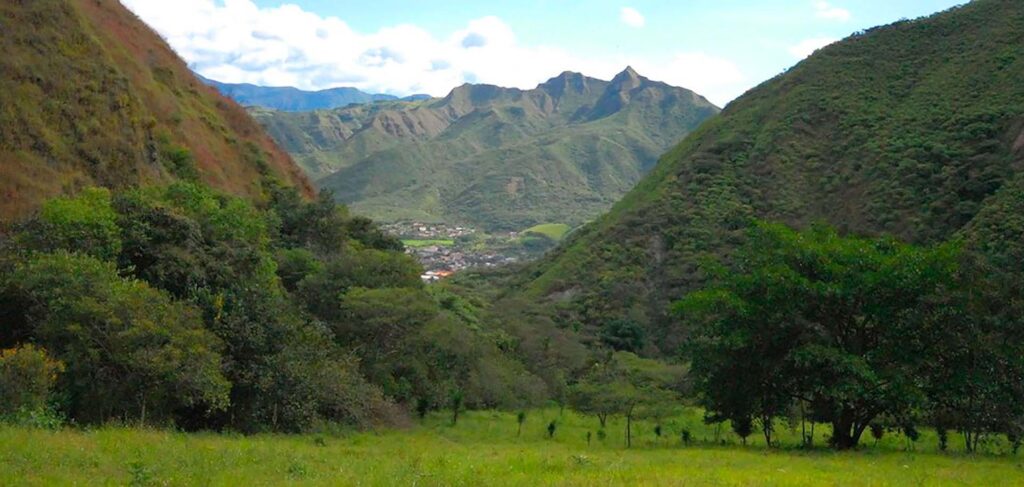
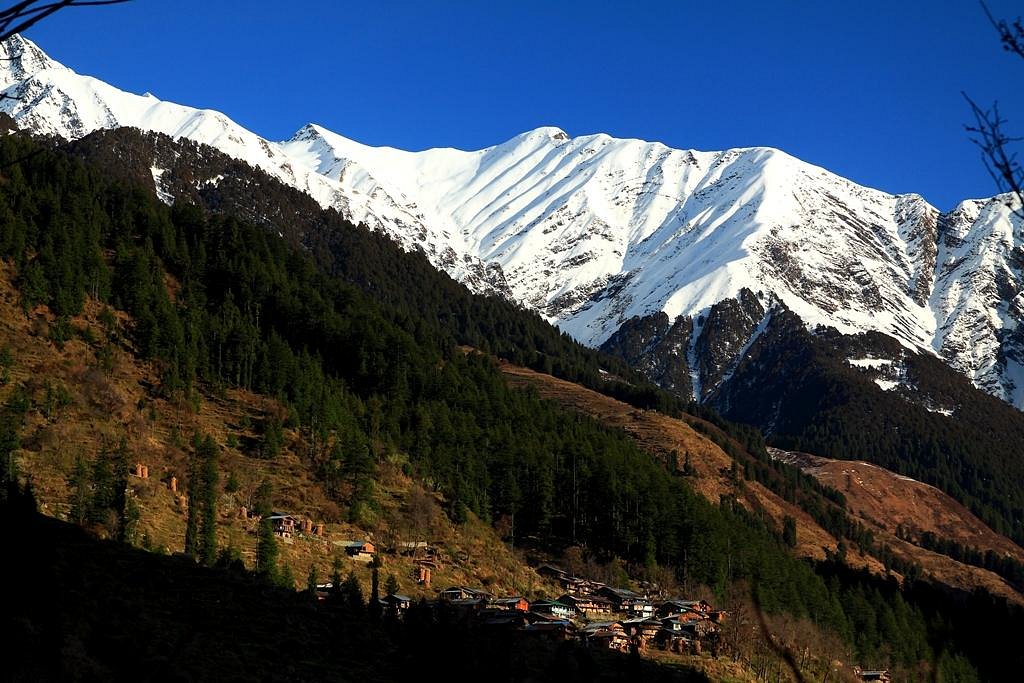
By Wahid Ali | Operations Lead, Astamb Holidays, Mumbai The numbers at Astamb Holidays have been telling a clear story for the past two years. Inquiries for offbeat destinations in India — places like Tirthan Valley, Toranmal, and Gurez Valley — have gone up by nearly 40% year-on-year. Meanwhile, bookings for the usual suspects — Shimla, Manali, Goa — have either plateaued or started declining among our repeat traveler base. This isn’t a coincidence, and it isn’t just a social media trend. Something more fundamental is shifting in how Indian travelers think about holidays. After years of planning tours across the country, I can say with confidence: the era of checklist tourism is ending, and something richer is taking its place. Why Are Offbeat Destinations Becoming India’s Biggest Travel Trend? 🌿 Indian travel culture has evolved dramatically since 2019. The post-pandemic reset gave millions of travelers a chance to ask a question they’d never had time to consider before: What do I actually want from a trip? The answers are driving one of the most interesting shifts in domestic tourism history. The Overtourism Problem at Popular Destinations Overtourism is no longer an abstract concern. It’s a visible, lived experience for anyone who has tried to visit Shimla Mall Road in May or reach Dudhsagar Falls in Goa on a December weekend. Shimla receives roughly 50 lakh visitors annually, a number that strains a city built for a fraction of that load. The Himachal Pradesh Tourism Development Corporation has acknowledged the growing pressure on infrastructure — water supply, waste management, road capacity — all of which directly degrade the visitor experience. Destination carrying capacity, the maximum tourist volume a location can absorb without environmental or social harm, is regularly breached at major Indian hotspots. In Goa, the situation is similarly stretched. Baga Beach, Calangute, and Anjuna handle combined footfall during peak season that overwhelms local sanitation systems and pushes accommodation prices to levels comparable with Bangkok or Bali. The result: travelers pay more, fight more crowds, and often leave feeling underwhelmed. This means the places that once defined Indian travel are now working against the very experiences that made them famous. In practice, when a destination exceeds its carrying capacity, the quality gap between marketing images and on-ground reality becomes embarrassing. Travelers Want Experiences, Not Checklists For years, the dominant travel behavior in India was what I’d call flag-planting — visiting a place long enough to photograph it and check it off a list. Experiential tourism is the direct cultural pushback against that approach. Travelers today want to participate, not just observe. They want to cook with a local family in Ziro Valley, learn natural dyeing techniques from an artisan in Kutch, or spend an evening listening to folk music in a Spiti Valley monastery. These aren’t premium experiences available only to luxury travelers — many of them cost far less than a generic hotel stay in a tourist hotspot. Meaningful travel, as an industry concept, measures trip value not by distance covered but by depth of engagement. The shift is real, and it’s changing what travelers are willing to book. Social Media Has Changed How We Discover Places Instagram and YouTube Shorts have fundamentally rewired destination discovery. In 2018, a traveler planning a trip to Himachal Pradesh would default to Shimla or Manali — destinations with strong brand recognition built over decades. By 2023, that same traveler might discover Jibhi through a 45-second reel posted by a solo traveler from Pune, plan their entire trip using comments and DMs, and book a homestay directly with the owner. This disintermediation of traditional travel media is powerful. Micro-destinations that previously had zero marketing budgets now gain organic visibility through user-generated content. Chopta in Uttarakhand, Kalap Village in Uttarkashi, and Sandhan Valley in Maharashtra — all became traveler conversations before tourism boards even noticed them. The flip side is that viral destinations can overcrowd faster than before. This makes the window for genuine offbeat discovery shorter, which is exactly why planning ahead matters. Why Gen Z Is Leading the Offbeat Travel Movement Gen Z travelers (born between 1997 and 2012) are rewriting the rules. They value sustainability, authenticity, and flexibility over comfort and status signaling. A significant number work remotely, which means a workcation in Tirthan Valley or Kasol for three weeks is as practical as a weekend break used to be. This remote work travel behavior is structurally different from traditional vacation planning. It doesn’t require peak-season timing, preset itineraries, or proximity to airports. It rewards destinations with decent Wi-Fi, peaceful environments, and affordable long-stay options — criteria that favor offbeat locations overwhelmingly. Flexible travel also means Gen Z travelers are willing to visit during shoulder or off-peak seasons, which further distributes pressure away from standard tourist circuits. Their values around responsible tourism and environmental impact are real purchase drivers, not just stated preferences. What Exactly Is an Offbeat Destination? 🗺️ Before going further, it helps to be precise about what we mean — because this term gets stretched in all directions. Definition An offbeat destination is a location that offers genuine travel value — natural beauty, cultural richness, or unique experiences — but sits outside mainstream tourist circuits and lacks the commercial tourism infrastructure of established hotspots. These destinations typically have lower annual visitor counts, limited branded accommodation, and stronger community-to-visitor ratios. Characteristics Hidden Gem vs. Offbeat Destination These terms overlap but aren’t identical. A hidden gem is a destination almost no one knows about — information is limited, access may be difficult, and it may lack even basic traveler infrastructure. An offbeat destination, by contrast, is discoverable — it has homestays, some traveler reviews, and a small but established visitor base. In practice, most travelers are better served by offbeat destinations than true hidden gems, which require experienced planning to navigate safely. Tourist Hotspots vs. Offbeat Destinations — Which Offers Better Value? 💰 Let’s put the comparison into concrete terms, because the value gap is larger than most travelers

Why Indian Travelers Are Choosing Offbeat Destinations Over Tourist Hotspots Read More »

Panoramic view of Gangtok city surrounded by Himalayan mountains during a Sikkim tour

Sikkim Tour Guide 2026: Best Places, Budget, Itinerary & Hidden Gems

If you’ve been putting off a Sikkim tour because you weren’t sure where to start, this guide will change that. Sikkim isn’t just another hill station — it’s one of the most logistically distinct, culturally layered, and visually dramatic destinations in the entire Indian subcontract. But it also comes with entry permits, altitude risks, and route planning that can trip up first-timers. I’ve spent years managing Northeast India itineraries from our operations desk at Astamb Holidays in Mumbai, and what I’ve found is that travelers who do their homework before arriving have a completely different experience from those who wing it. This guide covers everything — the best places to visit, realistic budgets in INR, seasonal windows, permit requirements updated for 2026, and a few corners of Sikkim that most group tours will never show you. 🏔️ Why a Sikkim Tour Is Different From Other Himalayan Trips Sikkim sits at a geographic and political crossroads that no other Indian hill destination can match. The state shares borders with Tibet (China) to the north and east, Nepal to the west, and Bhutan to the southeast. This proximity to three international boundaries means the Indian government controls tourist access through a mandatory permit system — the Inner Line Permit (ILP) and Protected Area Permit (PAP) — which fundamentally shapes how you plan your itinerary. Compare this to Himachal Pradesh or Uttarakhand, where you can drive anywhere, book hotels on arrival, and improvise your route. In Sikkim, especially in North Sikkim and parts of East Sikkim, your vehicle, your guide, and your permit all need to be pre-arranged through a Gangtok-registered agency. That’s not a drawback — it’s actually what keeps these areas cleaner, less crowded, and more ecologically intact than most Himalayan zones. Sikkim Tourism has deliberately adopted a controlled-access model. There are no budget airline flights directly into Sikkim, no expressways cutting through fragile zones, and no mass-market hotel chains along the Yumthang corridor. The state’s approach has earned it recognition as India’s first fully organic state. For travelers increasingly moving away from the noise of Shimla, Manali, or Mussoorie — all of which now resemble overcrowded weekend getaways — Sikkim offers a rare contrast. The Tibeto-Buddhist cultural influence is visible everywhere: in the prayer flags strung across mountain passes, in the centuries-old monasteries overlooking river valleys, and in the cuisine. This isn’t branding — it’s an authentic reflection of the Lepcha, Bhutia, and Nepali communities who have lived here across generations. When I plan itineraries for travelers at Astamb Holidays, the first thing I tell them is: Sikkim requires patience, preparation, and a willingness to slow down. Those who do walk away with some of the most meaningful travel experiences of their lives. 📍 Best Places for Your Sikkim Tour Gangtok — The Basecamp Altitude: 5,410 feet (1,650 metres) Recommended Stay: 2–3 nights Crowd Density: High (8/10) How to Reach: Shared taxis from New Jalpaiguri (NJP) take approximately 4.5–5 hours and cost around ₹250–₹350 per seat. Private cabs from NJP run ₹2,500–₹3,500. Every Sikkim itinerary begins in Gangtok, the state capital and your operational hub for permits. It’s where you register for North and East Sikkim permits, arrange your Sikkim-registered vehicles, and get acclimatized before heading to higher altitudes. Beyond logistics, Gangtok has genuine character. The MG Marg pedestrian zone is where local life happens in the evenings. Rumtek Monastery, about 24 km from the city center, is one of the most significant Kagyu Buddhist monasteries outside Tibet. Enchey Monastery on the hilltop above the city is a quieter, less-visited alternative with better mountain views at sunrise. The Namgyal Institute of Tibetology is undervisited for a place of its scholarly importance. It houses one of the largest collections of Tibetan manuscripts and Buddhist artifacts outside Lhasa. 💡 Local Insight Tip by Wahid Ali: Don’t try to rush Gangtok in a single day. Spend your first evening on MG Marg and your second morning at Enchey Monastery before the day-trippers arrive. Gangtok is also where you must confirm your vehicle bookings and permit status for onward travel — ideally the night before departure. Tsomgo Lake (Changu Lake) — The Sacred Glacier Mirror Altitude: 12,313 feet (3,753 metres) Recommended Stay: Day trip from Gangtok Crowd Density: Very High (9/10) How to Reach: Private vehicles from Gangtok cover the 40 km distance in approximately 1.5 hours. Only Sikkim-registered vehicles are permitted on this route. Costs around ₹1,200–₹1,800 per vehicle as a day trip. Tsomgo Lake is a glacial lake that sits along the Gangtok–Nathula road in East Sikkim. The name means “source of the lake” in the Bhutia language. It changes character dramatically by season — frozen in winter, covered in rhododendrons in spring, and often shrouded in mist during monsoon. The best clarity and crowds come in October–November. This is one of the most visited spots in all of Sikkim, which means early arrival is essential. Most tour vehicles converge between 10 AM and 2 PM. If you arrive by 8 AM, you’ll often have the lake almost to yourself. 💡 Local Insight Tip by Wahid Ali: The temperature at Tsomgo can drop 15–20°C compared to Gangtok even in summer. Always carry a warm layer, regardless of how warm the city feels. Tourists who arrive in summer clothing regularly get caught off-guard by the wind chill at this altitude. Nathula Pass — The Frontier Altitude: 14,140 feet (4,310 metres) Recommended Stay: Half-day add-on from Tsomgo trip Crowd Density: High (7/10, due to restricted entry quota) How to Reach: 56 km from Gangtok via the Tsomgo route. Entry is only through pre-approved Nathula Day Permits, available through registered agencies. The pass is closed on Mondays and Tuesdays. Nathula Pass marks the India–China border. It was part of the ancient Silk Route and only reopened for limited trade and tourism in 2006. You’ll see Indian Army border posts, Chinese military structures on the other side, and — if weather is clear — a spectacular ridge-line panorama. Altitude sickness is a real concern at

Sikkim Tour Guide 2026: Best Places, Budget, Itinerary & Hidden Gems Read More »

Kodaikanal Tourist Places 2026: Top Attractions, Hidden Gems & Travel Guide

I’ve been sending groups to the hills for over 20 years now, and every single time someone from Chennai, Bangalore, or Mumbai asks me, “Where should I go for a quick 2-3 day break that won’t drain my wallet?” — my answer is almost always the same: Kodaikanal. The kodaikanal tourist places are genuinely unlike anything else in South India. Sitting at 2,133 metres above sea level in the Western Ghats of Tamil Nadu, this hill station is cool, misty, and refreshingly laid-back. In 2026, with more people wanting to escape city heat and deadlines, Kodaikanal has become one of the smartest short getaways you can plan. What Are the Best Kodaikanal Tourist Places? (Quick Answer) The top kodaikanal tourist places are Kodai Lake (boating + cycling), Coaker’s Walk (panoramic valley views), Pillar Rocks (three towering granite columns), Silver Cascade Falls (best during monsoon), Berijam Lake (wildlife and forest), and Guna Caves (famous from Tamil cinema). These 6 spots alone can fill a solid 2-day itinerary for most travellers. 🌿 Why Visit Kodaikanal? Let me be direct. Kodaikanal is not Ooty. It’s quieter, less commercial, and far more intimate. The temperature here ranges between 8°C and 20°C in winter and 13°C to 24°C in summer — a dream for anyone coming from the 38°C streets of Chennai or Mumbai. The hill station sits right in the heart of the Palani Hills, which form part of the larger Western Ghats range. This means you get dense pine forests, rolling grasslands, and valley views that will actually stop you mid-scroll on your phone. For couples, the misty atmosphere and private corners around the lake make it one of South India’s most romantic destinations. For solo travellers and groups, the trail access to off-the-beaten-path spots makes it just as rewarding. And since Madurai is only about 120 km away, the drive up through those spectacular ghats is part of the experience. 🏔️ Top Kodaikanal Tourist Places You Must Visit 🌊 Lakes — Kodai Lake & Berijam Lake Kodai Lake is the centrepiece of the hill station — and the first place I always send first-time visitors. This 60-acre, star-shaped, man-made lake was built in 1863 by Sir Vere Henry Levinge, the then Collector of Madurai, and has been welcoming visitors ever since. Berijam Lake is a completely different experience. Located 22–23 km from town inside a reserved forest, this natural freshwater lake requires a forest department permit (free, but limited entries). The drive itself passes through thick shola forests and is worth the trip. Keep an eye out for bison, deer, and monkeys along the way. 👁️ Viewpoints — Coaker’s Walk & Dolphin’s Nose Coaker’s Walk is a 1 km paved promenade built along the edge of a mountain — and on a clear day, you can see all the way to Madurai. I always tell my clients: go early morning, skip the weekend rush, and carry a light jacket. The views of the valley below, especially when the clouds are at eye level, are something else. Dolphin’s Nose is a flat rock jutting out over the valley at about 6,600 feet. The viewpoint offers a wide look at the Pambar Valley below. It’s about 8 km from town and best visited in the morning before mist rolls in. Combine this with Echo Rock nearby. 🗿 Attractions — Pillar Rocks & Guna Caves Pillar Rocks is one of the most dramatic sights in Kodaikanal. Three massive granite columns rise nearly 400 feet from the earth, often half-covered in mist. There’s a small garden and viewing platform here, making it a great photo stop. Guna Caves (previously called Devil’s Kitchen) sits just beside Pillar Rocks and became famous after Kamal Haasan’s 1991 Tamil film “Guna” was shot here. The cave itself is fenced off due to safety concerns, but the surrounding pine forest trails are open and genuinely atmospheric. 💧 Waterfalls — Silver Cascade Falls Silver Cascade Falls drops 180 feet down a rocky cliff face, 8 km below Kodaikanal on the Kodaikanal–Madurai road. It’s formed by the overflow of Kodai Lake and is best seen during and after the monsoon when the flow is strongest. Local vendors selling fresh fruits and snacks line the roadside, making it a nice pit stop on your way up or down the ghat. 🌄 What Are the Hidden Tourist Places in Kodaikanal? This is where it gets interesting. These are spots I personally recommend to travellers who’ve already “done” the main circuit and want something real. Vattakanal is a small hamlet about 2 km from Kodai Lake and a favourite among solo trekkers and backpackers. The waterfall at Vattakanal is peaceful, surrounded by thick forest, and rarely crowded. The Dolphin’s Nose viewpoint is actually best accessed via a trek from Vattakanal. Poombarai Village is a terraced farming community about 20 km from Kodaikanal town. The view from the hilltop overlooking the village and surrounding valley is stunning — and almost no tour operator sends tourists here. Go for the quiet, stay for the photos. Mannavanur Lake sits inside a sheep farm, 35 km from Kodaikanal, with flocks of sheep grazing on the banks. The Forest Department offers coracle rides for ₹10 per person, and the drive there through eucalyptus and pine-lined roads is itself worth the trip. Silent Valley View is less-visited than Green Valley View (Suicide Point) but equally dramatic. It’s a calmer spot with fewer crowds and gives you uninterrupted views of the valley below. 📅 Is Kodaikanal Worth Visiting in 2 Days? (Itinerary) Yes — 2 days is the sweet spot for Kodaikanal. Here’s the exact plan I give my clients booking a kodaikanal 2 day trip plan: Day 1 — The Main Circuit Time Activity 7:00 AM Coaker’s Walk (early morning, misty views) 9:00 AM Kodai Lake — boating + cycling 11:00 AM Bryant Park (botanical garden, eastern shore of lake) 1:00 PM Lunch at a local Tamil restaurant (try Kothu Parotta!) 3:00 PM Pillar Rocks + Guna Caves forest walk 5:30

Kodaikanal Tourist Places 2026: Top Attractions, Hidden Gems & Travel Guide Read More »

Northeast India Tourism Guide 2026: Best Places, Itinerary, Cost & Hidden Gems

Every year at Astamb Holidays, I handle hundreds of tour requests. And lately, one region keeps coming up again and again: Northeast India. People are tired of crowded hill stations. They want something raw, real, and worth the journey. After personally scouting routes through Assam, Meghalaya, Arunachal Pradesh, Nagaland, and Sikkim, I can tell you this — northeast india tourism is not just a trend. It is a quiet revolution in how Indians travel. This guide is everything I would tell a close friend planning their first Northeast trip in 2026. What is Northeast India Tourism and Why It Is Trending in 2026? Northeast India tourism refers to travel across the eight states collectively known as the Seven Sisters (Assam, Meghalaya, Arunachal Pradesh, Nagaland, Mizoram, Manipur, Tripura) plus Sikkim. In 2026, this region is seeing one of its sharpest rises in search interest and footfall. The short answer: Indian travelers are shifting away from mass-tourism. They want slower trips with real cultural depth. Northeast India delivers exactly that — no commercial malls, no tourist traps, and landscapes that still look like a geography textbook illustration. New rail connections, better roads, and a growing network of local homestays are making the region more accessible than at any point before. The biggest pull is simple: you get more for less. Why Northeast India Tourism is Perfect for Indian Travelers If you are an Indian traveler, this region has four big advantages that other destinations simply cannot match: The Seven Sisters together hold over 50% of India’s bird species, nearly 40% of its flowering plants, and are home to flagship wildlife including the one-horned rhinoceros and the Hoolock gibbon — Asia’s only ape. For a wildlife or nature lover, this region is irreplaceable. Northeast India Tourism – Best Places to Visit in 2026 Assam – Rhinos, Rivers & Tea Gardens Assam is the natural entry point into Northeast India. Most flights land at Guwahati, which sits on the banks of the mighty Brahmaputra River. A ferry ride on the Brahmaputra at sunset is one of those moments you do not quickly forget. Kaziranga National Park is the centerpiece of any Assam trip. It is a UNESCO World Heritage Site and home to the world’s largest population of Indian one-horned rhinoceroses. Book your jungle safari early — morning slots fill up fast. Expect to pay ₹350 to ₹600 per person for the entry and elephant safari. Majuli Island is equally worth your time. It is one of the world’s largest river islands, sitting right in the middle of the Brahmaputra. The Vaishnavite monasteries (called satras) here are unique to Assam’s culture. The ferry ride to Majuli takes about 1 to 1.5 hours from Jorhat. Plan at least 2 nights here to see mask-making, traditional dance, and village life. Best for: Wildlife, river culture, tea tourism Meghalaya – Clouds, Caves & Living Bridges Meghalaya translates to “abode of clouds,” and it earns that name. Shillong, the state capital, is one of Northeast India’s most comfortable base cities. You get cafes, live music, and friendly locals — all without the chaos of a typical tourist town. Cherrapunji (now officially called Sohra) is one of the wettest places on earth and is about 54 km from Shillong. The Nohkalikai Falls here drop a stunning 340 meters — one of India’s tallest. The Mawsmai Caves are a short drive away and great for families. The Double Decker Living Root Bridge in Nongriat village is a bucket-list item. These bridges are grown — not built — from the aerial roots of Ficus Elastica trees by the local Khasi community over hundreds of years. The trek is about 3,000 steps each way, and takes roughly 3 hours round trip. Go early. Carry water. Dawki and the Umngot River offer some of the clearest water you will ever see in India. Boats appear to float in thin air. And Mawlynnong, just 90 km from Shillong, has been recognized as Asia’s cleanest village — a title it takes seriously. Best for: Nature, trekking, culture, photography Arunachal Pradesh – The Land of the Dawn-lit Mountains Arunachal Pradesh is where Northeast India goes from beautiful to breathtaking. The state shares borders with China, Bhutan, and Myanmar, and that geography shows in its monasteries, tribes, and mountain scenery. Tawang is the crown jewel. At 3,048 meters above sea level, the Tawang Monastery is the largest monastery in India and one of the largest in the world. The drive from Bomdila to Tawang is one of the most dramatic road journeys in the country — passing through the Sela Pass at nearly 4,200 meters. Ziro Valley, home to the Apatani tribe, is a UNESCO-nominated landscape of terraced rice fields and pine forests. The Ziro Music Festival held every September draws indie music lovers from across the country. ⚠️ Note: You need an Inner Line Permit (ILP) to enter Arunachal Pradesh. Apply online at arunachalilp.com at least 5–7 days in advance. Best for: Adventure, culture, Himalayan landscapes Sikkim – Gateway to the Himalayas Sikkim is the most organized of all Northeast states for tourism. Gangtok, the capital, has good food options, clean hotels, and a well-marked tourist trail. Rumtek Monastery and the Nathu La Pass (shared Indo-China border) are major draws. For trekkers, the Goecha La Trek near Yuksom offers close views of Kangchenjunga, the world’s third-highest peak. No ILP is needed to enter Sikkim as an Indian citizen, but some inner zones like Nathu La and Gurudongmar Lake require additional permits (easily arranged through your hotel or local agent). Best for: Trekking, monasteries, mountain views Northeast India Tourism – Hidden Gems You Must Visit These are the spots I personally recommend when clients ask me for something beyond the usual: What is the Best Time to Visit Northeast India? The ideal time for most travelers is October to April. Skies are clear, roads are passable, and wildlife is visible. Avoid the peak monsoon months of June to August for most states (though Meghalaya lovers actually

Northeast India Tourism Guide 2026: Best Places, Itinerary, Cost & Hidden Gems Read More »

Thailand Hidden Islands Travel Guide 2026: Secret Islands, Budget Itinerary & Crowd-Free Beaches for Indians

Let me be straight with you. I have been planning Thailand tours for Indian travellers for over 20 years, and I still get excited when someone asks me about the islands most people never see. The Thailand hidden islands travel guide you are about to read is not a recycled list. It is the same advice I give my clients at Astamb Holidays — the kind you get after booking hundreds of ferry tickets, arguing with guesthouse owners, and once, memorably, getting stranded on a sandbar off Koh Lipe because I ignored the tide chart. 2026 is a genuinely great year to go. As of February 13, 2026, Indian passport holders now enjoy 60 days visa-free entry into Thailand — no more Visa on Arrival queues, no fees at the counter. That is a massive deal. And with flights from Mumbai and Delhi to Bangkok or Phuket sitting between ₹15,000–₹25,000 return, the barrier to entry has never been lower. So if you are done watching everyone else post the same Phuket photos, keep reading. 🌊 What Are Thailand Hidden Islands? Answer: Thailand hidden islands are the lesser-known, less-commercialised alternatives to crowded hotspots like Phuket, Phi Phi, and Koh Samui. Islands like Koh Lipe, Koh Yao Noi, Koh Kood, Koh Tao, and Koh Phayam offer pristine beaches, quiet bays, and local Thai life without the noise, inflated prices, or Instagram crowds of the mainstream circuit. Thailand has over 1,400 islands spread across two coastlines — the Andaman Sea to the west and the Gulf of Thailand to the east. Most tourists land in Phuket and never explore beyond. That is their loss and your gain. These hidden islands are not inaccessible jungles. They have decent guesthouses, ferry connections, good food, and breathtaking nature. What they lack — and this is the point — is the mass-tourism machinery that turns paradise into a theme park. 🆚 Why Choose Thailand Hidden Islands Over Phuket & Krabi? I am not here to trash Phuket. It has its place. But there is a reason “slow travel” has become the dominant trend among Indian Gen Z and millennial travellers. After spending a few days on Patong Beach — sunburn, touts, and thumping club music at noon — people come to my office and say, “Wahid bhai, is there something better?” There always is. Stand on Koh Kood and you will hear waves. That is it. No jet-skis, no DJ sets, no tuk-tuk horns. The beach might just be you and a fishing boat in the distance. Here is how they compare at a glance: Factor Phuket / Krabi Thailand Hidden Islands Crowds Very high, especially Nov–Feb Low to moderate Prices ₹4,000–₹10,000/night (resort) ₹1,200–₹5,000/night Nightlife Intense (Patong, Bangla Road) Minimal to none Beaches Busy, often crowded Often near-empty Instagram appeal Very high (everyone has the same shot) Unique, less-seen content Authenticity Touristy Real local Thai life Best for First-timers, party trips Couples, solo, slow travel The slow travel trend is about going deeper, not wider. And these islands let you do exactly that. 🏝️ Best Thailand Hidden Islands to Visit in 2026 Koh Lipe — The Maldives of Thailand Best for: Honeymooners, couples, underwater photography enthusiasts If there is one island in Thailand that makes people physically stop and say “wait, this is real?”, it is Koh Lipe. Located in Satun Province in the far south of the Andaman Sea, near the Tarutao National Marine Park, this tiny island — only about 3.5 km long — punches far above its weight. The water here is the kind of blue that looks edited. It is not. Soft white sand, vibrant coral reefs you can snorkel directly from shore, and a Walking Street that fills up with local restaurants, roti stalls, and hammock bars at sunset. Sunrise Beach is the star — calm, clear, and magical in the early morning before the day trippers arrive from the ferry. One thing that surprises many Indian visitors: the food here carries a strong Malaysian influence thanks to the island’s proximity to Langkawi. Roti stalls with over a hundred fillings? Yes. Worth the trip alone. How to reach: Fly to Phuket or Hat Yai, then take a van/bus to Pak Bara Pier in Satun, followed by a 2-hour speedboat to Koh Lipe. Ferries also run from Koh Lanta and Krabi during high season. Book ferry tickets in advance at 12go.asia or Lomprayah. Best time: November to April (Andaman dry season) Koh Yao Noi — The Peaceful Local Island Near Phuket Best for: Couples, slow travellers, cycling enthusiasts Here is something that blows people’s minds: Koh Yao Noi is sandwiched between Phuket and Krabi — two of Thailand’s most tourist-heavy destinations — and yet it has managed to stay quiet. It is a 30-minute longtail boat ride from Bang Rong Pier in Phuket, and it feels like a different world. Local fishing villages, rubber tree forests, paddy fields, and a handful of boutique eco-resorts. The best way to see this island is to rent a bicycle or scooter and simply ride around. Stop at a beach shack for a papaya salad. Watch the dramatic limestone karsts of Phang Nga Bay from shore. If you get the timing right, the view of those rock formations at sunset is the kind of thing you do not stop talking about for years. There are no big resorts here pushing you into tour packages. That is the whole point. How to reach: Bang Rong Pier (Phuket) → longtail boat → Koh Yao Noi (~30 mins). Also accessible from Krabi. Multiple daily departures. Best time: November to April Koh Tao — The Budget Diving Mecca Best for: Solo travellers, budget backpackers, scuba diving beginners Koh Tao is technically not unknown — but compared to Koh Samui or Koh Phangan, it is a completely different energy. And for Indian travellers specifically, it remains off the radar simply because most Thailand itineraries skip the Gulf of Thailand entirely. This is where you get your PADI Open Water certification for

Thailand Hidden Islands Travel Guide 2026: Secret Islands, Budget Itinerary & Crowd-Free Beaches for Indians Read More »

Sathodi Falls Travel Guide 2026: How to Reach, Best Time, Trekking & FAQs

I still remember the first time I stood in front of Sathodi Falls—the thundering cascade of water, the emerald green pool at its base, and the sheer raw power of nature in the Western Ghats. It was during a monsoon recce trip I was organizing for Astamb Holidays, and I knew instantly that this was one of those rare finds that don’t make it to every travel brochure. Often called the “Mini Niagara of Karnataka,” Sathodi Falls is tucked away in the dense forests of Uttara Kannada District, and frankly, it’s the kind of place that makes you feel like you’ve discovered something truly special. I’m Wahid Ali, and I’ve been in the travel business for 20 years now, managing operations and crafting experiences that go beyond the usual tourist circuits. Based in Mumbai, I head operations at Astamb Holidays, where we focus on destinations that offer genuine cultural richness and natural beauty. Sathodi Falls checks every box—adventure, photography, nature, and that authentic “off-the-map” feeling that seasoned travelers crave. 2026 is shaping up to be the year for exploring the Western Ghats properly. With improved road connectivity, better awareness about sustainable tourism, and travelers actively seeking hidden gems over crowded hotspots, places like Sathodi Falls are finally getting the attention they deserve. Whether you’re a family looking for a weekend escape, a solo traveler chasing waterfalls, or a trekking enthusiast wanting something different from the usual trails, this guide will give you everything you need to plan your visit like a pro. 🗺️ Where is Sathodi Falls Located? Sathodi Falls sits in the heart of the Uttara Kannada District in Karnataka, about 32 kilometers from the town of Yellapur. The waterfall is part of the Kallaramane Ghat region, which is known for its thick forest cover, winding roads, and dramatic landscapes shaped by the Kali River system. Here’s what makes the location interesting from a geographical standpoint: the Kodasalli Dam on the Kali River has significantly altered the water flow patterns in this region. During the monsoon months (June to September), when the dam releases excess water, Sathodi Falls transforms into a roaring spectacle. The waterfall drops from a height of approximately 15 meters over a wide rocky ledge, creating that signature curtain-like effect that earned it the “Mini Niagara” nickname. The falls are located at the coordinates 14.9167° N, 74.6833° E (you can plug this directly into Google Maps). The surrounding area is part of the Western Ghats biodiversity hotspot, so you’re looking at pristine forests, diverse wildlife, and some seriously fresh air. The Kallaramane Ghat road itself is a scenic drive, though I’ll be honest—it’s not for the faint-hearted during heavy rains. Quick Location Reference: 🚗 How to Reach Sathodi Falls (The Logistics) Getting to Sathodi Falls requires some planning, but that’s part of the adventure. In my 20 years of managing tours, I’ve learned that the journey to hidden waterfalls is often as memorable as the destination itself. Here’s the breakdown based on where you’re starting from: From Goa (Nearest Major Hub) From Hubli From Bangalore Nearest Transport Hubs: Transport Mode Location Distance from Sathodi Falls Airport Hubli Airport 95 km Airport Dabolim Airport (Goa) 110 km Railway Station Londa Junction 65 km Railway Station Hubli Junction 95 km Bus Stand Yellapur Bus Stand 32 km Expert Tips from the Field: Vehicle Recommendation: Based on my experience organizing trips here, I strongly recommend a high-clearance vehicle like an SUV or a sturdy hatchback with good ground clearance. The last 8-10 kilometers before the falls involve navigating through forest roads with potholes, loose gravel, and during monsoons, occasional water crossings. Sedans can make it, but you’ll be holding your breath at several points. Parking Situation: There’s a small clearing about 500 meters from the actual waterfall where you can park your vehicle. It’s not a formal parking lot—just an open area where locals have designated space. Arrive early (before 9 AM) during weekends to secure a spot, especially between October and January when visitor numbers peak. Road Conditions Warning: The stretch from Yellapur to Sathodi Falls is maintained by the forest department, and road quality can vary dramatically depending on recent rainfall. I always tell my clients to check with locals in Yellapur about current road conditions before heading out. A quick stop at a tea shop or asking the auto-rickshaw drivers gives you real-time intel. Fuel & Facilities: Fill up your tank in Yellapur. There are no fuel stations once you head toward the falls. Also, carry sufficient water, snacks, and a basic first-aid kit. Mobile network coverage (primarily BSNL and Jio) becomes spotty after Yellapur. 📅 Best Time to Visit Sathodi Falls Timing your visit to Sathodi Falls can make the difference between an okay experience and an absolutely spectacular one. Having visited during different seasons for site inspections, I can break this down month by month so you know exactly what to expect. Monthly Breakdown: Month Water Flow Crowd Level Trekking Conditions Recommendation January Moderate Low Excellent ⭐⭐⭐⭐ Great February Low-Moderate Low Excellent ⭐⭐⭐ Good March-May Low Very Low Hot & Dry ⭐⭐ Average June-August Very High Moderate Risky ⚠️ Avoid September High Low-Moderate Slippery ⭐⭐⭐ Good October High Moderate Good ⭐⭐⭐⭐⭐ Excellent November Moderate-High High Excellent ⭐⭐⭐⭐⭐ Excellent December Moderate Moderate Excellent ⭐⭐⭐⭐ Great The Sweet Spot: October to January This is when Sathodi Falls is at its absolute best. The monsoon has just ended, so the waterfall still has impressive volume, but the trails have dried out enough to be safe. The weather is pleasant—temperatures range between 15°C and 25°C—and the surrounding forest is lush and green from the recent rains. October and November are my personal favorites. I’ve organized numerous group trips during this window, and the feedback is consistently excellent. The water flow is strong enough to create that dramatic curtain effect, the pool at the base is perfect for a quick dip, and the lighting is ideal for photography. Monsoon Months: June to August (Proceed with Caution) Yes, the

Sathodi Falls Travel Guide 2026: How to Reach, Best Time, Trekking & FAQs Read More »

Nongjrong, Meghalaya: The Ultimate 2026 Travel Guide to India’s Most Spectacular Cloud Viewpoint

Picture this: You’re standing at the edge of a cliff at 5:30 AM, wrapped in layers against the biting cold, watching the first rays of sunlight pierce through the darkness. Below you isn’t the ground—it’s an endless ocean of clouds stretching to the horizon, with distant peaks emerging like islands in a celestial sea. This isn’t a dream or a heavily edited Instagram post. This is Nongjrong, Meghalaya—a tiny Khasi village in the East Khasi Hills that has quietly become one of India’s most breathtaking sunrise destinations. I’m Wahid Ali, Operations Lead at Astamb Holidays and a travel professional with over 20 years of experience crafting itineraries across India’s hidden corners. When Anand Mahindra shared images of Nongjrong’s cloud inversion phenomenon on social media in recent years, it sparked a wave of curiosity. Suddenly, travelers were asking us: “Where is this place? How do we get there? Is it real?” The answer is yes—it’s very real, and in my experience managing tours to Meghalaya, Nongjrong offers something truly rare: a spectacular natural phenomenon without the crowds that plague similar spots. This 2026 travel guide is designed to give you everything you need—from the 3 AM wake-up call logistics to understanding why those clouds gather below you. Whether you’re planning a sunrise day trip from Shillong or building a multi-day offbeat circuit through East Khasi Hills, I’ll share the practical insights we’ve gathered from sending dozens of groups to this remarkable viewpoint. Let’s get you above the clouds. What Is Nongjrong Famous For? ☁️ Direct Answer: Nongjrong is famous for its spectacular cloud inversion phenomenon and sunrise viewpoint, where visitors stand above a sea of clouds with the sun rising over distant Himalayan foothills. The “Sea of Clouds” at Nongjrong isn’t just a poetic description—it’s a meteorological event that transforms the valley below into what looks like an endless white ocean. During the cooler months (particularly October through February), cold air settles in the valleys while warmer air sits above, creating a temperature inversion. The moisture in the valley forms clouds that fill the low-lying areas completely, leaving the higher viewpoints—like Nongjrong—floating above this ethereal landscape. What sets Nongjrong apart from better-known spots like Laitlum Canyons or Mawlynnong? Three things: In my experience organizing tours, the emotional response from travelers at Nongjrong is unlike almost anywhere else. There’s something profound about standing literally above the clouds—it shifts your perspective in ways a mountain view or waterfall simply can’t match. Location & Geographic Context 📍 Nongjrong is a small village located in the East Khasi Hills district of Meghalaya, approximately 30 kilometers northeast of the district headquarters at Jowai (also known as Jwai). Administratively, it falls under the Amlarem subdivision, positioning it in the southeastern section of the Khasi Hills plateau. How Far Is Nongjrong from Shillong? Direct Answer: Nongjrong is approximately 55 kilometers from Shillong, taking about 2.5 to 3 hours by road under normal conditions. The coordinates of the main viewpoint are approximately 25.4°N, 92.3°E, placing it at an elevation of around 1,400 to 1,500 meters above sea level—high enough to stay above the cloud layer but accessible by standard vehicles. Distance & Travel Time Reference Table Starting Point Distance Travel Time Road Condition Shillong 55 km 2.5-3 hours Good (NH-6 + village roads) Guwahati 160 km 5-5.5 hours Good (NH-6 majority) Jowai 30 km 1-1.5 hours Moderate (village roads) Dawki 85 km 3-3.5 hours Good to moderate Cherrapunji 95 km 3.5-4 hours Good The village sits along a ridge that provides natural elevation advantage—this is why the clouds form below rather than around the viewpoint, creating that signature “floating above the world” feeling that makes Nongjrong so special. How to Reach Nongjrong 🚗 Getting to Nongjrong requires planning, particularly if you want to catch the sunrise. Here’s the breakdown based on what we’ve learned from multiple tours: By Air ✈️ The nearest airport is Shillong Airport (Umroi), located about 70 kilometers from Nongjrong (3-3.5 hours drive). However, this airport has limited connectivity. Most travelers fly into Lokpriya Gopinath Bordoloi International Airport, Guwahati (160 km, 5-5.5 hours), which offers far better flight options and connections to major Indian cities. Pro Tip from Experience: If you’re flying into Guwahati specifically for a Nongjrong sunrise, arrive the previous evening and stay in Shillong. The 5+ hour drive from Guwahati to Nongjrong would require leaving around midnight—exhausting and not recommended. By Train 🚂 Guwahati Railway Station is the nearest major railhead. From there, hire a taxi or take a shared cab to Shillong (approximately 100 km, 3 hours), then continue to Nongjrong. By Road (The Real Journey) This is where the rubber meets the road—literally. Here are your options: Option 1: Self-Drive If you’re comfortable with mountain roads and have experience with Indian hill driving, self-driving is rewarding. The route from Shillong: Road conditions are generally good on the highway, but the final stretch involves narrower roads. A sedan can make it, but an SUV provides more comfort and confidence. Option 2: Hired Taxi (Recommended for First-Timers) This is what we arrange for 95% of our Astamb Holidays clients. Hiring a local taxi from Shillong costs approximately: Critical Timing Advice: To catch the sunrise (approximately 5:45-6:15 AM depending on season), you need to leave Shillong by 3:00 AM. The driver needs to account for: Most local drivers are experienced with early morning Nongjrong runs and know the roads well. Option 3: Shared Cabs from Jowai If you’re basing yourself in Jowai (which I sometimes recommend for deeper East Khasi Hills exploration), shared cabs occasionally run to nearby villages. However, for sunrise timing, a private hire is more reliable. Navigation Notes Best Time to Visit & The Sunrise Experience 🌅 Seasonality: When Do the Clouds Appear? Direct Answer: The best time to visit Nongjrong for the cloud inversion phenomenon is October through February, with November to January offering the most consistent cloud formations. Here’s the seasonal breakdown: Peak Season (November-January): Good Season (October & February): Off-Season (March-September): The Science Behind the Clouds (Simply

Nongjrong, Meghalaya: The Ultimate 2026 Travel Guide to India’s Most Spectacular Cloud Viewpoint Read More »

What Animals Live in Bale Mountains Ethiopia? Complete Wildlife Guide

Standing at dawn on the windswept Sanetti Plateau, you might spot something extraordinary—a rust-colored wolf silhouetted against Africa’s largest Afro-alpine moorland. This isn’t just any wildlife encounter. The Bale Mountains Ethiopia harbor one of Earth’s most remarkable concentrations of endemic species, creatures found absolutely nowhere else on the planet. Stretching across southeastern Ethiopia, this UNESCO World Heritage Site candidate rises from 1,500 meters in the misty Harenna Forest to over 4,000 meters on the frozen plateau, creating a “lost world” where evolution took a unique path. The Bale Mountains aren’t just mountains—they’re living laboratories where rare Ethiopian Wolves hunt Giant Molerats, Mountain Nyalas browse ancient woodlands, and Bale Monkeys swing through bamboo forests that time forgot. Quick Reference: Bale Mountains Wildlife at a Glance 🗺️ Category Key Information Location Southeastern Ethiopia, Oromia Region Altitude Range 1,500m – 4,377m (Tullu Dimtu peak) Main Habitats Afro-alpine Plateau, Montane Woodlands, Harenna Forest Flagship Species Ethiopian Wolf, Mountain Nyala, Bale Monkey Total Mammal Species 78+ species (29 endemic to Ethiopia) Bird Species 300+ species (16 endemic) Best Wildlife Months October – January (dry season) UNESCO Status World Heritage Site Tentative List Conservation Priority Critical (home to world’s rarest canid) Unique Feature Highest endemism rate for any mountain ecosystem globally Flagship Species — The Icons of Bale 🐺 Ethiopian Wolf (Canis simensis) Imagine a fox that evolved into a wolf—that’s essentially what you’re looking at when you spot an Ethiopian Wolf. With its long legs built for the high-altitude chase, russet-red coat blazing against dark moorland, and distinctive white throat markings, this creature looks like it wandered out of a wildlife photographer’s dream. But here’s what makes your heart skip: fewer than 500 individuals exist on Earth, making this the world’s most endangered canid species. You’ll find them on the Sanetti Plateau, usually at dawn or dusk, nose-down in a hunting crouch. What are they hunting? Giant Molerats—those bizarre, buck-toothed rodents that pop up from underground burrows like whack-a-mole targets. The Ethiopian Wolf has perfected a hunting technique over millennia: patient stalking followed by a lightning-fast pounce. This predator-prey relationship isn’t just fascinating—it’s the backbone of the entire Afro-alpine ecosystem [Source: Ethiopian Wolf Conservation Programme]. Your best chance of spotting one? Drive the road crossing Sanetti Plateau between 6-8 AM. They’re surprisingly tolerant of vehicles when you maintain respectful distance, often hunting within 50 meters of the road. During mating season (August-November), you might even witness pack dynamics, with subordinate wolves helping raise pups in a communal den [Source: IUCN Red List – Ethiopian Wolf]. Mountain Nyala (Tragelaphus buxtoni) Picture an antelope the size of a large horse, draped in shaggy chocolate-brown fur, with males sporting magnificent spiral horns that corkscrew up to 118 centimeters. The Mountain Nyala is Ethiopia’s answer to the kudu, but bigger, rarer, and infinitely more elusive. These gentle giants are endemic to Ethiopia’s highlands, with the Bale Mountains hosting the largest population. Mountain Nyalas prefer the transition zones—where montane woodlands meet forest edges, particularly around 3,000-3,400 meters elevation. They’re browsers, not grazers, delicately selecting leaves, shoots, and lichens with lips as precise as surgical instruments. Males are solitary wanderers for most of the year, only joining female herds during the November-December breeding season. Females travel in small groups of 4-6 individuals, often with calves hiding in thick vegetation. Spotting them requires patience and local knowledge. The Dinsho area, near park headquarters, offers your best odds, especially early morning when they venture into open glades to feed. Move slowly, speak softly, and you’ll witness behaviors that few outsiders ever see—the territorial displays of dominant males, the protective vigilance of mothers, the playful curiosity of young calves [Source: African Wildlife Foundation – Mountain Nyala]. Lesser-Known Mammals — Rodents, Primates & More 🐒 Bale Monkey (Chlorocebus djamdjamensis) Here’s something most visitors miss entirely: deep in the Harenna Forest, a unique primate species swings through bamboo canopies in troops of 20-30 individuals. The Bale Monkey, also called the Bale Mountains Vervet, isn’t just another monkey—it’s a bamboo specialist found nowhere else. Unlike their lowland cousins, Bale Monkeys have adapted to life at 2,400-3,400 meters, where temperatures drop to freezing at night. Their diet consists heavily of bamboo shoots, leaves, and seeds, supplemented by forest fruits when available. Watch them closely and you’ll notice their thick fur coats, smaller body size compared to lowland vervets, and distinctive social behaviors adapted to dense forest living. The Harenna Forest’s southern slopes provide the best viewing opportunities. Trek the Katcha Trail or the route toward Rira, and listen for their sharp alarm calls echoing through the canopy. They’re most active mid-morning when sunlight penetrates the forest, warming their preferred feeding zones. What makes them truly special? They represent an evolutionary adaptation to high-altitude forest life that scientists are still studying [Source: Primate Conservation – Bale Monkey Research]. Giant Molerat (Tachyoryctes macrocephalus) You might think a rat deserves less attention than wolves and antelopes. You’d be wrong. The Giant Molerat is the unsung hero of the Bale Mountains Ethiopia ecosystem, and here’s why: without them, the Ethiopian Wolves wouldn’t survive. These bizarre creatures look like someone mixed a beaver’s teeth with a potato, added tiny eyes (they’re nearly blind), and created an underground earth-moving machine. Weighing up to 900 grams, they’re the largest molerats in Africa. They spend 99% of their lives underground, excavating elaborate tunnel systems up to 3 meters deep, pushing up fresh soil mounds that dot the plateau like miniature volcanoes. Here’s where it gets fascinating: Giant Molerats are the primary food source for Ethiopian Wolves, comprising up to 96% of their diet on the Sanetti Plateau. But their importance goes beyond being prey. Their constant digging aerates the soil, prevents vegetation from becoming too woody, and essentially maintains the entire Afro-alpine heathland ecosystem. They’re ecosystem engineers in the truest sense [Source: Journal of Zoology – Molerat Ecology Studies]. You won’t see them easily—they’re underground. But you’ll see their fresh earth mounds everywhere on the plateau, and if you’re incredibly patient and lucky, you might

What Animals Live in Bale Mountains Ethiopia? Complete Wildlife Guide Read More »

Providencia Island Colombia: The Hidden Caribbean Gem You Must Visit in 2026

Forget the crowded beaches of Cartagena and the party scene of San Andrés. If you’re searching for an authentic Caribbean paradise that feels like stepping back in time, Providencia Island Colombia is your answer. This tiny volcanic island, rising from the turquoise waters off Colombia’s Caribbean coast, offers something most tropical destinations have lost: genuine tranquility, untouched natural beauty, and a culture that hasn’t been diluted by mass tourism. Picture this: you’re standing on a beach so secluded you can count the other visitors on one hand, gazing out at what locals call the sea of seven colours—layers of turquoise, emerald, sapphire, and aquamarine stretching toward the horizon. The warm Caribbean breeze carries the scent of salt air mixed with coconut bread baking in a nearby Raizal family’s kitchen. A parrot calls from the hillside while fishing boats painted in bright colors bob gently in the protected lagoon. This isn’t a postcard or a dream—this is daily life on Providencia Island. Quick Reference Guide to Providencia Island Essential Information Details Location Caribbean Sea, 775 km northwest of mainland Colombia Size Approximately 17 km² (6.5 square miles) Population Around 5,000 residents (predominantly Raizal people) Language Spanish and San Andrés-Providencia Creole (English-based) Currency Colombian Peso (COP) Best Time to Visit December to April (dry season) How to Get There Flight from mainland Colombia to San Andrés, then small plane or ferry to Providencia Airport El Embrujo Airport (PVA) UNESCO Status Part of Seaflower Biosphere Reserve Major Natural Park Old Providence McBean Lagoon National Natural Park Connected Island Santa Catalina Island (via pedestrian bridge) Average Daily Budget $50-100 USD (budget to mid-range) Accommodation Type Posadas (guesthouses), beach huts, small hotels Must-Try Food Rondón (seafood stew), pan de coco (coconut bread) Top Activity Snorkeling at Crab Cay (Cayo Cangrejo) Important Note Recovery ongoing from Hurricane Iota (2020)—verify current conditions What Is Providencia Island — Geography, People & Culture 🏝️ Providencia Island is a mountainous volcanic island that rises dramatically from the Caribbean Sea, its highest point—The Peak—reaching 360 meters (1,180 feet) above sea level. Connected to the smaller Santa Catalina Island by a charming pedestrian bridge called the Bridge of Love, Providencia feels worlds away from the hustle of modern life, despite being part of Colombia. The Raizal People: Guardians of Island Culture What truly sets Providencia apart isn’t just its natural beauty—it’s the Raizal people, an Afro-Caribbean community with roots dating back to English, Scottish, and African settlers from the 17th century. The Raizals speak San Andrés-Providencia Creole, an English-based Creole language that sounds like a melodic blend of Caribbean English, Spanish, and African linguistic influences. When you hear locals chatting in Creole while repairing fishing nets or selling fresh catch at the market, you’re experiencing a living cultural treasure. The island’s history is a fascinating tapestry woven from English colonization (it was under British rule until 1822), Spanish control, pirate legends (yes, Henry Morgan supposedly hid treasure here!), and African heritage. This unique blend created a culture that feels distinctly Caribbean rather than typically Colombian—more reggae than reggaeton, more cricket than soccer, more fish stew than arepas. The laid-back lifestyle here isn’t a marketing slogan—it’s a way of life. Island time means something on Providencia. Shops might close for an afternoon siesta, locals stop to chat for twenty minutes, and rushing is simply not part of the vocabulary. This slower pace is part of what makes the island so special for travelers seeking authentic experiences. Natural Beauty & Ecosystem — What Makes It Special 🌊 The Seven-Colours Sea: Nature’s Watercolor Masterpiece The seven-coloured sea surrounding Providencia isn’t just beautiful—it’s otherworldly. As you approach the island by plane, looking down feels like gazing at an artist’s palette where someone mixed every shade of blue and green imaginable. The phenomenon occurs due to varying depths of crystal-clear water over white sand and coral formations, creating distinct bands of color: deep navy in the channels, brilliant turquoise over shallow reefs, emerald green in the lagoons, and pale aquamarine near shore. This isn’t exaggeration or Instagram filters—the sea of seven colours is genuinely visible to the naked eye, especially on sunny days when the light penetrates the water. Scientists have identified at least seven distinct color zones, though locals joke you can see more if you look closely enough. A Marine Sanctuary of Global Importance Providencia sits within the Seaflower Biosphere Reserve, a UNESCO-designated area covering 65,000 km² of marine and coastal ecosystems—one of the largest marine protected areas in the Caribbean. The reserve earned this prestigious status in 2000 due to its exceptional biodiversity and the intact nature of its ecosystems. The island is surrounded by the third-largest barrier coral reef in the world, stretching approximately 32 kilometers (20 miles) and creating a natural breakwater that keeps the inner waters calm and protected. This massive reef system is home to the Old Providence McBean Lagoon National Natural Park, Colombia’s only oceanic natural park, established in 1995. The marine biodiversity here rivals anything in the Caribbean. The protected waters host over 150 species of fish, including parrotfish, angelfish, groupers, and barracudas. Sea turtles (hawksbill, green, and loggerhead) nest on Providencia’s beaches and feed in the seagrass beds. Spotted eagle rays glide through the channels, nurse sharks rest in shallow waters, and if you’re exceptionally lucky, you might spot a Caribbean reef shark patrolling the outer reef. The coral reef itself is a living kaleidoscope: brain corals the size of small cars, delicate sea fans waving in the current, neon-bright sponges, and forests of elkhorn and staghorn corals that provide nurseries for juvenile fish. Marine biologists consider the Seaflower Biosphere Reserve one of the healthiest coral reef systems remaining in the Caribbean—a remarkable achievement given the widespread coral bleaching and degradation elsewhere. Top Things to Do — Beaches, Snorkeling, Hiking & Island Life ⛱️ Dive into the Seven-Colours Sea: Underwater Paradise If you only do one thing on Providencia Island, make it exploring the underwater world. This is genuinely world-class snorkeling and diving, comparable to Belize,

Providencia Island Colombia: The Hidden Caribbean Gem You Must Visit in 2026 Read More »

Vilcabamba Ecuador – The Lost City Where Longevity Meets Hidden Adventure

I still remember the first time I stepped off the bus in Vilcabamba, Ecuador – The Lost City, my lungs filling with air so crisp it felt medicinal. The emerald peaks of Mandango rose sharply against the impossibly blue Andean sky, and an elderly woman—easily in her nineties—strode past me carrying a basket of papayas without breaking stride. This wasn’t the tourist-packed Ecuador I’d expected. This was something else entirely: a place where time moved differently, where legends of people living to 120 weren’t just folklore but a tourism claim that sparked decades of scientific curiosity. Whether you’re a wellness seeker hunting for the world’s healthiest lifestyle, a hiker craving undiscovered trails, or a digital nomad searching for affordable paradise, Vilcabamba, Ecuador – The Lost City offers something rare in our hyperconnected world—a chance to truly disconnect and rediscover what living well actually means. At XploreHeaven.com, we specialize in unearthing hidden gems that most guidebooks skip over, and this sacred valley in southern Ecuador might be our most intriguing find yet. Quick Facts: About Vilcabamba, Ecuador – The Lost City at a Glance Detail Information Location Loja Province, Southern Ecuador Elevation 1,500 meters (4,921 feet) Climate Eternal Spring (15-26°C / 59-79°F year-round) Distance from Loja 45 km (28 miles), 1.5 hours by bus Distance from Quito 650 km (404 miles), 12-14 hours by bus or 1-hour flight to Loja + transfer Currency US Dollar Best Time to Visit June to September (dry season) Famous For Longevity legends, hiking, wellness retreats, expat community Primary Language Spanish (some English in expat areas) Population Approximately 5,000 (including surrounding areas) Where Is Vilcabamba Ecuador – The Lost City? Vilcabamba, Ecuador – The Lost City sits tucked away in the Loja Province, cradled between the rugged foothills of the Andes Ecuador hidden valley system. About 45 kilometers south of the colonial city of Loja, this sacred valley feels like it exists outside the normal flow of time. The name itself—derived from the Quechua word “Huillcopamba” meaning “sacred valley”—hints at the reverence indigenous communities held for this land. Getting here requires commitment, which is precisely why it remains unspoiled. From Quito, you’ll either endure a scenic but lengthy 12-14 hour bus journey through mountain passes and cloud forests, or you can fly to Loja (about an hour) and catch a local bus or taxi for the final leg. The road from Loja winds through eucalyptus groves and past small farms where horses graze freely. Cell service becomes spotty. The modern world starts to fade. The valley itself stretches along the banks of the Chamba River, surrounded by peaks that shift from green to gold depending on the season. At 1,500 meters elevation, you’re high enough to enjoy cool mountain air without the harsh altitude effects of places like Quito or Cusco. The climate here earned Vilcabamba its nickname: the land of eternal spring. Why “The Lost City”? Let me clear something up right away: Vilcabamba, Ecuador – The Lost City isn’t a ruins site like Machu Picchu or the actual Lost City (Ciudad Perdida) in Colombia. There are no ancient stone temples hidden in the jungle here. Instead, the “Lost City” moniker captures something more subtle—a sense of being forgotten by time, a place that modernity somehow overlooked. When I walked through the town square on my first evening, I understood. Old men in worn ponchos sat on benches, sharing jokes in Quechua-inflected Spanish. A farmer led his donkey down the cobblestone street. The only “chain” establishment was a single pharmacy. This wasn’t curated for Instagram—this was authentic smalltown Andean life continuing as it has for generations. The indigenous Palta people inhabited these valleys long before Spanish conquest, and their descendants still farm the surrounding hillsides. The Spanish colonizers largely bypassed Vilcabamba because it lacked precious metals and proved difficult to access. This isolation preserved traditional agricultural practices and a slower pace of life that would later attract both scientists and seekers. In the 1970s, when National Geographic and other outlets began publishing stories about the Valley of Longevity, the world suddenly took notice of this secluded paradise. Yet even today, it remains wonderfully off the beaten path—a true hidden gem for travelers willing to venture beyond the Galapagos-Quito-Cuenca circuit. The Longevity Myth & Science Here’s where things get fascinating—and where I need to separate fact from marketing hype. The Legend: Starting in the 1950s, stories emerged about residents of Vilcabamba routinely living to 120, 130, even 140 years old. Dr. Miguel Salvador of Quito reportedly found dozens of centenarians in the valley. By the 1970s, journalists and researchers flooded in, dubbing it the Valley of Longevity and comparing it to other “Blue Zones” like Okinawa and Sardinia. The Reality: Later scientific investigations—including work by Dr. Alexander Leaf from Harvard and demographic studies in the 1980s—revealed a less miraculous but still interesting truth [Link to Source: National Institutes of Health longevity studies]. Many age claims were exaggerated, often because residents lacked official birth certificates and conflated their ages with those of deceased relatives sharing the same name. The 140-year-old grandfather? Probably closer to 90. But here’s what remains true: The elderly population in Vilcabamba exhibits remarkable vitality. I met Don Miguel, who claimed to be 103 (likely closer to 85), still tending his coffee plants and walking two miles daily to visit his grandchildren. The combination of factors—clean mineral-rich water from mountain streams, an active lifestyle farming steep hillsides, a plant-based diet heavy on legumes and corn, strong social bonds, and that perfect climate—creates genuine health benefits. Modern researchers now focus on these lifestyle factors rather than record-breaking ages [Link to Source: Journal of Public Health Studies]. The longevity study Vilcabamba legacy isn’t about superhuman genetics but about how traditional mountain living naturally promotes wellness—a lesson increasingly valuable in our sedentary, processed-food world. Nature, Climate & Environment That Support Well-being The moment you arrive in Vilcabamba, you feel it—the air tastes different. Cleaner. Almost sweet. The Eternal Spring Climate delivers consistent temperatures between 15-26°C (59-79°F)

Vilcabamba Ecuador – The Lost City Where Longevity Meets Hidden Adventure Read More »