Patalkot Tourism: A Complete Guide to What to See in Patalkot (2025)
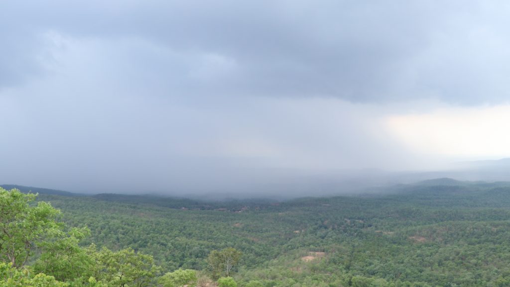
Looking for a destination far from the usual tourist crowds? Imagine stepping into a valley so hidden that it feels like nature’s best-kept secret. Welcome to Patalkot Valley in Madhya Pradesh – a place where time moves slowly, tribal culture thrives, and every sunrise feels like a personal gift from the mountains. This untouched haven in Chhindwara district offers something rare in today’s world: authentic experiences. Whether you’re seeking adventure through hidden trails, wanting to connect with the indigenous Bharia community, or simply craving a digital detox surrounded by pristine nature, Patalkot delivers all of this and more. In this complete guide, you’ll discover everything you need to plan your perfect Patalkot adventure – from practical travel tips to the most rewarding experiences waiting in this remarkable valley. Quick Information Table Detail Information Location Chhindwara District, Madhya Pradesh Best Time to Visit October to February (Winter) Nearest Airport Nagpur (170 km) Nearest Railway Station Chhindwara (25 km) Trek Difficulty Moderate to Challenging Duration Recommended 2-5 days Primary Tribe Bharia Community Network Connectivity Very Limited ATM Availability None (Carry Cash) Accommodation Homestays, Eco-lodges, Camping How to Reach Patalkot: Your Travel Plan Getting to Patalkot requires some planning, but the journey itself becomes part of the adventure. Here’s how to reach this hidden gem: By Air The nearest airport is Nagpur, located approximately 170 kilometers from Patalkot. From Nagpur, you can hire a taxi or take a bus to Chhindwara, which serves as your base for exploring the valley. The drive from Nagpur takes about 4-5 hours through scenic countryside. By Train Chhindwara Railway Station is your closest rail connection, just 25 kilometers from Patalkot. Regular trains connect Chhindwara to major cities like: From Chhindwara station, local taxis and shared jeeps are readily available to take you into the valley. By Road Road travel offers flexibility and stunning views. Here are the main routes: From Nagpur: Take NH44 to Chhindwara, then local roads to Tamia and finally to Patalkot (Total: 170 km) From Bhopal: Drive via Hoshangabad and Chhindwara (Total: 280 km) From Jabalpur: Take the route through Seoni to Chhindwara (Total: 200 km) Local Transport Once you reach Chhindwara or Tamia, hire local taxis or join shared jeeps that run regularly to Patalkot. The final stretch involves a scenic drive through forest roads that adds to the excitement of your arrival. Where to Stay: From Eco-Lodges to Homestays Your choice of accommodation can make or break your Patalkot experience. Here’s what works best: Community Homestays (Highly Recommended) Staying with local families offers the most authentic experience. These homestays are run by the Bharia community and provide: Eco-Lodges A few eco-friendly lodges operate in and around the valley, focusing on: Camping in Chhindwara Valley For adventure seekers, camping offers an unforgettable experience: Safety Tip: Always camp at designated areas and inform locals about your plans. Sustainable Travel Tip: Choosing community-run accommodations directly supports the Bharia tribe’s economy and helps preserve their traditional lifestyle. Your stay becomes a meaningful exchange rather than just tourism. Top 7 Things to See and Do in Patalkot 1. Trekking the Hidden Trails The valley reveals itself best to those who walk its ancient paths. Multiple trekking routes wind through dense forests, leading to breathtaking viewpoints like Raja Kho. The descent into the valley takes about 2-3 hours, depending on your pace and chosen route. You’ll walk through: The trek back up can be challenging, so start early and carry plenty of water. 2. Meet the Bharia Community The heart of Patalkot’s magic lies with its people. The Bharia tribe has called this valley home for centuries, developing an incredible understanding of forest ecosystems. Respectful interaction with community members offers insights into: Always ask permission before photographing people, and consider hiring local guides to support the community directly. 3. Discover Local Chhind Crafts The artistic traditions of Patalkot reflect the community’s deep connection to nature. Local artisans create beautiful items from: Visiting workshops allows you to see these crafts being made and purchase authentic souvenirs that directly support artisan families. 4. Go on a Guided Nature Walk Patalkot’s biodiversity becomes truly apparent with local guidance. Experienced guides from the community can identify: These walks typically last 3-4 hours and can be arranged through your accommodation. 5. Experience Monsoon Magic (July-September) If you visit during monsoon season, prepare for a completely transformed landscape: The rains can make trails slippery, so proper footwear becomes essential. 6. Try Stargazing and Camping With minimal light pollution, Patalkot offers some of India’s best stargazing opportunities. On clear nights, you can see: Many homestays and eco-lodges arrange stargazing sessions with basic equipment. 7. Participate in a Craft Workshop Several community initiatives offer hands-on workshops where visitors can: These workshops typically last 2-3 hours and provide unique souvenirs made by your own hands. The Best Time to Visit Patalkot Timing your visit makes a significant difference in your Patalkot experience: Winter (October – February) – Best Overall Time Monsoon (July – September) – For Nature Lovers Summer (March – June) – Early/Late Activity Times What to Eat: A Taste of Local Flavors Food in Patalkot reflects the community’s connection to the forest and simple living: Traditional Bharia Cuisine Homestay Meals Most homestays provide: What to Expect Meals are simple but nutritious, focusing on: The dining experience often includes eating on traditional leaf plates and sharing meals with host families. Practical Tips for a Safe & Respectful Trip Essential Packing Checklist Connectivity Reality Check Be prepared for limited connectivity: Plan accordingly by: Cultural Etiquette Guidelines Respect for local culture ensures positive experiences for everyone: Photography Ethics: Environmental Responsibility: Community Interaction: Your Adventure Awaits Patalkot Valley offers something increasingly rare in our connected world: genuine escape and authentic cultural exchange. This hidden gem in Madhya Pradesh rewards visitors who come with open hearts and respect for local traditions. From the physical challenge of trekking into the valley to the spiritual reward of connecting with the Bharia community, every aspect of a Patalkot visit creates lasting memories.
Patalkot Tourism: A Complete Guide to What to See in Patalkot (2025) Read More »