India Travel

Explore India travel guides, itineraries, places to visit, travel tips, and destination insights for popular tourist destinations across India.

spiti valley

Is Spiti Valley Open Now April 2026? Latest Road Status, Weather & Travel Advisory

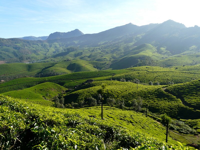
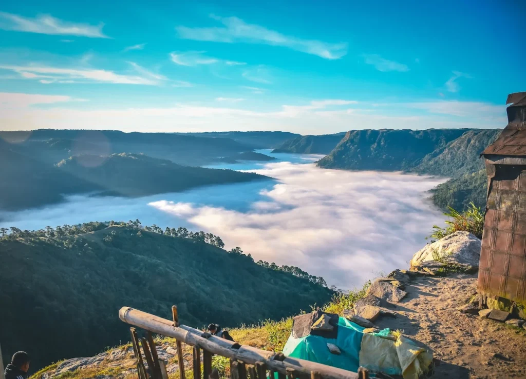
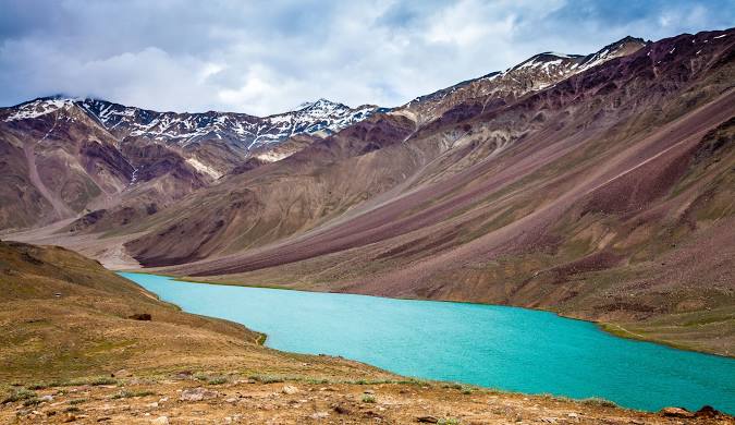
I get this question in my inbox every single week between February and May — “is Spiti Valley open now?” And honestly, I understand why. Most travel blogs give you the same recycled answer. So let me give you a straight, real answer based on what’s actually happening on the ground in April 2026, along with everything you need to plan smartly. Here’s the short version: Spiti Valley is accessible right now — but only from one direction. The rest of this article will tell you exactly which route works, what to expect when you get there, and whether this is the right trip for you. Is Spiti Valley Open Now in April 2026? Yes, Spiti Valley is open in April 2026, but only via the Shimla–Kinnaur route. The Manali route via Kunzum Pass remains closed due to heavy snow. You can reach Kaza and explore the core valley, but a full circuit trip is not possible right now. That said, let me be honest with you — “open” in April doesn’t mean smooth roads and clear skies all the way. It means the Shimla–Kinnaur highway (NH-05) is operational, maintained by BRO and HPPWD crews throughout winter and early spring. There can be icy patches near Nako, some single-lane stretches after winter damage, and the odd weather disruption near Sumdo. But people are getting in and out. I’ve spoken to travellers who made this trip in the second week of April 2026 — they reached Kaza without major issues. The key word is planning. Go in with the right vehicle, the right gear, and a flexible mindset, and this trip will be one you talk about for years. 🛣️ What is the Current Road Status of Spiti Valley? Let me break this down clearly because confusion about routes is the number one reason travellers make bad decisions before heading to Spiti. Route Status (April 2026) Key Details Shimla → Kaza via Kinnaur, Reckong Peo, Nako, Tabo ✅ OPEN Year-round route; occasional ice patches near Nako Manali → Kaza via Kunzum Pass ❌ CLOSED Under heavy snow; expected to open late May 2026 Keylong → Kaza ❌ CLOSED Closed until Kunzum Pass clears Karchham → Chitkul via Sangla ✅ OPEN (as of late April) Route advisory updated 21-04-2026 Chandratal Lake ❌ CLOSED Accessible only after mid-June Full Spiti Circuit (Shimla in, Manali out) ❌ NOT POSSIBLE Requires Kunzum Pass to open Bottom line: If you’re planning a full circuit trip right now, it is simply not happening. You go in via Shimla, explore the core valley, and come back the same way. Anyone telling you otherwise is giving you dangerous information. 🔵 Shimla–Kinnaur Route: Your Only Gateway Right Now The Shimla to Kaza distance is approximately 420 km, and it takes 2 to 3 days with proper acclimatisation stops. The route goes through Narkanda → Rampur → Reckong Peo → Nako → Tabo → Kaza. This is also called the Hindustan-Tibet Highway, and it is your lifeline for early-season Spiti travel. The road from Shimla to Narkanda and through most of Kinnaur is in good condition. As you pass Pooh and approach Nako, expect slush and ice patches, especially in the first two weeks of April. Beyond Tabo, the road improves again into Kaza. Keep a buffer of at least one extra day for this stretch. 🔴 Manali–Kaza Route: Don’t Even Try It Kunzum Pass sits at 4,590 metres (15,060 feet) and remains buried under snow until late May or early June. The Border Roads Organisation (BRO) typically begins snow clearance operations in March–April, but the road doesn’t open for tourist traffic until much later. In 2025, BRO started clearance in April and the road opened around late May. Expect a similar timeline for 2026. Even with the Atal Tunnel operational for local residents, travel beyond Sissu/Keylong towards Kunzum Pass base is simply not possible right now. Don’t attempt this route. Blizzards on this stretch are sudden and serious. 🚗 Can You Travel from Manali to Spiti Valley Now? No. The Manali-to-Kaza route via Kunzum Pass is closed. Period. The entire stretch from Gramphu to Kunzum Pass base is under deep snow. BRO has started early clearance operations, but the route will not be motorable for tourist traffic until late May 2026 at the earliest. This is where I always urge travellers to be realistic. Every year, a handful of people try to “push through” the Manali route in April — sometimes successfully, mostly not. The risk-reward ratio is just not worth it. You could get stranded for days, and rescue in these areas is slow and complicated. If Manali is your starting point, take the long way around: Manali → Shimla (by road or bus), then begin the Kinnaur route. I know that sounds inconvenient, but it’s the safe and smart play. 🌡️ What is the Weather in Spiti Valley in April? Spiti is a cold desert — that context matters. It’s not the wet, freezing cold of Manali or Shimla. It’s dry, sharp, and intense. In April 2026, here’s what you can realistically expect in Kaza: Weather Factor Early April (1–10) Mid April (11–20) Late April (21–30) Daytime High 0°C to 2°C 2°C to 5°C 4°C to 8°C Nighttime Low -12°C to -15°C -10°C to -13°C -10°C to -13°C Snow Possibility High Moderate Low to moderate Sunshine Hours ~9 hours ~9 hours ~10 hours Wind Chill Significant Significant Significant Wind is the sneaky one. Between Tabo and Kaza, the valley funnels wind through narrow gorges, and the wind chill can make the actual temperature feel 5 to 8 degrees colder than what any thermometer shows. Pack accordingly. The good news? Spiti gets clear, sunny days even in April. When that sun hits the snow-covered peaks of Key, Kibber, and Langza against the brown desert valley floor — the contrast is dramatic and completely stunning. Very few tourists ever see Spiti like this. 🎒 April Packing Checklist for Bikers and Backpackers ❓ What Are Travellers Asking? (Real Questions, Real

Is Spiti Valley Open Now April 2026? Latest Road Status, Weather & Travel Advisory Read More »

Ooty Best Time to Visit (2026): Month-Wise Guide, Weather, Budget & Travel Tips

You know that feeling when the Mumbai heat is absolutely suffocating, your AC is working overtime, and all you want is to wake up to cold mountain air and a cup of freshly brewed Nilgiri tea? That’s exactly when I start planning my next trip to Ooty. And trust me, after two decades of sending thousands of travellers to this hill station, I can tell you — knowing the Ooty best time to visit makes ALL the difference between a holiday you’ll rave about and one you’ll want to forget. Whether you’re coming from Bangalore, Chennai, Hyderabad, or Mumbai, this month-wise Ooty climate guide will tell you exactly when to go, what to expect, and how to get the most out of every rupee you spend. 🗓️ Ooty Best Time to Visit — Quick Answer for Travellers The best time to visit Ooty is between March and June (peak season) or October to February (off-peak/romantic season). If you want a budget trip with fewer crowds, July to September is your window. Quick picks based on your goal: 🌿 Why Timing Matters When Planning Your Ooty Trip I’ve been to Ooty in every single month of the year. And I can tell you — the Nilgiri Hills in January feel nothing like the Nilgiris in July. This isn’t just about rain or sunshine. It’s about the whole vibe. In March, the Botanical Garden is bursting with colour, the roads are clear, and you can actually see Doddabetta Peak without squinting through thick fog. In July, those same roads can be slick with rain, leeches pop up on forest trails, and visibility can drop to almost nothing on hairpin bends. But then — the entire valley turns an electric shade of green that honestly looks unreal. The practical side matters too. Peak summer weekends see traffic jams stretching for kilometres near Ooty Lake. Winter fog means you need an extra hour on mountain roads after sunset. And the famous Nilgiri Mountain Railway — the UNESCO-listed toy train — sometimes suspends services during heavy rains. Pack accordingly. April afternoons can surprise you with a chill once the sun dips. January nights near Doddabetta can drop close to 5°C. Always carry a light jacket, no matter when you go. 🌤️ Ooty Best Time to Visit Based on Seasons 🌼 Ooty Best Time to Visit in Summer (March–May) This is Ooty’s peak tourist season, and for good reason. Temperatures sit between a comfortable 15°C and 25°C during the day — perfect when the rest of South India is baking at 40°C+. Schools are on holiday, families flood in from Chennai and Bangalore, and the whole town feels alive. The big highlight? The Ooty Summer Festival, usually held in May, featuring the famous Flower Show at the Government Botanical Garden. Think hundreds of flower varieties, hot air balloon displays, and boat races on Ooty Lake. It’s genuinely spectacular. The honest reality: April and May are crowded. Hotels charge 30–50% more than off-season rates. You need to book accommodation and the Nilgiri Mountain Railway tickets (via IRCTC) at least 4–6 weeks in advance. Weekends in May near Ooty Lake can feel more like a city market than a hill station. My tip: If you must visit in peak season, travel on weekdays and arrive by Thursday. The crowds thin out significantly Monday to Thursday. 🌧️ Ooty Best Time to Visit in Monsoon (June–September) Here’s the truth most travel blogs won’t tell you: monsoon Ooty is massively underrated. Yes, it rains — sometimes heavily. But between July and September, the Nilgiri Hills transform into something that looks straight out of a National Geographic cover. Waterfalls like Pykara are absolutely roaring. The tea plantations are a shade of green so rich it almost looks painted. Temperatures drop to a cool 12°C to 20°C, and you might have entire viewpoints to yourself. Is June a good time to visit Ooty? Early June (before the monsoon fully kicks in) is actually a sweet spot — pleasant weather, lower prices, and manageable crowds. By late July, you should check road and weather conditions before heading out. What to watch out for: leeches on forest trails after heavy rain, slippery roads especially near sharp curves, and the occasional landslide alert. The toy train sometimes runs reduced services in heavy rain. Always carry insect repellent and waterproof footwear. Is Ooty in monsoon worth it? For couples, nature lovers, and photographers — absolutely yes. For families with small kids or seniors — plan for indoor backup options. ❄️ Ooty Best Time to Visit in Winter (October–February) This is the season I recommend most to honeymooners and couples. October and November give you the best of both worlds — the post-monsoon greenery is still fresh, the skies are clear, and the famous “Second Season” brings a second bloom to Ooty’s gardens. By December and January, things get properly cold. Nights near Doddabetta Peak can drop to 5°C or lower. Early mornings sometimes bring frost on the racecourse grounds. It looks magical — thin mist sitting over the valley, the smell of eucalyptus in cold air. It’s incredibly romantic. Pack heavy woolens, thermals, gloves, and a beanie for December and January trips. Nothing ruins a romantic getaway faster than shivering through dinner because you packed only a light sweater. 📊 Ooty Best Time to Visit Month Wise (Detailed Breakdown) Here’s the complete Ooty weather month-wise breakdown I use when advising travellers at Astamb Holidays: Month Avg Temp (Day/Night) Rainfall Crowd Level Wahid’s Recommendation January 21°C / 5°C Low Moderate ❤️ Romantic, carry heavy woolens February 22°C / 7°C Low Low–Moderate 📸 Best for photography & clear skies March 24°C / 10°C Low High ✅ Great weather, book hotels in advance April 25°C / 13°C Light Very High ⚠️ Peak crowds, weekday travel only May 25°C / 14°C Light–Moderate Very High 🌸 Flower Festival — book 6 weeks ahead June 20°C / 12°C Moderate–Heavy Low 💰 Budget sweet spot, early June is best July 18°C / 12°C

Ooty Best Time to Visit (2026): Month-Wise Guide, Weather, Budget & Travel Tips Read More »

Kodaikanal Tourist Places 2026: Top Attractions, Hidden Gems & Travel Guide

I’ve been sending groups to the hills for over 20 years now, and every single time someone from Chennai, Bangalore, or Mumbai asks me, “Where should I go for a quick 2-3 day break that won’t drain my wallet?” — my answer is almost always the same: Kodaikanal. The kodaikanal tourist places are genuinely unlike anything else in South India. Sitting at 2,133 metres above sea level in the Western Ghats of Tamil Nadu, this hill station is cool, misty, and refreshingly laid-back. In 2026, with more people wanting to escape city heat and deadlines, Kodaikanal has become one of the smartest short getaways you can plan. What Are the Best Kodaikanal Tourist Places? (Quick Answer) The top kodaikanal tourist places are Kodai Lake (boating + cycling), Coaker’s Walk (panoramic valley views), Pillar Rocks (three towering granite columns), Silver Cascade Falls (best during monsoon), Berijam Lake (wildlife and forest), and Guna Caves (famous from Tamil cinema). These 6 spots alone can fill a solid 2-day itinerary for most travellers. 🌿 Why Visit Kodaikanal? Let me be direct. Kodaikanal is not Ooty. It’s quieter, less commercial, and far more intimate. The temperature here ranges between 8°C and 20°C in winter and 13°C to 24°C in summer — a dream for anyone coming from the 38°C streets of Chennai or Mumbai. The hill station sits right in the heart of the Palani Hills, which form part of the larger Western Ghats range. This means you get dense pine forests, rolling grasslands, and valley views that will actually stop you mid-scroll on your phone. For couples, the misty atmosphere and private corners around the lake make it one of South India’s most romantic destinations. For solo travellers and groups, the trail access to off-the-beaten-path spots makes it just as rewarding. And since Madurai is only about 120 km away, the drive up through those spectacular ghats is part of the experience. 🏔️ Top Kodaikanal Tourist Places You Must Visit 🌊 Lakes — Kodai Lake & Berijam Lake Kodai Lake is the centrepiece of the hill station — and the first place I always send first-time visitors. This 60-acre, star-shaped, man-made lake was built in 1863 by Sir Vere Henry Levinge, the then Collector of Madurai, and has been welcoming visitors ever since. Berijam Lake is a completely different experience. Located 22–23 km from town inside a reserved forest, this natural freshwater lake requires a forest department permit (free, but limited entries). The drive itself passes through thick shola forests and is worth the trip. Keep an eye out for bison, deer, and monkeys along the way. 👁️ Viewpoints — Coaker’s Walk & Dolphin’s Nose Coaker’s Walk is a 1 km paved promenade built along the edge of a mountain — and on a clear day, you can see all the way to Madurai. I always tell my clients: go early morning, skip the weekend rush, and carry a light jacket. The views of the valley below, especially when the clouds are at eye level, are something else. Dolphin’s Nose is a flat rock jutting out over the valley at about 6,600 feet. The viewpoint offers a wide look at the Pambar Valley below. It’s about 8 km from town and best visited in the morning before mist rolls in. Combine this with Echo Rock nearby. 🗿 Attractions — Pillar Rocks & Guna Caves Pillar Rocks is one of the most dramatic sights in Kodaikanal. Three massive granite columns rise nearly 400 feet from the earth, often half-covered in mist. There’s a small garden and viewing platform here, making it a great photo stop. Guna Caves (previously called Devil’s Kitchen) sits just beside Pillar Rocks and became famous after Kamal Haasan’s 1991 Tamil film “Guna” was shot here. The cave itself is fenced off due to safety concerns, but the surrounding pine forest trails are open and genuinely atmospheric. 💧 Waterfalls — Silver Cascade Falls Silver Cascade Falls drops 180 feet down a rocky cliff face, 8 km below Kodaikanal on the Kodaikanal–Madurai road. It’s formed by the overflow of Kodai Lake and is best seen during and after the monsoon when the flow is strongest. Local vendors selling fresh fruits and snacks line the roadside, making it a nice pit stop on your way up or down the ghat. 🌄 What Are the Hidden Tourist Places in Kodaikanal? This is where it gets interesting. These are spots I personally recommend to travellers who’ve already “done” the main circuit and want something real. Vattakanal is a small hamlet about 2 km from Kodai Lake and a favourite among solo trekkers and backpackers. The waterfall at Vattakanal is peaceful, surrounded by thick forest, and rarely crowded. The Dolphin’s Nose viewpoint is actually best accessed via a trek from Vattakanal. Poombarai Village is a terraced farming community about 20 km from Kodaikanal town. The view from the hilltop overlooking the village and surrounding valley is stunning — and almost no tour operator sends tourists here. Go for the quiet, stay for the photos. Mannavanur Lake sits inside a sheep farm, 35 km from Kodaikanal, with flocks of sheep grazing on the banks. The Forest Department offers coracle rides for ₹10 per person, and the drive there through eucalyptus and pine-lined roads is itself worth the trip. Silent Valley View is less-visited than Green Valley View (Suicide Point) but equally dramatic. It’s a calmer spot with fewer crowds and gives you uninterrupted views of the valley below. 📅 Is Kodaikanal Worth Visiting in 2 Days? (Itinerary) Yes — 2 days is the sweet spot for Kodaikanal. Here’s the exact plan I give my clients booking a kodaikanal 2 day trip plan: Day 1 — The Main Circuit Time Activity 7:00 AM Coaker’s Walk (early morning, misty views) 9:00 AM Kodai Lake — boating + cycling 11:00 AM Bryant Park (botanical garden, eastern shore of lake) 1:00 PM Lunch at a local Tamil restaurant (try Kothu Parotta!) 3:00 PM Pillar Rocks + Guna Caves forest walk 5:30

Kodaikanal Tourist Places 2026: Top Attractions, Hidden Gems & Travel Guide Read More »

Northeast India Tourism Guide 2026: Best Places, Itinerary, Cost & Hidden Gems

Every year at Astamb Holidays, I handle hundreds of tour requests. And lately, one region keeps coming up again and again: Northeast India. People are tired of crowded hill stations. They want something raw, real, and worth the journey. After personally scouting routes through Assam, Meghalaya, Arunachal Pradesh, Nagaland, and Sikkim, I can tell you this — northeast india tourism is not just a trend. It is a quiet revolution in how Indians travel. This guide is everything I would tell a close friend planning their first Northeast trip in 2026. What is Northeast India Tourism and Why It Is Trending in 2026? Northeast India tourism refers to travel across the eight states collectively known as the Seven Sisters (Assam, Meghalaya, Arunachal Pradesh, Nagaland, Mizoram, Manipur, Tripura) plus Sikkim. In 2026, this region is seeing one of its sharpest rises in search interest and footfall. The short answer: Indian travelers are shifting away from mass-tourism. They want slower trips with real cultural depth. Northeast India delivers exactly that — no commercial malls, no tourist traps, and landscapes that still look like a geography textbook illustration. New rail connections, better roads, and a growing network of local homestays are making the region more accessible than at any point before. The biggest pull is simple: you get more for less. Why Northeast India Tourism is Perfect for Indian Travelers If you are an Indian traveler, this region has four big advantages that other destinations simply cannot match: The Seven Sisters together hold over 50% of India’s bird species, nearly 40% of its flowering plants, and are home to flagship wildlife including the one-horned rhinoceros and the Hoolock gibbon — Asia’s only ape. For a wildlife or nature lover, this region is irreplaceable. Northeast India Tourism – Best Places to Visit in 2026 Assam – Rhinos, Rivers & Tea Gardens Assam is the natural entry point into Northeast India. Most flights land at Guwahati, which sits on the banks of the mighty Brahmaputra River. A ferry ride on the Brahmaputra at sunset is one of those moments you do not quickly forget. Kaziranga National Park is the centerpiece of any Assam trip. It is a UNESCO World Heritage Site and home to the world’s largest population of Indian one-horned rhinoceroses. Book your jungle safari early — morning slots fill up fast. Expect to pay ₹350 to ₹600 per person for the entry and elephant safari. Majuli Island is equally worth your time. It is one of the world’s largest river islands, sitting right in the middle of the Brahmaputra. The Vaishnavite monasteries (called satras) here are unique to Assam’s culture. The ferry ride to Majuli takes about 1 to 1.5 hours from Jorhat. Plan at least 2 nights here to see mask-making, traditional dance, and village life. Best for: Wildlife, river culture, tea tourism Meghalaya – Clouds, Caves & Living Bridges Meghalaya translates to “abode of clouds,” and it earns that name. Shillong, the state capital, is one of Northeast India’s most comfortable base cities. You get cafes, live music, and friendly locals — all without the chaos of a typical tourist town. Cherrapunji (now officially called Sohra) is one of the wettest places on earth and is about 54 km from Shillong. The Nohkalikai Falls here drop a stunning 340 meters — one of India’s tallest. The Mawsmai Caves are a short drive away and great for families. The Double Decker Living Root Bridge in Nongriat village is a bucket-list item. These bridges are grown — not built — from the aerial roots of Ficus Elastica trees by the local Khasi community over hundreds of years. The trek is about 3,000 steps each way, and takes roughly 3 hours round trip. Go early. Carry water. Dawki and the Umngot River offer some of the clearest water you will ever see in India. Boats appear to float in thin air. And Mawlynnong, just 90 km from Shillong, has been recognized as Asia’s cleanest village — a title it takes seriously. Best for: Nature, trekking, culture, photography Arunachal Pradesh – The Land of the Dawn-lit Mountains Arunachal Pradesh is where Northeast India goes from beautiful to breathtaking. The state shares borders with China, Bhutan, and Myanmar, and that geography shows in its monasteries, tribes, and mountain scenery. Tawang is the crown jewel. At 3,048 meters above sea level, the Tawang Monastery is the largest monastery in India and one of the largest in the world. The drive from Bomdila to Tawang is one of the most dramatic road journeys in the country — passing through the Sela Pass at nearly 4,200 meters. Ziro Valley, home to the Apatani tribe, is a UNESCO-nominated landscape of terraced rice fields and pine forests. The Ziro Music Festival held every September draws indie music lovers from across the country. ⚠️ Note: You need an Inner Line Permit (ILP) to enter Arunachal Pradesh. Apply online at arunachalilp.com at least 5–7 days in advance. Best for: Adventure, culture, Himalayan landscapes Sikkim – Gateway to the Himalayas Sikkim is the most organized of all Northeast states for tourism. Gangtok, the capital, has good food options, clean hotels, and a well-marked tourist trail. Rumtek Monastery and the Nathu La Pass (shared Indo-China border) are major draws. For trekkers, the Goecha La Trek near Yuksom offers close views of Kangchenjunga, the world’s third-highest peak. No ILP is needed to enter Sikkim as an Indian citizen, but some inner zones like Nathu La and Gurudongmar Lake require additional permits (easily arranged through your hotel or local agent). Best for: Trekking, monasteries, mountain views Northeast India Tourism – Hidden Gems You Must Visit These are the spots I personally recommend when clients ask me for something beyond the usual: What is the Best Time to Visit Northeast India? The ideal time for most travelers is October to April. Skies are clear, roads are passable, and wildlife is visible. Avoid the peak monsoon months of June to August for most states (though Meghalaya lovers actually

Northeast India Tourism Guide 2026: Best Places, Itinerary, Cost & Hidden Gems Read More »

Alleppey Tourist Places: 25 Best Places to Visit in Alleppey Backwaters (2026 Travel Guide)

I’ve been organizing Kerala tours from Mumbai for over 20 years, and I still feel a quiet excitement every single time I say the words — Alleppey backwaters. There’s something about this place that works on you slowly. It doesn’t dazzle you all at once like a city does. Instead, it draws you in — one canal, one paddy field, one toddy shop at a time. If you’re researching alleppey tourist places for your next trip, you’ve landed in the right guide. I’m Wahid Ali, Operations Lead at Astamb Holidays, Mumbai, and in this 2026 travel guide, I’ll walk you through the 25 best places to visit in Alleppey, honest houseboat pricing, practical itinerary tips, hidden spots most tour groups skip, and everything in between. Whether you’re planning a romantic getaway, a family holiday, or a solo escape — Alleppey has something that will stick with you long after you’re home. 📌 Quick Reference: Alleppey at a Glance 📌 Detail Information Location Alappuzha, Kerala, India Also Known As Venice of the East; Alleppey Best Time to Visit October – February (Peak Season) Houseboat Price ₹9,000 – ₹1,05,000 per boat (per day/night) Nearest Airport Cochin International Airport (~84 km) Nearest Railway Station Alleppey Railway Station (in town) Ideal Trip Duration 2 – 3 Days Famous For Backwater Houseboats, Snake Boat Race, Kerala Cuisine Language Malayalam (English widely understood) 🌊 Why Alleppey Is Famous for Backwater Tourism Alleppey (officially Alappuzha) sits about 84 km south of Kochi on the shores of the Laccadive Sea. Lord Curzon, the British Viceroy of India, famously called it the “Venice of the East” — and the name has stuck for over a century, because frankly, it fits. What makes this place extraordinary is its geography. The town is essentially built on a network of canals, lakes, and lagoons. The Vembanad Lake, the longest lake in India, runs through its heart. And then there’s the Kuttanad region — a vast stretch of backwaters below sea level, where rice is grown on fields reclaimed from the water itself. The Alleppey backwater ecosystem spans over 900 km of interconnected waterways. When you float through this on a traditional kettuvallam (houseboat), you’re not just sightseeing — you’re stepping into a way of life that hasn’t changed much in centuries. Add the famous Nehru Trophy Snake Boat Race, the beautiful temples, the Portuguese-era churches, and the most soulful Kerala cuisine you’ll ever eat — and you begin to understand why Alleppey is one of the top 10 tourist destinations in India. 🗺️ 25 Best Alleppey Tourist Places You Must Visit 1. 🛶 Alleppey Backwaters There’s no conversation about Alleppey that doesn’t start here. The backwaters are the whole reason most people make the trip. Stretching across the Alappuzha district, this web of canals and lakes connects villages, paddy fields, and coconut groves in the most beautiful way imaginable. Book a houseboat or at minimum a shikara canoe ride. Morning cruises give you the best light — golden, calm, and free of the afternoon heat. I always tell my Mumbai clients: sit on the deck with a cup of chai and just watch. You’ll see kids rowing canoes to school, women washing clothes on the ghats, and fishermen throwing their nets at dawn. 📍 Best time: October to February | Entry: Free (boat charges apply) 2. 🏖️ Alappuzha Beach One of the best beaches in South India, Alappuzha Beach is a wide stretch of sand where multiple water bodies — lagoons, rivers, and the Arabian Sea — meet in one place. The famous 150-year-old pier juts out into the sea, crumbling but magnificent. The beach isn’t the Maldives. It’s not meant to be. It’s a working, living beach — fishermen haul in their catch at sunrise, families fly kites in the evenings, and the Alappuzha Lighthouse watches over it all. I love the raw energy of this place. 📍 Best time: Early morning or sunset | Entry: Free 3. 💧 Vembanad Lake Vembanad Lake is the largest lake in Kerala and the longest in India — stretching over 96 km. It’s the lifeline of Alleppey. Most houseboat routes pass through it, and the famous Nehru Trophy Boat Race is held here on Punnamada Lake, which is an extension of Vembanad. At sunrise, the lake is glass-still. You can sometimes see otters and water birds alongside the houseboats. The Thanneermukkom Bund, the longest lake bridge in India, cuts across Vembanad and is an interesting engineering landmark worth crossing. 4. 🌅 Marari Beach About 11 km north of Alleppey town, Marari Beach is the quieter, cleaner cousin of Alappuzha Beach. It’s named after the local fishing village Mararikulam. Palm trees lean dramatically over the sand, and the water is calmer here — perfect for a swim or an evening walk. National Geographic once rated this among the World’s Top Five Hammock Beaches. I’ve spent some genuinely relaxed hours here after intense tour operations, just sitting under a palm and doing absolutely nothing. Families love it, and so do honeymooners. 📍 Distance from Alleppey: ~11 km | Entry: Free 5. 🦜 Pathiramanal Island Pathiramanal means “Sands of the Night” in Malayalam. It’s a small, uninhabited island sitting right in Vembanad Lake, accessible only by boat. What makes it special: it hosts around 91 local bird species and 50 migratory bird species, making it a paradise for birdwatchers. Because it’s uninhabited, there are no hawkers or tourist stalls — just birds, trees, and silence. Siberian ducks, storks, and herons gather here between November and March. Bring binoculars. Seriously. 📍 Access: By boat from Alleppey | Best time: Nov – March for migratory birds 6. 🌾 Kuttanad — Rice Bowl of Kerala Kuttanad is one of the few places in the world where farming happens below sea level. Spread across parts of Alappuzha and Kottayam districts, this is where Kerala grows most of its rice, in fields literally reclaimed from backwater lakes. Travelling through Kuttanad by boat is a completely different experience from the usual canal

Alleppey Tourist Places: 25 Best Places to Visit in Alleppey Backwaters (2026 Travel Guide) Read More »

Munnar Tourist Places: 20 Best Places to Visit in Munnar, Tea Gardens, Itinerary & Hidden Gems (2026 Travel Guide)

By Wahid Ali | Operations Lead, Astamb Holidays, Mumbai I’ve sent hundreds of travelers to Kerala over my 20 years in the tourism industry — and I can tell you this honestly: Munnar never stops surprising people. Every single client who visits comes back and says the same thing: “Wahid, I wasn’t prepared for how beautiful it really is.” Munnar tourist places range from rolling tea plantations that stretch for miles to misty viewpoints where clouds literally touch your feet. This hill station in Idukki district, Kerala, sits at 1,600 meters above sea level and welcomes over 1.2 million tourists every year — and for very good reason. In this guide, I’m covering 20 must-visit places in Munnar, hidden spots most tourists completely miss, a 3-day itinerary, the best time to visit, travel tips, and a complete FAQ section. Whether you’re a couple, a family, or a solo traveler, this is the only Munnar guide you’ll need for 2026. 🌿 Why Munnar Is One of the Most Beautiful Hill Stations in Kerala Munnar means “three rivers” in Malayalam — referring to the Muthirapuzha, Nallathanni, and Kundala rivers that meet here. The Western Ghats give Munnar its dramatic terrain, altitude range of 4,921 ft to 8,842 ft, and year-round cool climate that feels like a relief from India’s plains. What makes Munnar stand out even among Kerala’s many beautiful destinations? For me personally, nothing compares to that first morning drive into Munnar — misty hills, damp air, green everywhere. It resets you completely. 🗺️ Munnar Tourist Map 🌅 Best Sunrise & Sunset Spots in Munnar Spot Best For Timing Distance from Munnar Town Kolukkumalai Sunrise above clouds 5:00 AM – 6:30 AM ~40 km (Jeep needed) Top Station Sunset + valley views 5:00 PM – 6:30 PM ~32 km Lockhart Gap Morning mist views 6:00 AM – 8:00 AM ~12 km Pothamedu View Point Sunrise + plantations 5:30 AM – 7:00 AM ~3 km Kolukkumalai at sunrise is genuinely one of the most spectacular natural experiences I’ve arranged for clients. You’re literally above the clouds. It requires a jeep ride on a rough terrain road — not for the faint-hearted, but completely worth it. Top Station, at the highest motorable point in Munnar, gives you sweeping views of Tamil Nadu’s Theni Valley below. Sunset here turns the sky into shades of gold and red that no filter can replicate. 📸 Best Photography Locations in Munnar For photographers — amateur or professional — Munnar is paradise: Carry a wide-angle lens and ND filters — and always go early. Post-noon cloud cover closes in fast. 🍵 Tea Plantation Experience Guide in Munnar Munnar’s identity is inseparable from tea. Here’s how to get the most out of the experience: Experience What to Expect Best Places Tea Picking Walk with pickers, try plucking yourself Kolukkumalai, Lockhart Estate Factory Tours See full production cycle: wilting → oxidation → packaging Tata Tea Museum, Lockhart Factory Tea Tasting Sample Cardamom Tea, Green Tea, CTC varieties Tata Tea Museum café, local shops Estate Walks Guided walks through terraced gardens Rajamala, Pothamedu estates The Tata Tea Museum is particularly brilliant for first-timers. You’ll see century-old machinery still in working condition. Entry is nominal and well worth your time. Pro Tip from Wahid: Carry cash for tea and spice shopping. The small roadside estate shops have better prices and fresher stock than the main market stores. 🏔️ 20 Best Munnar Tourist Places You Must Visit 1. Eravikulam National Park This is non-negotiable on any Munnar trip. Spread across 97 sq. km in the Western Ghats, Eravikulam National Park was declared a national park in 1978 specifically to protect the Nilgiri Tahr. It’s home to half the world’s population of this rare mountain goat. Anamudi Peak — the highest point in South India at 2,695 meters — sits within the park. Book tickets in advance; entry counters open from 9:00 AM to 3:00 PM with a reservation fee of ₹50. 2. Tea Gardens of Munnar You can’t visit Munnar without walking through the tea gardens. These plantations were first started in 1880 and today cover thousands of acres across the hills. The most scenic stretches are along Rajamala Road and near Kolukkumalai. Early morning walks through the rows of tea bushes, with mist hanging low and the smell of fresh leaves in the air — there’s simply nothing like it. 3. Mattupetty Dam Located at 1,700 meters above sea level, Mattupetty Dam is a storage masonry dam surrounded by thick forest and hills. The boating options here — including speed boats — are very popular with families and couples. I always tell my clients: go early in the morning, and you may spot elephants near the water. The Indo-Swiss Livestock Project dairy farm is also located nearby. 4. Echo Point About 15 km from Munnar town, Echo Point is exactly what it sounds like — shout across the valley and hear your voice bounce back. It’s fun, it’s quick, and it’s great for families. The spot overlooks a lake surrounded by green hills. It can get crowded by mid-morning, so aim to be there by 7:30 AM for a peaceful experience. 5. Top Station At the highest motorable point in Munnar — about 32 km from town — Top Station sits at 1,700 meters and gives you a direct view into Tamil Nadu’s Theni Valley below. On a clear day, the views stretch for miles. This was historically the top station of a ropeway that transported tea. Today it’s one of the most iconic munnar sightseeing places. 6. Kundala Lake Just 20 km from Munnar, Kundala Lake sits beside a scenic dam and offers shikara (boat) rides that feel straight out of Kashmir. The lake is surrounded by hills and is quieter than most other spots. During certain months, cherry blossoms bloom nearby. It’s one of the best honeymoon places in Munnar and perfect for photographers. 7. Attukal Waterfalls Attukal Waterfalls drops through dense forest and rocky terrain, creating a thunderous

Munnar Tourist Places: 20 Best Places to Visit in Munnar, Tea Gardens, Itinerary & Hidden Gems (2026 Travel Guide) Read More »

Sathodi Falls Travel Guide 2026: How to Reach, Best Time, Trekking & FAQs

I still remember the first time I stood in front of Sathodi Falls—the thundering cascade of water, the emerald green pool at its base, and the sheer raw power of nature in the Western Ghats. It was during a monsoon recce trip I was organizing for Astamb Holidays, and I knew instantly that this was one of those rare finds that don’t make it to every travel brochure. Often called the “Mini Niagara of Karnataka,” Sathodi Falls is tucked away in the dense forests of Uttara Kannada District, and frankly, it’s the kind of place that makes you feel like you’ve discovered something truly special. I’m Wahid Ali, and I’ve been in the travel business for 20 years now, managing operations and crafting experiences that go beyond the usual tourist circuits. Based in Mumbai, I head operations at Astamb Holidays, where we focus on destinations that offer genuine cultural richness and natural beauty. Sathodi Falls checks every box—adventure, photography, nature, and that authentic “off-the-map” feeling that seasoned travelers crave. 2026 is shaping up to be the year for exploring the Western Ghats properly. With improved road connectivity, better awareness about sustainable tourism, and travelers actively seeking hidden gems over crowded hotspots, places like Sathodi Falls are finally getting the attention they deserve. Whether you’re a family looking for a weekend escape, a solo traveler chasing waterfalls, or a trekking enthusiast wanting something different from the usual trails, this guide will give you everything you need to plan your visit like a pro. 🗺️ Where is Sathodi Falls Located? Sathodi Falls sits in the heart of the Uttara Kannada District in Karnataka, about 32 kilometers from the town of Yellapur. The waterfall is part of the Kallaramane Ghat region, which is known for its thick forest cover, winding roads, and dramatic landscapes shaped by the Kali River system. Here’s what makes the location interesting from a geographical standpoint: the Kodasalli Dam on the Kali River has significantly altered the water flow patterns in this region. During the monsoon months (June to September), when the dam releases excess water, Sathodi Falls transforms into a roaring spectacle. The waterfall drops from a height of approximately 15 meters over a wide rocky ledge, creating that signature curtain-like effect that earned it the “Mini Niagara” nickname. The falls are located at the coordinates 14.9167° N, 74.6833° E (you can plug this directly into Google Maps). The surrounding area is part of the Western Ghats biodiversity hotspot, so you’re looking at pristine forests, diverse wildlife, and some seriously fresh air. The Kallaramane Ghat road itself is a scenic drive, though I’ll be honest—it’s not for the faint-hearted during heavy rains. Quick Location Reference: 🚗 How to Reach Sathodi Falls (The Logistics) Getting to Sathodi Falls requires some planning, but that’s part of the adventure. In my 20 years of managing tours, I’ve learned that the journey to hidden waterfalls is often as memorable as the destination itself. Here’s the breakdown based on where you’re starting from: From Goa (Nearest Major Hub) From Hubli From Bangalore Nearest Transport Hubs: Transport Mode Location Distance from Sathodi Falls Airport Hubli Airport 95 km Airport Dabolim Airport (Goa) 110 km Railway Station Londa Junction 65 km Railway Station Hubli Junction 95 km Bus Stand Yellapur Bus Stand 32 km Expert Tips from the Field: Vehicle Recommendation: Based on my experience organizing trips here, I strongly recommend a high-clearance vehicle like an SUV or a sturdy hatchback with good ground clearance. The last 8-10 kilometers before the falls involve navigating through forest roads with potholes, loose gravel, and during monsoons, occasional water crossings. Sedans can make it, but you’ll be holding your breath at several points. Parking Situation: There’s a small clearing about 500 meters from the actual waterfall where you can park your vehicle. It’s not a formal parking lot—just an open area where locals have designated space. Arrive early (before 9 AM) during weekends to secure a spot, especially between October and January when visitor numbers peak. Road Conditions Warning: The stretch from Yellapur to Sathodi Falls is maintained by the forest department, and road quality can vary dramatically depending on recent rainfall. I always tell my clients to check with locals in Yellapur about current road conditions before heading out. A quick stop at a tea shop or asking the auto-rickshaw drivers gives you real-time intel. Fuel & Facilities: Fill up your tank in Yellapur. There are no fuel stations once you head toward the falls. Also, carry sufficient water, snacks, and a basic first-aid kit. Mobile network coverage (primarily BSNL and Jio) becomes spotty after Yellapur. 📅 Best Time to Visit Sathodi Falls Timing your visit to Sathodi Falls can make the difference between an okay experience and an absolutely spectacular one. Having visited during different seasons for site inspections, I can break this down month by month so you know exactly what to expect. Monthly Breakdown: Month Water Flow Crowd Level Trekking Conditions Recommendation January Moderate Low Excellent ⭐⭐⭐⭐ Great February Low-Moderate Low Excellent ⭐⭐⭐ Good March-May Low Very Low Hot & Dry ⭐⭐ Average June-August Very High Moderate Risky ⚠️ Avoid September High Low-Moderate Slippery ⭐⭐⭐ Good October High Moderate Good ⭐⭐⭐⭐⭐ Excellent November Moderate-High High Excellent ⭐⭐⭐⭐⭐ Excellent December Moderate Moderate Excellent ⭐⭐⭐⭐ Great The Sweet Spot: October to January This is when Sathodi Falls is at its absolute best. The monsoon has just ended, so the waterfall still has impressive volume, but the trails have dried out enough to be safe. The weather is pleasant—temperatures range between 15°C and 25°C—and the surrounding forest is lush and green from the recent rains. October and November are my personal favorites. I’ve organized numerous group trips during this window, and the feedback is consistently excellent. The water flow is strong enough to create that dramatic curtain effect, the pool at the base is perfect for a quick dip, and the lighting is ideal for photography. Monsoon Months: June to August (Proceed with Caution) Yes, the

Sathodi Falls Travel Guide 2026: How to Reach, Best Time, Trekking & FAQs Read More »

Nongjrong, Meghalaya: The Ultimate 2026 Travel Guide to India’s Most Spectacular Cloud Viewpoint

Picture this: You’re standing at the edge of a cliff at 5:30 AM, wrapped in layers against the biting cold, watching the first rays of sunlight pierce through the darkness. Below you isn’t the ground—it’s an endless ocean of clouds stretching to the horizon, with distant peaks emerging like islands in a celestial sea. This isn’t a dream or a heavily edited Instagram post. This is Nongjrong, Meghalaya—a tiny Khasi village in the East Khasi Hills that has quietly become one of India’s most breathtaking sunrise destinations. I’m Wahid Ali, Operations Lead at Astamb Holidays and a travel professional with over 20 years of experience crafting itineraries across India’s hidden corners. When Anand Mahindra shared images of Nongjrong’s cloud inversion phenomenon on social media in recent years, it sparked a wave of curiosity. Suddenly, travelers were asking us: “Where is this place? How do we get there? Is it real?” The answer is yes—it’s very real, and in my experience managing tours to Meghalaya, Nongjrong offers something truly rare: a spectacular natural phenomenon without the crowds that plague similar spots. This 2026 travel guide is designed to give you everything you need—from the 3 AM wake-up call logistics to understanding why those clouds gather below you. Whether you’re planning a sunrise day trip from Shillong or building a multi-day offbeat circuit through East Khasi Hills, I’ll share the practical insights we’ve gathered from sending dozens of groups to this remarkable viewpoint. Let’s get you above the clouds. What Is Nongjrong Famous For? ☁️ Direct Answer: Nongjrong is famous for its spectacular cloud inversion phenomenon and sunrise viewpoint, where visitors stand above a sea of clouds with the sun rising over distant Himalayan foothills. The “Sea of Clouds” at Nongjrong isn’t just a poetic description—it’s a meteorological event that transforms the valley below into what looks like an endless white ocean. During the cooler months (particularly October through February), cold air settles in the valleys while warmer air sits above, creating a temperature inversion. The moisture in the valley forms clouds that fill the low-lying areas completely, leaving the higher viewpoints—like Nongjrong—floating above this ethereal landscape. What sets Nongjrong apart from better-known spots like Laitlum Canyons or Mawlynnong? Three things: In my experience organizing tours, the emotional response from travelers at Nongjrong is unlike almost anywhere else. There’s something profound about standing literally above the clouds—it shifts your perspective in ways a mountain view or waterfall simply can’t match. Location & Geographic Context 📍 Nongjrong is a small village located in the East Khasi Hills district of Meghalaya, approximately 30 kilometers northeast of the district headquarters at Jowai (also known as Jwai). Administratively, it falls under the Amlarem subdivision, positioning it in the southeastern section of the Khasi Hills plateau. How Far Is Nongjrong from Shillong? Direct Answer: Nongjrong is approximately 55 kilometers from Shillong, taking about 2.5 to 3 hours by road under normal conditions. The coordinates of the main viewpoint are approximately 25.4°N, 92.3°E, placing it at an elevation of around 1,400 to 1,500 meters above sea level—high enough to stay above the cloud layer but accessible by standard vehicles. Distance & Travel Time Reference Table Starting Point Distance Travel Time Road Condition Shillong 55 km 2.5-3 hours Good (NH-6 + village roads) Guwahati 160 km 5-5.5 hours Good (NH-6 majority) Jowai 30 km 1-1.5 hours Moderate (village roads) Dawki 85 km 3-3.5 hours Good to moderate Cherrapunji 95 km 3.5-4 hours Good The village sits along a ridge that provides natural elevation advantage—this is why the clouds form below rather than around the viewpoint, creating that signature “floating above the world” feeling that makes Nongjrong so special. How to Reach Nongjrong 🚗 Getting to Nongjrong requires planning, particularly if you want to catch the sunrise. Here’s the breakdown based on what we’ve learned from multiple tours: By Air ✈️ The nearest airport is Shillong Airport (Umroi), located about 70 kilometers from Nongjrong (3-3.5 hours drive). However, this airport has limited connectivity. Most travelers fly into Lokpriya Gopinath Bordoloi International Airport, Guwahati (160 km, 5-5.5 hours), which offers far better flight options and connections to major Indian cities. Pro Tip from Experience: If you’re flying into Guwahati specifically for a Nongjrong sunrise, arrive the previous evening and stay in Shillong. The 5+ hour drive from Guwahati to Nongjrong would require leaving around midnight—exhausting and not recommended. By Train 🚂 Guwahati Railway Station is the nearest major railhead. From there, hire a taxi or take a shared cab to Shillong (approximately 100 km, 3 hours), then continue to Nongjrong. By Road (The Real Journey) This is where the rubber meets the road—literally. Here are your options: Option 1: Self-Drive If you’re comfortable with mountain roads and have experience with Indian hill driving, self-driving is rewarding. The route from Shillong: Road conditions are generally good on the highway, but the final stretch involves narrower roads. A sedan can make it, but an SUV provides more comfort and confidence. Option 2: Hired Taxi (Recommended for First-Timers) This is what we arrange for 95% of our Astamb Holidays clients. Hiring a local taxi from Shillong costs approximately: Critical Timing Advice: To catch the sunrise (approximately 5:45-6:15 AM depending on season), you need to leave Shillong by 3:00 AM. The driver needs to account for: Most local drivers are experienced with early morning Nongjrong runs and know the roads well. Option 3: Shared Cabs from Jowai If you’re basing yourself in Jowai (which I sometimes recommend for deeper East Khasi Hills exploration), shared cabs occasionally run to nearby villages. However, for sunrise timing, a private hire is more reliable. Navigation Notes Best Time to Visit & The Sunrise Experience 🌅 Seasonality: When Do the Clouds Appear? Direct Answer: The best time to visit Nongjrong for the cloud inversion phenomenon is October through February, with November to January offering the most consistent cloud formations. Here’s the seasonal breakdown: Peak Season (November-January): Good Season (October & February): Off-Season (March-September): The Science Behind the Clouds (Simply

Nongjrong, Meghalaya: The Ultimate 2026 Travel Guide to India’s Most Spectacular Cloud Viewpoint Read More »

Koundinya Wildlife Sanctuary Travel Guide 2026: Timings, Safari, Map, Reviews & Wildlife Highlights

Nestled in the rugged terrain of the Eastern Ghats in Chittoor district, Koundinya Wildlife Sanctuary offers a unique wilderness experience just 120 km from Bangalore. This remarkable sanctuary holds a special place in Andhra Pradesh’s conservation history—it’s the only sanctuary in the state where you can witness majestic Asian elephants (Elephas maximus) in their natural habitat. After an absence of 200 years, these gentle giants returned to this region between 1983 and 1986, transforming this 358 sq km expanse into one of India’s most fascinating elephant reserves. From my years organizing wildlife expeditions across South India, I’ve found that Koundinya Wildlife Sanctuary remains one of the most underrated gems for travelers seeking authentic jungle experiences. The sanctuary’s dramatic landscape—where the Deccan Plateau slopes down into Tamil Nadu’s plains—creates a mosaic of high hills, deep valleys, and pristine tributaries that support incredible biodiversity. Whether you’re an avid birdwatcher hoping to spot the vulnerable Yellow-throated Bulbul or a nature photographer chasing golden-hour elephant sightings, Koundinya delivers experiences that rival better-known sanctuaries at a fraction of the crowds. 🗺️ Where Is Koundinya Wildlife Sanctuary Located? (Map & Directions) Koundinya Wildlife Sanctuary is strategically located in the Palamaner and Kuppam Ranges of Chittoor district, Andhra Pradesh, where three states—Andhra Pradesh, Karnataka, and Tamil Nadu—converge. This tri-state location makes it exceptionally accessible from multiple major cities. Quick Reference Location Details Detail Information State Andhra Pradesh District Chittoor Forest Ranges Palamaner-Kuppam Nearest Town Palamaner (28-31 km) GPS Coordinates 13.0°N, 78.25°E (approx.) Total Area 357.6 km² (35,760 hectares) Established December 1990 Distance from Major Cities How to Reach Koundinya Wildlife Sanctuary By Air: The nearest airports are Kempegowda International Airport in Bangalore (approximately 120-160 km) and Tirupati Airport (around 143 km). From Bangalore airport, hire a taxi or take a bus to Chittoor/Palamaner, then proceed to the sanctuary. Bangalore airport is better connected with frequent domestic and international flights. By Rail: Chittoor Railway Station is the nearest major railhead at approximately 50 km from the sanctuary. Alternatively, Bangalore City Railway Station (also known as KSR Bengaluru Station) is about 120 km away and offers excellent connectivity. From either station, hire a taxi or take local buses to Palamaner, then to the sanctuary entrance. By Road: Koundinya Wildlife Sanctuary is easily accessible via National Highway 44 and state highways. The sanctuary lies along the Palamaner-Kuppam road. From Bangalore, take the Hosur-Krishnagiri route or via Kolar. Regular state transport buses run from Bangalore, Chittoor, and Tirupati to Palamaner. From Palamaner, local transport or hired vehicles can take you to the sanctuary entrance. Pro Tip from Experience: If you’re driving from Bangalore, the route via Kolar is approximately 150 km and offers better road conditions compared to the Hosur-Krishnagiri route which can exceed 200 km. However, GPS navigation can be tricky—always confirm directions with locals in Palamaner who speak primarily Telugu. Download offline maps before your journey as mobile network coverage becomes sparse near the sanctuary. 🌤️ Best Time to Visit Koundinya Wildlife Sanctuary The best time to visit Koundinya Wildlife Sanctuary is from October to March when the weather is pleasant and wildlife sightings are at their peak. Season-wise Breakdown Winter (October to February) ⭐ BEST SEASON Summer (March to May) Monsoon (June to September) ⚠️ NOT RECOMMENDED Elephant Migration Patterns: From my conversations with forest officers, Asian elephants in Koundinya Wildlife Sanctuary show seasonal movement between the sanctuary and Sri Venkateswara National Park via the planned elephant corridor. November to March sees more stable elephant herds within the sanctuary boundaries, increasing your chances of sightings during jeep safaris. Birdwatching: If spotting the Yellow-throated Bulbul is on your list, winter months (October-February) offer the best opportunities when these vulnerable birds are more active and visible in the scrub habitats. 🎫 Koundinya Wildlife Sanctuary Timings & Entry Fees Official Timings Koundinya Wildlife Sanctuary is open to visitors: The sanctuary is open all days of the week, but it’s advisable to check with forest authorities during monsoon season (June-September) when access may be restricted due to weather conditions. Entry Fees (2025-2026 Estimates) Category Entry Fee Camera Fee Indian Adults ₹20-50 ₹25-50 Indian Children ₹10-20 ₹25-50 Foreign Nationals ₹200-500 ₹100-200 Still Camera – ₹25-50 Video Camera – ₹100-200 Important Note: Entry fees can vary and are subject to change by the Andhra Pradesh Forest Department. Always confirm current rates before your visit by contacting: Safari Costs & Booking Jeep Safari Charges (Approximate): Important Safari Information: My Honest Assessment: Based on recent visitor reviews and my discussions with the Andhra Pradesh Forest Department, Koundinya Wildlife Sanctuary doesn’t have the highly organized safari system of Karnataka’s parks. The experience is more exploratory and less commercialized. Permission from sanctuary authorities is essential before entering, and having your own vehicle offers more flexibility for exploration. 🚙 Koundinya Wildlife Sanctuary Safari & Activities Safari Operations & Practical Reality Let me be transparent about what to expect: Koundinya Wildlife Sanctuary safari operations differ significantly from the well-established systems at Nagarhole or Kabini. This is an open forest sanctuary where wildlife viewing is more about patience, local knowledge, and serendipity than guaranteed sightings. Safari Options: Duration: Typical safaris last 2-3 hours, covering key zones where Asian elephants, sloth bears, and cheetal are frequently spotted. Wildlife Photography in Koundinya Koundinya Wildlife Sanctuary offers excellent opportunities for wildlife photography, especially if you’re prepared for less predictable conditions than commercial parks. Photography Tips: Birdwatching Hotspots: The sanctuary is an Important Bird Area (IBA) recognized by BirdLife International. Key species include: Where to Look: Rocky outcrops, scrub vegetation zones, and water sources near Kaigal and Koundinya streams. Trekking & Nature Walks Koundinya Wildlife Sanctuary terrain—characterized by high hills and deep valleys—is perfect for adventurous trekkers. Several trails lead through southern tropical dry deciduous forests and thorn forests. Popular Trekking Routes: Trekking Safety: Other Activities Nature Photography Workshops: The sanctuary’s unique landscape—mixing Deccan Plateau topography with Eastern Ghats biodiversity—offers opportunities for landscape and macro photography. Educational Tours: Under Project Elephant, the sanctuary occasionally hosts educational programs about elephant conservation and human-elephant conflict mitigation.

Koundinya Wildlife Sanctuary Travel Guide 2026: Timings, Safari, Map, Reviews & Wildlife Highlights Read More »

Kaas Plateau Travel Guide 2026: Best Time to Visit, Bloom Season, How to Reach & FAQs

Imagine standing on a vast expanse where nature paints the ground in every color imaginable—crimson reds, sunshine yellows, deep purples, and soft whites stretching as far as your eyes can see. This isn’t a fantasy; this is Kaas Plateau, Maharashtra’s very own Valley of Flowers! Nestled in the majestic Western Ghats near Satara, this UNESCO World Natural Heritage Site transforms into a living, breathing canvas every monsoon season, hosting over 850+ species of flowers that bloom in spectacular fashion. As someone who has guided countless travelers through India’s hidden gems at Astamb Holidays, I can confidently say that Kaas Plateau offers one of the most magical natural experiences you’ll ever witness. This comprehensive 2026 travel guide will give you everything you need to plan your perfect visit—from the exact bloom dates to booking tips, travel routes, and insider secrets that only come from years of ground experience. What is Kaas Plateau? Kaas Plateau, locally known as Kaas Pathar (where “Pathar” means plateau in Marathi), is a biodiversity hotspot that sits at approximately 1,200 meters (3,937 feet) above sea level. Located about 25 kilometers from Satara city in Maharashtra, this extraordinary plateau lies within the ecologically rich Western Ghats, one of the world’s eight “hottest biodiversity hotspots.” What makes Kaas Plateau truly special? In 2012, it earned the prestigious designation of a UNESCO World Natural Heritage Site due to its remarkable ecosystem and unique geological features. The plateau showcases an ancient laterite formation that dates back millions of years, creating the perfect conditions for an incredible diversity of plant life that you won’t find anywhere else on Earth. The name “Kaas” comes from the Kaas tree (Elaeocarpus glandulosus), which once dominated the region. Today, while these trees are less common, the plateau has gained worldwide fame for something even more spectacular—its seasonal flower carpet that attracts nature lovers, photographers, and botanists from across the globe. Quick Facts About Kaas Plateau: Detail Information Location Near Satara, Maharashtra, Western Ghats Elevation 1,200 meters (3,937 feet) above sea level Distance from Satara 25 kilometers (approx. 45 minutes drive) Distance from Pune 130 kilometers (approx. 3 hours drive) Distance from Mumbai 290 kilometers (approx. 6 hours drive) UNESCO Status World Natural Heritage Site (since 2012) Flora Diversity 850+ species of flowering plants Best Known As Valley of Flowers of Maharashtra 🌺 Why Visit Kaas Plateau? (The Magic Awaits) The Mesmerizing Valley of Flowers Experience Kaas Plateau isn’t just another tourist spot—it’s a living botanical museum that transforms dramatically with the seasons. During the bloom season, the entire plateau becomes a spectacular carpet of wildflowers that change composition and color almost daily. Walking through this natural wonderland feels like stepping into a painter’s dream, where every footstep reveals new colors, patterns, and fragrances. What truly sets Kaas Plateau apart is the sheer variety of flowers blooming simultaneously. You might spot delicate purple smithias alongside cheerful yellow sonki flowers, vibrant red toothcup blossoms next to clusters of rare insectivorous plants. The plateau hosts everything from tiny ground-hugging species to taller flowering plants, creating layers of color that photographers and nature enthusiasts absolutely adore. Incredible Biodiversity & Ecosystem The plateau’s biodiversity is staggering. With 850+ documented species of flowering plants, including many endemic varieties found nowhere else on the planet, Kaas Plateau represents one of India’s most important conservation areas. The ecosystem includes: Beyond flowers, you’ll encounter fascinating wildlife including various butterfly species, beetles, grasshoppers, and numerous bird species that thrive in this protected ecosystem. The fragile laterite soil and seasonal water pools create microhabitats that support an intricate web of life. Beyond the Plateau: Nearby Natural Wonders Your Kaas Plateau adventure shouldn’t end at the flower fields. The surrounding Satara region offers several breathtaking attractions that perfectly complement your visit: 🏞️ Kaas Lake: Just 2 kilometers from the plateau entrance, this serene lake offers stunning reflections of the surrounding hills. During the monsoon season, the lake reaches its fullest, creating picture-perfect moments, especially during sunrise and sunset. It’s an ideal spot for a peaceful break and some contemplative photography. 💧 Thoseghar Waterfalls: Located approximately 20 kilometers from Kaas Plateau, Thoseghar is a magnificent cascading waterfall system where water plunges from a height of 500 meters through multiple tiers. During peak monsoon (July-August), the falls are at their most powerful and dramatic. The viewpoints offer spectacular panoramas of the water crashing into the valley below, surrounded by lush green hills. 🌊 Vajrai Waterfall: Known as one of India’s tallest waterfalls, Vajrai Waterfall drops from an impressive height of 853 feet (260 meters). Located about 25 kilometers from Kaas, this three-tiered wonder is best visited during or immediately after the monsoon season when water flow is at its peak. The surrounding Sahyadri ranges create a dramatic backdrop that makes the journey absolutely worth it. Pro Tip from My Experience: Plan a 2-day itinerary to fully experience the region. Visit Kaas Plateau early morning on Day 1, explore Kaas Lake by afternoon, stay overnight in Satara town, and then visit the waterfalls on Day 2. This way, you won’t feel rushed and can truly soak in the natural beauty of the entire area. 📅 Best Time to Visit Kaas Plateau (Timing is Everything!) The Golden Window: Bloom Season Here’s the most important information for planning your trip: The best time to visit Kaas Plateau is from late August to early October, with mid-September being the absolute peak bloom period. This is when the plateau transforms into its legendary carpet of flowers, and the biodiversity is at its most vibrant. Bloom Season Breakdown: Time Period Bloom Status What to Expect Late August (20-31 Aug) Early Bloom (40-50%) First wave of flowers appear; fewer crowds, pleasant weather Early September (1-15 Sept) Peak Bloom (80-90%) Maximum variety and density; vibrant colors everywhere Mid September (15-25 Sept) ABSOLUTE PEAK (95-100%) Best time! All species in full bloom; incredible diversity Late September (25-30 Sept) Late Peak (70-80%) Still spectacular; certain species fade while others emerge Early October (1-15 Oct) Declining (40-60%) Many flowers have

Kaas Plateau Travel Guide 2026: Best Time to Visit, Bloom Season, How to Reach & FAQs Read More »