Maharashtra

Maharashtra Temperature May 2026: Why Toranmal Hill Stattion (14°C) Is the Coolest Escape from the Heatwave

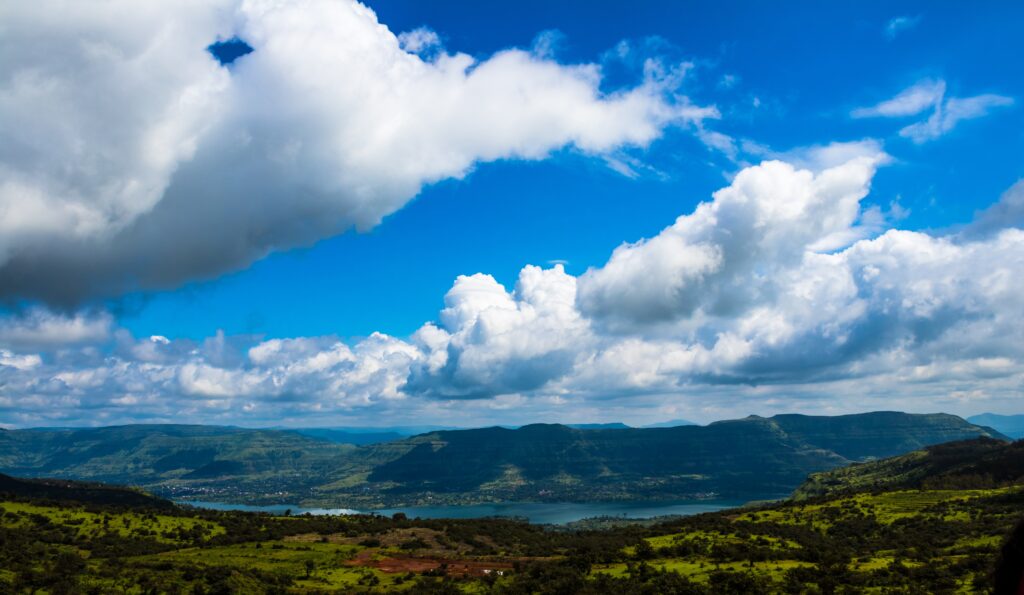
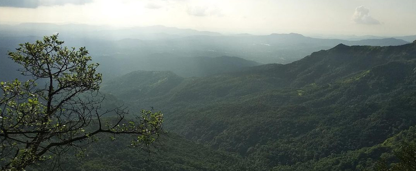
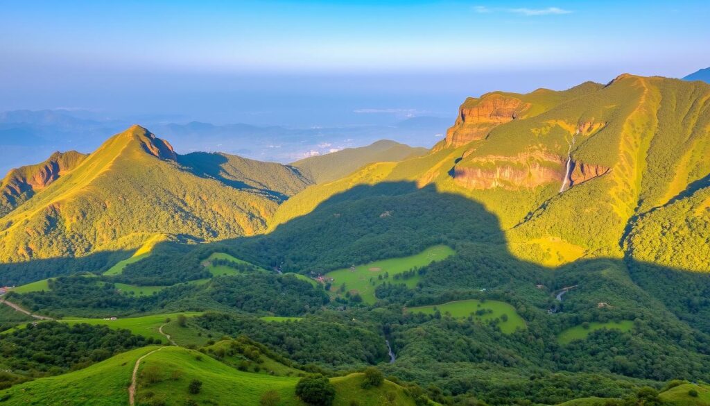
By Imran Mulla | Founder, TravelJunctions.in | 17 Years in the Travel Industry Let me be straight with you. The Maharashtra temperature in May 2026 is brutal. I have been running tours across this state for 17 years, and this year’s heat is one of the worst I’ve seen. Nagpur is hitting 43–45°C. Pune crossed 38°C earlier this week. Mumbai feels like a pressure cooker with no lid. If you are sitting in one of these cities right now — sweating, irritable, desperately scrolling for somewhere to breathe — I have exactly the answer you need. Toranmal Hill Station. It’s sitting at 14°C as you read this. And most people have no idea it even exists. What Is the Current Maharashtra Temperature in May 2026? Direct Answer: In May 2026, Maharashtra is experiencing above-normal temperatures across most of the state. Vidarbha and Marathwada are seeing 43–45°C, Pune hovers around 37–40°C, and Mumbai is battling suffocating heat and humidity. The IMD has confirmed above-normal heatwave days for Maharashtra this month. Maharashtra in May is always hot — that’s nothing new. But May 2026 is tracking differently. The India Meteorological Department (IMD) in its monthly outlook confirmed that above-normal heatwave days are likely over parts of Gujarat and Maharashtra during this period. Minimum temperatures too are expected to stay above normal across most of the state — meaning even the nights are not giving any relief. Here’s a quick snapshot of what’s happening right now across the state: City / Region Day Temperature (May 2026) Night Temperature Humidity Nagpur 43–45°C 28–30°C Moderate Pune 37–40°C 22–25°C Low–Moderate Mumbai 33–36°C 26–28°C Very High Nashik 36–39°C 22–24°C Low Aurangabad 40–42°C 26–28°C Low Toranmal 14–28°C 13–16°C Low–Comfortable That last row is not a typo. Toranmal is cooler than your AC room. Why Is Maharashtra Experiencing Extreme Heat in May 2026? Direct Answer: Maharashtra’s extreme heat in May 2026 is driven by evolving El Niño-like conditions over the equatorial Pacific, above-normal minimum temperatures nationwide, and the typical pre-monsoon dry air mass that blankets interior Maharashtra. IMD has officially flagged above-normal heatwave risk for the state. The science here is straightforward. The IMD’s May 2026 forecast points to ENSO-neutral conditions shifting toward El Niño, which suppresses rainfall and allows temperatures to climb faster and stay higher. When that happens, interior Maharashtra — particularly Vidarbha and Marathwada — gets absolutely cooked. The dry, flat terrain has no forest cover to moderate temperatures. The sun hits the ground directly, and the heat bounces back up. Three big reasons it feels worse this year: Which Cities Are the Hottest in Maharashtra Right Now? Direct Answer: As of May 2026, Nagpur is the hottest city in Maharashtra at 43–45°C, followed by Aurangabad and Nanded at 40–42°C. Pune is crossing 38–40°C consistently. Mumbai may feel more tolerable temperature-wise, but extreme humidity makes it feel like 40°C or more. From my experience running tours across Maharashtra, here’s the ground truth — and it’s worse than the numbers suggest: Nagpur (43–45°C): Known as the “Orange City” but in May it earns a different nickname. Heat here is dry but intense. Standing outside between 11 AM and 5 PM is genuinely dangerous. I never schedule stops in Nagpur in May. Pune (37–40°C): Pune used to pride itself on being cooler than Mumbai. That advantage has been shrinking every year. In early May 2026, forecasts show 38.4°C — above its historical average. If you’re in Pune, you know what I mean. Mumbai (33–36°C + High Humidity): The number looks smaller, but the humidity makes it feel like a sauna that you can’t leave. The IMD flagged hot and humid weather conditions for Konkan through the first week of May. Walking outside at noon in Mumbai in May is not advisable for anyone above 50. Which Is the Coolest Place in Maharashtra Right Now? (Toranmal Explained) Direct Answer: Toranmal is the coolest place in Maharashtra in May 2026, recording minimum temperatures of around 14°C and maximum temperatures of 28°C. It sits at approximately 1,150 meters above sea level in the Satpura Range of Nandurbar district — far from the crowds of Lonavala and Mahabaleshwar. I’ve taken groups to Toranmal twice in the last three years, and both times the reaction was the same: “Why did nobody tell us about this place?” Toranmal is tucked away in the Satpura Range in Nandurbar district, right near the Maharashtra–Madhya Pradesh border. While the rest of the state is melting, Toranmal sits at roughly 1,150 metres above sea level with thick forest cover on all sides. In May 2026, it is recording lows of 14°C and highs of around 28°C — making it the single coolest destination in all of Maharashtra during this heatwave. And here’s the best part: almost nobody goes there in May. No traffic jams on the ghat. No overpriced hotels. No queues at restaurants. Just cool air, green hills, and actual peace. Why Is Toranmal Hill Station So Cool Even in Peak Summer? Direct Answer: Toranmal stays cool in summer because of its elevation of approximately 1,150 metres in the Satpura Range, its dense forest cover that keeps the plateau shaded, and its unusual microclimate that actually receives more rainfall in summer than during the monsoon months. These factors together keep temperatures 15–20°C cooler than Nagpur or Pune. Three things make Toranmal climatically special: 1. Elevation: At ~1,150 metres, it is Maharashtra’s second highest and second coldest hill station. Every 100 metres of gain drops temperatures by about 0.65°C. Do the math — that’s roughly a 7–10°C natural drop compared to the plains below. 2. Plateau + Forest Shield: Toranmal sits on a natural plateau shaped almost like a soccer field — a geographical quirk that traps cool air and moisture. Dense Satpura forests surround it on all sides, blocking direct sunlight and acting as a natural air-conditioner. 3. Unusual Climate Pattern: This is the part that surprises most travelers. Toranmal actually receives more rainfall during summer than during the monsoon months — a rare Koppen-classified microclimate.

Maharashtra Temperature May 2026: Why Toranmal Hill Stattion (14°C) Is the Coolest Escape from the Heatwave Read More »

Long Weekend Guide 2026: Best Short Trips from Thane for Maharashtra Day

By Imran Mulla | Founder, Travel Junctions | Published on XploreHeaven.com Maharashtra Day 2026 is landing on a Friday — May 1st. That means you get a clean, beautiful 3-day long weekend from Friday to Sunday without burning a single leave. I’ve been planning group tours and getaways from this region for 17 years, and I’ll tell you straight — this is one of the best windows in the entire year to travel. Not too hot if you leave early. Roads clear by dawn. And the destinations? Ready and waiting. This long weekend guide is built specifically for travelers starting from Thane — not generic “Mumbai” tips you’ve already read a hundred times. Real routes. Real timings. Real budgets. Let’s get into it. What is a Long Weekend Guide & Why is Maharashtra Day Perfect for Travel? A long weekend guide is a practical travel plan built around a public holiday that falls adjacent to the weekend, giving travelers 3 or more consecutive days off without taking paid leave. For Maharashtra Day 2026, the holiday falls on Friday, May 1st, creating a natural 3-day break from May 1 to May 3. Maharashtra Day — also called Maharashtra Din — celebrates the formation of the state of Maharashtra on May 1, 1960. In 2026, it falls on a Friday, giving you a seamless Friday–Saturday–Sunday break. Add Buddha Purnima (also May 1, 2026) and International Labour Day falling on the same date, and you’ve got triple-confirmed holiday status. Government offices, schools, and most private firms will be closed. For anyone in Thane — whether you’re a student, a freelancer working from home, or a young professional — this is your cue. Start planning now. Accommodation near popular spots will fill up fast. Which Are the Best Short Trips from Thane for This Long Weekend Guide? Here are 3 tried-and-tested destinations I personally recommend for the May 1–3, 2026 long weekend. Each one suits a different traveler type. 1. Lonavala – Best for Scenic Relaxation Travel Time from Thane: Approximately 1.5 to 2 hours via NH48 (Mumbai–Pune Expressway). Leave from Thane’s Ghodbunder Road side, merge onto the Eastern Express Highway toward Airoli, cross Vashi, and you’re on NH48 before Panvel. Distance is around 82–90 km. Early morning departure keeps you well under 2 hours. Lonavala is the classic weekend escape. But here’s what most blogs skip: May in Lonavala is pre-monsoon, meaning the landscapes are dry but the weather is manageable if you leave before 6:30 AM. Post 11 AM, it gets warm. Plan accordingly. Crisp 2-Day Itinerary: Day 1 (Friday, May 1): Day 2 (Saturday, May 2): Budget Estimate (Per Person): 2. Igatpuri – Best for Nature & Peace If you haven’t been to Igatpuri, you’ve been missing out. Seriously. I take groups there year-round and it never disappoints. It sits around 100 km from Thane via the Eastern Express Highway → Bhiwandi → Shahapur → Kasara Ghat route. Drive time is typically 2 to 2.5 hours. Expert Edge — The Hidden Spot: Most tourists stop at the famous Vipassana centre or Bhawali Dam. But few know about Camel Valley — the plateau visible right opposite the Ghatandevi Temple on the highway. No entry fee. Zero crowds. Breathtaking views of the Sahyadri ridgeline. If you visit in the very early morning, the valley fills with soft mist. I’ve taken groups there at 7 AM and watched jaws drop. Another lesser-known stop: Drive 6 km off the highway through the village of Pimpri past Igatpuri to reach Bhawali Dam. Lush green fields, hay stacks, and mountain backdrops — it’s the kind of scenery that doesn’t feel real. Traffic Avoidance Tips for Kasara Ghat: The Kasara Ghat (Thal Ghat) section on the Mumbai–Nashik Highway has separate 2-lane roads for each direction since 2009, so head-on traffic is gone. That said, the ghat still gets congested on holiday weekends after 9:00 AM. 3. Alibaug – Best for Beach Getaway Alibaug is the beach pick for this long weekend. And the transport question — Ro-Ro Ferry or road via Pen? — actually has a nuanced answer depending on your group size and budget. Option A: Ro-Ro Ferry (M2M Ferries) from Ferry Wharf, Mumbai The M2M Ro-Ro Ferry departs from Bhaucha Dhakka (Ferry Wharf) near Mazgaon and reaches Mandwa Jetty in about 60–75 minutes. From Thane, reach Ferry Wharf via the Eastern Express Highway — roughly 40–50 minutes in early morning traffic. The Ro-Ro runs year-round, 7 days a week, making it the most reliable option. Once you dock at Mandwa, you’re just 19 km from Alibaug town. Option B: Road via Pen (NH66) From Thane, take the Eastern Express Highway → Vashi → Panvel → NH66 → Pen → Alibaug. Total distance: approximately 120–130 km. Drive time in normal conditions: 2.5 to 3 hours. During long weekends? Expect 4 hours or more near Panvel and Pen. Cost vs. Crowd Comparison: Mode Solo Traveler (Approx.) Group of 4 (Approx.) Time Ro-Ro Ferry (foot passenger) ₹360 + local taxi ₹300 ₹1,440 ferry + shared taxi ₹600 ~2 hrs total Ro-Ro Ferry (with car) ₹1,200 car + ₹360/person ₹1,200 + ₹1,440 = ₹2,640 ~2.5 hrs total Road via Pen (car) ₹800–₹1,000 fuel/toll ₹800–₹1,000 shared 3–4+ hrs My honest pick: For a group of 4 or more, take your car on the Ro-Ro. The time saving is massive and the per-head cost becomes very reasonable. Solo travelers or couples? Take the passenger ferry — cheaper and faster. How to Plan a Perfect Long Weekend Trip from Thane? (Step-by-Step Guide) Planning a long weekend trip doesn’t need to be complicated. Here’s the exact checklist I give every first-time traveler in my tours: Step 1 — Book early (at least 2 weeks ahead) Accommodation near Lonavala, Igatpuri, and Alibaug gets sold out fast around long weekends. Book by mid-April at the latest. Step 2 — Transport confirmation Confirm your mode of travel. For Alibaug Ro-Ro, book ferry slots online. For road trips, check vehicle condition, fuel, and tyre pressure. Step 3

Long Weekend Guide 2026: Best Short Trips from Thane for Maharashtra Day Read More »

Kaas Plateau Travel Guide 2026: Best Time to Visit, Bloom Season, How to Reach & FAQs

Imagine standing on a vast expanse where nature paints the ground in every color imaginable—crimson reds, sunshine yellows, deep purples, and soft whites stretching as far as your eyes can see. This isn’t a fantasy; this is Kaas Plateau, Maharashtra’s very own Valley of Flowers! Nestled in the majestic Western Ghats near Satara, this UNESCO World Natural Heritage Site transforms into a living, breathing canvas every monsoon season, hosting over 850+ species of flowers that bloom in spectacular fashion. As someone who has guided countless travelers through India’s hidden gems at Astamb Holidays, I can confidently say that Kaas Plateau offers one of the most magical natural experiences you’ll ever witness. This comprehensive 2026 travel guide will give you everything you need to plan your perfect visit—from the exact bloom dates to booking tips, travel routes, and insider secrets that only come from years of ground experience. What is Kaas Plateau? Kaas Plateau, locally known as Kaas Pathar (where “Pathar” means plateau in Marathi), is a biodiversity hotspot that sits at approximately 1,200 meters (3,937 feet) above sea level. Located about 25 kilometers from Satara city in Maharashtra, this extraordinary plateau lies within the ecologically rich Western Ghats, one of the world’s eight “hottest biodiversity hotspots.” What makes Kaas Plateau truly special? In 2012, it earned the prestigious designation of a UNESCO World Natural Heritage Site due to its remarkable ecosystem and unique geological features. The plateau showcases an ancient laterite formation that dates back millions of years, creating the perfect conditions for an incredible diversity of plant life that you won’t find anywhere else on Earth. The name “Kaas” comes from the Kaas tree (Elaeocarpus glandulosus), which once dominated the region. Today, while these trees are less common, the plateau has gained worldwide fame for something even more spectacular—its seasonal flower carpet that attracts nature lovers, photographers, and botanists from across the globe. Quick Facts About Kaas Plateau: Detail Information Location Near Satara, Maharashtra, Western Ghats Elevation 1,200 meters (3,937 feet) above sea level Distance from Satara 25 kilometers (approx. 45 minutes drive) Distance from Pune 130 kilometers (approx. 3 hours drive) Distance from Mumbai 290 kilometers (approx. 6 hours drive) UNESCO Status World Natural Heritage Site (since 2012) Flora Diversity 850+ species of flowering plants Best Known As Valley of Flowers of Maharashtra 🌺 Why Visit Kaas Plateau? (The Magic Awaits) The Mesmerizing Valley of Flowers Experience Kaas Plateau isn’t just another tourist spot—it’s a living botanical museum that transforms dramatically with the seasons. During the bloom season, the entire plateau becomes a spectacular carpet of wildflowers that change composition and color almost daily. Walking through this natural wonderland feels like stepping into a painter’s dream, where every footstep reveals new colors, patterns, and fragrances. What truly sets Kaas Plateau apart is the sheer variety of flowers blooming simultaneously. You might spot delicate purple smithias alongside cheerful yellow sonki flowers, vibrant red toothcup blossoms next to clusters of rare insectivorous plants. The plateau hosts everything from tiny ground-hugging species to taller flowering plants, creating layers of color that photographers and nature enthusiasts absolutely adore. Incredible Biodiversity & Ecosystem The plateau’s biodiversity is staggering. With 850+ documented species of flowering plants, including many endemic varieties found nowhere else on the planet, Kaas Plateau represents one of India’s most important conservation areas. The ecosystem includes: Beyond flowers, you’ll encounter fascinating wildlife including various butterfly species, beetles, grasshoppers, and numerous bird species that thrive in this protected ecosystem. The fragile laterite soil and seasonal water pools create microhabitats that support an intricate web of life. Beyond the Plateau: Nearby Natural Wonders Your Kaas Plateau adventure shouldn’t end at the flower fields. The surrounding Satara region offers several breathtaking attractions that perfectly complement your visit: 🏞️ Kaas Lake: Just 2 kilometers from the plateau entrance, this serene lake offers stunning reflections of the surrounding hills. During the monsoon season, the lake reaches its fullest, creating picture-perfect moments, especially during sunrise and sunset. It’s an ideal spot for a peaceful break and some contemplative photography. 💧 Thoseghar Waterfalls: Located approximately 20 kilometers from Kaas Plateau, Thoseghar is a magnificent cascading waterfall system where water plunges from a height of 500 meters through multiple tiers. During peak monsoon (July-August), the falls are at their most powerful and dramatic. The viewpoints offer spectacular panoramas of the water crashing into the valley below, surrounded by lush green hills. 🌊 Vajrai Waterfall: Known as one of India’s tallest waterfalls, Vajrai Waterfall drops from an impressive height of 853 feet (260 meters). Located about 25 kilometers from Kaas, this three-tiered wonder is best visited during or immediately after the monsoon season when water flow is at its peak. The surrounding Sahyadri ranges create a dramatic backdrop that makes the journey absolutely worth it. Pro Tip from My Experience: Plan a 2-day itinerary to fully experience the region. Visit Kaas Plateau early morning on Day 1, explore Kaas Lake by afternoon, stay overnight in Satara town, and then visit the waterfalls on Day 2. This way, you won’t feel rushed and can truly soak in the natural beauty of the entire area. 📅 Best Time to Visit Kaas Plateau (Timing is Everything!) The Golden Window: Bloom Season Here’s the most important information for planning your trip: The best time to visit Kaas Plateau is from late August to early October, with mid-September being the absolute peak bloom period. This is when the plateau transforms into its legendary carpet of flowers, and the biodiversity is at its most vibrant. Bloom Season Breakdown: Time Period Bloom Status What to Expect Late August (20-31 Aug) Early Bloom (40-50%) First wave of flowers appear; fewer crowds, pleasant weather Early September (1-15 Sept) Peak Bloom (80-90%) Maximum variety and density; vibrant colors everywhere Mid September (15-25 Sept) ABSOLUTE PEAK (95-100%) Best time! All species in full bloom; incredible diversity Late September (25-30 Sept) Late Peak (70-80%) Still spectacular; certain species fade while others emerge Early October (1-15 Oct) Declining (40-60%) Many flowers have

Kaas Plateau Travel Guide 2026: Best Time to Visit, Bloom Season, How to Reach & FAQs Read More »

What to See in Vengurla – Ultimate Konkan Beach Guide

Quick Vengurla Travel Information Category Details Location Sindhudurg District, Maharashtra (South Konkan Coast) Distance from Mumbai ~520 km (10-11 hours by road) Distance from Pune ~430 km (8-9 hours by road) Distance from Goa ~120 km (3 hours by road) Best Time to Visit October to March (cool and pleasant) Nearest Railway Station Kudal (12 km away) Language Spoken Marathi, Konkani, Malvani Famous For Pristine beaches, lighthouse views, Malvani cuisine Ideal Trip Duration 2-3 days Introduction Ever felt tired of fighting for a spot on crowded beaches? Sick of overpriced shacks and noisy beach parties? Then Vengurla is calling your name. Tucked away in Maharashtra’s Sindhudurg district, Vengurla is that rare Konkan treasure most travelers haven’t discovered yet. While everyone’s rushing to Goa or standing shoulder-to-shoulder at Alibaug, this quiet coastal town offers something truly special – empty white-sand beaches, crystal-clear waters, and the kind of peace that makes you forget your phone exists. This guide will walk you through everything what to see in Vengurla, from its stunning beaches and historic lighthouse to hidden coves only locals know about. Whether you’re planning a family holiday, a solo escape, or a romantic weekend, Vengurla delivers that authentic Konkan experience you’ve been searching for. Ready? Let’s explore this hidden paradise. Best Beaches When Visiting Vengurla 1. Khavane Beach – The Crown Jewel Khavane Beach is where most travelers fall in love with Vengurla. Picture this: soft white sand stretching for miles, gentle waves perfect for swimming, and barely another soul in sight. The beach curves beautifully, creating natural pools during low tide that kids absolutely love. What Makes It Special: Beach-Specific Tips: Best Time Local Food Crowd Avoidance What to Pack 6:30-8:00 AM for sunrise magic Try Bhaji-Pav and fresh coconut water from the blue cart near the entrance Visit on weekdays; weekends get busier after 10 AM Sunscreen, hat, reusable water bottle, beach mat Local Secret: Walk to the rocky section at the south end during low tide (around 4-5 PM). You’ll find tide pools filled with tiny crabs and colorful fish – perfect for photography! 2. Kondura Beach – The Adventure Spot If you’re craving some action, Kondura Beach delivers. This beach is rockier than Khavane, making it ideal for exploring tide pools and watching powerful waves crash against ancient stones. It’s less crowded and has a wilder, more rugged charm. What Makes It Special: Beach-Specific Tips: Best Time Local Food Crowd Avoidance What to Pack 5:00-7:00 PM for golden hour Fresh fried fish from the shack near parking (ask for Surmai) Mornings are almost empty Water shoes (rocks can be sharp), camera, light jacket for evening breeze Safety Note: The waves here can be strong. Stay cautious if you’re planning to swim, especially during monsoon months. 3. Mochemad Beach – The Peaceful Retreat Want a beach all to yourself? Mochemad Beach is your answer. This lesser-known stretch is quieter than its famous neighbors, making it perfect for meditation, reading, or just listening to the waves without interruption. What Makes It Special: Beach-Specific Tips: Best Time Local Food Crowd Avoidance What to Pack Early morning or late afternoon (avoid midday sun) Carry your own snacks – limited food options nearby Already uncrowded! Picnic supplies, hammock (trees are perfect), binoculars for bird watching Insider Tip: This beach is ideal for practicing yoga or meditation. The morning silence is truly special. 4. Vayangani Beach – The Local Favorite Vayangani Beach sits slightly off the main tourist circuit, which means you’ll see more local families here than tourists. That’s exactly what makes it charming! The beach has a community feel, with fishermen mending nets and kids playing cricket on the sand. What Makes It Special: Beach-Specific Tips: Best Time Local Food Crowd Avoidance What to Pack 6:00-9:00 AM (join morning walkers) Small tea stall near the fishermen’s area serves fantastic chai and vada-pav Relatively quiet throughout the day Sports equipment (locals are friendly and might invite you for cricket!), camera 5. Sagareshwar Beach – The Temple Beach Named after the Sagareshwar Temple nearby, this beach combines spiritual vibes with natural beauty. It’s smaller than the others but has its own unique character, with black rock formations creating interesting patterns against the golden sand. What Makes It Special: Beach-Specific Tips: Best Time Local Food Crowd Avoidance What to Pack Post-temple visit (7-8 AM) or evening aarti time Limited food options – better to eat before coming Very quiet except during temple festivals Modest clothing (for temple visit), offerings if you wish to pray, sun protection Cultural Respect: If you visit the temple, dress modestly (covered shoulders and knees) and remove footwear before entering. Must-Visit Landmarks & Viewpoints in Vengurla Vengurla Lighthouse – The Iconic Viewpoint Standing tall since 1922, the Vengurla Lighthouse offers the most breathtaking 360-degree views of the Konkan coastline. Climbing the 135 steps is totally worth the effort when you see the Arabian Sea stretching endlessly before you. Visiting Details: Pro Tips: What You’ll See: From the top, spot dolphins if you’re lucky, watch fishing boats returning with their catch, and see the entire coastline from Mochemad to Sagareshwar beaches. Reference: Directorate General of Lighthouses and Lightships provides official information about lighthouse visiting policies. Vengurla Jetty – Where Life Happens The jetty isn’t just a landmark – it’s the heartbeat of Vengurla. Early mornings bring hundreds of fishing boats returning with the night’s catch, while evenings transform it into a social gathering spot for locals and travelers alike. Best Times to Visit: What to Experience: Bargaining Tip: If you’re hiring a boat to Tsunami Island or for fishing trips, establish the price clearly before starting. Fair prices range from ₹500-800 per boat (not per person) for a 2-3 hour trip. Sagareshwar Shiva Temple – Ancient Spirituality This centuries-old temple sits right by the beach, creating a rare combination of spiritual energy and natural beauty. The temple architecture showcases traditional Konkani style with intricate stone carvings. Visiting Guidelines: Why Visit: Even if you’re not religious, the peaceful atmosphere and historical

What to See in Vengurla – Ultimate Konkan Beach Guide Read More »

Things to Do in Diveagar – The Complete Guide for Your Weekend Escape

Picture this: soft waves gently kissing a stretch of pristine sand, coconut groves swaying in the salty breeze, and fishing boats dotting the horizon as the sun paints the sky in shades of orange and pink. Welcome to Diveagar, a hidden gem tucked along Maharashtra’s stunning Konkan coastline. Unlike the crowded beaches you’re probably tired of, this peaceful paradise offers the perfect blend of relaxation and adventure. Whether you’re hunting for the best things to do in Diveagar or simply craving a break from city chaos, this coastal village delivers an authentic experience that’ll refresh your soul. Just a comfortable drive from Mumbai or Pune, Diveagar has become my go-to spot whenever I need to hit the reset button. What makes it special? It’s the rare combination of untouched natural beauty, rich cultural heritage, thrilling water sports, and some of the most mouthwatering seafood you’ll ever taste. This guide covers everything you need to plan the perfect weekend escape—from the safest routes to hidden spots only locals know about, plus practical tips on where to stay, what to eat, and how to make every moment count. Quick Information: Diveagar at a Glance Category Details Distance from Mumbai Approx. 170 km (4-5 hours by road) Distance from Pune Approx. 180 km (4-5 hours by road) Best Time to Visit October to March (pleasant weather); June-Sept (monsoon beauty) Ideal Duration 1-2 nights (2 days recommended) Main Attractions Diveagar Beach, Suvarna Ganesh Temple, Water Sports, Phansad Wildlife Sanctuary Average Budget (2 Days) ₹3,000-₹8,000 per person (depending on accommodation) Food Specialty Fresh seafood, fish curry-rice, solkadhi, bombil fry Nearby Attractions Shrivardhan Beach (8 km), Harihareshwar (25 km), Murud-Janjira Fort (50 km) 1. Reach & Best Time: Planning Your Things to Do in Diveagar How to Reach Diveagar from Mumbai and Pune Getting to Diveagar is half the adventure! The journey takes you through scenic countryside, traditional villages, and lush greenery that’ll have you reaching for your camera. From Pune (Recommended Route): Here’s the route I always take—it’s smoother and safer. From Pune, take the Expressway to Khalapur and go via Pali and Mangaon to Diveagar. This route keeps you on better-maintained roads and cuts down on those nerve-wracking narrow patches. The entire journey takes about 4-5 hours, depending on traffic and how many chai stops you make (and trust me, you’ll want to stop at least once!). From Mumbai: Head out via the Mumbai-Goa Highway (NH66), take the turn at Mangaon, and follow the signs to Diveagar. The route passes through Mahad and offers gorgeous views of the Western Ghats. Early morning starts work best to avoid city traffic—aim to leave by 6 AM and you’ll reach in time for a late breakfast by the beach. By Train + Taxi: The nearest railway station is Mangaon (about 40 km away). From there, you can hire a taxi or catch a local bus. Check train schedules on Indian Railways for the most current timings. Pro Tip: Keep your fuel tank topped up—petrol pumps become sparse once you’re deep into the Konkan region. Best Time to Visit Diveagar October to March is absolutely perfect for beach lovers. The weather stays pleasant (20-30°C), the sea is calm enough for water sports, and you can spend hours on the sand without getting scorched. I remember watching the most stunning sunset in January—the sky turned into this incredible canvas of purples and golds. Monsoon (June-September) transforms Diveagar into a lush green paradise. The countryside becomes absolutely breathtaking, but here’s the catch—the sea gets rough and most water activities shut down. If you’re someone who loves rain-soaked landscapes and doesn’t mind skipping the beach swim, monsoon has its own magical charm. Summer (April-May) can get pretty hot and humid, though it’s still manageable if you stick to early mornings and evenings. How Long Should You Stay? Two days are enough to cover all the major attractions leisurely if you start early in the morning. A single night works if you’re really pressed for time, but you’ll be rushing. My best advice is to take it slow—this place deserves more than a quick checklist visit. Unique Tip: Set your alarm for an early morning walk on Diveagar Beach before 7 AM. The beach is practically empty, the air is crisp, and you might spot fishermen hauling in their fresh catch. It’s a completely different vibe from the afternoon crowd scene. 2. Diveagar Beach: Sun, Sand & Sea-side Strolls The star attraction! Diveagar Beach stretches for about 3 kilometers and offers a unique blackish-white sand mix (thanks to the minerals from the Sahyadri ranges). Unlike some Konkan beaches with steep drops, Diveagar has a gentle slope that makes it incredibly safe for families with kids. The waves here are relatively calm compared to other beaches along the coast. Sunrise & Sunset Magic The beach faces west, making it a sunset lover’s dream. But here’s a secret most tourists miss—head to the northern end near the coconut grove around 6:30 AM. You’ll find a quieter spot where local fishermen prepare their boats, and the morning light creates this golden glow across the sand. It’s perfect for photography or just soaking in the peaceful vibes. Sunset happens around 6-6:30 PM (depending on the season), and the entire beach comes alive. Families spread out picnic mats, couples take long walks, and food vendors start setting up their stalls. The sight of the sun dipping into the Arabian Sea never gets old. What Makes This Beach Special The fishing village vibe is authentic—no over-commercialization or pushy vendors. You’ll see traditional fishing boats (called nausenas) lined up on the shore, and if you’re lucky, you might witness the fishermen coming back with their morning catch. The coconut groves provide natural shade, perfect for when the afternoon sun gets intense. What to Pack Insider Tip: Walk towards the fishing village on the southern end of the beach. You’ll find a small path leading through coconut groves that opens up to a quieter beach section. This is where

Things to Do in Diveagar – The Complete Guide for Your Weekend Escape Read More »

Why is Amboli Ghat Famous? A Deep Dive into Maharashtra’s Hidden Hill-Station

Picture this: You’re driving through thick mist, waterfalls cascading right next to your car, and suddenly the clouds part to reveal a breathtaking valley stretching endlessly below. Welcome to Amboli Ghat, Maharashtra’s best-kept secret that’s been quietly stealing hearts for decades. Why is Amboli Ghat famous? Simply put, it’s the ‘Cherrapunji of Maharashtra’ – a place where nature puts on its most spectacular show during the monsoons, where biodiversity thrives like nowhere else in the state, and where misty mountain magic meets the dramatic drop to the Konkan coast. This Amboli hidden gem Maharashtra offers isn’t just another hill station; it’s an experience that lingers long after you’ve left. Tucked away in the Western Ghats Maharashtra, Amboli transforms into a wonderland between June and September. The moment you arrive, you’ll understand why travelers, nature photographers, and adventure seekers can’t stop talking about this place. Whether you’re chasing waterfalls, spotting rare frogs, or simply soaking in the cool mountain air while munching on piping hot bhajis, Amboli delivers experiences that big-name tourist spots simply can’t match. Quick Information Table: Amboli Ghat at a Glance Feature Details Location Sindhudurg District, Maharashtra Altitude Approximately 690 meters (2,264 feet) Famous For Heavy monsoon rainfall, waterfalls, biodiversity hotspot Nickname “Cherrapunji of Maharashtra” Annual Rainfall Over 7,500 mm Source: India Meteorological Department Best Season June to September (Monsoon) Nearest Airport Goa International Airport (95 km), Belgaum Airport (90 km) Nearest Railway Station Sawantwadi Road (32 km) Distance from Mumbai Approximately 525 km (10-11 hours drive) Key Attractions Amboli Waterfall, Kavlesad Point, Nangarta Falls, Hiranyakeshi Temple Wildlife Significance Western Ghats UNESCO World Heritage Site, biodiversity hotspot 1. Location & Landscape – Why Amboli Ghat Stands Out Amboli Ghat sits perched at roughly 690 meters above sea level in Maharashtra’s Sindhudurg district, marking the final Amboli hill station before the land dramatically plunges toward the Konkan coast. This isn’t your typical plateau hill station – Amboli is positioned right on the edge, where the mighty Sahyadri range rain forest meets the Arabian Sea’s coastal plains. What makes this location truly special? It’s all about the geography. The Western Ghats Maharashtra section here acts like a giant natural wall, forcing moisture-laden monsoon winds from the Arabian Sea to rise rapidly. As these winds climb the steep slopes, they cool down and release their moisture – creating the perfect recipe for those legendary rains and the lush green carpet that covers every inch of the landscape Source: Western Ghats Ecology Studies, biodiversityindia.org. Stand at any viewpoint in Amboli, and you’ll witness nature’s drama unfold. On one side, dense tropical forests climb the mountain slopes, their canopy so thick that sunlight barely touches the forest floor. On the other, the land drops away sharply into the Konkan belt, revealing distant villages, rice paddies, and on clear days, even glimpses of the Arabian Sea shimmering in the distance. The “ghat” section – meaning mountain pass – winds through this terrain with hairpin bends that challenge even experienced drivers. But these twisting roads are part of Amboli’s charm. Each turn reveals something new: a hidden waterfall, a viewpoint shrouded in mist, or suddenly, an explosion of color from wildflowers clinging to rocky outcrops. The landscape here doesn’t just look pretty; it tells the story of millions of years of geological evolution, where ancient volcanic activity, erosion, and the relentless monsoons have sculpted a masterpiece. 2. Heavy Rainfall & Monsoon Magic – A Major Reason Why Amboli Ghat is Famous Let’s talk about rain – and not just any rain. Amboli Ghat records an average annual rainfall of over 7,500 mm, earning its well-deserved nickname as the “Cherrapunji of Maharashtra” Source: Indian Institute of Tropical Meteorology. Between June and September, the skies open up with such intensity that the entire region transforms into a living, breathing water world. Imagine waking up to the sound of rain drumming on your roof, stepping outside to see waterfalls that weren’t there yesterday now thundering down every cliff face, and watching mist roll through valleys like waves in slow motion. This is Monsoon waterfall Amboli season – when the hill station becomes absolutely magical. The already green landscape turns several shades deeper, streams swell into roaring rivers, and the air fills with the fresh, earthy smell of petrichor mixed with wild flowers. But here’s the thing about Amboli’s monsoons: they’re not gentle. The rain comes down with purpose, creating conditions that are both spectacular and demanding respect. Roads can become slippery, visibility drops to just a few meters, and those charming streams can turn into powerful torrents within hours. Your 3-Point Monsoon Safety Guide for Amboli: The monsoon here isn’t just weather; it’s an event. Local residents celebrate the first rains with festivals, and you’ll find families gathering around steaming cups of chai, sharing stories while the world outside turns silver with rain. This is when Amboli shows its true colors – quite literally, as the waterfalls create rainbow mists in the afternoon sun between showers. 3. Waterfalls & Viewpoints – The Visual Wonders That Make Amboli Ghat Famous Let’s get to the main attractions that keep cameras clicking and jaws dropping throughout the monsoon season. The Amboli water fall Maharashtra scene isn’t just about one or two cascades – it’s about dozens of waterfalls appearing across the landscape like nature’s own art installation. Amboli Waterfall stands as the star performer. Located just 6 kilometers from the main town, this multi-tiered cascade drops approximately 30 meters in a series of steps, creating natural pools where locals and visitors (carefully!) enjoy the cool mountain water. During peak monsoon, the falls swell dramatically, and the spray creates a constant mist that rainbows dance through when sunlight breaks through the clouds. The surrounding area has been developed with viewing platforms and steps, making it accessible while maintaining its natural beauty. Pro tip: Visit early morning around 7 AM to catch the falls in golden morning light and avoid the crowds. Nangarta Falls, about 4 kilometers away, offers a completely different

Why is Amboli Ghat Famous? A Deep Dive into Maharashtra’s Hidden Hill-Station Read More »

Bedse Caves, Maharashtra: A Complete Guide to Its Ancient Wonders

Ever wondered what it feels like to stand inside a 2,000-year-old prayer hall carved straight into a mountain? At Bedse Caves in Maharashtra, you can do exactly that. Unlike their famous neighbors Karla and Bhaja, these ancient Buddhist caves offer something special: intricate pillar carvings and a peaceful atmosphere away from the crowds. This complete guide covers everything you need to know about visiting Bedse Caves, from its fascinating history to practical tips that will make your trip memorable. Whether you’re a history enthusiast, architecture lover, or weekend adventurer, you’ll find the essential information to plan your perfect visit. Quick Facts About Bedse Caves Location: Near Kamshet, Pune District, MaharashtraBuilt: Around 1st Century BCEKnown For: Grand Chaitya (Prayer Hall) & Vihara (Monastery)Best Time to Visit: Monsoon & Winter (June to February)Trek Difficulty: Easy to Moderate (approximately 400 steps)Entry Fee: Free entry (Check ASI official website for latest updates)Timings: Sunrise to sunset (Verify current timings here)Distance from Pune: 60 kmDistance from Mumbai: 120 km Planning Your Visit to Bedse Caves How to Reach Bedse Caves From Pune (60 km, 1.5 hours): Take the Mumbai-Pune Expressway and exit at Kamshet. From Kamshet, follow the road toward Bedse village. The last 2 km involves a narrow village road, so drive carefully. Park at the base of the hill near the village and begin your climb. From Mumbai (120 km, 2.5 hours): Take the Mumbai-Pune Expressway toward Pune. Exit at Kamshet and follow the same route as mentioned above. Early morning departure is recommended to avoid expressway traffic. Transport Options: By Car: Most convenient option. The road to Bedse village is accessible but narrow in the final stretch. By Train + Auto: Take a train to Kamshet station, then hire an auto-rickshaw to the base of Bedse Caves (approximately ₹200-300). By Bike: Popular choice among adventure enthusiasts. The winding roads offer scenic views, especially during monsoon season. The Final Climb From the parking area near Bedse village, you’ll face approximately 400 stone steps carved into the hillside. The climb takes 20-30 minutes at a steady pace. The initial section is steeper, but the path levels out as you approach the caves. During monsoon, the steps can be slippery, so wear shoes with good grip. The path winds through rocky terrain dotted with small shrubs and wildflowers during the rainy season. About halfway up, you’ll get your first glimpse of the cave entrances carved into the dark basalt rock face. Essential Visitor Information Best Season to Visit: Monsoon (June to September): The surrounding landscape transforms into lush green valleys. Waterfalls appear on nearby hills, creating a magical atmosphere. However, the climb can be challenging due to wet steps. Winter (October to February): Pleasant weather with clear skies. Perfect for photography and comfortable exploration. The morning mist often creates dramatic views of the valley below. Summer (March to May): Hot and dry conditions. Early morning or late afternoon visits are recommended if you’re traveling during this period. Available Facilities: The Story of Bedse Caves: A Journey Through Ancient India Historical Background Bedse Caves were carved during the Satavahana dynasty around the 1st century BCE, making them contemporary with the more famous Karla Caves. These caves served as a Buddhist monastery, strategically located along the ancient trade route connecting the ports of western India with inland markets. Archaeological evidence suggests that wealthy merchants and royal patrons funded the construction of these caves. The location wasn’t random – positioned on a hilltop, the monastery had commanding views of the trade routes below, while providing monks with the solitude needed for meditation and study. Dr. James Burgess, who extensively documented these caves in the late 19th century, noted their architectural significance in his surveys for the Archaeological Survey of India. His work revealed that Bedse represents a crucial phase in the evolution of rock-cut architecture in the Western Ghats. Architecture and Carvings Explained The Main Chaitya (Prayer Hall): Walking into the main chaitya at Bedse is like stepping into a stone cathedral. The hall stretches 45 feet long and 25 feet wide, with a vaulted ceiling that rises 35 feet above. The most striking feature is the colonnade of octagonal pillars leading toward the stupa at the far end. Each pillar tells a story through its carvings. Unlike the simpler designs at nearby caves, Bedse pillars feature elaborate capitals decorated with riders on elephants and horses. These aren’t just decorative – they represent the donors who funded the cave’s construction, immortalized in stone. The solid stone stupa at the hall’s end served as the focal point for Buddhist rituals. Monks would walk clockwise around it during prayers, following a practice that continues in Buddhist monasteries today. The Vihara (Monastery): Adjacent to the prayer hall, the residential quarters consist of small cells arranged around a central courtyard. Each cell measures roughly 8 feet by 6 feet – just enough space for a monk’s sleeping mat, robes, and begging bowl. The walls show evidence of wooden fittings that once held the monks’ few possessions. Looking closely, you can still see slots cut into the rock where wooden shelves and pegs were inserted. Water Management System: One of Bedse’s most impressive features is its sophisticated water harvesting system. Large cisterns carved into the rock collected rainwater, ensuring the monastery’s survival during dry months. This engineering marvel demonstrates the practical wisdom of ancient Indian architects who understood the monsoon patterns of the region. The Unique Pillar Carvings: What sets Bedse apart from other Buddhist caves in Maharashtra are its distinctive pillar capitals. Each capital features a pot-shaped base supporting figures of riders – some on elephants, others on horses. Art historians believe these represent the merchant-donors who funded the caves. The craftsmanship is remarkable. Despite being carved over 2,000 years ago, the expressions on the riders’ faces remain clearly visible. The horses’ manes flow naturally, and the elephants’ trunks curve gracefully, showing the sculptors’ deep understanding of animal anatomy. Making Your Trip Better: Practical Tips and Insights Photography Tips for Bedse Caves

Bedse Caves, Maharashtra: A Complete Guide to Its Ancient Wonders Read More »