Ooty Best Time to Visit (2026): Month-Wise Guide, Weather, Budget & Travel Tips
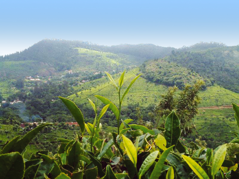
You know that feeling when the Mumbai heat is absolutely suffocating, your AC is working overtime, and all you want is to wake up to cold mountain air and a cup of freshly brewed Nilgiri tea? That’s exactly when I start planning my next trip to Ooty. And trust me, after two decades of sending thousands of travellers to this hill station, I can tell you — knowing the Ooty best time to visit makes ALL the difference between a holiday you’ll rave about and one you’ll want to forget. Whether you’re coming from Bangalore, Chennai, Hyderabad, or Mumbai, this month-wise Ooty climate guide will tell you exactly when to go, what to expect, and how to get the most out of every rupee you spend. 🗓️ Ooty Best Time to Visit — Quick Answer for Travellers The best time to visit Ooty is between March and June (peak season) or October to February (off-peak/romantic season). If you want a budget trip with fewer crowds, July to September is your window. Quick picks based on your goal: 🌿 Why Timing Matters When Planning Your Ooty Trip I’ve been to Ooty in every single month of the year. And I can tell you — the Nilgiri Hills in January feel nothing like the Nilgiris in July. This isn’t just about rain or sunshine. It’s about the whole vibe. In March, the Botanical Garden is bursting with colour, the roads are clear, and you can actually see Doddabetta Peak without squinting through thick fog. In July, those same roads can be slick with rain, leeches pop up on forest trails, and visibility can drop to almost nothing on hairpin bends. But then — the entire valley turns an electric shade of green that honestly looks unreal. The practical side matters too. Peak summer weekends see traffic jams stretching for kilometres near Ooty Lake. Winter fog means you need an extra hour on mountain roads after sunset. And the famous Nilgiri Mountain Railway — the UNESCO-listed toy train — sometimes suspends services during heavy rains. Pack accordingly. April afternoons can surprise you with a chill once the sun dips. January nights near Doddabetta can drop close to 5°C. Always carry a light jacket, no matter when you go. 🌤️ Ooty Best Time to Visit Based on Seasons 🌼 Ooty Best Time to Visit in Summer (March–May) This is Ooty’s peak tourist season, and for good reason. Temperatures sit between a comfortable 15°C and 25°C during the day — perfect when the rest of South India is baking at 40°C+. Schools are on holiday, families flood in from Chennai and Bangalore, and the whole town feels alive. The big highlight? The Ooty Summer Festival, usually held in May, featuring the famous Flower Show at the Government Botanical Garden. Think hundreds of flower varieties, hot air balloon displays, and boat races on Ooty Lake. It’s genuinely spectacular. The honest reality: April and May are crowded. Hotels charge 30–50% more than off-season rates. You need to book accommodation and the Nilgiri Mountain Railway tickets (via IRCTC) at least 4–6 weeks in advance. Weekends in May near Ooty Lake can feel more like a city market than a hill station. My tip: If you must visit in peak season, travel on weekdays and arrive by Thursday. The crowds thin out significantly Monday to Thursday. 🌧️ Ooty Best Time to Visit in Monsoon (June–September) Here’s the truth most travel blogs won’t tell you: monsoon Ooty is massively underrated. Yes, it rains — sometimes heavily. But between July and September, the Nilgiri Hills transform into something that looks straight out of a National Geographic cover. Waterfalls like Pykara are absolutely roaring. The tea plantations are a shade of green so rich it almost looks painted. Temperatures drop to a cool 12°C to 20°C, and you might have entire viewpoints to yourself. Is June a good time to visit Ooty? Early June (before the monsoon fully kicks in) is actually a sweet spot — pleasant weather, lower prices, and manageable crowds. By late July, you should check road and weather conditions before heading out. What to watch out for: leeches on forest trails after heavy rain, slippery roads especially near sharp curves, and the occasional landslide alert. The toy train sometimes runs reduced services in heavy rain. Always carry insect repellent and waterproof footwear. Is Ooty in monsoon worth it? For couples, nature lovers, and photographers — absolutely yes. For families with small kids or seniors — plan for indoor backup options. ❄️ Ooty Best Time to Visit in Winter (October–February) This is the season I recommend most to honeymooners and couples. October and November give you the best of both worlds — the post-monsoon greenery is still fresh, the skies are clear, and the famous “Second Season” brings a second bloom to Ooty’s gardens. By December and January, things get properly cold. Nights near Doddabetta Peak can drop to 5°C or lower. Early mornings sometimes bring frost on the racecourse grounds. It looks magical — thin mist sitting over the valley, the smell of eucalyptus in cold air. It’s incredibly romantic. Pack heavy woolens, thermals, gloves, and a beanie for December and January trips. Nothing ruins a romantic getaway faster than shivering through dinner because you packed only a light sweater. 📊 Ooty Best Time to Visit Month Wise (Detailed Breakdown) Here’s the complete Ooty weather month-wise breakdown I use when advising travellers at Astamb Holidays: Month Avg Temp (Day/Night) Rainfall Crowd Level Wahid’s Recommendation January 21°C / 5°C Low Moderate ❤️ Romantic, carry heavy woolens February 22°C / 7°C Low Low–Moderate 📸 Best for photography & clear skies March 24°C / 10°C Low High ✅ Great weather, book hotels in advance April 25°C / 13°C Light Very High ⚠️ Peak crowds, weekday travel only May 25°C / 14°C Light–Moderate Very High 🌸 Flower Festival — book 6 weeks ahead June 20°C / 12°C Moderate–Heavy Low 💰 Budget sweet spot, early June is best July 18°C / 12°C
Ooty Best Time to Visit (2026): Month-Wise Guide, Weather, Budget & Travel Tips Read More »