Travel Blog

Phillip Island, Victoria: Ultimate Travel Guide (Wildlife, Best Time to Visit & Insider Tips)

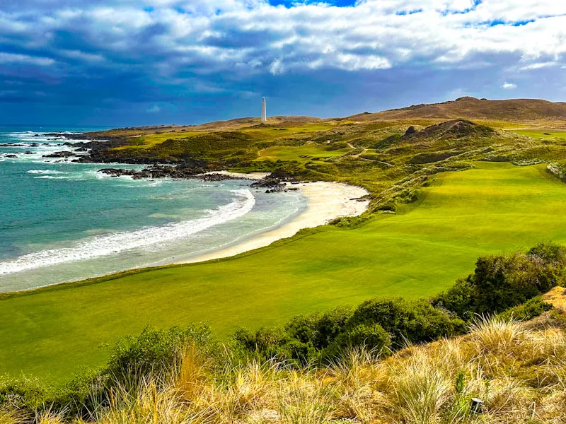
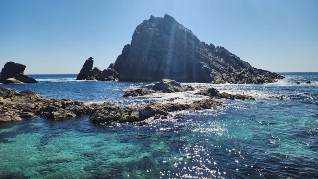
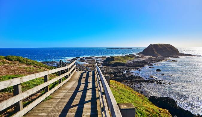
Just 90 minutes from Melbourne, Phillip Island, Victoria is one of Australia’s most loved wildlife destinations. This small island packs a massive punch with its famous Penguin Parade, stunning beaches, and unique Australian animals. Whether you’re planning a family holiday, a solo adventure, or a romantic weekend, Phillip Island offers something special for everyone. In my experience managing tours across Australia for the past 20 years at Astamb Holidays, I’ve seen travelers from all over the world fall in love with this place. The island combines natural beauty, amazing wildlife experiences, and great food—all within easy reach of Melbourne. Let me walk you through everything you need to know to plan the perfect trip. 🌟 What is So Special About Phillip Island? Quick Answer: Phillip Island is home to the world’s largest little penguin colony, Australia’s biggest fur seal colony at Seal Rocks, and some of Victoria’s best surf beaches. The island offers up-close wildlife encounters, dramatic coastal scenery, and family-friendly attractions—all just 140 kilometers from Melbourne. Phillip Island stands out for three main reasons: wildlife, landscapes, and accessibility. Wildlife You Won’t Find Anywhere Else The star attraction is definitely the Penguin Parade. Every single night of the year, hundreds of tiny little penguins (also called fairy penguins) waddle out of the ocean and return to their sand dune burrows. These blue-and-white birds are the smallest penguin species in the world, standing just 33 centimeters tall. The Penguin Parade at Summerland Beach has been running since 1920, and it’s still as magical today as it was a century ago. But the penguins aren’t the only stars. Seal Rocks is home to around 16,000 to 20,000 Australian fur seals—the largest colony in the country. You can watch them from the Nobbies Centre boardwalks, where they lounge on the rocks, play in the waves, and raise their pups during autumn. The Koala Conservation Centre lets you walk through treetop boardwalks to see wild koalas munching eucalyptus leaves at eye level. And Churchill Island offers a working heritage farm where kids can milk cows, watch sheep shearing, and meet Highland cattle with their impressive horns. Stunning Coastal Landscapes Phillip Island’s coastline is seriously beautiful. The northern beaches facing Western Port Bay have calm, shallow waters perfect for families. Cowes Beach is the main swimming spot with cafes and shops right on the waterfront. The southern coast is wild and dramatic. Cape Woolamai—the island’s highest point—offers world-class surf breaks and walking tracks with ocean views. The Nobbies rock formations and blowhole showcase the power of the Southern Ocean, especially when waves crash into the cliffs. The island is part of the UNESCO Western Port Biosphere Reserve, which protects its unique marine environment and wildlife habitats. Towns, Culture & Local Life Cowes is the main town, and it has a proper seaside holiday vibe. Thompson Avenue is lined with restaurants, fish-and-chip shops, boutique stores, and bars serving local wines. The Cowes Jetty is great for sunset strolls and watching local anglers bring in their catch. San Remo—the gateway town on the mainland side—is famous for its daily pelican feeding at 12:00 PM. The Fisherman’s Co-op restaurant serves some of the freshest fish and chips in Victoria, with outdoor tables overlooking the water. The island has a strong farming heritage, and you’ll still see working farms alongside tourist attractions. Churchill Island was the site of Victoria’s first European farm in 1801, and today it preserves traditional farming methods. 🎯 What Can You See & Do on Phillip Island, Victoria? Penguin Parade: The Must-See Experience The Penguin Parade is the reason most people visit Phillip Island, and it truly lives up to the hype. Here’s what you need to know: Timing: The penguins return to shore every night just after sunset. Arrival times vary by season—from around 5:15 PM in June to 8:45 PM in January. Always check the official penguin arrival calendar before your visit. Tickets & Prices: Book online in advance, especially during summer and school holidays. General viewing costs AUD 33 for adults, AUD 16.50 for children (4-15 years), and AUD 82.50 for a family pass (2 adults + 2 children). Australian pensioners pay AUD 23.10. The Experience: You’ll watch from tiered grandstands overlooking Summerland Beach as groups of penguins emerge from the waves. They waddle across the sand in small groups, calling to each other with adorable yapping sounds. After the main parade, you can walk along boardwalks through the colony and watch penguins up close as they find their burrows. Photography Rules: This is important—no cameras, phones, or flash photography are allowed after sunset. The penguins have sensitive eyes, and bright lights can disorient them. The rule is strictly enforced to protect the birds. Insider Tips: Arrive at least one hour before penguin arrival time. This gives you time to explore the excellent visitor center with its penguin displays, grab food at the cafe, and find good seats. During summer (December-January), seats fill fast—arrive even earlier or you might end up standing. What to Wear: Even in summer, bring warm layers, a jacket, and a blanket. The evening sea breeze off Bass Strait can be cold. In winter, dress like you’re going to a footy match in freezing weather—thermal layers, warm hat, gloves, and a windproof jacket. The Nobbies Centre & Seal Watching The Nobbies offers some of the most dramatic coastal scenery on Phillip Island. This rocky headland at Point Grant features boardwalks, viewing platforms, and the famous blowhole. Seal Rocks sit just offshore, and you can spot hundreds of Australian fur seals lounging on the rocks or swimming. The colony has recovered from near-extinction in the 1800s when hunters nearly wiped them out for their fur. Today, with around 16,000-20,000 seals, it’s Australia’s largest colony. The 500-meter boardwalk winds along clifftops with stunning views. You’ll see the Nobbies rock formations, the powerful blowhole (when conditions are right), and possibly migrating humpback whales during winter (June-August). The Nobbies Centre has free entry and features educational displays about local marine life,

Phillip Island, Victoria: Ultimate Travel Guide (Wildlife, Best Time to Visit & Insider Tips) Read More »

What to Do in Perth Australia — Ultimate 2026 Travel Guide

Looking for what to do in Perth Australia in 2026? You’re in for a treat! Perth is capturing hearts worldwide as one of Australia’s most exciting destinations, and I can tell you from 20 years managing tours across this incredible city—it’s hitting its stride like never before. Perth blends sun-soaked beaches with urban energy, world-class wine regions within 25 minutes of the CBD, and those famous quokka selfies on Rottnest Island. In my experience coordinating trips through Astamb Holidays, Perth consistently surprises travelers who expect just another Australian city. Instead, they discover a Mediterranean-style paradise that’s both laid-back and thrilling. This guide covers everything: itineraries, hidden gems, practical costs, and insider secrets you won’t find in generic guides. Whether you’re planning a 3-day city escape or a 5-day adventure through Perth’s surrounding wonders, you’ll get actionable advice from someone who’s actually navigated these streets, beaches, and wine valleys countless times. 🌟 Is Perth, Australia Worth Visiting? Yes, absolutely—Perth is worth visiting in 2026. The city offers Australia’s best weather (300+ sunny days annually), stunning beaches minutes from downtown, and a quality-of-life vibe that Sydney and Melbourne can’t match. Perth consistently ranks high in global livability indexes. The Mediterranean climate means hot, dry summers (December-February) and mild winters, making it perfect for year-round exploration. Unlike the east coast’s crowded tourist circuits, Perth feels spacious and accessible. What makes Perth special in 2026? New luxury hotels like the Hyde Perth (opening March 2026), the Perth Sky Sculpture Park (spring 2026), and expanded direct flights from Europe via Rome-Perth services make it more connected than ever. The city’s investing heavily in cultural precincts, with the WA Museum Boola Bardip and renovated waterfront areas transforming the urban experience. From managing tour groups, I’ve noticed Perth appeals to travelers seeking authenticity over Instagram-perfect scenes. The locals are genuinely friendly, the pace is relaxed, and you can actually afford a decent meal near the beach—something becoming rare in Australian cities. 🏖️ What is Perth Best Known For? Perth is famous for three things: pristine coastline, the Swan River, and Rottnest Island’s quokkas. The Coast: Perth’s 19 beaches stretch along the Indian Ocean, offering some of Australia’s cleanest sand and clearest water. Cottesloe Beach draws families and swimmers, while Scarborough Beach attracts surfers and sunset chasers. You can watch the sun sink into the ocean—a rarity in Australia where most major cities face east. Swan River: This natural waterway curves through the city, creating recreational spaces and stunning viewpoints. The river connects Perth to Fremantle and provides ferry routes, cycling paths, and waterfront dining from Elizabeth Quay to Matilda Bay. Quokka Island: Rottnest Island sits 18 kilometers offshore, home to the world’s happiest-looking marsupials. The car-free island features 63 beaches, crystal-clear snorkeling spots, and cycling routes around a landscape that feels untouched by time. Perth’s emerging coffee and nightlife culture rivals Melbourne’s. Northbridge, the entertainment district, pulses with small bars, live music venues, and diverse restaurants. The wine regions—especially Swan Valley—produce world-class wines just 25 minutes from the city center. 🎯 Best Things to Do in Perth Australia — Top Attractions 🌳 Nature & Outdoor Experiences Kings Park: Australia’s Largest Inner-City Green Space Kings Park covers 400 hectares (bigger than New York’s Central Park) and sits just 1.5 kilometers from Perth’s CBD. This isn’t just a park—it’s a conservation area with 267 hectares of native bushland. What to see: Entry is completely FREE. The spring wildflower display (September-November) transforms the gardens into a kaleidoscope of colors—over 12,000 species bloom during this period. I recommend arriving early morning when kangaroos occasionally hop through the bushland sections. Getting there: Take the free Route 935 bus or Blue CAT from Perth CBD. Parking is free for up to 4 hours. Rottnest Island: Quokka Selfies and Pristine Beaches Rottnest Island (locals call it “Rotto”) is Western Australia’s most photographed destination thanks to quokkas—small marsupials with permanent “smiles.” The island operates entirely car-free, perfect for cycling between hidden coves and snorkel spots. Ferry options: Book ferries through Rottnest Express, SeaLink, or Rottnest Fast Ferries. I always recommend the Fremantle departure—it’s faster and you can explore Fremantle before or after your island adventure. Top activities: Pack your own snacks—island food prices run high. Rent snorkel gear on the mainland to save money. Cottesloe & Scarborough Beaches: Where Perth Lives Cottesloe Beach is Perth’s postcard-perfect swimming spot. The protected bay offers calm water, grassy terraces for picnics, and the iconic Indiana Tea House restaurant perched on the sand. Families love the gentle waves and lifeguard patrols. Scarborough Beach underwent a $100 million redevelopment and now features modern facilities, surf breaks, and a bustling promenade. The amphitheater hosts free concerts during summer, and the restaurants along the esplanade serve everything from fish and chips to fine dining. Pro tip: Visit Cottesloe for swimming and sunset photos. Choose Scarborough for surfing lessons ($60-80 for 2 hours) and the vibrant beach club atmosphere. AQWA: Journey Through Australia’s Largest Aquarium The Aquarium of Western Australia (AQWA) at Hillarys Boat Harbour showcases marine life from Western Australia’s 12,000-kilometer coastline. The star attraction is the 98-meter underwater tunnel where you glide on a conveyor belt beneath 3 million liters of seawater, watching giant sharks, stingrays, and sea turtles swim overhead. Entry fees (2026): Highlights: Open 9am-4pm daily. Budget 2-3 hours for a complete visit. The on-site cafe serves lunch with harbor views. 🎨 Cultural & Urban Experiences Perth Cultural Centre: Where Art Meets History The Perth Cultural Centre in Northbridge brings together several world-class institutions in one walkable precinct: WA Museum Boola Bardip (“many stories” in Noongar language) opened in 2020 as a state-of-the-art museum exploring Western Australia’s natural and cultural history. The dinosaur exhibits, Aboriginal heritage displays, and interactive galleries make it Perth’s must-see cultural attraction. Entry is FREE. Art Gallery of Western Australia houses extensive Aboriginal art collections and rotating international exhibitions. Free entry, open 10am-5pm (closed Tuesdays). Perth Institute of Contemporary Arts (PICA) showcases cutting-edge visual and performance art in a converted heritage building. I always

What to Do in Perth Australia — Ultimate 2026 Travel Guide Read More »

Whitsundays Australia Travel Guide 2026: Best Time to Visit, Costs, Activities & Expert Tips

Picture this: 74 tropical islands floating in crystal-clear turquoise waters, silica sand so pure it squeaks beneath your feet, and coral reefs teeming with colorful marine life. Welcome to the Whitsundays Australia – one of the most stunning island groups on the planet. I’m Wahid Ali, Operations Lead at Astamb Holidays in Mumbai, and I’ve spent the last 20 years helping travelers discover iconic destinations worldwide. The Whitsundays Australia region has captured my heart like few places have. Whether you’re a budget backpacker, a family seeking adventure, or a couple wanting luxury, this guide provides everything you need to plan an unforgettable 2026 trip to this Queensland paradise. In my experience managing tours to Australia, the Whitsundays consistently deliver that “wow” factor travelers dream about. From timing your visit to avoid stinger season to finding the best deals on sailing tours, I’ll share insider knowledge gathered from years in the tourism industry. 🌴 What Are the Whitsundays Australia? The Whitsundays is an archipelago of 74 islands located off the coast of Queensland, right in the heart of the Great Barrier Reef. Only eight islands have resorts, while many others remain uninhabited and protected as part of the Whitsunday Islands National Park. These islands sit at the intersection of two UNESCO World Heritage areas: the Great Barrier Reef Marine Park to the east and the Whitsunday Islands National Park protecting most of the land. This dual protection means you’re visiting one of the most ecologically significant regions on Earth. Indigenous Heritage: The Ngaro and Gia People The Ngaro People (also known as the Gia People) called these islands home for over 9,000 years. These skilled seafaring people traveled between islands in bark canoes. You can still find ancient rock art at Nara Inlet on Hook Island. In my opinion, learning about this indigenous heritage adds deeper meaning to your visit – it’s about respecting and understanding the land’s history. Understanding the Layout Pull up Google Maps before you arrive. Notice how the islands create natural channels perfect for sailing – one reason this area is called the “sailing capital of Australia.” Whitehaven Beach sits on Whitsunday Island’s eastern side, facing the open ocean. That’s why the sand stays so pure – constant wave action washes away organic material. ✨ Why Are the Whitsundays So Special? After organizing trips worldwide, I can tell you the Whitsundays offer something genuinely rare: world-class beauty that’s still accessible to regular travelers. Whitehaven Beach: The Crown Jewel Whitehaven Beach stretches for 7 kilometers with 98% pure silica sand that doesn’t retain heat. You can walk barefoot even at midday. The beach consistently ranks among the top ten globally. The best photography time is two hours after sunrise or before sunset when low-angle light creates incredible contrasts. At Hill Inlet, check tide times – swirling sand patterns change dramatically with tidal movement. Sailing & Marine Biodiversity The Whitsundays offer world-class sailing conditions. Trade winds blow consistently from the southeast between May and September, creating perfect conditions. The protected waters host over 1,500 species of fish, 400 types of coral, sea turtles, reef sharks, rays, and – between June and September – migrating humpback whales. Whale watching season (roughly mid-July to mid-September) transforms the region. If your dates fall during this window, book a whale watching tour. Seeing a 40-ton whale breach is life-changing. ✈️ How to Get to Whitsundays Australia Can I Fly to the Whitsundays? Yes! You have two main airport options: Hamilton Island Airport (HTI) Located directly on Hamilton Island – step off the plane onto a Whitsunday Island. Flight Costs (2026 Estimates): Book 6-8 weeks in advance for best prices. Whitsunday Coast Airport (PPP) – Proserpine Located 25 kilometers from Airlie Beach on the mainland. Cheaper flights but requires ground transfer ($25-35 shuttle, 30-40 minutes). My Recommendation: If staying on Hamilton Island, fly directly there. If basing in Airlie Beach or on a budget, fly to Proserpine. Airport Best For Pros Cons Hamilton Island (HTI) Island resort stays Direct island access More expensive Proserpine (PPP) Budget travelers Cheaper flights Requires transfer Can I Drive to Whitsundays? Absolutely! The Whitsundays are accessible by road to Airlie Beach. From Brisbane: 1,150 kilometers (12-14 hours, spread over 2-3 days ideal)Fuel Cost: $180-220 one-way From Cairns: 630 kilometers (7-8 hours)Fuel Cost: $100-130 one-way Recommended Stops: Fraser Island, Rockhampton, Townsville, Mackay Eco-Tip: Consider carbon offsetting ($5-15 per flight) or sharing rides to minimize environmental impact. 📅 When Is the Best Time to Visit Whitsundays? Dry Season (May to October) – BEST OVERALL Temperature: 20-28°C | Rainfall: MinimalPerfect for: Sailing, whale watching, comfortable weatherTrade-off: Most expensive, book 3-4 months ahead Wet Season (December to March) – BUDGET OPTION Temperature: 24-31°C | Rainfall: HighPerfect for: Budget travelers, fewer crowds (30-40% cheaper)Trade-off: Humid, stinger season, possible cyclones Shoulder Season (April & November) – SWEET SPOT Temperature: 22-29°C | Prices: Mid-rangePerfect for: Best value, good weather, moderate crowds Season Weather Crowds Price Best For Dry (May-Oct) ☀️ Excellent High $$$ Whale watching, perfect weather Wet (Dec-Mar) 🌧️ Humid Low $ Budget travelers Shoulder (Apr/Nov) 🌤️ Good Medium $$ Value seekers Can I Swim in the Whitsundays in January? Yes, with precautions. January falls in stinger season (November-May) when dangerous jellyfish (box jellyfish and Irukandji) are present. Safety Measures: Always carry vinegar for stings and know emergency numbers (000). 💰 How Much Do Whitsundays Trips Cost? Budget Backpacker (Per Person, Per Day) Mid-Range Family (Family of 4, Per Day) Luxury (Per Person, Per Day) Specific Costs (2026 Estimates) Activity/Service Price Range Whitehaven Beach Tour $120-200 2-Day Sailing Trip $450-650 Great Barrier Reef Snorkel Day $180-260 Hamilton Island Day Ferry $60-80 return Diving (2 dives) $150-220 Whale Watching Tour $120-180 Wahid’s Money-Saving Tips: 🏖️ Top Things to Do in the Whitsundays Australia Visit Whitehaven Beach & Hill Inlet Access Options: Hill Inlet Lookout requires a 15-20 minute uphill walk (moderate fitness). Visit early morning for fewer crowds and best photos. Explore Hamilton Island Top Activities: My Tip: Day-trip from Airlie Beach ($60-80 return ferry)

Whitsundays Australia Travel Guide 2026: Best Time to Visit, Costs, Activities & Expert Tips Read More »

Ultimate Great Barrier Reef Snorkeling, Tours & Scuba Diving Guide — Costs, Best Times, Safety & Facts

Picture this: you’re floating above a kaleidoscope of coral gardens, schools of rainbow-colored fish dart around you, and a sea turtle glides past like it’s the most natural thing in the world. That’s what experiencing great barrier reef snorkeling feels like — and trust me, after 20 years of sending travelers to every corner of Australia, I can tell you this is one place that actually lives up to the hype. I’m Wahid Ali, and I’ve been in the tourism game long enough to know when a destination delivers and when it disappoints. The Great Barrier Reef delivers. Every single time. Whether you’re planning your first underwater adventure with great barrier reef tours or you’re a seasoned diver ready for some world-class great barrier reef scuba diving, this guide will walk you through everything you need to know — the real costs, the best times to visit, safety tips that actually matter, and great barrier reef facts that go beyond the tourist brochures. In my years heading operations at Astamb Holidays in Mumbai, I’ve seen countless clients return from the reef with stories that give me goosebumps. But I’ve also seen travelers make rookie mistakes that cost them time, money, and memories. Let’s make sure you’re in the first group. 🌊 What Is the Great Barrier Reef? Quick Facts You Must Know The Great Barrier Reef is the world’s largest living structure, spanning 2,300 kilometers (1,400 miles) along Queensland’s northeast coast and covering 344,000 square kilometers — that’s roughly the size of Italy or Japan. Let me break down what makes this place so extraordinary: Location: Off the coast of Queensland, Australia, stretching from the northern tip near Cape York down to Bundaberg in the south. Size and Scale: We’re talking about 2,900 individual reefs and over 900 islands. It’s so massive you can see it from space — literally the only living structure visible from orbit. Biodiversity: The reef is home to over 1,500 species of fish, 400 types of coral, 4,000 types of mollusks, and 240 species of birds. You’ll find six of the world’s seven species of marine turtle here, plus dolphins, whales, sharks, and the stunning manta rays. UNESCO World Heritage Status: Listed since 1981 as a World Heritage Site, the reef is protected by the Great Barrier Reef Marine Park Authority (GBRMPA), which manages this incredible ecosystem. Current Environmental Status: I won’t sugarcoat it — the reef has faced six mass bleaching events since 2016, including back-to-back events in 2024 and 2025. However, coral cover remains near its long-term average due to recovery periods between events. The reef is resilient but facing real challenges from climate change. Quick Reef Facts Details Total Length 2,300 km (1,400 miles) Total Area 344,000 sq km (133,000 sq miles) Number of Reefs 2,900+ individual reefs Number of Islands 900+ islands Fish Species 1,500+ species Coral Types 400+ hard and soft coral species UNESCO Status World Heritage Site since 1981 Water Temperature 23°C-29°C (73°F-84°F) year-round Source: Great Barrier Reef Marine Park Authority 🤿 Great Barrier Reef Snorkeling: Experience, Tips & Spots Let me paint you a picture from my client feedback: you slip into the warm water, adjust your mask, and suddenly you’re in a completely different world. The water is so clear you can see 15-30 meters ahead on a good day. Below you, coral formations create underwater cities where fish communities go about their daily business. What Snorkeling the Reef Actually Feels Like: The first breath through your snorkel feels strange if you’re new to this, but within minutes, you’ll forget you’re breathing through a tube. The water temperature averages 24°C-28°C (75°F-82°F) depending on the season — warm enough that you won’t freeze but cool enough to be refreshing. You’ll float effortlessly thanks to your life vest, and that’s when the magic happens. Best Snorkeling Spots on the Great Barrier Reef: Based on years of client experiences and operator feedback, here are the top locations: 1. Agincourt Reef (Port Douglas) ⭐⭐⭐⭐⭐ Image Source: https://www.queensland.com/in/en/home 2. Moore Reef (Cairns) ⭐⭐⭐⭐⭐ Image Source: https://cairns-tours.com/ 3. Norman Reef (Cairns) ⭐⭐⭐⭐⭐ Image Source: https://cairns-tours.com/ 4. Flynn Reef (Cairns) ⭐⭐⭐⭐ Image Source: https://cairns-tours.com/ Essential Snorkeling Gear (Usually Provided): Pro Tips from 20 Years of Experience: 🚢 Great Barrier Reef Tours: How to Choose the Best One This is where travelers get overwhelmed — there are literally hundreds of tour operators between Cairns and Port Douglas. Here’s how to cut through the noise and find your perfect reef experience. Understanding Reef Tour Types: 1. Day Tours to Outer Reef (Most Popular) 2. Pontoon Platform Tours 3. Small Group Tours 4. Liveaboard Tours (Overnight) Cairns vs. Port Douglas Departures: Factor Cairns Port Douglas Tour Options 50+ operators 15+ operators Travel Time to Outer Reef 60-90 minutes 90 minutes Reef Sites Norman, Flynn, Moore, Hastings Agincourt, Opal, Low Isles Crowd Level Higher (busier season) Lower (more exclusive feel) Price Range $179-$325 AUD $260-$410 AUD Departure Vibe Busy marina, big city energy Relaxed tropical village Best For More options, budget-friendly Quieter experience, premium feel Outer Reef vs. Inner Reef — What’s the Difference? Outer Reef: Inner Reef & Islands: What’s Actually Included in Most Tours: What Costs Extra: 🤿 Great Barrier Reef Scuba Diving Options for All Levels Here’s where it gets really exciting. If snorkeling is watching a movie on your phone, scuba diving the Great Barrier Reef is watching it in IMAX 3D. You’re not just looking down at the reef — you’re in it, moving through it, breathing underwater while fish swim inches from your face. Introductory Dives (No Experience Needed): What it involves: You’ll get a 30-minute briefing on boat, practice in shallow water or on the platform, then descend with an instructor holding your hand (literally). The instructor controls everything — you just breathe and enjoy. It’s called a “Discover Scuba Dive” or “Resort Dive.” Who it’s perfect for: Anyone nervous about diving but wanting to try. You’ll be amazed at how natural breathing underwater feels after the first few breaths.

Ultimate Great Barrier Reef Snorkeling, Tours & Scuba Diving Guide — Costs, Best Times, Safety & Facts Read More »

Uluru-Kata Tjuta National Park — Complete Travel Guide 2026

Standing at the edge of Australia’s Red Centre, watching the sunrise paint Uluru-Kata Tjuta National Park in shades of crimson and gold, I’m reminded why this place captivates millions. As someone who manages travel operations and has organized countless tours to this World Heritage-listed park, I can tell you that Uluru-Kata Tjuta National Park offers more than stunning photos – it delivers a soul-stirring connection to ancient Anangu culture and landscapes that have existed for millennia. Here’s the thing: planning a trip to Uluru-Kata Tjuta National Park requires more than just booking flights. You need insider knowledge about entry fees, the best walking trails, cultural sensitivities, and practical logistics. After years of helping travelers experience the Red Centre properly, I’ve put together everything you need to know for an unforgettable 2026 visit. What Is Uluru-Kata Tjuta National Park? 🏜️ Located in Australia’s Northern Territory, approximately 450 kilometers southwest of Alice Springs, Uluru-Kata Tjuta National Park is a dual-listed UNESCO World Heritage site recognized for both its outstanding natural and cultural values. This designation – one of only a handful worldwide – honors the park’s geological significance and its deep spiritual importance to the Anangu people, who have been the traditional custodians of this land for over 30,000 years. The park spans 1,325 square kilometers of red desert, home to two of Australia’s most iconic natural landmarks: Uluru (the massive sandstone monolith) and Kata Tjuta (a collection of 36 weathered rock domes). Park Feature Details Size 1,325 square kilometers Nearest Town Yulara (18 km from Uluru) Climate Type Semi-arid desert UNESCO Status Dual-listed (1987 for natural, 1994 for cultural) Traditional Owners Anangu (Pitjantjatjara and Yankunytjatjara people) Elevation – Uluru 348 meters above ground Elevation – Kata Tjuta 546 meters above ground (tallest dome) Annual Visitors Approximately 250,000+ The park operates under joint management between Parks Australia and the Anangu traditional owners – a model that has set international standards for indigenous land management since the historic 1985 Handback, when the Australian Government returned ownership to its rightful custodians. Uluru vs Kata Tjuta — Are They the Same Thing? This is one of the most common questions I get from travelers. While both are part of the same national park, Uluru and Kata Tjuta are distinctly different geological formations with their own unique characteristics. Uluru is a single massive sandstone monolith – essentially one enormous rock rising 348 meters above the desert floor with a circumference of 9.4 kilometers. What you see is actually just the tip; geologists estimate that most of Uluru extends several kilometers underground. The rock is approximately 550 million years old and was formed through the compression of ancient sand dunes. Kata Tjuta, whose name means “many heads” in the local Anangu language, consists of 36 separate dome formations spread across more than 20 square kilometers. The tallest dome, Mount Olga, rises 546 meters – actually 200 meters higher than Uluru. These domes are made of conglomerate rock (a mixture of boulders, pebbles, and sand cemented together) and are estimated to be around 500 million years old. Think of it this way: Uluru is like a single, smooth cathedral dome, while Kata Tjuta is a cluster of weathered, rounded peaks that create mysterious valleys and gorges between them. Why Is Uluru-Kata Tjuta National Park So Famous? 🌟 Beyond the obvious visual drama, Uluru-Kata Tjuta National Park holds profound significance that transcends typical tourist attractions. In my experience planning tours, understanding this “why” transforms a simple sightseeing trip into a meaningful journey. Geological Wonder: These formations represent one of Earth’s most remarkable geological stories. The sandstone of Uluru contains minerals that oxidize (rust) when exposed to air, creating that famous red color. At sunrise and sunset, the changing angle of sunlight amplifies different mineral compositions, making the rock appear to glow in shades ranging from deep purple to brilliant orange-red. Spiritual Heart: For the Anangu people, this landscape embodies Tjukurpa – their traditional law, culture, and creation stories. Tjukurpa explains how ancestral beings shaped the land, created the waterholes, and established the laws that govern Anangu life. Every cave, waterhole, and rock formation has stories attached, making the entire park a living cultural textbook. According to Anangu Tjukurpa, during the creation period, ancestral beings traveled across the land, hunting, fighting, loving, and teaching. As they moved, they created the landscape features we see today. The Mala (rufous hare-wallaby) people camped at Uluru, the Kuniya (woma python) fought the Liru (poisonous snake) at Mutitjulu Waterhole, and these stories are preserved in the rock art and landscape itself. Global Icon Status: Uluru has become one of the world’s most photographed natural landmarks, featured in countless films, documentaries, and travel campaigns. It represents Australia’s ancient heart and has become a pilgrimage site for travelers seeking connection with nature and indigenous culture. Scientific Importance: The park protects rare desert ecosystems, including over 400 plant species and numerous threatened animals like the Great Desert Skink and Mulgara. The joint management model has pioneered fire management techniques that balance traditional Anangu burning practices with modern conservation science. Visitor Planning Essentials (Logistics Focus) 📋 Let me share the practical details that can make or break your visit. As someone who coordinates logistics daily, I know these specifics matter. Uluru-Kata Tjuta National Park Entry Fee 💰 All visitors require a park pass to enter Uluru-Kata Tjuta National Park. Here’s what you need to know for 2026: Pass Details: How to Purchase: Where Money Goes: This is important to understand. 100% of park pass revenue is reinvested directly into: You cannot use a Northern Territory parks pass here – Uluru-Kata Tjuta National Park is federally managed by Parks Australia, requiring its own separate pass. Uluru-Kata Tjuta National Park Opening Hours ⏰ The park operates year-round with seasonal hour variations: Season Opening Hours Note December-February (Summer) 5:00 AM – 9:00 PM Extremely hot; walks close early March-May (Autumn) 5:00 AM – 8:00 PM Ideal conditions June-August (Winter) 6:30 AM – 7:30 PM Cold nights, perfect days September-November (Spring)

Uluru-Kata Tjuta National Park — Complete Travel Guide 2026 Read More »

King Island, Tasmania Travel Guide 2026 — How to Get There, What to Do & Why It’s Worth Visiting

Standing on the windswept coastline of King Island, Tasmania, watching waves roll in from Antarctica across the Bass Strait, I’m reminded why this remote paradise has become one of Australia’s most talked-about destinations. After two decades organizing travel experiences across Australia’s hidden corners, I can say with confidence that King Island delivers something increasingly rare—authentic wilderness, world-class experiences, and a pace of life that feels like stepping back in time. In my experience at Astamb Holidays, travelers who discover King Island, Tasmania often struggle to leave. This isn’t your typical tourist trap with crowded beaches and overpriced attractions. This is 1,098 square kilometers of rolling green pastures, rugged coastlines, award-winning cheese, and golf courses that rival Scotland’s finest. It’s where you’ll find beaches entirely to yourself, surf breaks rated among the world’s best, and a community of 1,600 people who still wave as you drive past. 🏝️ What and Where Is King Island, Tasmania? King Island sits roughly 80 kilometers northwest of Tasmania’s mainland and about 80 kilometers southeast of Victoria’s Cape Otway, positioned directly in the path of the legendary Roaring Forties winds. This strategic location in the Bass Strait has shaped everything about the island—from its tempestuous maritime history to the salt-kissed pastures that produce world-renowned dairy products. How big is King Island? The island spans 1,098 square kilometers (approximately 1,091 km²), measuring roughly 64 kilometers long and 27 kilometers wide at its widest point. To put this in perspective, you can drive from the Cape Wickham Lighthouse at the northern tip to Grassy in the south in under an hour—though you’ll want to take much longer to explore properly. Quick Facts: King Island at a Glance Feature Details Size 1,098 km² (424 sq miles) Population 1,617 (2021 Census) Main Towns Currie (main hub), Grassy, Naracoopa Coastline 164 km of stunning beaches Highest Point Gentle Annie (162 meters) Location Bass Strait, between Tasmania and Victoria Time Zone Australian Eastern Standard Time (AEST) Climate Temperate maritime, average 10-17°C King Island is the second-largest island in Bass Strait (after Flinders Island) and the largest of the New Year Group of islands. The island’s gentle rolling topography rises to a modest hill called Gentle Annie at 162 meters, giving it a distinctly pastoral character. Three smaller offshore islands—New Year Island, Christmas Island, and Councillor Island—dot the waters nearby, named by early explorers who spotted them during the holiday season. The island forms part of the official boundary between the Great Australian Bight and Bass Strait, making it a crucial waypoint for vessels navigating these treacherous waters. This strategic position contributed to over 60 recorded shipwrecks around the island’s shores throughout the 19th century, earning it a dark reputation among sailors but eventually leading to the construction of the magnificent Cape Wickham Lighthouse. ✈️ How Do You Get to King Island Tasmania? Let me be direct: King Island requires commitment. There’s no ferry service, no bridge, and no shortcuts. The only way to reach this island paradise is by air—and that’s precisely what keeps it special. Flight Options to King Island Daily flights operate from multiple departure points across Victoria and Tasmania, with flight times ranging from 30 to 60 minutes. Here’s your complete breakdown: Sharp Airlines operates the most comprehensive service: Regional Express (REX) provides: King Island Airlines flies from: In my experience managing tour logistics, booking 4-6 weeks in advance is essential, especially during peak season (December to February) and long weekends. These small aircraft fill quickly, particularly during the King Island Open golf tournament in November. Important Flight Details Baggage Allowances: Pro Tip from Years of Experience: Always call ahead if you’re bringing golf clubs or surfboards. The small prop planes have limited space, and you don’t want surprises at check-in. Why No Ferry Service? The Bass Strait between King Island and the mainland is notoriously rough, with powerful currents and unpredictable weather driven by the Roaring Forties. Commercial ferry services simply aren’t viable or safe. Freight arrives via shipping to Grassy Harbour, but passenger transport remains exclusively by air. Ground Transportation: Car Hire is Mandatory There’s no taxi service, no rideshare, and no public transportation on King Island. You must arrange car hire in advance and pick it up at King Island Airport. Most rental companies (King Island Car Rentals being the primary provider) leave keys in vehicles at the airport—a charming reminder of the island’s low crime rate. Important Logistics: 🤔 Is It Worth Visiting King Island, Tasmania? This is the question I hear most often, and my answer depends on what you’re seeking. If you want nightlife, shopping malls, and packed tourist attractions, King Island isn’t your destination. But if you’re craving authenticity, unspoiled natural beauty, and experiences that feel increasingly rare in our hyper-connected world—this island delivers in spades. The Honest Truth About King Island Let me give you the real talk: King Island embraces isolation. The nearest city is over 80 kilometers across notoriously rough waters. Your phone signal will be patchy outside the main towns. The island has six shops on its main street. Dining options are limited, and many close by 7 PM. The weather can be brutal, with winds regularly exceeding 100 km/h in winter. And yet, people return year after year. Why? The “Empty Beach Luxury”: On King Island, you’ll have world-class beaches entirely to yourself. Martha Lavinia Beach—rated among the top 10 surf beaches globally—might see only a handful of surfers on a good day. Compare this to mainland Australia’s crowded coastlines, and the appeal becomes obvious. Reddit communities dedicated to Tasmania consistently praise King Island for its uncrowded attractions and authentic experiences. One traveler summed it up perfectly: “It’s like Tasmania was 40 years ago—no crowds, genuine locals, and nature that hasn’t been Instagrammed to death.” Who Should Visit King Island? In my 20 years organizing travel experiences, I’ve found King Island perfect for: Investment of Time and Money Budget Expectations (Per Person, 3 Days): Yes, King Island is more expensive than mainland Tasmania. But the lack

King Island, Tasmania Travel Guide 2026 — How to Get There, What to Do & Why It’s Worth Visiting Read More »

Things to Do in Margaret River: The Ultimate Guide to Attractions, Activities & Travel Tips (2026)

Picture this: You’re standing on a limestone cliff 270 kilometers south of Perth, watching world-class surfers carve through crystal-clear Indian Ocean waves while vineyards stretch behind you into ancient karri forests. This isn’t a dream—it’s Margaret River, and in 2026, it’s calling your name with more incredible experiences than ever before. As someone who’s been managing tours in Australia’s South West for 20 years, I can tell you that things to do in Margaret River extend far beyond the postcard-perfect scenery. From exploring 100+ underground limestone caves formed over 1 million years ago to tasting world-renowned wines at 90+ cellar doors, this region delivers the perfect blend of adventure, luxury, and natural wonder. Whether you’re planning to walk the legendary 135-kilometer Cape to Cape Track, dive into ancient caves like Lake Cave and Mammoth Cave, or simply sip Chardonnay while watching the sunset over Sugarloaf Rock, Margaret River offers something extraordinary for every traveler. Things to Do in Margaret River include exploring 90+ world-class wineries, surfing at legendary breaks like Prevelly Beach, discovering ancient limestone caves (Lake Cave, Mammoth Cave, Jewel Cave), hiking the 135km Cape to Cape Track, visiting the Boranup Karri Forest, and experiencing Wadandi Aboriginal culture through guided tours. The region combines premium wine tasting, spectacular coastal scenery, adventure activities, and fresh gourmet produce into one unforgettable destination. This 2026 guide is backed by the latest information, current costs, hidden gems I’ve discovered while operating tours here, and insider secrets that’ll help you experience Margaret River like a local—not a tourist. 🍷 Why Is Margaret River So Famous? When people ask me what makes Margaret River special, I tell them about the “Triple Threat” that put this region on the world map. World-Class Wine That Rivals Bordeaux Margaret River produces less than 3% of Australia’s total wine output but accounts for over 20% of the country’s premium wine market. That’s incredible! The region’s 138+ wineries specialize in Cabernet Sauvignon and Chardonnay, with over 65 wineries rated 5-star by Halliday Wine Companion. In my experience managing wine tours, I’ve seen firsthand how the Mediterranean climate, ocean breezes from the Indian Ocean, and unique terracotta soils create perfect conditions for grape growing. Founding wineries like Vasse Felix (established 1967), Leeuwin Estate, and Cullen Wines (Australia’s first 100% carbon-neutral winery) set the standard. Today, boutique producers like Passel Estate, Victory Point, and Cape Naturaliste Vineyard offer intimate tastings where you’ll often meet the winemakers themselves. Legendary Surf That Draws World Champions Before Margaret River became famous for wine, surfers discovered its 75+ world-class breaks spanning 130 kilometers of coastline. The Margaret River Pro (held annually in April/May) attracts top World Surf League competitors to Surfers Point (Main Break) in Prevelly—one of the most challenging waves in competitive surfing. Popular breaks include: Ancient Caves Holding Earth’s Secrets Beneath the Leeuwin-Naturaliste Ridge lie over 150 limestone caves formed approximately 1 million years ago. Four spectacular “show caves” are open to the public: Indigenous Wadandi Culture & Deep Connection to Country For over 60,000 years, the Wadandi (Saltwater) people have been the traditional custodians of this land, known as Wadandi Boodja. Their cultural knowledge runs incredibly deep, with six seasonal calendars (Birak, Bunuru, Djeran, Makuru, Djilba, and Kambarang) still used today to live in harmony with the land. I highly recommend booking a Koomal Dreaming tour with Wadandi custodian Josh ‘Koomal’ Whiteland, who shares stories, traditional practices, and the significance of sites like Ngilgi Cave in Wadandi culture. These experiences add profound depth to your understanding of the region’s natural and cultural heritage. For more details: https://saltwaterbusselton.com.au/ 🌤️ Best Time to Visit Margaret River (2026 Seasonal Guide) Margaret River is beautiful year-round, but timing your visit right can save you money and help you avoid crowds. Here’s my breakdown based on 20 years of operating tours here: Season Months Temperature Crowd Level Price Range Best For What to Pack Summer (Peak) Dec–Mar 22°C–30°C (72°F–86°F) HIGH $$$$ Beach activities, swimming, festivals Sunscreen (SPF 30+), swimwear, hat, light clothing Autumn Apr–May 12°C–24°C (54°F–75°F) MEDIUM $$$ Wine tasting, Margaret River Pro surfing competition, harvest season Layers, light jacket, sunglasses Winter (Off-peak) Jun–Aug 8°C–18°C (46°F–64°F) LOW $$ Whale watching, cozy winery visits, best value Warm jacket, rain gear, hiking boots Spring (Ideal) Sep–Nov 9°C–24°C (48°F–75°F) MEDIUM $$$ Wildflowers, whale watching, perfect hiking weather Layers, rain jacket, camera, binoculars Pro Insider Tips: 2026 Special Events: 🚗 How Long Does It Take to Drive From Perth to Margaret River? The drive from Perth to Margaret River is one of Western Australia’s most scenic road trips—and one I’ve done countless times organizing tours. Distance: 270–280 kilometers (168–174 miles)Drive Time: 3–3.5 hours without stopsRoute: Take Kwinana Freeway → Forrest Highway → Bussell Highway into Margaret River The journey is straightforward on fully sealed roads, making it perfect for a long weekend getaway or the start of a longer South West adventure. 3 Must-Stop Spots on the Drive 🛑 From my experience managing transfers and tours, these three stops will break up your journey perfectly: 1. Busselton Jetty (2 hours 20 minutes from Perth)The longest timber-piled jetty in the Southern Hemisphere at 1.8 kilometers! Walk the jetty for free or take the train to the end ($14 adults, $7 children). The Underwater Observatory at the jetty’s end offers incredible views of marine life without getting wet ($35 adults, $17 children). 2. Bunbury Dolphin Discovery Centre (1.5 hours from Perth)Spot wild bottlenose dolphins from the beach or jetty. The Discovery Centre offers interactive exhibits ($15 adults, $8 children). If you’re lucky, dolphins swim right up to the shore! 3. Vineyard 28 in Yarloop (1.5 hours from Perth)A hidden gem! This boutique winery specializes in Italian grape varieties like Pignoletto, Arneis, Dolcetto, and Nebbiolo—rare finds in Western Australia. Perfect for a mid-journey wine tasting and grazing board. Bonus Stop: Lake Clifton Thrombolites—ancient living fossils lining the lake shore, resembling Earth’s earliest life forms. A fascinating 5-minute stop with a boardwalk for easy viewing. 🏖️ Top Things to Do in Margaret River, Western Australia

Things to Do in Margaret River: The Ultimate Guide to Attractions, Activities & Travel Tips (2026) Read More »

New Zealand Snow Mountain

New Zealand Tour 2026: Ultimate Travel Guide, Itineraries, Costs & Tips

Picture this: glaciers descending into rainforests, golden beaches kissed by turquoise waters, geothermal pools bubbling beneath snow-capped peaks, and cultures so rich they’ve shaped landscapes for over a thousand years. Welcome to New Zealand – where every new zealand tour becomes a story you’ll tell for a lifetime. I’m Wahid Ali, and after 20 years of managing tours at Astamb Holidays in Mumbai, I’ve helped thousands of travelers experience destinations that take their breath away. But New Zealand? This place holds a special spot in my heart. It’s not just about the scenery (though trust me, you’ll run out of memory on your phone). It’s about standing on volcanic ridges at sunrise, sharing a traditional Maori hangi, or feeling your heart race as you bungy jump over crystal waters in Queenstown. 2026 is shaping up to be an incredible year to visit New Zealand. With flight connections improving, accommodation options expanding, and sustainability initiatives making travel more responsible, there’s never been a better time to plan your Kiwi adventure. Whether you’re a solo adventurer chasing adrenaline, a family seeking unforgettable memories, or a couple dreaming of romantic landscapes, this guide will show you exactly how to make your New Zealand tour 2026 absolutely perfect. 🌏 What is a New Zealand Tour and Why Visit in 2026? A new zealand tour isn’t just a vacation – it’s an immersion into two stunning islands where ancient Maori traditions meet modern adventure culture. Here’s what makes New Zealand genuinely special: The Land of Contrasts: The North Island gives you geothermal wonderlands like Rotorua, where the earth literally steams and bubbles. Meanwhile, the South Island delivers jaw-dropping alpine scenery with Milford Sound, glaciers, and mountain ranges that seem pulled from fantasy novels. Maori Culture Meets Natural Wonders: New Zealand is one of the few places where indigenous culture thrives alongside spectacular wilderness. You’ll witness authentic Maori welcomes (powhiri), traditional dances (haka), and earth-oven feasts (hangi) – experiences that connect you to thousands of years of Pacific heritage. Adventure Capital of the World: From Queenstown’s bungy jumping and Abel Tasman’s kayaking to Tongariro National Park’s volcanic hiking, New Zealand practically invented adventure tourism. But here’s the secret I tell my clients: you don’t need to be an adrenaline junkie. Gentle walks, wine tastings, and scenic drives deliver equally powerful experiences. Why 2026 Specifically? After years of managing international tours, I’ve noticed travel patterns. 2026 brings better flight connectivity through Emirates and Singapore Airlines, improved infrastructure across both islands, and – importantly – more sustainable tourism practices that let you experience New Zealand responsibly. Feature North Island South Island Landscape Volcanic, geothermal Alpine, glacial Climate Subtropical north, temperate south Cooler, more variable Main Attractions Rotorua, Auckland, Hobbiton Queenstown, Milford Sound, glaciers Best For Culture, geothermal wonders Adventure, dramatic scenery 🌤️ When is the Best Time to Go on a New Zealand Tour? Timing your new zealand tour makes all the difference. Let me break down what I’ve learned from years of sending travelers across seasons: Summer (December – February): Peak Season Temperature: 20-25°C (68-77°F) This is when New Zealand absolutely shines. Long daylight hours (14-15 hours daily), warm temperatures, and stable weather make summer ideal for hiking, beaches, and outdoor activities. January and February are the warmest months. Pros: Cons: My Take: If you’ve got school-age kids or can only travel during peak season, absolutely go. Just book early and be prepared for company on popular trails. Autumn (March – May): The Sweet Spot Temperature: 15-20°C (59-68°F) This is my personal favorite time to recommend. After 20 years in travel operations, I’ve seen autumn deliver the best value-to-experience ratio. Pros: Cons: Expert Tip: March specifically offers summer weather without summer crowds – it’s the hack I share with clients who want the best of both worlds. Winter (June – August): Ski Season Temperature: 12-16°C (53-61°F) in coastal areas, below freezing in mountains Pros: Cons: Perfect For: Ski enthusiasts and budget travelers willing to embrace indoor attractions and urban experiences. Spring (September – November): Wildflower Season Temperature: 16-19°C (61-66°F) Pros: Cons: Best Month: November combines spring beauty with increasingly stable weather. 📋 Visa & Entry Requirements for New Zealand Tourists Let me walk you through the visa process – this trips up many first-time visitors, but it’s actually straightforward once you understand the system. Understanding NZeTA vs Visitor Visa New Zealand uses two main entry systems: 1. NZeTA (New Zealand Electronic Travel Authority): This electronic permission links directly to your passport. Think of it as a streamlined entry system for visa-waiver countries. Who Needs It: Cost: NZD $23 (via mobile app) or NZD $27 (via website) + NZD $100 IVL (International Visitor Conservation and Tourism Levy) Processing Time: Up to 72 hours (most approved within 24 hours) Validity: 2 years or until passport expires Important: Even if you’re just transiting through Auckland Airport, you still need an NZeTA if you’re from a visa-waiver country. 2. Visitor Visa: Required for citizens from countries NOT on the visa-waiver list, including India, China (when not transiting from Australia), and many African and Asian nations. Application: Submit online through Immigration New Zealand or at local visa application centers Processing: Varies by nationality and application completeness (2-4 weeks typical) Cost: Varies by country; generally NZD $211-246 plus NZD $100 IVL Essential Entry Requirements (Everyone) Regardless of visa type, you must have: New Zealand Traveller Declaration (NZTD) This free digital form must be completed by EVERYONE arriving in New Zealand (including citizens, children, and infants): Biosecurity Matters: New Zealand takes biosecurity seriously. Declare ALL food, plant materials, hiking boots, and camping gear. Undeclared items can result in NZD $400 fines. Official Resource: Check your specific requirements at https://www.immigration.govt.nz/ My Professional Advice Apply for your NZeTA or visa at least 2 weeks before your flight, even though processing is usually faster. This gives you buffer time if additional documentation is needed. I’ve seen clients miss trips because they assumed 72-hour processing meant they could wait until the last minute – don’t make that

New Zealand Tour 2026: Ultimate Travel Guide, Itineraries, Costs & Tips Read More »

Nongjrong, Meghalaya: The Ultimate 2026 Travel Guide to India’s Most Spectacular Cloud Viewpoint

Picture this: You’re standing at the edge of a cliff at 5:30 AM, wrapped in layers against the biting cold, watching the first rays of sunlight pierce through the darkness. Below you isn’t the ground—it’s an endless ocean of clouds stretching to the horizon, with distant peaks emerging like islands in a celestial sea. This isn’t a dream or a heavily edited Instagram post. This is Nongjrong, Meghalaya—a tiny Khasi village in the East Khasi Hills that has quietly become one of India’s most breathtaking sunrise destinations. I’m Wahid Ali, Operations Lead at Astamb Holidays and a travel professional with over 20 years of experience crafting itineraries across India’s hidden corners. When Anand Mahindra shared images of Nongjrong’s cloud inversion phenomenon on social media in recent years, it sparked a wave of curiosity. Suddenly, travelers were asking us: “Where is this place? How do we get there? Is it real?” The answer is yes—it’s very real, and in my experience managing tours to Meghalaya, Nongjrong offers something truly rare: a spectacular natural phenomenon without the crowds that plague similar spots. This 2026 travel guide is designed to give you everything you need—from the 3 AM wake-up call logistics to understanding why those clouds gather below you. Whether you’re planning a sunrise day trip from Shillong or building a multi-day offbeat circuit through East Khasi Hills, I’ll share the practical insights we’ve gathered from sending dozens of groups to this remarkable viewpoint. Let’s get you above the clouds. What Is Nongjrong Famous For? ☁️ Direct Answer: Nongjrong is famous for its spectacular cloud inversion phenomenon and sunrise viewpoint, where visitors stand above a sea of clouds with the sun rising over distant Himalayan foothills. The “Sea of Clouds” at Nongjrong isn’t just a poetic description—it’s a meteorological event that transforms the valley below into what looks like an endless white ocean. During the cooler months (particularly October through February), cold air settles in the valleys while warmer air sits above, creating a temperature inversion. The moisture in the valley forms clouds that fill the low-lying areas completely, leaving the higher viewpoints—like Nongjrong—floating above this ethereal landscape. What sets Nongjrong apart from better-known spots like Laitlum Canyons or Mawlynnong? Three things: In my experience organizing tours, the emotional response from travelers at Nongjrong is unlike almost anywhere else. There’s something profound about standing literally above the clouds—it shifts your perspective in ways a mountain view or waterfall simply can’t match. Location & Geographic Context 📍 Nongjrong is a small village located in the East Khasi Hills district of Meghalaya, approximately 30 kilometers northeast of the district headquarters at Jowai (also known as Jwai). Administratively, it falls under the Amlarem subdivision, positioning it in the southeastern section of the Khasi Hills plateau. How Far Is Nongjrong from Shillong? Direct Answer: Nongjrong is approximately 55 kilometers from Shillong, taking about 2.5 to 3 hours by road under normal conditions. The coordinates of the main viewpoint are approximately 25.4°N, 92.3°E, placing it at an elevation of around 1,400 to 1,500 meters above sea level—high enough to stay above the cloud layer but accessible by standard vehicles. Distance & Travel Time Reference Table Starting Point Distance Travel Time Road Condition Shillong 55 km 2.5-3 hours Good (NH-6 + village roads) Guwahati 160 km 5-5.5 hours Good (NH-6 majority) Jowai 30 km 1-1.5 hours Moderate (village roads) Dawki 85 km 3-3.5 hours Good to moderate Cherrapunji 95 km 3.5-4 hours Good The village sits along a ridge that provides natural elevation advantage—this is why the clouds form below rather than around the viewpoint, creating that signature “floating above the world” feeling that makes Nongjrong so special. How to Reach Nongjrong 🚗 Getting to Nongjrong requires planning, particularly if you want to catch the sunrise. Here’s the breakdown based on what we’ve learned from multiple tours: By Air ✈️ The nearest airport is Shillong Airport (Umroi), located about 70 kilometers from Nongjrong (3-3.5 hours drive). However, this airport has limited connectivity. Most travelers fly into Lokpriya Gopinath Bordoloi International Airport, Guwahati (160 km, 5-5.5 hours), which offers far better flight options and connections to major Indian cities. Pro Tip from Experience: If you’re flying into Guwahati specifically for a Nongjrong sunrise, arrive the previous evening and stay in Shillong. The 5+ hour drive from Guwahati to Nongjrong would require leaving around midnight—exhausting and not recommended. By Train 🚂 Guwahati Railway Station is the nearest major railhead. From there, hire a taxi or take a shared cab to Shillong (approximately 100 km, 3 hours), then continue to Nongjrong. By Road (The Real Journey) This is where the rubber meets the road—literally. Here are your options: Option 1: Self-Drive If you’re comfortable with mountain roads and have experience with Indian hill driving, self-driving is rewarding. The route from Shillong: Road conditions are generally good on the highway, but the final stretch involves narrower roads. A sedan can make it, but an SUV provides more comfort and confidence. Option 2: Hired Taxi (Recommended for First-Timers) This is what we arrange for 95% of our Astamb Holidays clients. Hiring a local taxi from Shillong costs approximately: Critical Timing Advice: To catch the sunrise (approximately 5:45-6:15 AM depending on season), you need to leave Shillong by 3:00 AM. The driver needs to account for: Most local drivers are experienced with early morning Nongjrong runs and know the roads well. Option 3: Shared Cabs from Jowai If you’re basing yourself in Jowai (which I sometimes recommend for deeper East Khasi Hills exploration), shared cabs occasionally run to nearby villages. However, for sunrise timing, a private hire is more reliable. Navigation Notes Best Time to Visit & The Sunrise Experience 🌅 Seasonality: When Do the Clouds Appear? Direct Answer: The best time to visit Nongjrong for the cloud inversion phenomenon is October through February, with November to January offering the most consistent cloud formations. Here’s the seasonal breakdown: Peak Season (November-January): Good Season (October & February): Off-Season (March-September): The Science Behind the Clouds (Simply

Nongjrong, Meghalaya: The Ultimate 2026 Travel Guide to India’s Most Spectacular Cloud Viewpoint Read More »

Kaas Plateau Travel Guide 2026: Best Time to Visit, Bloom Season, How to Reach & FAQs

Imagine standing on a vast expanse where nature paints the ground in every color imaginable—crimson reds, sunshine yellows, deep purples, and soft whites stretching as far as your eyes can see. This isn’t a fantasy; this is Kaas Plateau, Maharashtra’s very own Valley of Flowers! Nestled in the majestic Western Ghats near Satara, this UNESCO World Natural Heritage Site transforms into a living, breathing canvas every monsoon season, hosting over 850+ species of flowers that bloom in spectacular fashion. As someone who has guided countless travelers through India’s hidden gems at Astamb Holidays, I can confidently say that Kaas Plateau offers one of the most magical natural experiences you’ll ever witness. This comprehensive 2026 travel guide will give you everything you need to plan your perfect visit—from the exact bloom dates to booking tips, travel routes, and insider secrets that only come from years of ground experience. What is Kaas Plateau? Kaas Plateau, locally known as Kaas Pathar (where “Pathar” means plateau in Marathi), is a biodiversity hotspot that sits at approximately 1,200 meters (3,937 feet) above sea level. Located about 25 kilometers from Satara city in Maharashtra, this extraordinary plateau lies within the ecologically rich Western Ghats, one of the world’s eight “hottest biodiversity hotspots.” What makes Kaas Plateau truly special? In 2012, it earned the prestigious designation of a UNESCO World Natural Heritage Site due to its remarkable ecosystem and unique geological features. The plateau showcases an ancient laterite formation that dates back millions of years, creating the perfect conditions for an incredible diversity of plant life that you won’t find anywhere else on Earth. The name “Kaas” comes from the Kaas tree (Elaeocarpus glandulosus), which once dominated the region. Today, while these trees are less common, the plateau has gained worldwide fame for something even more spectacular—its seasonal flower carpet that attracts nature lovers, photographers, and botanists from across the globe. Quick Facts About Kaas Plateau: Detail Information Location Near Satara, Maharashtra, Western Ghats Elevation 1,200 meters (3,937 feet) above sea level Distance from Satara 25 kilometers (approx. 45 minutes drive) Distance from Pune 130 kilometers (approx. 3 hours drive) Distance from Mumbai 290 kilometers (approx. 6 hours drive) UNESCO Status World Natural Heritage Site (since 2012) Flora Diversity 850+ species of flowering plants Best Known As Valley of Flowers of Maharashtra 🌺 Why Visit Kaas Plateau? (The Magic Awaits) The Mesmerizing Valley of Flowers Experience Kaas Plateau isn’t just another tourist spot—it’s a living botanical museum that transforms dramatically with the seasons. During the bloom season, the entire plateau becomes a spectacular carpet of wildflowers that change composition and color almost daily. Walking through this natural wonderland feels like stepping into a painter’s dream, where every footstep reveals new colors, patterns, and fragrances. What truly sets Kaas Plateau apart is the sheer variety of flowers blooming simultaneously. You might spot delicate purple smithias alongside cheerful yellow sonki flowers, vibrant red toothcup blossoms next to clusters of rare insectivorous plants. The plateau hosts everything from tiny ground-hugging species to taller flowering plants, creating layers of color that photographers and nature enthusiasts absolutely adore. Incredible Biodiversity & Ecosystem The plateau’s biodiversity is staggering. With 850+ documented species of flowering plants, including many endemic varieties found nowhere else on the planet, Kaas Plateau represents one of India’s most important conservation areas. The ecosystem includes: Beyond flowers, you’ll encounter fascinating wildlife including various butterfly species, beetles, grasshoppers, and numerous bird species that thrive in this protected ecosystem. The fragile laterite soil and seasonal water pools create microhabitats that support an intricate web of life. Beyond the Plateau: Nearby Natural Wonders Your Kaas Plateau adventure shouldn’t end at the flower fields. The surrounding Satara region offers several breathtaking attractions that perfectly complement your visit: 🏞️ Kaas Lake: Just 2 kilometers from the plateau entrance, this serene lake offers stunning reflections of the surrounding hills. During the monsoon season, the lake reaches its fullest, creating picture-perfect moments, especially during sunrise and sunset. It’s an ideal spot for a peaceful break and some contemplative photography. 💧 Thoseghar Waterfalls: Located approximately 20 kilometers from Kaas Plateau, Thoseghar is a magnificent cascading waterfall system where water plunges from a height of 500 meters through multiple tiers. During peak monsoon (July-August), the falls are at their most powerful and dramatic. The viewpoints offer spectacular panoramas of the water crashing into the valley below, surrounded by lush green hills. 🌊 Vajrai Waterfall: Known as one of India’s tallest waterfalls, Vajrai Waterfall drops from an impressive height of 853 feet (260 meters). Located about 25 kilometers from Kaas, this three-tiered wonder is best visited during or immediately after the monsoon season when water flow is at its peak. The surrounding Sahyadri ranges create a dramatic backdrop that makes the journey absolutely worth it. Pro Tip from My Experience: Plan a 2-day itinerary to fully experience the region. Visit Kaas Plateau early morning on Day 1, explore Kaas Lake by afternoon, stay overnight in Satara town, and then visit the waterfalls on Day 2. This way, you won’t feel rushed and can truly soak in the natural beauty of the entire area. 📅 Best Time to Visit Kaas Plateau (Timing is Everything!) The Golden Window: Bloom Season Here’s the most important information for planning your trip: The best time to visit Kaas Plateau is from late August to early October, with mid-September being the absolute peak bloom period. This is when the plateau transforms into its legendary carpet of flowers, and the biodiversity is at its most vibrant. Bloom Season Breakdown: Time Period Bloom Status What to Expect Late August (20-31 Aug) Early Bloom (40-50%) First wave of flowers appear; fewer crowds, pleasant weather Early September (1-15 Sept) Peak Bloom (80-90%) Maximum variety and density; vibrant colors everywhere Mid September (15-25 Sept) ABSOLUTE PEAK (95-100%) Best time! All species in full bloom; incredible diversity Late September (25-30 Sept) Late Peak (70-80%) Still spectacular; certain species fade while others emerge Early October (1-15 Oct) Declining (40-60%) Many flowers have

Kaas Plateau Travel Guide 2026: Best Time to Visit, Bloom Season, How to Reach & FAQs Read More »